- Cave Spring, Georgia
Infobox Settlement
official_name = Cave Spring, Georgia
other_name =
native_name =
nickname =
settlement_type =City
motto =
imagesize =
image_caption =
flag_size =
image_
seal_size =
image_shield =
shield_size =
image_blank_emblem =
blank_emblem_type =
blank_emblem_size =
imagesize =
image_caption =
flag_size =
image_
seal_size =
image_shield =
shield_size =
image_blank_emblem =
blank_emblem_type =
blank_emblem_size =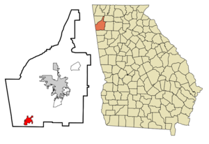
mapsize = 250px
map_caption = Location in Floyd County and the state of Georgia
mapsize1 =
map_caption1 =
image_dot_
dot_mapsize =
dot_map_caption =
dot_x =
dot_y =
pushpin_
pushpin_label_position =
pushpin_map_caption =
pushpin_mapsize =
subdivision_type = Country
subdivision_name =United States
subdivision_type1 = State
subdivision_name1 = Georgia
subdivision_type2 = County
subdivision_name2 = Floyd
subdivision_type3 =
subdivision_name3 =
subdivision_type4 =
subdivision_name4 =
government_footnotes =
government_type =
leader_title =
leader_name =
leader_title1 =
leader_name1 =
leader_title2 =
leader_name2 =
leader_title3 =
leader_name3 =
leader_title4 =
leader_name4 =
established_title =
established_date =
established_title2 =
established_date2 =
established_title3 =
established_date3 =
area_magnitude =
unit_pref = Imperial
area_footnotes =
area_total_km2 = 10.4
area_land_km2 = 10.4
area_water_km2 = 0
area_total_sq_mi = 4
area_land_sq_mi = 4
area_water_sq_mi = 0
area_water_percent =
area_urban_km2 =
area_urban_sq_mi =
area_metro_km2 =
area_metro_sq_mi =
area_blank1_title =
area_blank1_km2 =
area_blank1_sq_mi =
population_as_of = 2000
population_footnotes =
population_note =
population_total = 975
population_density_km2 = 93.8
population_density_sq_mi = 243.8
population_metro =
population_density_metro_km2 =
population_density_metro_sq_mi =
population_urban =
population_density_urban_km2 =
population_density_urban_sq_mi =
population_blank1_title =
population_blank1 =
population_density_blank1_km2 =
population_density_blank1_sq_mi =
timezone = Eastern (EST)
utc_offset = -5
timezone_DST = EDT
utc_offset_DST = -4
latd = 34 |latm = 6 |lats = 32 |latNS = N
longd = 85 |longm = 20 |longs = 10 |longEW = W
elevation_footnotes =
elevation_m = 195
elevation_ft = 640
postal_code_type =ZIP code
postal_code = 30124
area_code = 706
blank_name = FIPS code
blank_info = 13-14108GR|2
blank1_name = GNIS feature ID
blank1_info = 0355041GR|3
website =
footnotes =Cave Spring is a city in Floyd County, Georgia,
United States . It is located 12.24 miles south ofRome, Georgia . The population was 975 at the 2000 census. It is part of the 'Rome, GeorgiaMetropolitan Statistical Area '. The name of town was named after itscave andwater spring hence "Cave Spring". The cave has impressive stalagmites and the legendary "Devil's Stool". It is located in Rolater Park. The spring water has won awards for purity and taste. Many visitors bring jugs to fill at the spring and take home for drinking.Geography
Cave Spring is located at coor dms|34|6|32|N|85|20|10|W|city (34.108912, -85.336018)GR|1.
History
Cave Spring is well known for the natural wonders of the cave and spring site where native Indians came to the area (both
Cherokee and earlierMississippian culture ). Legend has it that tribal meetings and games used to be held at the site. In 1839, Cave Spring was formed as a small town; founded by Baptists who were among the early settlers. The cave and spring site is now the part of Rolater Park formerly used by educational institutions such as Cave Spring Manual Labor School (renamed Hearn Academy) and others including Georgia School for the Deaf. During theAmerican Civil War of 1864 by followingAtlanta campaign , both Confederate and Union troops came to Cave Spring for hospitalization and rest from fighting on the battlefields before Atlanta.Cave Spring has historic homes and buildings from its early years such as the 1867 Presbyterian Church, 1880 train depot, and 19th Century hotels and boarding houses. The spring flows into a sparkling pond from Rolater Park and then into a 1.5–acre swimming pool that is shaped like the state of Georgia. The pool is constructed out of stones.
According to the
United States Census Bureau , the city has a total area of 4.0square mile s (10.4km² ), of which, 4.0 square miles (10.4 km²) of it is land and 0.04 square miles (0.1 km²) of it (0.50%) is water.Demographics
As of the
census GR|2 of 2000, there were 975 people, 404 households, and 281 families residing in the city. Thepopulation density was 242.7 people per square mile (93.6/km²). There were 431 housing units at an average density of 107.3/sq mi (41.4/km²). The racial makeup of the city was 84.82% White, 12.41% African American, 0.62% Native American, 0.10% Pacific Islander, 1.44% from other races, and 0.62% from two or more races. Hispanic or Latino of any race were 2.15% of the population.There were 404 households out of which 28.2% had children under the age of 18 living with them, 52.0% were married couples living together, 14.9% had a female householder with no husband present, and 30.2% were non-families. 29.5% of all households were made up of individuals and 15.3% had someone living alone who was 65 years of age or older. The average household size was 2.36 and the average family size was 2.89.
In the city the population was spread out with 23.7% under the age of 18, 5.1% from 18 to 24, 23.8% from 25 to 44, 24.5% from 45 to 64, and 22.9% who were 65 years of age or older. The median age was 44 years. For every 100 females there were 83.3 males. For every 100 females age 18 and over, there were 75.5 males.The median income for a household in the city was $33,750, and the median income for a family was $47,917. Males had a median income of $35,395 versus $20,962 for females. The
per capita income for the city was $17,850. About 14.0% of families and 15.1% of the population were below thepoverty line , including 22.6% of those under age 18 and 13.9% of those age 65 or over.Cave Spring is the home of Georgia School for the Deaf, established in 1846, is a state-funded residential school operating under the auspices of the Office of Special Services of the Georgia State Department of Education and the Georgia State Board of Education to ensure that appropriate educational programs are available for hearing impaired and multi-handicapped hearing impaired students residing in Georgia. G.S.D. was used to be a field hospital for both Confederate and Union troops during the Civil War. Now new G.S.D. buildings on different land that used to be Perry Farm (Original farmhouse is still standing).
References
External links
* [http://www.cityofcavespring.com Cave Spring, Georgia website]
* [http://www.gsdweb.org/ Georgia School for the Deaf website]
Wikimedia Foundation. 2010.