- Turner County, Georgia
Infobox U.S. County
county = Turner County
state = Georgia
seallink =
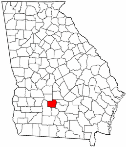
map size = 225
founded year = August 18, 1905
seat = Ashburn
largest city = Ashburn
area_total_sq_mi = 290
area_total_km2 = 751
area_land_sq_mi = 286
area_land_km2 = 741
area_water_sq_mi = 4
area_water_km2 = 10
area percentage = 1.32%
census estimate yr = 2005
pop = 9474
density_sq_mi = 13
density_km2 = 33
time zone = Eastern
UTC offset = -5
DST offset = -4
web =
named for =Henry Gray Turner Turner County is a
county located in theU.S. state of Georgia. It was created on August 18, 1905. As of 2000, the population is 9,504. The 2007 Census Estimate shows a population of 20,270 [http://www.census.gov/popest/counties/tables/CO-EST2007-01-13.xls] . Thecounty seat is Ashburn, GeorgiaGR|6.History
The County is named for
Henry Gray Turner , U.S. representative and Georgia state Supreme Court justice.Geography
According to the
U.S. Census Bureau , the county has a total area of 290 square miles (751 km²), of which, 286 square miles (741 km²) of it is land and 4 square miles (10 km²) of it (1.32%) is water.Major highways
*
*
*
*
*
*Adjacent counties
*Wilcox County (northeast)
*Ben Hill County (east)
*Irwin County (east-southeast)
*Tift County (southeast)
*Worth County (southwest)
*Crisp County (northwest)Demographics
As of the
census GR|2 of 2000, there were 9,504 people, 3,435 households, and 2,538 families residing in the county. Thepopulation density was 33 people per square mile (13/km²). There were 3,916 housing units at an average density of 14 per square mile (5/km²). The racial makeup of the county was 20.98% White, 70.37% Black or African American, 0.15% Native American, 0.33% Asian, 0.01% Pacific Islander, 1.81% from other races, and 0.36% from two or more races. 2.57% of the population were Hispanic or Latino of any race.There were 3,435 households out of which 35.70% had children under the age of 18 living with them, 50.00% were married couples living together, 18.60% had a female householder with no husband present, and 26.10% were non-families. 23.20% of all households were made up of individuals and 10.40% had someone living alone who was 65 years of age or older. The average household size was 2.72 and the average family size was 3.19.
In the county the population was spread out with 29.40% under the age of 18, 10.20% from 18 to 24, 26.40% from 25 to 44, 21.10% from 45 to 64, and 12.90% who were 65 years of age or older. The median age was 33 years. For every 100 females there were 92.60 males. For every 100 females age 18 and over, there were 87.00 males.
The median income for a household in the county was $25,676, and the median income for a family was $31,445. Males had a median income of $25,694 versus $18,472 for females. The
per capita income for the county was $13,454. About 20.50% of families and 26.70% of the population were below thepoverty line , including 35.80% of those under age 18 and 24.80% of those age 65 or over.Cities and towns
Wikimedia Foundation. 2010.