- Ashburn, Georgia
Infobox Settlement
official_name = Ashburn, Georgia, USA
other_name =
native_name =
nickname = Peanut Capital of the World
settlement_type =City
motto =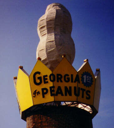
imagesize =
image_caption =
flag_size =
image_
seal_size =
image_shield =
shield_size =
image_blank_emblem =
blank_emblem_type =
blank_emblem_size =
flag_size =
image_
seal_size =
image_shield =
shield_size =
image_blank_emblem =
blank_emblem_type =
blank_emblem_size =
mapsize = 250px
map_caption = Location in Turner County and the state of Georgia
mapsize1 =
map_caption1 =
image_dot_
dot_mapsize =
dot_map_caption =
dot_x =
dot_y =
pushpin_
pushpin_label_position =
pushpin_map_caption =
pushpin_mapsize =
subdivision_type = Country
subdivision_name =United States
subdivision_type1 = State
subdivision_name1 = Georgia
subdivision_type2 = County
subdivision_name2 = Turner
subdivision_type3 =
subdivision_name3 =
subdivision_type4 =
subdivision_name4 =
government_footnotes =
government_type =
leader_title =Mayor
leader_name = Jim Hedges
leader_title1 =
leader_name1 =
leader_title2 =
leader_name2 =
leader_title3 =
leader_name3 =
leader_title4 =
leader_name4 =
established_title =
established_date =
established_title2 =
established_date2 =
established_title3 =
established_date3 =
area_magnitude = 1 E9
unit_pref = Imperial
area_footnotes =
area_total_km2 = 11.8
area_land_km2 = 11.7
area_water_km2 = 0.1
area_total_sq_mi = 4.6
area_land_sq_mi = 4.5
area_water_sq_mi = 0.0
area_water_percent =
area_urban_km2 =
area_urban_sq_mi =
area_metro_km2 =
area_metro_sq_mi =
area_blank1_title =
area_blank1_km2 =
area_blank1_sq_mi =
population_as_of = 2000
population_footnotes =
population_note =
population_total = 4419
population_density_km2 = 377.5
population_density_sq_mi = 978.6
population_metro =
population_density_metro_km2 =
population_density_metro_sq_mi =
population_urban =
population_density_urban_km2 =
population_density_urban_sq_mi =
population_blank1_title =
population_blank1 =
population_density_blank1_km2 =
population_density_blank1_sq_mi =
timezone = EST
utc_offset = -5
timezone_DST = EDT
utc_offset_DST = -4
latd = 31 |latm = 42 |lats = 16 |latNS = N
longd = 83 |longm = 39 |longs = 14 |longEW = W
elevation_footnotes =
elevation_m = 130
elevation_ft = 427
postal_code_type =ZIP code
postal_code = 31714
area_code = 229
blank_name = FIPS code
blank_info = 13-03236GR|2
blank1_name = GNIS feature ID
blank1_info = 0354404GR|3
website = www.cityofashburn.net
footnotes =Ashburn is a city in, and the
county seat of, Turner County, Georgia,United States . The population was 4,419 at the 2000 census.The 2007 Census Estimate shows a population of 9,898. Ashburn's government is classified as a "council/manager" form of municipal government. Ashburn is noted for itspeanuts and a Fire Ant festival.History
Ashburn, Georgia was incorporated on December 26, 1890. The city was named for the early settler W. W. Ashburn, who purchased a portion of the future town site for ten dollars. The city's original name was Troupville Crossroads.
Geography
Ashburn is located at coor dms|31|42|16|N|83|39|14|W|city (31.704378, -83.653786)GR|1.
According to the
United States Census Bureau , the city has a total area of 4.6square mile s (11.8km² ), of which, 4.5 square miles (11.7 km²) of it is land and 0.04 square miles (0.1 km²) of it (0.66%) is water.Demographics
As of the
census GR|2 of 2000, there were 4,419 people, 1,624 households, and 1,117 families residing in the city. Thepopulation density was 978.6 people per square mile (377.5/km²). There were 1,846 housing units at an average density of 408.8/sq mi (157.7/km²). The racial makeup of the city was 65.22% African American, 32.59% White, 0.09% Native American, 0.23% Asian, 1.65% from other races, and 0.23% from two or more races. Hispanic or Latino of any race were 2.67% of the population.There were 1,624 households out of which 33.8% had children under the age of 18 living with them, 36.1% were married couples living together, 27.3% had a female householder with no husband present, and 31.2% were non-families. 27.6% of all households were made up of individuals and 12.0% had someone living alone who was 65 years of age or older. The average household size was 2.68 and the average family size was 3.28.
In the city the population was spread out with 30.7% under the age of 18, 12.0% from 18 to 24, 24.1% from 25 to 44, 19.6% from 45 to 64, and 13.6% who were 65 years of age or older. The median age was 31 years. For every 100 females there were 83.4 males. For every 100 females age 18 and over, there were 75.7 males.
The median income for a household in the city was $18,702, and the median income for a family was $21,481. Males had a median income of $22,328 versus $16,269 for females. The
per capita income for the city was $10,786. About 29.6% of families and 38.1% of the population were below thepoverty line , including 53.6% of those under age 18 and 29.3% of those age 65 or over.References
External links
* [http://www.cityofashburn.net Ashburn, GA Website]
Wikimedia Foundation. 2010.