- Columbus, Georgia
-
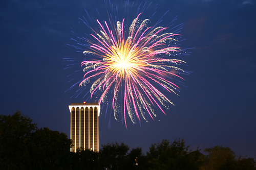
City of Columbus — Consolidated city — Downtown Columbus skyline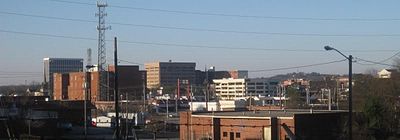
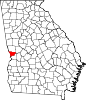
SealNickname(s): The Lowell of the South or The Fountain City Motto: What Progress Has Preserved Location in Muscogee County and the state of Georgia
Coordinates: 32°29′32″N 84°56′25″W / 32.49222°N 84.94028°WCoordinates: 32°29′32″N 84°56′25″W / 32.49222°N 84.94028°W Country United States State Georgia County Muscogee Founded 1828 Named for Christopher Columbus Government – Mayor Teresa Tomlinson Area – Total 220.8 sq mi (572 km2) – Land 216.1 sq mi (592.1 km2) – Water 4.7 sq mi (12.3 km2) Population (2010) – Total 189,885 (123rd) – Density 861.4/sq mi (332.6/km2) – MSA 292,795 (160th) – CSA 450,467 (73rd) Time zone EST (UTC-5) – Summer (DST) EDT (UTC-4) ZIP codes 31820, 31829, 31900-09, 31914, 31917, 31993-94, 31997-99 Area code(s) 706, 762 FIPS code 13-19007[1] GNIS feature ID 0331158[2] Airport Columbus Airport-
CSGWebsite City of Columbus Columbus is a city in and the county seat of Muscogee County, Georgia, United States,[3] with which it is consolidated. As of the 2010 census, the city had a population of 189,885[4]. It is the principal city of the Columbus, Georgia metropolitan area, which, in 2009, had an estimated population of 292,795. It joins with the Auburn, Alabama metropolitan area to form the Columbus, Georgia-Auburn, Alabama Combined Statistical Area, which, in 2009, had an estimated population of 450,467. It is the third largest city and fourth largest metropolitan area in the state, and also the 123rd largest city in the United States.
Columbus lies 100 miles (160 km) south of Atlanta. Fort Benning, a major employer, is located south of the city in Chattahoochee County. The city is home to museums and other tourism sites. The area is served by the Columbus Airport. The current mayor is Teresa Tomlinson, who was elected in November 2010. The city was ranked number 4 on the 100 Best U.S. Cities to live by Best Life Magazine.[5]
Contents
History
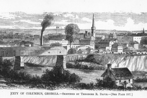
 Downtown in 1880
Founded in 1828 by an act of the Georgia Legislature, Columbus was situated at the beginning of the navigable portion of the Chattahoochee River and on the last stretch of the Federal Road before entering Alabama. The city was named for Christopher Columbus, its founders likely influenced by the writings of Washington Irving. The plan for the city was drawn up by Dr. Edwin L. DeGraffenried who placed the town on a bluff overlooking the river. Across the river, where Phenix City, Alabama is now located, Creek Indians lived until their removal in 1836.
The river served as Columbus' connection to the world, particularly connecting the plantations in the region with the international cotton market via New Orleans and ultimately Liverpool, England. The city's commercial importance increased in the 1850s with the arrival of the railroad. In addition, textile mills began springing up along the river, bringing industry to an area reliant upon agriculture. By 1860, the city was one of the more important industrial centers of the South, earning it the nickname "the Lowell of the South," in deference to the industrial town in Massachusetts.
Civil War and Reconstruction
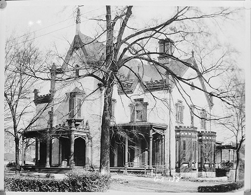
Main article: Battle of Columbus (1865)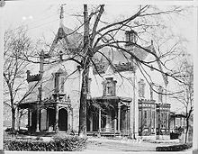 Redd House, Columbus, Historic American Buildings Survey
When the outbreak of war came in 1861, the industries of Columbus expanded their production and Columbus became one of the most important centers of industry in the Confederacy. During the war, Columbus ranked second to Richmond in the manufacture of supplies for the Confederate army.[6] In addition to textiles, the city had an ironworks and a sword factory as well as a shipyard for the Confederate Navy. Unaware of Lee's surrender to Grant and the assassination of Abraham Lincoln, Union and Confederates clashed in the Battle of Columbus, Georgia on Easter Sunday, April 16, 1865, when a Union detachment under General James H. Wilson attacked the city and burned many of the industrial buildings. The inventor of Coca-Cola, Dr. John Stith Pemberton, was wounded in this battle. The owner of America's last slave ship, Col. Charles Augustus Lafayette Lamar, was also killed here. A historic marker has been erected in Columbus marking the battle by Wilson's troops as the "Last Land Battle in the War Between the States."
Reconstruction began almost immediately and prosperity followed. Factories such as the Eagle and Phenix Mills were revived and the industrialization of the town led to rapid growth; the city outgrew its original plan. The Springer Opera House was built on 10th Street attracting such notables as Oscar Wilde. The Springer is now the official State Theater of Georgia.
By the time of the Spanish American War, the city saw much modernization including the addition of trolleys extending to outlying neighborhoods such as Rose Hill and Lakebottom and a new water works. Mayor Lucius Chappell also brought a training camp for soldiers to the area. This training camp named Camp Benning would grow into present day Fort Benning, named for General Henry L. Benning, a native of the city.
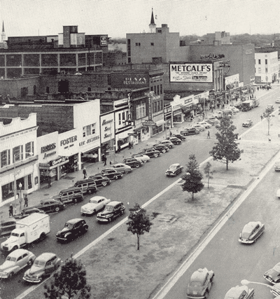
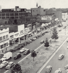 Downtown Columbus in the early 1950s
20th Century
With the expansion of the city, the need for a university saw the establishment of Columbus College, a two-year institution which would later grow into Columbus State University, now a comprehensive center of higher learning. The city would consolidate city and county governments in 1971 and become the first of its kind in Georgia (and one of only 16 in the U.S. at the time). As the city has turned from its initial industry of textiles, it has provided a home for other prominent industries including the headquarters for Aflac, Synovus, TSYS and Carmike Cinemas.
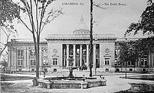 The Muscogee County Courthouse in 1941, which was destroyed in 1970.
During the 1960s, 1970s and 1980s, urban blight, flight, and prostitution were serious problems in much of downtown Columbus and adjacent neighborhoods. Early efforts to halt the gradual deterioration of downtown began with the saving and restoration of the Springer Opera House in 1965. With the revitalization of the Springer and its subsequent designation as the State Theatre of Georgia, a historic preservation movement was sparked and various historic districts were established in and around downtown. Large tracts of blighted areas were cleaned up and a modern Columbus Consolidated Government Center was constructed in the city center. A significant period of urban renewal and revitalization followed in the mid to late 1990s. With these improvements, residents and businesses began moving back to these formerly blighted areas. Examples of these municipal projects including the construction of a softball complex which hosted the 1996 Olympic softball competition, construction of the Chattahoochee RiverWalk along the Chattahoochee River, construction of the National Civil War Naval Museum at Port Columbus, construction of the Coca-Cola Space Science Center, the expansion of the Columbus Museum, and road improvements to include a new downtown bridge crossing the Chattahoochee River to Phenix City. During the late 1990s, commercial activity expanded north of downtown along the I-185 corridor.
21st century
During the 2000s, expansion and historic preservation was continuing throughout the city. An example of this is the revitalization of South Commons, an area which combines the 1996 Olympic softball competition complex, A. J. McClung Memorial Stadium, Golden Park, the Columbus Civic Center, and the recently added Jonathan Hatcher Skateboard Park into a single complex area. Other additions to the city include the National Infantry Museum in South Columbus, located just outside the Fort Benning main gate, and the .
Columbus has also established itself as a center for the fine and performing arts. RiverCenter for the Performing Arts, which opened in 2002, houses Columbus State University's music department. In 2002 Columbus State's art and drama departments moved to downtown locations. Such initiatives are provide Columbus with a cultural niche with vibrant and modern architecture mixed with its old brick facades.
In upcoming years, it is predicted that there will be an additional 30,000 Soldiers trained at Fort Benning each year due to Base Realignment and Closure.[7] As a result of this, Columbus is expected to see a major population increase.
Geography
Columbus is one of Georgia's three Fall Line Cities, along with Augusta and Macon. The Fall Line is where the hilly lands of the Piedmont plateau meet the flat terrain of the coastal plain. As such, Columbus has a varied landscape of rolling hills on the north side and flat plains on the south. The fall line causes rivers in the area to decline rapidly towards sea level, making it a good location for textile mills in the past. The Chattahoochee River is the major river that runs through Columbus.
The city is located at 32°29′23″N 84°56′26″W / 32.489608°N 84.940422°W (32.489608, -84.940422).[8]
According to the US Census Bureau, the city has a total area of 221.0 square miles (572 km2), of which, 216.3 square miles (560 km2) of it is land and 4.7 square miles (12 km2) of it (2.14%) is water.
Climate
Columbus has a humid subtropical climate. Daytime summer temperatures often reaches a high in the mid 90s, and low temperatures in the winter average in the upper 30s. Columbus is often considered a dividing line or "natural snowline" of the southeastern United States with areas north of the city receiving snowfall annually, with areas to the south typically not receiving snowfall every year or at all.
Climate data for Columbus, Georgia Month Jan Feb Mar Apr May Jun Jul Aug Sep Oct Nov Dec Year Record high °F (°C) 83
(28)83
(28)89
(32)93
(34)97
(36)104
(40)104
(40)104
(40)100
(38)94
(34)86
(30)82
(28)104
(40)Average high °F (°C) 57
(14)62
(17)69
(21)77
(25)89
(32)90
(32)92
(33)91
(33)86
(30)77
(25)68
(20)59
(15)76.4
(24.7)Average low °F (°C) 37
(3)39
(4)46
(8)52
(11)61
(16)69
(21)72
(22)71
(22)66
(19)55
(13)46
(8)39
(4)54.4
(12.5)Record low °F (°C) −2
(−19)10
(−12)16
(−9)28
(−2)39
(4)44
(7)59
(15)57
(14)38
(3)24
(−4)10
(−12)4
(−16)−2
(−19)Precipitation inches (mm) 4.78
(121.4)4.48
(113.8)5.75
(146.1)3.84
(97.5)3.62
(91.9)3.51
(89.2)5.04
(128)3.78
(96)3.07
(78)2.33
(59.2)3.97
(100.8)4.40
(111.8)48.57
(1,233.7)Source: Weather Channel[9] Cityscape
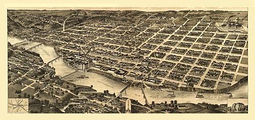
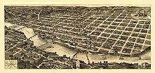 Downtown panorama (1840)Main article: Neighborhoods in Columbus, Georgia
Columbus is divided into five geographic areas, and they are as follows:[10]
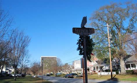
- Downtown(also called "Uptown") is the city's central business district, and home to many historic districts, homes, and churches such as the Columbus Historic Riverfront Industrial District, the Mott House, and the Church of the Holy Family. It is considered by some to be the area bounded on the north by Talbotton Road; on the South by 30th Avenue; on the West by Front Avenue the Chattahoochee River; and on the East by Brown Avenue.
- East Columbus is the largest of the five Columbus areas. It is home to Bull Creek Golf Course, the largest of seven golf courses in the city.[11] The area is roughly bounded by Macon Road to the North, Buena Vista Road to the South, Schatulga Road and Fort Benning to the East, and I-185 to the West.
- MidTown is a residential and commercial area. It is home to two major shopping areas: Peachtree Mall, an indoor shopping mall opened in 1975; The Landings, an outdoor strip mall that opened in 2005. MidTown is also home to the majority of bars and nightclubs in the Columbus area. It is bounded roughly by I-185 to the East, J. R. Allen Parkway to the North, River Road to the West and Wynnton Road to the South.
- North Columbus is a diverse suburban area of the city that is home to established neighborhoods and newly built subdivisions. It is home to very upscale areas such as Green Island Hills. It is also home to Columbus Park Crossing, a major outdoor strip mall. It is bounded roughly by Moore Road to the North, Manchester Expressway to the South, Moon Road to the East, and J. R. Allen Parkway to the West.
- South Columbus is situated just below MidTown. It is home to the National Infantry Museum, a museum that honors the history of infantry forces in the U.S. Army. The South Columbus area has a noticeably higher military population than other areas, most likely because it is located just above the United States Army post Fort Benning.
Surrounding cities and towns
Main article: Greater Columbus, Georgia Downtown Columbus at sunset
The Columbus Metropolitan Area includes four counties in Georgia, and two in Alabama. A 2008 Census estimate showed 287,653 in the metro area, with 442,953 in the combined statistical area. Below are the cities in the Columbus CSA:
- Hopewell
- Hurtsboro
- Juniper
- Ladonia
- Loachapoka
- Marvyn
- Mountain Hill
Demographics
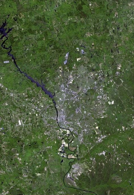
Historical populations Census Pop. %± 1840 3,114 — 1850 5,942 90.8% 1860 9,621 61.9% 1870 7,401 −23.1% 1880 10,123 36.8% 1890 17,303 70.9% 1900 17,614 1.8% 1910 20,554 16.7% 1920 31,125 51.4% 1930 43,131 38.6% 1940 53,280 23.5% 1950 79,611 49.4% 1960 116,779 46.7% 1970 155,028 32.8% 1980 169,441 9.3% 1990 178,681 5.5% 2000 186,291 4.3% 2010 189,885 1.9% 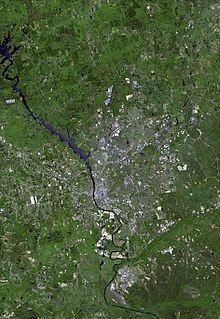 Satellite image of Columbus
As of the 2010 U.S. Census[1], Columbus had a total population of 189,885, up from 186,291 in the 2000 Census. The 2000 Census reported 186,291 people, 69,819 households, and 47,686 families residing in the city. The population density was 861.4 people per square mile (332.6/km2). There were 76,182 housing units at an average density of 352.3 per square mile (136.0/km2). The racial makeup of the city was 50.42% White, 43.74% African American, 1.54% Asian, 0.38% Native American, 0.14% Pacific Islander, and 1.90% from other races. Hispanic or Latino of any race were 4.49% of the population.
There were 69,819 households out of which 34.6% had children under the age of 18 living with them, 44.7% were married couples living together, 19.6% had a female householder with no husband present, and 31.7% were non-families. 26.7% of all households were made up of individuals and 9.4% had someone living alone who was 65 years of age or older. The average household size was 2.54 and the average family size was 3.08.
In the city the population was spread out with 26.8% under the age of 18, 11.9% from 18 to 24, 29.8% from 25 to 44, 19.7% from 45 to 64, and 11.7% who were 65 years of age or older. The median age was 33 years. For every 100 females there were 94.7 males. For every 100 females age 18 and over, there were 91.6 males.
The median income for a household in the city was $34,798, and the median income for a family was $41,244. Males had a median income of $30,238 versus $24,336 for females. The per capita income for the city was $18,262. About 12.8% of families and 15.7% of the population were below the poverty line, including 22.0% of those under age 18 and 12.1% of those age 65 or over.
Religion
Christianity
Columbus contains approximately 200 Christian churches, with the Southern Baptist Convention being the largest denomination by number of churches.[12]
Islam
Columbus is home to three Mosques: Masjid Al Jannah, Masjid An-Nur and Masjid Abdullah Bin Masud.
Jehovah's Witnesses
Columbus is also home to three Kingdom Halls for Jehovah's Witnesses.[13] The Columbus Civic Center hosts a convention for thousands of members for two weekends each summer.
Judaism
Columbus is home to two congregations: Temple Israel (Reform) and Shearith Israel (Conservative).
Economy
Companies headquartered in Columbus include Aflac, Masterbuilt, TSYS, Synovus, Carmike Cinemas, and the W. C. Bradley Co.
Buildings
This is a list of the five tallest buildings in Columbus.[citation needed]
# Name Height in feet Stories Year completed 1 Muscogee County Courthouse 374 13 1973 2 Aflac Building 246 19 1975 3 The Ralston Addition 12 4 Corporate Center 129 10 5 The Ralston Addition 110 10 1919 Top employers
According to Columbus's 2009 Comprehensive Annual Financial Report,[14] the top employers in the city are:
# Employer # of Employees 1 Fort Benning 41,462 2 Muscogee County School District 6,200 3 TSYS 4,300 4 Aflac 4,100 5 Columbus-Muscogee County Consolidated Government 2,933 6 Columbus Regional Healthcare System 2,700 7 Blue Cross Blue Shield of Georgia 1,540 8 Pezold Management 1,500 9 St. Francis Hospital 1,470 10 Synovus 1,021 Arts and culture
Points of interest
Museums
- Founded in 1953, the Columbus Museum (accredited by the American Association of Museums) contains much artifacts on both American art and regional history, displayed in both its permanent collection as well as temporary exhibitions.
- Columbus is home to the National Civil War Naval Museum, a 40,000-square-foot (3,700 m2) facility that opened in 1962 and features two original American Civil War military vessels, uniforms, equipment and weapons used by the Union and Confederate navies.
- The Coca-Cola Space Science Center opened in 1996 for the purpose of public education in science, physics, and astronomy. It includes seven flight simulators and a planetarium.[15]
- The National Infantry Museum and Soldier Center opened in June 2009 and honors the service of Infantry forces in the United States Army. The museum includes displays related to the history of the Infantry from the founding of the nation to the present. It also has its own IMAX theatre.
Shopping
Columbus is served by one major indoor shopping mall, Peachtree Mall, which is anchored by major department stores Dillard's, Macy's, and J.C. Penney. The total retail floor area is 821,000 square feet (76,300 m2). Major strip malls include Columbus Park Crossing, which opened in 2004, and The Landings, which opened in 2005. Columbus is also served by The Shoppes at Bradley Park, a lifestyle center.
MidTown contains two of the city's early suburban shopping centers (the Village on 13th and St. Elmo), both recently renovated and each offering local shops, restaurants, and services.
Major venues
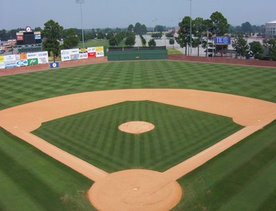
 Golden Park, the city's oldest baseball park
Below is the list of major venues in the city of Columbus:
- A. J. McClung Memorial Stadium, a football stadium. It was the site of the football games between the Georgia Bulldogs and the Auburn Tigers (the Deep South's Oldest Rivalry) from 1916 to 1958. It became the home of college football's Pioneer Bowl in December 2010, and hosts annual rivalry games between Tuskegee University and Morehouse College as well as between Albany State University and Fort Valley State University.
- The Bradley Theater, a performance theatre that opened in mid-1940 by Paramount Pictures.
- Columbus Civic Center, a 10,000-seat multi-purpose arena that opened in 1996 and is home to the Columbus Cottonmouths (SPHL, and the Columbus Lions (SIFL). It is also the primary arena used for concert events in Columbus.
- Golden Park, a 5,000 seat baseball stadium, is the former home to the Columbus Catfish. It was also the site of the softball events of the 1996 Summer Olympics that were held in the city of Columbus. It opened in 1926, making it the oldest baseball park in the city.
- RiverCenter for the Performing Arts, a 2,000-seat modern performance theatre that first opened in 2002 and is operated by the Columbus not-for-profit organization RiverCenter Inc. The theatre is commonly frequently used for local events, but occasionally, it is used for nationally-recognized performances.
- Springer Opera House, a historic live performance theater located in Downtown that opened in early 1871. Former United States President Jimmy Carter proclaimed it the State Theatre of Georgia for the 1971-72 season. The legislature made the designation permanent in 1992.[16]
Historic Districts
Columbus is home to 8 historic districts, all listed in the NRHP. They are as follows:
- Bibb City Historic District
- Columbus Historic District
- Columbus Historic Riverfront Industrial District
- Dinglewood Historic District
- Peacock Woods-Dimon Circle Historic District
- Weracoba-St. Elmo Historic District
- Wynn's Hill-Overlook-Oak Circle Historic District
- Wynnton Village Historic District
Sports
Club Sport League Venue Columbus Cottonmouths Ice hockey Southern Professional Hockey League Columbus Civic Center Columbus Lions Indoor football Professional Indoor Football League Columbus Civic Center Columbus Riverballers Basketball American Basketball Association Columbus State University CSU Cougars Baseball, Basketball, Cross Country/Track, Golf, Tennis NCAA Division II (Peach Belt Conference) Columbus State University Parks and recreation
Main article: List of parks in Columbus, GeorgiaColumbus is home to upwards of fifty parks, four recreation centers, four senior centers and parks, and Standing Boy Creek State Park, a 1,579 acres (6.39 km2) Georgia state park created by the executive order issued by then-Governor Sonny Perdue on January 21, 2004. It offers swimming, boating (on Lake Oliver), camping, hiking, and hunting.
Walking trails
- The Chattahoochee RiverWalk is a 15-mile (24 km) long bike trail that connects users from Downtown to South Columbus and the northern section of Fort Benning.
- The Columbus Fall Line Trace[17] is a fitness trail that runs from Downtown to the northeastern section of the city.[18] The Black Heritage Trail is a Certified National Recreation Trail walking/biking trail of local and national historical significance.
Golf
Columbus is home to the following seven golf courses.[19]
- Bull Creek Golf Course
- Country Club of Columbus
- Follow Me Golf Course (partially; most of the course is located within Fort Benning)
- Godwin Creek Golf Course
- Green Island Country Club
- Maple Ridge Golf Club
- Oxbow Creek Golf Course
Law and government
Elected Officials
Mayor
- Teresa Tomlinson
City Council
- Jerry Barnes (District 1)
- Glenn Davis (District 2)
- Bruce Huff (District 3)
- Evelyn Turner-Pugh (District 4)
- Mike Baker (District 5)
- R. Gary Allen (District 6)
- Evelyn Woodson (District 7)
- C. E. McDaniel (District 8)
- Judy Thomas (District 9)
- Berry "Skip" Henderson (District 10)
District Attorney
- Julia Slater[21]
Sheriff
- John Darr (2008)[22]
Tax Commissioner
- Lula Huff[23]
Clerk of Court
- Linda Pierce[24]
Crime
For 2008, Columbus had an overall crime rate of 8,533.7 per 100,000 residents;[25] this exceeds the national average of 4,479.3 crimes per 100,000 people by over 75%. By way of comparison, New York City's overall crime rate was 2,378 per 100,000 residents.[26]
The rate for violent crimes was 620.8 per 100,000, compared to the national average of 553.5 per 100,000; murders and robberies exceeded the national average, while rapes and aggravated assaults were below the national average. Property-crime rates, such as burglaries, larceny and motor vehicle thefts, significantly exceeded the national average (7,229.8 in Columbus, compared to the national average of 3,906.1).
Education
Primary and secondary education
The Muscogee County School District holds grades pre-school to grade twelve, that consists of thirty-five elementary schools, twelve middle schools, and nine high schools.[27][28] The district has 2,068 full-time teachers and over 32,944 students.[29]
Libraries
 Columbus Public Library
Columbus is served by four branches of the Chattahoochee Valley Libraries:
- Columbus Public Library
- Mildred L Terry Public Library
- North Columbus Public Library
- South Columbus Public Library
Higher education
Public
- Columbus State University
- Columbus Technical College
- Georgia Military College - main campus in Milledgeville, Georgia
- Miller-Motte Technical College - main campus in Wilmington, North Carolina
- Troy University - main campus in Troy, Alabama
- Virginia College - main campus in Birmingham, Alabama
Private
- Christian Life School of Theology
- Rivertown School of Beauty
- Southeastern Beauty School
- Strayer University - main campus in Baltimore, Maryland
- University of Phoenix - main campus in Phoenix, Arizona
Media and communications
Main article: Media in Columbus, GeorgiaColumbus is served by the Columbus, Georgia Designated Market Area (DMA). Charter Communications, Comcast, Knology, and Mediacom provide cable television service. DirecTV and Dish Network provide direct broadcast satellite television including both local and national channels to area residents.
Newspapers
- The Ledger-Enquirer, the only daily newspaper in Columbus.
- The Columbus Times, a weekly publication featuring African-American perspectives of current events.
- The Bayonet, a weekly publication of news and events in Fort Benning and south Columbus.
- The Courier and Eco Latino, a biweekly tabloid combining news and opinion about African-American issues with the city's only Spanish-language newspaper.
- Playgrounds Magazine, a monthly entertainment and arts magazine.
- The Saber, the Columbus State University campus newspaper.
- Tid Bits, a weekly publication featuring news throughout the southeast.
- To Do, a weekly publication featuring current events.
Radio
AM stations
FM stations
- WJSP 88.1 (Public radio)
- WBOJ 88.5 (Contemporary Christian)
- WELL 88.7 (Contemporary Christian)
- WYFK 89.5 (Religious)
- WFRC 90.5 (Christian)
- WEGL 91.1 (Variety)
- WTJB 91.7 (Classical)
- WKZJ 92.7 (Urban adult contemporary)
- WVFJ 93.3 (Contemporary Christian)
- WQSI 93.9 (Classic country)
- WRLD 95.3 (Classic hits)
- WIOL 95.7 (Sports)
- WTGZ 95.9 (Modern rock)
- WBUE 96.1 (Contemporary Christian)
- WMXA 96.7 (Adult contemporary)
- WURY 97.1 (Religious)
- WKKR 97.7 (Country)
- WBFA 98.3 (Mainstream Urban)
- WKCN 99.3 (Country)
- WQNR 99.9 (Variety hits)
- WGSY 100.1 (Adult contemporary)
- WEAM 100.7 (Gospel)
- WAGH 101.3 (Urban adult contemporary)
- WVRK 102.9 (Album-oriented rock)
- WLTC 103.7 (Light rock)
- WAUF 104.5 (Contemporary Christian)
- WFXE 104.9 (Mainstream Urban)
- WSTH 106.1 (Country)
- WRCG 106.9 (Classic rock)
- WCGQ 107.3 (Contemporary hits)
Television
- WRBL 3, Media General, Inc (CBS)
- 3.2 WRBL-DT2 (RTN)
- 3.3 WRBL-DT3 (AccuWeather)
- W06BH 6, (Religious)
- WTVM 9, Raycom Media (ABC)
- 9.2 WTVM-DT2 (AccuWeather)
- WWCG 11, White Springs Media (WSTV)
- WYBU 16, Christian Television Network (CTN)
- WACS 25, Georgia Public Telecommunications Commission (GPB, PBS)
- 25.2 WACS-DT2 (GPB Kids)
- 25.3 WACS-DT3 (GPB Knowledge)
- WJSP 28, Georgia Public Telecommunications Commission (GPB, PBS)
- 28.2 WJSP-DT2 (GPB Kids)
- 28.3 WJSP-DT3 (GPB Knowledge)
- WLTZ 38, SagamoreHill Broadcasting (NBC)
- 38.2 WLTZ-DT2 (The CW)
- WGIQ 43, Alabama Public Television (PBS, APT)
- WXTX 54, Southeastern Media Holdings (Fox, myNetworkTV)
- 54.2 WXTX-DT2 (This TV)
Movie theaters
The following 6 movie theaters located in the Columbus area:
- Carmike 15
- Ritz 13
- Wynnsong 10
- Wynnsong 10 (Fort Benning)
- Peachtree 8
- National Infantry Museum IMAX 3D
Infrastructure
Transportation
Airports
The following are public general aviation airports that operate in the metropolitan area:
- The Columbus Airport (IATA: CSG, ICAO: KCSG, FAA LID: CSG) is the metro area's primary airport and the fourth busiest airport in Georgia. It is located just off of I-185 exit 8. It is served by Atlantic Southeast Airlines and American Eagle, both of whom offer many daily flights to Atlanta and Dallas/Fort Worth.[30]
The following are private general aviation airports that operate in the metropolitan area:
- Harris County Airport (IATA: PIM, ICAO: KPIM, FAA LID: PIM), located in Pine Mountain, Georgia.
- Jones Light Aviation Airport, located in Smiths Station, Alabama
- Marion County Airport, located in Buena Vista, Georgia.
The following is a military aviation airport that operates in the metropolitan area:
- Lawson Army Airfield (IATA: LSF, ICAO: KLSF, FAA LID: LSF), located on Fort Benning.
Highways
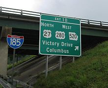 I-185 exit 1B in South Columbus
U.S. Routes
Georgia State Routes
Public transit
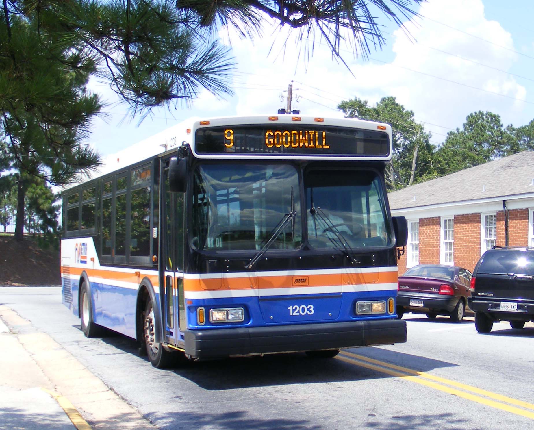
 METRA bus in MidTown
METRA Transit System is the primary provider of mass transportation in Muscogee County, currently operating nine routes in Columbus. The current public transportation services are operated as a function of the Columbus Consolidated Government under METRA.[31]
Greyhound Lines provides intercity bus service with the Columbus station located on Veterans Parkway, Downtown Columbus.[32]
Columbus Airport Shuttle Service provides luxury shuttle service between Columbus, Fort Benning, and the Atlanta Hartsfield International Airport.[33]
Groome Transportation is a ground transportation carrier that operates shuttle and charter services between Columbus and the Atlanta Hartsfield International Airport.[34]
Taxi cab and limousine services are provided by more than two-dozen companies throughout the Columbus area.
Healthcare
-
This list is incomplete; you can help by expanding it.
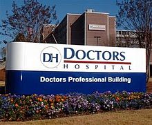 Doctors Hospital
- Aflac Cancer Center and Blood Disorders Service
- Columbus Regional Hospital
- Columbus Specialty Hospital
- Doctors Hospital
- Hughston Orthopedic Hospital
- Martin Army Community Hospital
- St. Francis Hospital
- Veterans Affairs Columbus Clinic
- West Central Georgia Regional Hospital
Notable residents
The following people are closely associated with the city of Columbus, or one of its surrounding communities, and have garnered a level of national or international recognition. For a more comprehensive list of notable Columbus natives and residents, see People from Columbus, Georgia.
- Reggie Abercrombie, former Major League Baseball player
- Robert M. Barr, Famed Band Director
- Bo Bartlett, painter
- Henry L. Benning, Confederate general and namesake of Fort Benning
- Brentson Buckner, former NFL defensive tackle
- Eugene Bullard, first African-American fighter pilot
- William Calley, U.S. Army officer convicted of ordering the My Lai Massacre
- Robert Cray, Blues guitarist and vocalist
- Austin Creed, wrestler
- Glenn Davis, former Major League Baseball player
- Donna D'Errico, actress and model
- Newt Gingrich, former speaker of the U.S. House of Representatives.
- Phil Gramm, former United States senator
- Justin Guarini, musician, actor, and American Idol runner-up
- Jake Hess, Southern Gospel musician
- Roderick Hood, NFL cornerback
- Tim Hudson, Major League Baseball pitcher
- Edwin Jackson, Major League Baseball player
- Marty Jannetty, professional wrestler
- Nunnally Johnson, screenwriter, film producer and author
- Mirabeau B. Lamar, third President of the Republic of Texas.[35]
- Carson McCullers, novelist, author of The Heart Is a Lonely Hunter
- Sam Mitchell, former NBA player and coach
- Curley Money, Rockabilly artist and songwriter
- Bebo Norman, Contemporary Christian singer and songwriter
- Nate Odomes, former NFL defensive back
- George Foster Peabody, namesake of the Peabody Award
- John Stith Pemberton, creator of Coca-Cola
- James Rachels, philosopher
- Ma Rainey, Blues musician known as "The Mother of the Blues"
- Colby Rasmus, Major League Baseball player
- Otis Sistrunk, former NFL defensive tackle
- Mack Strong, former NFL fullback
- Alma Thomas, color field painter
- Frank Thomas, former Major League Baseball player
- Keni Thomas, country music singer
- Rozonda Thomas, singer known as "Chilli" in the female group, TLC
- Cleo Walker, former NFL linebacker and center
- Danny Whitten, musician
- Blind Tom Wiggins, pianist and savant
- Tim Wilson, comedian and country music singer
- Robert W. Woodruff, long-time president of The Coca-Cola Company
Sister cities
Columbus has four official sister cities:[36]
See also
- Downtown Columbus
- MidTown Columbus
- List of neighborhoods in Columbus, Georgia
- List of mayors of Columbus, Georgia
- List of schools in Muscogee County, Georgia
- Metro Columbus
- Black Heritage Trail (Columbus, Georgia) – a National Recreation Trail going though the city
- Further Reading
- Our Town: An Introduction to the History of Columbus, Georgia by Roger Harris, 1992, Historic Columbus Foundation
- Columbus, Georgia (Black America Series) by Judith Grant, 1999, Arcadia Publishing
- Columbus Celebrates The Millennium: An International Quest (The American Enterprise Series) by Pamela Baker and Delane Chappell, 1999, Community Communications Inc.
- Yankee Blitzkrieg: Wilson's Raid Through Alabama and Georgia by James Pickett Jones, 2000, University Press of Kentucky
- Columbus, Georgia in Vintage Postcards (GA) (Postcard History Series) by Kenneth H. Thomas, Jr., 2001, Arcadia Publishing
- Historic Linwood Cemetery (Images of America: Georgia) by Linda J. Kennedy, 2004, Arcadia Publishing
- Hell's Broke Loose in Georgia: Survival in a Civil War Regiment by Scott Walker, 2007, University of Georgia Press
- Lower Chattahoochee River (GA) (Images of America) by The Columbus Museum, 2007, Arcadia Publishing
- Columbus, Georgia, 1865: The Last True Battle of the Civil War, by Charles A. Misulia, 2010, University of Alabama Press
References
- ^ a b "American FactFinder". United States Census Bureau. http://factfinder.census.gov. Retrieved 2008-01-31.
- ^ "US Board on Geographic Names". United States Geological Survey. 2007-10-25. http://geonames.usgs.gov. Retrieved 2008-01-31.
- ^ "Find a County". National Association of Counties. http://www.naco.org/Counties/Pages/FindACounty.aspx. Retrieved 2011-06-07.
- ^ http://quickfacts.census.gov/qfd/states/13/1319000.html
- ^ 100-Best Places to Live Retrieved 2009-08-06
- ^ Encyclopaedia Britannica. vol. VI. New York. 1911. p. 746.
- ^ Base Realignment And Closure. Retrieved 2011-04-11.
- ^ "US Gazetteer files: 2010, 2000, and 1990". United States Census Bureau. 2011-02-12. http://www.census.gov/geo/www/gazetteer/gazette.html. Retrieved 2011-04-23.
- ^ Average weather for Columbus Weather Channel Retrieved 2009-04-27
- ^ All neighborhood info and names taken from Google Maps.
- ^ Columbus golf info, Retrieved September 2009
- ^ Churches in Columbus Retrieved August 29, 2009
- ^ Kingdom Halls in Columbus, Georgia. Retrieved 2010-07-07.
- ^ City of Columbus CAFR
- ^ http://www.ccssc.org/ Description
- ^ Georgia Secretary of State - State Theatre, sos.state.ga.us; retrieved February 2007 (from Springer Opera House).
- ^ Columbus "Rails to Trails" Project gets its new name at WTVM.com. Retrieved 2010-07-29.
- ^ Trail map. Retrieved 2010-07-29.
- ^ Columbus, Georgia Golf Courses. Retrieved 2011-07-10.
- ^ Columbus City Council. Retrieved 2010-07-29.
- ^ Office of the District Attorney for Chattahoochee Judicial Circuit. Retrieved 2010-07-29.
- ^ Muscogee County Sheriff's Office. Retrieved 2010-07-29.
- ^ Columbus Consolidated Government City Phone Directory. Retrieved 2010-07-29.
- ^ Office of the Clerk of Superior, State & Juvenile Courts of Muscogee County. Retrieved 2010-07-29.
- ^ Columbus, Georgia profile (city-data.com). Retrieved 2010-07-29.
- ^ New York, New York profile (city-data.com). Retrieved 2010-07-29.
- ^ List of schools in Columbus, Retrieved Sept. 2009.
- ^ Georgia Board of Education, Retrieved June 24, 2010.
- ^ School Stats, Retrieved June 24, 2010.
- ^ Official website
- ^ METRA History
- ^ Columbus Greyhound station
- ^ Columbus Airport Shuttle Service
- ^ Groome Transportation
- ^ President Mirabeau B. Lamar, tsl.state.tx.us; retrieved March 2008
- ^ Sister City Relationships
http://www.emporis.com/city/columbus-ga-usa
External links
- Official Homepage
- Columbus Georgia Consolidated Government
- Columbus (entry in the New Georgia Encyclopedia)
- Columbus travel information from Wikitravel

Opelika, Alabama LaGrange Griffin Phenix City, Alabama 
Macon  Columbus

Union Springs, Alabama Albany Americus Columbus, Georgia Subject areas Airport · Greater area · Hospitals · Mayor · Media · Neighborhoods · Parks · Public school system · Public transitAttractions Shopping Columbus Park Crossing · Peachtree Mall · The Landings · The Shoppes at Bradley ParkNotable colleges & universities Surrounding cities
(with a pop. over 1K)Greater Columbus, Georgia Central cities/Largest cities Columbus · Auburn Location of the Columbus, Georgia-Auburn, Alabama CSA and its counties:Columbus, Georgia Metropolitan Statistical AreaAuburn, Alabama Metropolitan Statistical AreaTuskegee, Alabama Micropolitan Statistical Area
Cities in Georgia Bibb City · Buena Vista · Cataula · Columbus · Cusseta · Custer Terrace · Fort Benning South · Fortson · Hamilton · Hopewell · Juniper · Midland · Mountain Hill · Mulberry Grove · Pine Mountain · Rehobeth · Ridgeway · Shiloh · Upatoi · Waverly Hall · West Point · WhitesvilleCities in Alabama Beauregard · Bee Hive · Beulah · Creek Stand · Fort Mitchell · Franklin · Glenville · Gold Hill · Holy Trinity · Hurtsboro · Ladonia · Loachapoka · Marvyn · Notasulga · Opelika · Phenix City · Roxana · Salem · Seale · Shorter · Smiths Station · The Bottle · Tuskegee · WaverlyCounties in Georgia Counties in Alabama Municipalities and communities of Muscogee County, Georgia County seat: ColumbusCities Columbus
Unincorporated
communitiesMB Neighborhoods in Columbus, Georgia Downtown Avondale · Baker Village · Bibb City · City Village · WillettEast Columbus Crystal Valley · Englewood · Flat Rock · Forest Park · Glen Arden · Midland · Oakcrest/Roosevelt Heights · Schatulga · Sweetwater · Woodbriar · Woodlawn EstatesMidtown Averett Woods · Briarwood · Clubview Heights · Dimon Circle · Dinglewood · East Carver Heights · East Highland · East Wynnton · Garrard Woods · Hilton Heights · Lindsay Creek-Boxwood · Overlook-Wynn's Hill · Peacock Woods · Radcliff · Village of Wynnton · Weracoba - St. Elmo · Wildwood Circle - Hillcrest · Woodcrest · Wynnton GroveNorth Columbus Allendale · Caroline Park · Glenns · Green Island Hills · Highland Pines · Nankipooh · Lyn HillsSouth Columbus Benning Park · Carter Acres · Oakland Park · Pine Hill · Riverland Terrace · Vista Terrance
Mayors of cities with populations exceeding 100,000 in Georgia  Other states: AL • AK • AZ • AR • CA • CO • CT • DE • FL • GA • HI • ID • IL • IN • IA • KS • KY • LA • ME • MD • MA • MI • MN • MS • MO • MT • NE • NV • NH • NJ • NM • NY • NC • ND • OH • OK • OR • PA • RI • SC • SD • TN • TX • UT • VT • VA • WA • WV • WI • WY
50 most populous places of Georgia (U.S. state) Categories:- Neighborhoods in Columbus, Georgia
- Columbus, Georgia
- Cities in Georgia (U.S. state)
- Populated places in Muscogee County, Georgia
- County seats in Georgia (U.S. state)
- Populated places established in 1828
- Columbus, Georgia metropolitan area
- Consolidated city–counties in the United States


Wikimedia Foundation. 2010.