- Talbotton, Georgia
Infobox Settlement
official_name = Talbotton, Georgia
other_name =
native_name =
nickname =
settlement_type =City
motto =
imagesize =
image_caption =
flag_size =
image_
seal_size =
image_shield =
shield_size =
image_blank_emblem =
blank_emblem_type =
blank_emblem_size =
imagesize =
image_caption =
flag_size =
image_
seal_size =
image_shield =
shield_size =
image_blank_emblem =
blank_emblem_type =
blank_emblem_size =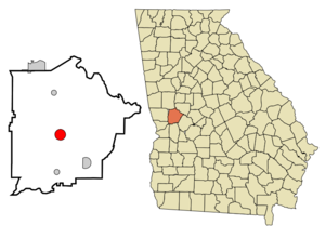
mapsize = 250px
map_caption = Location in Talbot County and the state of Georgia
mapsize1 =
map_caption1 =
image_dot_
dot_mapsize =
dot_map_caption =
dot_x =
dot_y =
pushpin_
pushpin_label_position =
pushpin_map_caption =
pushpin_mapsize =
subdivision_type = Country
subdivision_name =United States
subdivision_type1 = State
subdivision_name1 = Georgia
subdivision_type2 = County
subdivision_name2 = Talbot
subdivision_type3 =
subdivision_name3 =
subdivision_type4 =
subdivision_name4 =
government_footnotes =
government_type =
leader_title =
leader_name =
leader_title1 =
leader_name1 =
leader_title2 =
leader_name2 =
leader_title3 =
leader_name3 =
leader_title4 =
leader_name4 =
established_title =
established_date =
established_title2 =
established_date2 =
established_title3 =
established_date3 =
area_magnitude =
unit_pref = Imperial
area_footnotes =
area_total_km2 = 8.1
area_land_km2 = 8.1
area_water_km2 = 0
area_total_sq_mi = 3.1
area_land_sq_mi = 3.1
area_water_sq_mi = 0
area_water_percent =
area_urban_km2 =
area_urban_sq_mi =
area_metro_km2 =
area_metro_sq_mi =
area_blank1_title =
area_blank1_km2 =
area_blank1_sq_mi =
population_as_of = 2000
population_footnotes =
population_note =
population_total = 1019
population_density_km2 = 125.8
population_density_sq_mi = 328.7
population_metro =
population_density_metro_km2 =
population_density_metro_sq_mi =
population_urban =
population_density_urban_km2 =
population_density_urban_sq_mi =
population_blank1_title =
population_blank1 =
population_density_blank1_km2 =
population_density_blank1_sq_mi =
timezone = Eastern (EST)
utc_offset = -5
timezone_DST = EDT
utc_offset_DST = -4
latd = 32 |latm = 40 |lats = 41 |latNS = N
longd = 84 |longm = 32 |longs = 23 |longEW = W
elevation_footnotes =
elevation_m = 223
elevation_ft = 732
postal_code_type =ZIP code
postal_code = 31827
area_code = 706
blank_name = FIPS code
blank_info = 13-75244GR|2
blank1_name = GNIS feature ID
blank1_info = 0333180GR|3
website =
footnotes =Talbotton is a city in Talbot County, Georgia,
United States . The population was 1,019 at the 2000 census. The city is thecounty seat of Talbot CountyGR|6. Talbotton is known for students left behind, because they have a low graduation rate.Geography
Demographics
As of the
census GR|2 of 2000, there were 1,019 people, 377 households, and 257 families residing in the city. Thepopulation density was 326.8 people per square mile (126.1/km²). There were 420 housing units at an average density of 134.7/sq mi (52.0/km²). The racial makeup of the city was 19.63% White, 77.82% African American, 0.79% Native American, 1.37% Asian, 0.10% from other races, and 0.29% from two or more races. Hispanic or Latino of any race were 1.67% of the population.There were 377 households out of which 31.8% had children under the age of 18 living with them, 36.9% were married couples living together, 26.0% had a female householder with no husband present, and 31.6% were non-families. 29.4% of all households were made up of individuals and 13.8% had someone living alone who was 65 years of age or older. The average household size was 2.66 and the average family size was 3.27.
In the city the population was spread out with 27.8% under the age of 18, 9.5% from 18 to 24, 26.7% from 25 to 44, 22.4% from 45 to 64, and 13.6% who were 65 years of age or older. The median age was 36 years. For every 100 females there were 75.4 males. For every 100 females age 18 and over, there were 68.0 males.
The median income for a household in the city was $19,940, and the median income for a family was $24,792. Males had a median income of $27,250 versus $17,778 for females. The
per capita income for the city was $10,662. About 30.5% of families and 32.5% of the population were below thepoverty line , including 44.2% of those under age 18 and 27.8% of those age 65 or over.References
External links
Wikimedia Foundation. 2010.