- Hinesville, Georgia
Infobox Settlement
official_name = Hinesville, Georgia
other_name =
native_name =
nickname =
settlement_type =City
motto =
imagesize =
image_caption =
flag_size =
image_
seal_size =
image_shield =
shield_size =
image_blank_emblem =
blank_emblem_type =
blank_emblem_size =
imagesize =
image_caption =
flag_size =
image_
seal_size =
image_shield =
shield_size =
image_blank_emblem =
blank_emblem_type =
blank_emblem_size =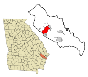
mapsize = 250px
map_caption = Location in Liberty County and the state of Georgia
mapsize1 =
map_caption1 =
image_dot_
dot_mapsize =
dot_map_caption =
dot_x =
dot_y =
pushpin_
pushpin_label_position =
pushpin_map_caption =
pushpin_mapsize =
subdivision_type = Country
subdivision_name =United States
subdivision_type1 = State
subdivision_name1 = Georgia
subdivision_type2 = County
subdivision_name2 = Liberty
subdivision_type3 =
subdivision_name3 =
subdivision_type4 =
subdivision_name4 =
government_footnotes =
government_type =
leader_title =Mayor
leader_name =James Thomas
leader_title1 =
leader_name1 =
leader_title2 =
leader_name2 =
leader_title3 =
leader_name3 =
leader_title4 =
leader_name4 =
established_title =
established_date =
established_title2 =
established_date2 =
established_title3 =
established_date3 =
area_magnitude =
unit_pref = Imperial
area_footnotes =
area_total_km2 = 42.3
area_land_km2 = 42
area_water_km2 = 0.3
area_total_sq_mi = 16.3
area_land_sq_mi = 16.2
area_water_sq_mi = 0.1
area_water_percent =
area_urban_km2 =
area_urban_sq_mi =
area_metro_km2 =
area_metro_sq_mi =
area_blank1_title =
area_blank1_km2 =
area_blank1_sq_mi =
population_as_of = 2000
population_footnotes =
population_note =
population_total = 30392
population_density_km2 = 718.5
population_density_sq_mi = 1864.5
population_metro =
population_density_metro_km2 =
population_density_metro_sq_mi =
population_urban =
population_density_urban_km2 =
population_density_urban_sq_mi =
population_blank1_title =
population_blank1 =
population_density_blank1_km2 =
population_density_blank1_sq_mi =
timezone = Eastern (EST)
utc_offset = -5
timezone_DST = EDT
utc_offset_DST = -4
latd = 31 |latm = 49 |lats = 57 |latNS = N
longd = 81 |longm = 36 |longs = 42 |longEW = W
elevation_footnotes =
elevation_m = 23
elevation_ft = 75
postal_code_type =
postal_code =
area_code = 912
blank_name = FIPS code
blank_info = 13-38964GR|2
blank1_name = GNIS feature ID
blank1_info = 0331992GR|3
website =
footnotes =Hinesville is a city in Liberty County, Georgia,
United States . The population was 30,392 at the 2000 census. The city is thecounty seat of Liberty CountyGR|6. Nearby Fort Stewart and the principal city of Hinesville together comprise the Hinesville-Fort Stewart metropolitan statistical area which comprises all of Liberty County.Geography
Hinesville is located at coor dms|31|49|57|N|81|36|42|W|city (31.832442, -81.611703)GR|1.
According to the
United States Census Bureau , the city.Area of 16.3 square miles (42.2 km²). 16.2 square miles (42.0 km²) of it is land and 0.1 square miles (0.3 km²) of it (0.61%) is water.Demographics
As of the
census GR|2 of 2000, there were 30,392 people, 10,528 households, and 8,032 families residing in the city. Thepopulation density was 1,874.0 people per square mile (723.5/km²). There were 11,742 housing units at an average density of 724.0/sq mi (279.5/km²). The racial makeup of the city was 41.50% White, 46.04% African American, 0.47% Native American, 2.26% Asian, 0.57% Pacific Islander, 5.00% from other races, and 4.16% from two or more races. Hispanic or Latino of any race were 9.11% of the population.There were 10,528 households out of which 50.2% had children under the age of 18 living with them, 56.0% were married couples living together, 16.7% had a female householder with no husband present, and 23.7% were non-families. 17.4% of all households were made up of individuals and 2.4% had someone living alone who was 65 years of age or older. The average household size was 2.89 and the average family size was 3.26.
In the city the population was spread out with 34.2% under the age of 18, 13.8% from 18 to 24, 36.0% from 25 to 44, 12.9% from 45 to 64, and 3.1% who were 65 years of age or older. The median age was 26 years. For every 100 females there were 97.3 males. For every 100 females age 18 and over, there were 95.3 males.
The median income for a household in the city was $35,013, and the median income for a family was $36,221. Males had a median income of $27,135 versus $20,813 for females. The
per capita income for the city was $14,300. About 13.8% of families and 14.8% of the population were below thepoverty line , including 20.9% of those under age 18 and 12.3% of those age 65 or over.chools
Elementary Schools
*Button Gwinnett Elementary
*Frank Long Elementary
*Jordye Bacon Elementary
*Joseph Martin Elementary
*Liberty Elementary
*Lyman Hall Elementary
*Taylors Creek Elementary
*Waldo Pafford ElementaryMiddle Schools
*Coastal Academy
*Lewis Frasier Middle School
*Midway Middle School
*Snelson Golden Middle School
*Trinity Christian academyHigh Schools
*
Bradwell Institute
*First Presbyterian Christian Academy
*Liberty County High School References
External links
* [http://www.hinesville.com/ Hinesville, GA Online Community ]
* [http://www.hinesvilleonline.net/ Hinesville Online]
Wikimedia Foundation. 2010.