- North Druid Hills, Georgia
-
North Druid Hills, Georgia
(Briarcliff, Toco Hills)— Community and CDP — Location in DeKalb County and the state of Georgia location within central Metro Atlanta
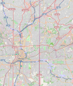
 North Druid Hills
Coordinates: 33°49′11″N 84°19′41″W / 33.81972°N 84.32806°WCoordinates: 33°49′11″N 84°19′41″W / 33.81972°N 84.32806°W Country United States State Georgia County DeKalb Area - Total 5 sq mi (12.9 km2) - Land 5 sq mi (12.9 km2) - Water 0 sq mi (0 km2) Elevation 1,014 ft (309 m) Population (2010) - Total 18,947 - Density 3,804.1/sq mi (1,468.8/km2) Time zone Eastern (EST) (UTC-5) - Summer (DST) EDT (UTC-4) FIPS code 13-56168[1] GNIS feature ID 1805271[2] North Druid Hills, known alternatively as Briarcliff or Toco Hills, is an unincorporated community and census-designated place (North Druid Hills CDP) in DeKalb County, Georgia, United States. The population was 18,947 at the 2010 census.[3] The center of the area is the intersection of Briarcliff and North Druid Hills roads. Among local residents and Metro Atlantans, the area is commonly known as Briarcliff or Toco Hills, in addition to North Druid Hills. The Briarcliff name is seen in the names of area subdivisions and shopping centers, and also sees use in government facilities, such as the Briarcliff Library and Briarcliff High School, both now closed. Toco Hills is a derivative of Toco Hill Shopping Center, one of the area's first, which is itself an informal abbreviation of "top of the County."[4][5]
Contents
Geography
North Druid Hills is located at 33°49′11″N 84°19′41″W / 33.819654°N 84.328061°W.[6]
According to the United States Census Bureau, the CDP has a total area of 5.0 square miles (13 km2), of which 0.20% is water. The CDP boundaries are:
- Interstate 85 to the north, across which is the Buford Highway corridor and Brookhaven (North Atlanta CDP)
- Clairmont Road and the North Decatur CDP and city of Decatur to the east
- the South Fork of Peachtree Creek and the Druid Hills CDP to the south, and
- the DeKalb County boundary and the Buckhead community of the city of Atlanta to the west
The North Druid Hills CDP has two large professional office parks on the south side of Interstate 85. Executive Park and Children's Healthcare of Atlanta are on the west and east sides of North Druid Hills Road, respectively. In addition to the commercial development around these office parks, there is a second commercial district known as the Toco Hills shopping center at North Druid Hills Road and LaVista Road.
Demographics
As of the census[1] of 2000, there were 18,852 people, 9,760 households, and 3,074 families residing in the CDP. Population density was 3,790.0 people per square mile (1,464.5/km²). There were 10,240 housing units at an average density of 2,058.7/sq mi (795.5/km²). CDP ethnic makeup was 82.50% White, 7.30% African American, 0.15% Native American, 4.32% Hispanic or Latino (any race), 6.73% Asian, 0.03% Pacific Islander, 1.44% from other races, and 1.85% from two or more races.
There were 9,760 households, of which 10.0% had children under age 18 living with them, 24.9% are married couples living together, 4.4% had a female householder with no husband present, and 68.5% were non-families. 45.5% of all households were made up of individuals and 10.6% had someone living alone who was 65 years of age or older. Average household size was 1.84 and average family size was 2.67.
CDP population had 9.9% under age 18, 16.6% from 18 to 24, 40.8% from 25 to 44, 16.1% from 45 to 64, and 16.7% who were age 65 or over. Median age was 33 years. For every 100 females there were 92.7 males. For every 100 females age 18 or over, there were 92.3 males.
CDP household median income was $48,530, and family median income was $67,956 (these figures rose to $49,790 and $82,003 respectively as of a 2007 estimate[7]). Males had a median income of $45,313 versus $37,327 for females. CDP per capita income was $33,288. About 4.9% of families and 13.7% of the population were below the poverty line, including 9.3% of those under age 18 and 8.4% of those age 65 or over.
History and architecture
An early settler in this part of DeKalb County was Chapman Powell, whose "Medicine House" cabin was built near 1218 Clairmont Road. (It has been preserved and relocated to Stone Mountain Park.) Dr. Powell (1798–1870) owned most of the land in the Candler Lake and South Fork Peachtree Creek area during his lifetime. His land was later purchased by Walter Candler.[8]
Major Washington Jackson Houston owned land on the north side of the South Fork of Peachtree Creek, in what is now the North Druid Hills CDP. Visitors used to visit Major Houston to buy ground cornmeal produced by his 1876 gristmill or to attend social gatherings held on his property. Major Houston converted the mill into an early hydroelectric plant circa 1900.[8] Atlanta contractor Harry J. Carr bought Houston's land in the 1920s and constructed the fieldstone and wrought iron home now known as the Houston Mill House. Emory University purchased the home in the 1960s and renovated it. Houston Mill House, located at 849 Houston Mill Road, is now open for dining and special events.[9]
Government and infrastructure
The United States Postal Service operates the Druid Hills Post Office at 1799 Briarcliff Road NE in the CDP.[10][11]
Diplomatic missions
The Consulate-General of Mexico in Atlanta is in the North Druid Hills CDP.[11][12]
Education
DeKalb County Schools serves the CDP. Briar Vista Elementary School, the zoned school of North Druid Hills, is in the CDP.[11][13] Residents zoned to Briar Vista are also zoned to Shamrock Middle School (in North Decatur CDP[14]) and Druid Hills High School (in Druid Hills CDP[15]).[16]
The Roman Catholic Archdiocese of Atlanta operates the Immaculate Heart of Mary School, a parochial school, at 2855 Briarcliff Road in the CDP.[11][17]
Private schools:
- Cliff Valley School, 2426 Clairmont Rd. Private elementary school.
- Intown Community School, 2059 LaVista Rd. Private PCA-affiliated school.
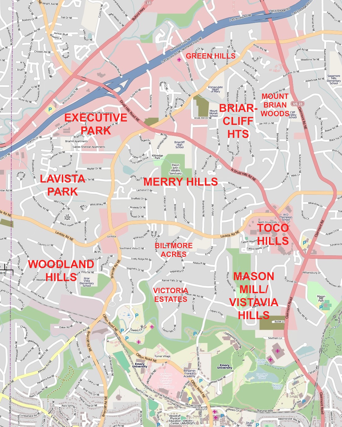
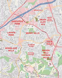 North Druid Hills neighborhoods
Neighborhoods
- Biltmore Acres. South of LaVista Rd., west of Houston Mill Rd. & north of the South Branch of Peachtree Creek.
- Briarcliff Heights. NW of Mount Brian Woods.
- Green Hills. North of Briarcliff Rd. & south of I-85.
- LaVista Park. East of DeKalb/Fulton line and west of Briarcliff Road.
- Merry Hills. Between LaVista Rd. & North Druid Hills Rd.
- Mount Brian Woods. North of North Druid Hills Rd., NW of LaVista Rd. & west of Clairmont Rd.
- Sheridan Court. In CDP NW corner, around Sheridan Drive.
- Woodland Hills. South of LaVista Road between Briarcliff Road & DeKalb County boundary.
- Mason Mill. South of North Druid Hills Road & LaVista Road, between Clairmont Road & Houston Mill.
- Vistavia Hills. On Vistavia Circle between Clairmont Road & Mason Woods Drive.
Parks
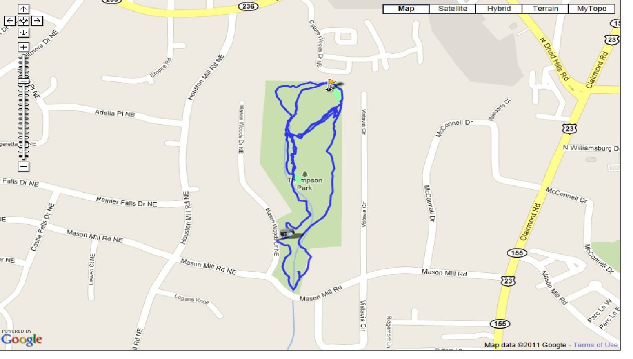
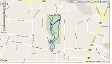 WD Thompson Park Trail Map
- Kittredge Park, 1520 Kittredge Park Rd., 2-acre (8,100 m2) park with baseball field, pool and multi-use court.
- LaVista Park, 1319 Brookforest Dr., 4-acre (16,000 m2) DeKalb County park with playground and picnic area.
- W.D. Thompson Park, 1760 Mason Mill Rd. (at Vistavia Cir.), 29-acre (120,000 m2) DeKalb County park with courts, playground, picnic area and trails.
Transportation
- Briarcliff Rd. Major road unifing the CDP.
- Interstate 85. CDP northern boundary.
- LaVista Rd. Primary E-W road.
- North Druid Hills Rd. Primary access from Interstate 85.
References
- ^ a b "American FactFinder". United States Census Bureau. http://factfinder.census.gov. Retrieved 2008-01-31.
- ^ "US Board on Geographic Names". United States Geological Survey. 2007-10-25. http://geonames.usgs.gov. Retrieved 2008-01-31.
- ^ "Race, Hispanic or Latino, Age, and Housing Occupancy: 2010 Census Redistricting Data (Public Law 94-171) Summary File (QT-PL), North Druid Hills CDP, Georgia". U.S. Census Bureau, American FactFinder 2. http://factfinder2.census.gov. Retrieved October 28, 2011.
- ^ http://www.city-data.com/neighborhood/Briarcliff-Atlanta-GA.html
- ^ http://www.atlantatimemachine.com/commercialbldgs/toco.htm
- ^ "US Gazetteer files: 2010, 2000, and 1990". United States Census Bureau. 2011-02-12. http://www.census.gov/geo/www/gazetteer/gazette.html. Retrieved 2011-04-23.
- ^ http://factfinder.census.gov/servlet/ACSSAFFFacts?_event=Search&geo_id=06000US0900384900&_geoContext=01000US%7C04000US09%7C05000US09003%7C06000US0900384900&_street=&_county=north+druid+hills&_cityTown=north+druid+hills&_state=04000US13&_zip=&_lang=en&_sse=on&ActiveGeoDiv=geoSelect&_useEV=&pctxt=fph&pgsl=060&_submenuId=factsheet_1&ds_name=ACS_2007_3YR_SAFF&_ci_nbr=null&qr_name=null®=null%3Anull&_keyword=&_industry=
- ^ a b Glen Creek Watershed History: "Points of Interest in the Watershed"
- ^ http://www.houstonmillhouse.com/history.php
- ^ "Post Office Location - DRUID HILLS." United States Postal Service. Retrieved on May 5, 2009.
- ^ a b c d "North Druid Hills CDP, GA." United States Census Bureau. Retrieved on May 5, 2009.
- ^ Home Page." Consulate-General of Mexico in Atlanta. Accessed October 26, 2008.
- ^ Home page. Briar Vista Elementary School. Retrieved on May 5, 2009.
- ^ "North Decatur CDP, GA." United States Census Bureau. Retrieved on May 5, 2009.
- ^ "Druid Hills CDP, GA." United States Census Bureau. Retrieved on May 5, 2009.
- ^ "Schools / Grade Configurations for 2008–2009." DeKalb County School System. Retrieved on May 5, 2009.
- ^ "Welcome to IHM!." Immaculate Heart of Mary School. Retrieved on May 5, 2009.
External links
- Arbor Atlanta: W.D. Thompson Park
- Clairmont Heights Civic Association
- Houston Mill House
- LaVista Park Civic Association
- Lindbergh-LaVista Corridor Coalition
- Merry Hills Homeowners Association
- North Druid Hills Residents Association
- Woodland Hills Neighborhood Association
Metro Atlanta Counties 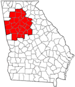
Major city Municipalities & communities 100k-250k 25k-100k Alpharetta • Brookhaven • Candler-McAfee • Duluth • Dunwoody • East Point • Gainesville • Johns Creek • Lawrenceville • Mableton • Marietta • Milton • Newnan • Peachtree City • Peachtree Corners • Redan • Smyrna • Tucker10k-25k Acworth • Belvedere Park • Buford • Carrollton • Cartersville • Chamblee • College Park • Conyers • Covington • Decatur • Doraville • Druid Hills • Douglasville • Fayetteville • Forest Park • Griffin • Kennesaw • Suwanee • Lilburn • Monroe • Mountain Park • North Decatur • North Druid Hills • Panthersville • Powder Springs • Riverdale • Snellville • Stockbridge • Sugar Hill • Union City • Vinings • Winder • WoodstockTopics Architecture • Culture • History • Media • Neighborhoods • People • Tourism • Transportation Municipalities and communities of DeKalb County, Georgia Cities Atlanta‡ | Avondale Estates | Chamblee | Clarkston | Decatur | Doraville | Dunwoody | Lithonia | Pine Lake | Stone Mountain
CDPs Belvedere Park | Candler-McAfee | Druid Hills | Gresham Park | North Atlanta | North Decatur | North Druid Hills | Panthersville | Redan | Scottdale | Tucker
Unincorporated
communitiesBrookhaven | Embry Hills | Lenox Park | Northlake | Pittsburg | Smoke Rise | Vista Grove
Ghost town Footnotes ‡This populated place also has portions in an adjacent county or counties
Categories:- Atlanta metropolitan area
- Populated places in DeKalb County, Georgia
- Census-designated places in Georgia (U.S. state)
- Unincorporated communities in Georgia (U.S. state)
- United States places with Orthodox Jewish communities


Wikimedia Foundation. 2010.