- Druid Hills, Georgia
-
Druid Hills, Atlanta, Georgia — CDP and neighborhood of the City of Atlanta — Location in DeKalb County and the state of Georgia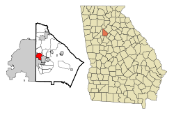 Druid Hills CDP, unincorporated DeKalb County
 Druid Hills (portion in City of Atlanta)
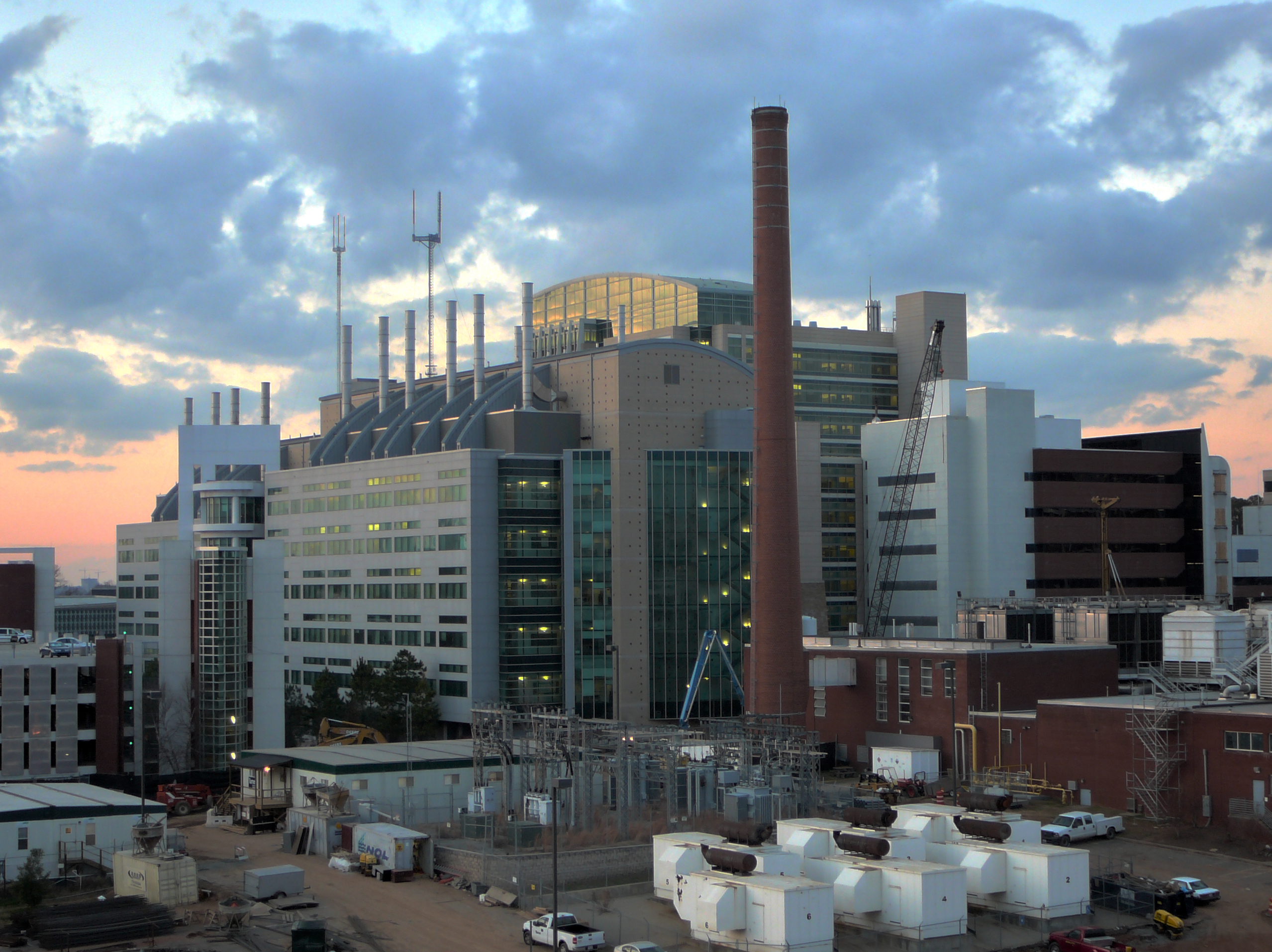
Coordinates: 33°47′14″N 84°19′34″W / 33.78722°N 84.32611°WCoordinates: 33°47′14″N 84°19′34″W / 33.78722°N 84.32611°W Country United States State Georgia County DeKalb Area – Total 4.2 sq mi (11 km2) – Land 4.2 sq mi (10.9 km2) – Water 0 sq mi (0.1 km2) Elevation 912 ft (278 m) Population (2010) – Total 14,568 – Density 3,430.1/sq mi (1,324.4/km2) (CDP only) Time zone Eastern (EST) (UTC-5) – Summer (DST) EDT (UTC-4) ZIP code 30333 Area code(s) 404 FIPS code 13-24264[1] GNIS feature ID 0331589[2] Druid Hills is a community which includes both a census-designated place (CDP) in unincorporated DeKalb County, Georgia, United States, as well as a neighborhood of the city of Atlanta. The CDP's population was 14,568 at the 2010 census.[3] The CDP contains the main campus of Emory University and the Centers for Disease Control and Prevention.
Contents
Geography
Druid Hills is located at 33°47′14″N 84°19′34″W / 33.78722°N 84.32611°W (33.787205, -84.325974).[4]
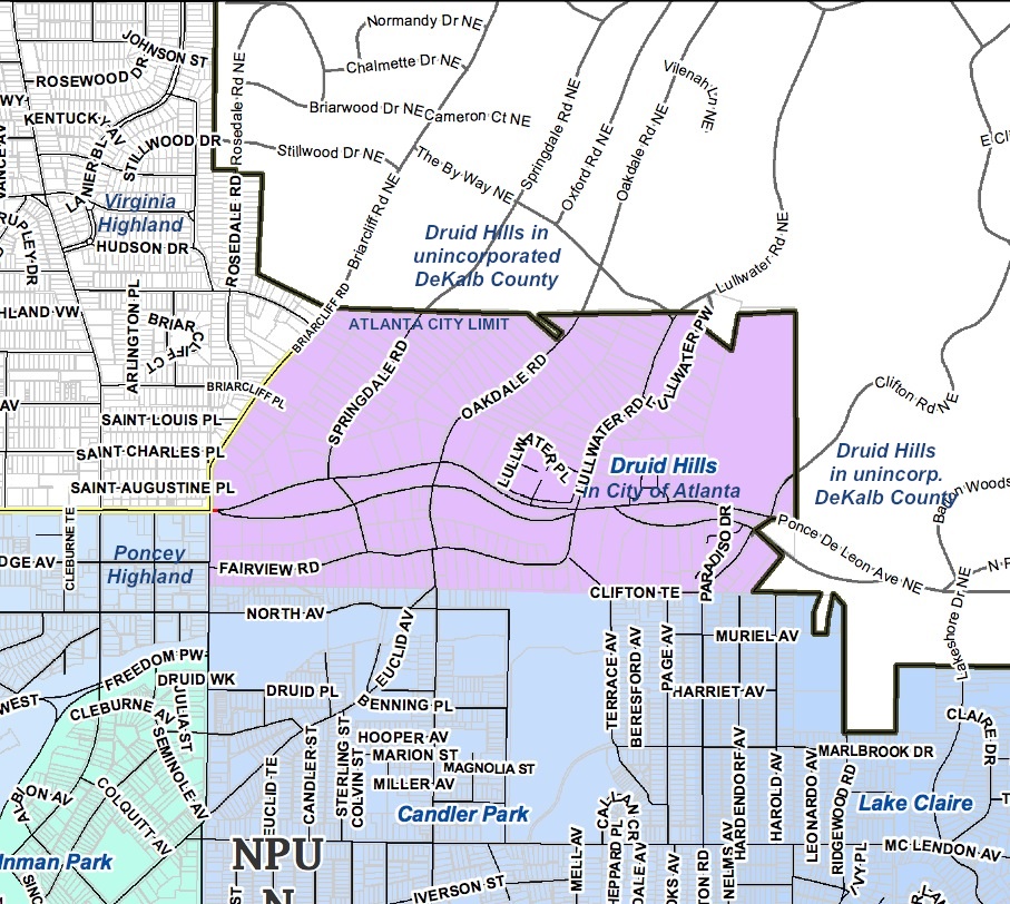
According to the United States Census Bureau, the CDP has a total area of 4.2 square miles (11 km2), of which 0.04 square miles (0.10 km2), or 0.48%, is water. The CDP's northern boundary is the South Fork of Peachtree Creek; the CSX track and the Decatur city limits are the eastern boundary; the DeKalb County line is the western boundary; and the southern boundary is the Atlanta city limit.
The Druid Hills neighborhood of Atlanta is bounded by the Druid Hills CDP (i.e. unincorporated DeKalb County) on the north and east; the Morningside/Lenox Park, Virginia-Highland and Poncey-Highland neighborhoods of Atlanta on the west; and the Candler Park neighborhood of Atlanta on the south.
Demographics
As of the census[1] of 2000, there were 12,742 people, 4,627 households, and 2,040 families residing in the CDP. The population density was 3,040.4 people per square mile (1,174.1/km²). There were 4,830 housing units at an average density of 1,152.6/sq mi (445.1/km²). The racial makeup of the CDP was 84.15% White, 6.0% African-American, 0.16% Native American, 7.34% Asian, 0.07% Pacific Islander, 0.64% from other races, and 1.64% from two or more races. Hispanic or Latino of any race were 2.43% of the population.
There were 4,627 households out of which 18.9% had children under the age of 18 living with them, 37.5% were married couples living together, 4.7% had a female householder with no husband present, and 55.9% were non-families. 37.4% of all households were made up of individuals and 10.0% had someone living alone who was 65 years of age or older. The average household size was 2.06 and the average family size was 2.80.
In the CDP the population was spread out with 13.0% under the age of 18, 30.2% from 18 to 24, 30.7% from 25 to 44, 16.5% from 45 to 64, and 9.6% who were 65 years of age or older. The median age was 28 years. For every 100 females there were 91.5 males. For every 100 females age 18 and over, there were 88.2 males.
The median income for a household in the CDP was $62,953, and the median income for a family was $106,196. Males had a median income of $57,017 versus $45,458 for females. The per capita income for the CDP was $34,829. About 2.3% of families and 7.7% of the population were below the poverty line, including 3.5% of those under age 18 and 4.2% of those age 65 or over.
History
The planned community was initially conceived by Joel Hurt, and developed with the effort of Atlanta's leading families, including Coca-Cola founder Asa Candler. It contains some of Atlanta's historic mansions from the late 19th and early 20th century. Druid Hills includes the main campus of Emory University, which relocated to Atlanta in 1914.
Druid Hills was designed by Frederick Law Olmsted and was one of his last commissions. A showpiece of the design was the string of parks along Ponce de Leon Avenue, which was designated as Druid Hills Parks and Parkways and listed on the National Register of Historic Places on April 11, 1975. The remainder of the development was listed on the Register as the Druid Hills Historic District on October 25, 1979.[5][6] Later the Park and Parkways district was consolidated into the Druid Hills Historic District. The other historic districts in Druid Hills are:
- Emory University District, added in 1975
- University Park-Emory Highlands-Emory Estates Historic District, added in 1998
- Emory Grove Historic District, added in 2000.[7]
Government and infrastructure

The United States Postal Service operates the Druid Hills Post Office at 1799 Briarcliff Road NE in the North Druid Hills CDP in unincorporated DeKalb.[8][9] The Centers for Disease Control and Prevention's main offices are located in the CDP.[10][11][12]
Culture
Druid Hills is home to The Atlanta Boy Choir on S. Ponce de Leon Ave. and Callanwolde Fine Arts Center, housed in the Gothic-Tudor style former estate of Charles Howard Candler, president of Coca-Cola and eldest son of Asa Griggs Candler, Coca-Cola's co-founder.
Education
Primary and secondary schools
Public schools
The CDP is served by the DeKalb County School System. Residents are zoned to Fernbank Elementary School (in the Druid Hills CDP[11]), Druid Hills Middle School (in the North Decatur CDP[13]), and Druid Hills High School (in the Druid Hills CDP[11]).[14]
Private schools
- The Paideia School [2] is a nearby preK–12 private school [3] in the city of Atlanta.
Colleges and universities
Emory University is a private university located in the Druid Hills CDP.[11]
Parks
- Baker Woodland, Emory University, between Fishburne Dr. & South Kilga Cir. Forest of oak, tulip poplar, beech, and hickory trees - contains over 100 plant species.
- Burbanck Park, Oxford Rd. & Clifton Rd. 1.2-acre (4,900 m2) natural park which borders Peavine Creek. It is named after Madeline and William Burbanck, Emory University professors who owned the property.
- Fernbank Forest, Fernbank Museum of Natural History.
- Fernbank School Park, 157 Heaton Park Dr. This DeKalb County 12-acre (49,000 m2) park is located west of the CSX railroad tracks. It includes a multi-use field and court, playground, picnic area and walking trails.
- Hahn Woods, Emory University, Houston Mill Rd. (at South Peachtree Creek). Nature preserve with trail and viewing platform over the creek.
- Medlock Park North Druid Hills subdivision, Nine little league baseball fields with concessions, playground and a running/cycling trail which follows Nancy Creek.
- Olmsted Linear Park, Druid Hills, Ponce de Leon Ave. 50 acres (200,000 m2) of six distinct parks, strung along Ponce de Leon Avenue like a necklace. They were designed by Frederick Law Olmsted in the late 19th Century. Each of the six parks has its own name: Deepdene, Dellwood, Shadyside, Springdale, Virgilee and Oak Grove (formerly Brightwood).
- Wesley Woods Forest, Emory University.
Churches
- Atlanta Metropolitian Cathedral, 999 Briarcliff Rd.
- Atlanta Primitive Baptist Church, 1367 S Ponce De Leon Ave.
- Emory Presbyterian Church (PCUSA), 1886 N Decatur Rd.
- Church of the Epiphany (AEC), 2089 Ponce De Leon Ave.
- Druid Hills Baptist Church (CBF), Ponce de Leon Ave. & N. Highland Ave.
- Druid Hills Presbyterian Church (PCUSA), 1026 Ponce De Leon Ave.
- Druid Hills United Methodist Church (UMC), Ponce de Leon Ave. & Briarcliff Rd.
- Glenn Memorial United Methodist Church (UMC), 1660 N. Decatur Rd.
- The Church of Jesus Christ of Latter-Day Saints (Mormon), 1450 Ponce De Leon Ave.
- St. Elias Antiochian Orthodox Church, 2045 Ponce de Leon Ave.
- Saint John's Lutheran Church (ELCA), 1410 Ponce de Leon Ave.
- St. John Chrysostom Melkite Church, 1428 Ponce De Leon Ave.
Notable residents
- Cully Cobb, founder of the Cobb Institute of Archaeology at Mississippi State University
See also
Bibliography
- Bryant, James C. Druid Hills Golf Club in Atlanta: The Story and the People, 1912–1997. Atlanta, Ga.: Druid Hills Golf Club, 1998
- Hartle, Robert, Jr. Atlanta's Druid Hills: A Brief History. The History Press, June 27, 2008.
References
- ^ a b "American FactFinder". United States Census Bureau. http://factfinder.census.gov. Retrieved 2008-01-31.
- ^ "US Board on Geographic Names". United States Geological Survey. 2007-10-25. http://geonames.usgs.gov. Retrieved 2008-01-31.
- ^ "Race, Hispanic or Latino, Age, and Housing Occupancy: 2010 Census Redistricting Data (Public Law 94-171) Summary File (QT-PL), Druid Hills CDP, Georgia". U.S. Census Bureau, American FactFinder 2. http://factfinder2.census.gov. Retrieved October 28, 2011.
- ^ "US Gazetteer files: 2010, 2000, and 1990". United States Census Bureau. 2011-02-12. http://www.census.gov/geo/www/gazetteer/gazette.html. Retrieved 2011-04-23.
- ^ "National Register Information System". National Register of Historic Places. National Park Service. 2009-03-13. http://nrhp.focus.nps.gov/natreg/docs/All_Data.html.
- ^ "[1]" National Register of Historic Places: DeKalb County Retrieved: 18 August 2008.
- ^ National Register of Historic Places: DeKalb County Retrieved: 3 September 2008
- ^ "Post Office Location - DRUID HILLS." United States Postal Service. Retrieved on May 5, 2009.
- ^ "North Druid Hills CDP, GA." United States Census Bureau. Retrieved on May 5, 2009.
- ^ Home Page. Centers for Disease Control and Prevention. Retrieved on November 19, 2008.
- ^ a b c d "Druid Hills CDP, GA." United States Census Bureau. Retrieved on May 5, 2009.
- ^ Kessler, John. "CDC flu chief: ‘Mother Nature rolling the dice’." Atlanta Journal-Constitution. Sunday May 3, 2009. Retrieved on February 5, 2011. "The second bolt of lightning struck two miles south of the CDC, in Druid Hills."
- ^ "North Decatur CDP, GA." United States Census Bureau. Retrieved on May 5, 2009.
- ^ "Schools / Grade Configurations for 2008–2009." DeKalb County School System. Retrieved on May 5, 2009.
External links
- Druid Hills Civic Association
- Druid Hills Historic District
- DeKalb County Schools Druid Hills Community History
- Arbor Atlanta: Hahn Woods
- Wesley Woods Forest
- Emory University Walking Tour
- Emory Village historic preservation incl. history of Emory Village
Architects Historic buildings Briarcliff (mansion) - Callanwolde - Lullwater House - Rainbow TerraceHistoric districts Druid Hills Historic District - Emory University District - Emory Grove Historic District - University Park-Emory Highlands-Emory Estates Historic DistrictInstitutions Callanwolde Fine Arts Center - Centers for Disease Control and Prevention - Druid Hills Golf Club - Druid Hills High School - Emory University - Emory University Hospital - Fernbank Forest - Fernbank Museum of Natural History - Fernbank Science Center - The Paideia SchoolPeople Asa Griggs Candler - Asa G. Candler, Jr. - Enrico Leide - Jimmy Carnes - Louie De Votie Newton - Lucy Beall Candler Owens Heinz Leide - Ron BlombergTransportation Atlanta freeway revolts - Clifton Corridor - Freedom Parkway - Moreland Avenue - PATH trails - Ponce de Leon Avenue - Stone Mountain FreewayOther Inman Park · Midtown · Morningside-Lenox Park · Old Fourth Ward · Poncey-Highland · Virginia-Highland · All neighborhoods of AtlantaMetro Atlanta Counties 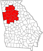
Major city Municipalities & communities 100k-250k 25k-100k Alpharetta • Brookhaven • Candler-McAfee • Duluth • Dunwoody • East Point • Gainesville • Johns Creek • Lawrenceville • Mableton • Marietta • Milton • Newnan • Peachtree City • Peachtree Corners • Redan • Smyrna • Tucker10k-25k Acworth • Belvedere Park • Buford • Carrollton • Cartersville • Chamblee • College Park • Conyers • Covington • Decatur • Doraville • Druid Hills • Douglasville • Fayetteville • Forest Park • Griffin • Kennesaw • Suwanee • Lilburn • Monroe • Mountain Park • North Decatur • North Druid Hills • Panthersville • Powder Springs • Riverdale • Snellville • Stockbridge • Sugar Hill • Union City • Vinings • Winder • WoodstockTopics Architecture • Culture • History • Media • Neighborhoods • People • Tourism • Transportation Municipalities and communities of DeKalb County, Georgia Cities Atlanta‡ | Avondale Estates | Chamblee | Clarkston | Decatur | Doraville | Dunwoody | Lithonia | Pine Lake | Stone Mountain
CDPs Belvedere Park | Candler-McAfee | Druid Hills | Gresham Park | North Atlanta | North Decatur | North Druid Hills | Panthersville | Redan | Scottdale | Tucker
Unincorporated
communitiesBrookhaven | Embry Hills | Lenox Park | Northlake | Pittsburg | Smoke Rise | Vista Grove
Ghost town Footnotes ‡This populated place also has portions in an adjacent county or counties
Neighborhoods of Atlanta, Georgia
Downtown Castleberry Hill - Fairlie-Poplar - Centennial Hill - Hotel District - Five Points - Luckie Marietta - Peachtree Center - SoNo - South DowntownMidtown Ansley Park - Atlantic Station - Colony Square - Fox Theatre Historic District - Historic Midtown - Home Park - Sherwood Forest - Technology SquareBuckhead Brookwood Hills - Buckhead Forest - Buckhead Village - Garden Hills - Historic Brookhaven - Lindbergh - Margaret Mitchell - North Buckhead - Paces - Peachtree Hills - Peachtree Park - Pine Hills - TerminusWest Midtown Blandtown - Home Park - Knight Park-Howell Station - Loring Heights - Marietta Street Artery - Underwood Hills - Westside ProvisionsEast Atkins Park - Cabbagetown - Candler Park - Druid Hills - East Atlanta - East Lake - Edgewood - Glenwood Park - Grant Park - Inman Park - Kirkwood - Lake Claire - Lindridge/Martin Manor - Little Five Points - Morningside/Lenox Park - North Ormewood Park - Oakland - Old Fourth Ward - Ormewood Park - Piedmont Heights - Poncey-Highland - Reynoldstown - Sweet Auburn - Villages of East Lake - Virginia HighlandSouth Benteen Park - Capitol Gateway - Chosewood Park - Joyland - Lakewood Heights - South Atlanta - Summerhill - Villages at CarverSouthwest Adair Park - Adamsville - Ben Hill - Capitol View - Capitol View Manor - Cascade Heights - Collier Heights - Just Us - Mechanicsville - Oakland City - Perkerson - Peoplestown - Pittsburgh - Sylvan Hills - Villages of Castleberry Hill - West End - WestviewNorthwest Bankhead - The Bluff - Center Hill - English Avenue - Grove Park - Hunter Hills - Mozley Park - Riverside - Vine City - Washington Park - West Highlands - West Lake - Whittier Mill Village
U.S. National Register of Historic Places Topics Lists by states Alabama • Alaska • Arizona • Arkansas • California • Colorado • Connecticut • Delaware • Florida • Georgia • Hawaii • Idaho • Illinois • Indiana • Iowa • Kansas • Kentucky • Louisiana • Maine • Maryland • Massachusetts • Michigan • Minnesota • Mississippi • Missouri • Montana • Nebraska • Nevada • New Hampshire • New Jersey • New Mexico • New York • North Carolina • North Dakota • Ohio • Oklahoma • Oregon • Pennsylvania • Rhode Island • South Carolina • South Dakota • Tennessee • Texas • Utah • Vermont • Virginia • Washington • West Virginia • Wisconsin • WyomingLists by territories Lists by associated states Other Historic Districts in Metro Atlanta Clayton County 
Cobb County Coweta County Grantville · Newnan: Cole Town · Greenville St.-LaGrange St. · Newnan Commercial · Newnan Cotton Mill and Mill Village · Northwest Newnan Residential · Platinum Point · Roscoe: Roscoe-Dunaway Gardens · Sargent · SenoiaDeKalb County Atlanta: Candler Park · Druid Hills · Inman Park-Moreland · Kirkwood · Avondale Estates · Brookhaven: · Oglethorpe University · Decatur: South Candler Street-Agnes Scott College ·Winnona Park · Druid Hills: Emory Grove · Emory University District · University Park-Emory Highlands-Emory Estate · Stone MountainDouglas County Fulton County Atlanta: Adair Park · Ansley Park · Atkins Park · Atlanta University Center · Berkeley Park · Brookhaven · Brookwood Hills · Cabbagetown · Castleberry Hill · Collier Heights · Druid Hills · Fairlie-Poplar · Fox Theatre Historic District · Garden Hills · Georgia Tech · Grant Park · Hotel Row · Howell Interlocking · Knight Park-Howell Station · Inman Park · Inman Park-Moreland · Knox Apts., Cauthorn House and Peachtree Rd. Apts. · Lakewood Heights · Martin Luther King, Jr., National Historic Site · Means St. · Midtown · Mozley Park · Oakland City · Peachtree Highlands-Peachtree Park · Pittsburgh · Reynoldstown · Southern Ry. North Ave. Yards · Sunset Ave. (proposed) · Sweet Auburn · Techwood Homes · Underground Atlanta · Virginia Highland · Washington Park · West End · Whittier Mills
College Park · East Point: Industrial District · Fairburn · Hapeville · RoswellGwinnett County Hall County Clermont · Flowery Branch · Gainesville: · Brenau College · Chicopee Mill and Village · Gainesville Commercial · Green Street · Green St.-Brenau · Gillsville · LulaNewton County Covington · Covington Mills and Mill Village · Floyd Street · Newborn · North Covington · Oxford · Porterdale · StarrsvilleRockdale County Categories:- Neighborhoods in Atlanta, Georgia
- Atlanta metropolitan area
- Populated places in DeKalb County, Georgia
- Census-designated places in Georgia (U.S. state)
- Historic districts in Georgia (U.S. state)


Wikimedia Foundation. 2010.