- Buford, Georgia
Infobox Settlement
official_name = Buford, Georgia
other_name =
native_name =
nickname =
settlement_type =City
motto =
imagesize =
image_caption =
flag_size =
image_
seal_size =
image_shield =
shield_size =
image_blank_emblem =
blank_emblem_type =
blank_emblem_size =
imagesize =
image_caption =
flag_size =
image_
seal_size =
image_shield =
shield_size =
image_blank_emblem =
blank_emblem_type =
blank_emblem_size =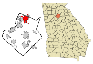
mapsize = 250x200px
map_caption = Location in Gwinnett County and the state of Georgia
mapsize1 =
map_caption1 =
image_dot_
dot_mapsize =
dot_map_caption =
dot_x =
dot_y =
pushpin_
pushpin_label_position =
pushpin_map_caption =
pushpin_mapsize =
subdivision_type = Country
subdivision_name =United States
subdivision_type1 = State
subdivision_name1 = Georgia
subdivision_type2 = Counties
subdivision_name2 = Gwinnett, Hall
subdivision_type3 =
subdivision_name3 =
subdivision_type4 =
subdivision_name4 =
government_footnotes =
government_type =
leader_title =
leader_name =
leader_title1 =
leader_name1 =
leader_title2 =
leader_name2 =
leader_title3 =
leader_name3 =
leader_title4 =
leader_name4 =
established_title =
established_date =
established_title2 =
established_date2 =
established_title3 =
established_date3 =
area_magnitude =
unit_pref = Imperial
area_footnotes =
area_total_km2 = 38.2
area_land_km2 = 38.1
area_water_km2 = 0.1
area_total_sq_mi = 14.8
area_land_sq_mi = 14.7
area_water_sq_mi = 0.1
area_water_percent =
area_urban_km2 =
area_urban_sq_mi =
area_metro_km2 =
area_metro_sq_mi =
area_blank1_title =
area_blank1_km2 =
area_blank1_sq_mi =
population_as_of = 2000
population_footnotes =
population_note =
population_total = 10668
population_density_km2 = 279.3
population_density_sq_mi = 720.8
population_metro =
population_density_metro_km2 =
population_density_metro_sq_mi =
population_urban =
population_density_urban_km2 =
population_density_urban_sq_mi =
population_blank1_title =
population_blank1 =
population_density_blank1_km2 =
population_density_blank1_sq_mi =
timezone = Eastern (EST)
utc_offset = -5
timezone_DST = EDT
utc_offset_DST = -4
latd = 34 |latm = 7 |lats = 1 |latNS = N
longd = 83 |longm = 59 |longs = 55 |longEW = W
elevation_footnotes =
elevation_m = 361
elevation_ft = 1184
postal_code_type =ZIP code s
postal_code = 30515, 30518, 30519
area_code = 770, 678
blank_name = FIPS code
blank_info = 13-11784GR|2
blank1_name = GNIS feature ID
blank1_info = 0312001GR|3
website =
footnotes =Buford is a city in Gwinnett and Hall counties in the
U.S. state of Georgia. The population was 10,668 at the 2000 census.Geography
Buford is located at coor dms|34|7|1|N|83|59|55|W|city (34.117080, -83.998535)GR|1.
According to the
United States Census Bureau , the city has a total area of 14.8square mile s (38.3km² ), of which, 14.7 square miles (38.2 km²) of it is land and 0.1 square miles (0.1 km²) of it (0.34%) is water.History
In a bid to host the lunch stop on the new
Atlanta and Richmond Air Line Railway , they renamed the town after its president,Algernon S. Buford . They won the lucrative stopping point. Buford has grown rapidly over the last few years, primarily because of theMall of Georgia , and a strong city school system.Demographics
As of the
census GR|2 of 2000, there were 10,668 people, 3,794 households, and 2,579 families residing in the city. Thepopulation density was 724.4 people per square mile (279.6/km²). There were 4,044 housing units at an average density of 274.6/sq mi (106.0/km²). The racial makeup of the city was 76.16% White, 13.33% African American, 0.31% Native American, 0.82% Asian, 0.04% Pacific Islander, 7.56% from other races, and 1.78% from two or more races. Hispanic or Latino of any race were 17.27% of the population.There were 3,794 households out of which 34.7% had children under the age of 18 living with them, 48.0% were married couples living together, 14.3% had a female householder with no husband present, and 32.0% were non-families. 26.0% of all households were made up of individuals and 7.7% had someone living alone who was 65 years of age or older. The average household size was 2.76 and the average family size was 3.29.
In the city the population was spread out with 26.5% under the age of 18, 10.7% from 18 to 24, 33.7% from 25 to 44, 19.0% from 45 to 64, and 10.0% who were 65 years of age or older. The median age was 32 years. For every 100 females there were 102.0 males. For every 100 females age 18 and over, there were 99.6 males.
The median income for a household in the city was $38,733, and the median income for a family was $43,100. Males had a median income of $29,458 versus $22,342 for females. The
per capita income for the city was $18,308. About 7.5% of families and 11.2% of the population were below thepoverty line , including 9.2% of those under age 18 and 17.2% of those age 65 or over.Schools with Buford mailing address
Elementary Schools
* Buford Academy (Buford City Schools)
* Buford Elementary (Buford City Schools)
* Friendship Elementary (Flowery Branch)
* Harmony Elementary (Mill Creek)
* Ivy Creek Elementary (Mill Creek)
* Patrick Elementary (Mill Creek) (opening 8/07)
* Sugar Hill Elementary (North Gwinnett)
* White Oak Elementary (opening 8/09)Middle Schools
* Glenn C. Jones Middle (Mill Creek)
* Lanier Middle (North Gwinnett)
* Twin Rivers Middle (opening 8/08)
* Buford Middle (Buford City)High Schools
* Buford High (Buford City)
* Lanier High (Lanier) (opening 8/10)References
External links
* [http://www.cityofbuford.com/ Official Page]
* [http://www.gwinnettchamber.org/ Official site of the Gwinnett Chamber of Commerce]
* [http://www.partnershipgwinnett.com/ Official site of Partnerhship Gwinnett]
Wikimedia Foundation. 2010.