- Doraville, Georgia
-
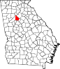
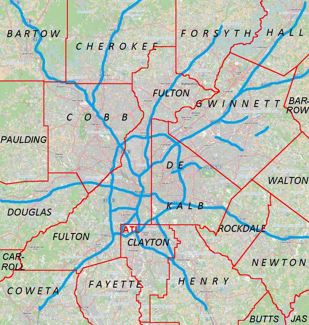
Doraville, Georgia — City — Location in DeKalb County and the state of Georgia Doraville location in Metro Atlanta
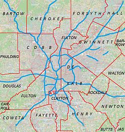
 Doraville
Coordinates: 33°54′19″N 84°16′26″W / 33.90528°N 84.27389°WCoordinates: 33°54′19″N 84°16′26″W / 33.90528°N 84.27389°W Country United States State Georgia County DeKalb Area – Total 3.6 sq mi (9.3 km2) – Land 3.6 sq mi (9.3 km2) – Water 0 sq mi (0 km2) Elevation 1,073 ft (327 m) Population (2010) – Total 8,330 – Density 2,739.4/sq mi (1,060.4/km2) Time zone Eastern (EST) (UTC-5) – Summer (DST) EDT (UTC-4) ZIP codes 30340, 30360, 30362 Area code(s) 770 FIPS code 13-23536[1] GNIS feature ID 0325924[2] Doraville is a city in DeKalb County, Georgia, United States, northeast of Atlanta. As of the 2010 census, the city had a population of 8,330[3].
Contents
History
Doraville was incorporated by an act of the Georgia General Assembly, approved December 15, 1871. From its inception until the 1940s, Doraville was a small agricultural community that served the interests of a larger surrounding farming area.
At the end of World War II, Doraville was on a main railroad line, and had a new water system available. General Motors selected Doraville as the site for its new assembly plant. The growth of Doraville exploded in the late 1940s and the 1950s as a result. In the late 1940s, plans for Guilford Village, the first subdivision, were announced by Southern Builders and Engineering Company. The 112-home subdivision at Tilly Mill and Flowers Roads was to cover some 58 acres.
In 1950, Doraville’s population was 472. By 1964, the city's population was 6,160 and land area was 1,722 acres. Part of the population growth during that period was because of the annexation of Northwoods in 1949 and Oakcliff in 1958.
By the 1980s Doraville and neighboring Chamblee atteracted immigrants relocating to the Atlanta area who settled along Buford Highway. The result is one of the largest Asian communities in the country. Many Latin American countries are also represented. 56% of residents speak a language other than English as a first language.
The Doraville MARTA Station was built in 1992, destroying the few buildings that remained of Doraville's downtown. The GM Plant closed in 2009, and the economy has stalled plans to turn the site into a mixed-use town center. Nonetheless, Doraville is becoming an attractive destination because of its close proximity to Atlanta, its MARTA Station, and the promise of a new town center.
Geography
Doraville is located at 33°54′19″N 84°16′26″W / 33.90528°N 84.27389°W (33.905302, -84.273870)[4]. Doraville is east of Chamblee, south of Dunwoody, west of Norcross, and north of Tucker.
According to the United States Census Bureau, the city has a total area of 3.6 square miles (9.3 km2), all of it land. Crooked Creek goes through Doraville. Crooked Creek is a tributary of the Chattahoochee River.
Demographics
Historical populations Census Pop. %± 1960 4,437 — 1970 9,039 103.7% 1980 7,414 −18.0% 1990 7,626 2.9% 2000 9,862 29.3% 2010 8,330 −15.5% As of the census[1] of 2000, there were 9,862 people, 2,998 households, and 1,981 families residing in the city. The population density was 2,747.0 people per square mile (1,060.7/km²). There were 3,102 housing units at an average density of 864.1 per square mile (333.6/km²). The racial makeup of the city was 46.35% White, 14.77% African American, 1.28% Native American, 12.67% Asian, 0.16% Pacific Islander, 20.62% from other races, and 4.14% from two or more races. Hispanic or Latino of any race were 43.44% of the population.
There were 2,998 households out of which 32.5% had children under the age of 18 living with them, 43.6% were married couples living together, 13.4% had a female householder with no husband present, and 33.9% were non-families. 21.8% of all households were made up of individuals and 5.3% had someone living alone who was 65 years of age or older. The average household size was 3.24 and the average family size was 3.62.
In the city the population was spread out with 23.6% under the age of 18, 14.9% from 18 to 24, 38.7% from 25 to 44, 16.4% from 45 to 64, and 6.4% who were 65 years of age or older. The median age was 30 years. For every 100 females there were 127.7 males. For every 100 females age 18 and over, there were 134.3 males.
The median income for a household in the city was $40,641, and the median income for a family was $41,903. Males had a median income of $23,681 versus $22,165 for females. The per capita income for the city was $15,048. About 9.6% of families and 15.3% of the population were below the poverty line, including 15.8% of those under age 18 and 9.3% of those age 65 or over.
Economy
On November 21, 2005, General Motors announced that it would close its Doraville automobile manufacturing plant on September 26, 2008. The plant assembled the Chevrolet Uplander/Pontiac Montana SV6/Buick Terraza/Saturn Relay family of minivans. The site is being considered for the future home of the NFL's Atlanta Falcons. In December 2008, the Atlanta Journal-Constitution reported that a land developer, The Sembler Company, is in preliminary talks and negotiations to buy the former plant to build a new stadium for the Falcons.[5][6] It is rumored that the site will remain vacant for at least another ten years.
Transportation
For mass transit, it is served by the Doraville MARTA heavy-rail station.
 Doraville MARTA station, with freight trains on the side tracks.
Education
Primary and secondary schools
DeKalb County School System serves Doraville.
The following elementary schools serve sections of Doraville:
- Henderson Mill Elementary School (Doraville)
- Oakcliff Elementary School (Doraville)
- Hightower Elementary School (Doraville)
- Cary Reynolds Elementary School (Doraville)
The following middle schools serve sections of Doraville:
- Peachtree Charter Middle School (Unincorporated area)
- Sequoyah Middle School (Doraville)
The following high schools serve sections of Doraville:
- Cross Keys High School [1] (Unincorporated area)
- Dunwoody High School (Dunwoody)
Public libraries
DeKalb County Public Library operates the Doraville Branch.[7]
Notable residents
- Astronaut John Casper lived in Doraville.
- The 70s Southern rock/adult contemporary band The Atlanta Rhythm Section was formed in Doraville.[8] The band's first top 40 single was an uptempo song titled "Doraville" from the Third Annual Pipe Dream album. The town was described in the 1974 song as "a touch of country in the city." [9] Their 1980 album was titled "The Boys from Doraville".
References
- ^ a b "American FactFinder". United States Census Bureau. http://factfinder.census.gov. Retrieved 2008-01-31.
- ^ "US Board on Geographic Names". United States Geological Survey. 2007-10-25. http://geonames.usgs.gov. Retrieved 2008-01-31.
- ^ http://quickfacts.census.gov/qfd/states/13/1323536.html
- ^ "US Gazetteer files: 2010, 2000, and 1990". United States Census Bureau. 2011-02-12. http://www.census.gov/geo/www/gazetteer/gazette.html. Retrieved 2011-04-23.
- ^ Sembler might build Falcons stadium in Doraville
- ^ GM site touted as Falcons’ new nest
- ^ "Library Locations & Hours." DeKalb County Public Library. Retrieved on February 24, 2010.
- ^ Official band site
- ^ Official band site
External links
- Citizen Resources
Municipalities and communities of DeKalb County, Georgia Cities Atlanta‡ | Avondale Estates | Chamblee | Clarkston | Decatur | Doraville | Dunwoody | Lithonia | Pine Lake | Stone Mountain
CDPs Unincorporated
communitiesBrookhaven | Embry Hills | Lenox Park | Northlake | Pittsburg | Smoke Rise | Vista Grove
Ghost town Footnotes ‡This populated place also has portions in an adjacent county or counties
Categories:- Cities in Georgia (U.S. state)
- Populated places in DeKalb County, Georgia
- Atlanta metropolitan area
- Populated places established in 1871


Wikimedia Foundation. 2010.