- Chamblee, Georgia
-
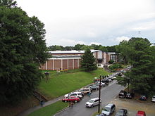
Chamblee, Georgia — City — A welcome to Chamblee sign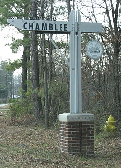 Location in DeKalb County and the state of Georgia
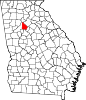
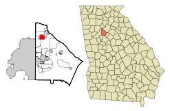 Chamblee in Metro Atlanta
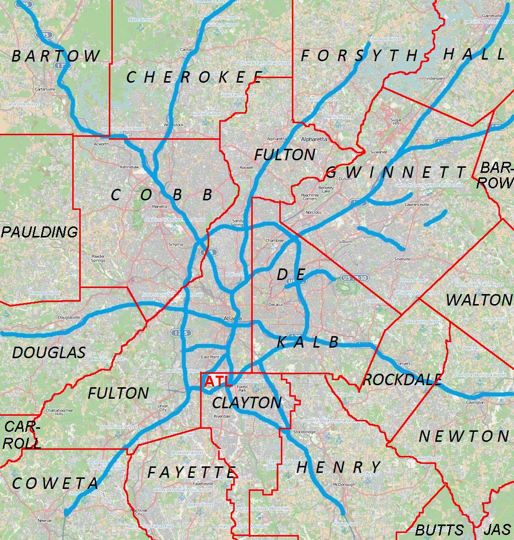
 Chamblee
Coordinates: 33°53′15″N 84°18′19″W / 33.8875°N 84.30528°WCoordinates: 33°53′15″N 84°18′19″W / 33.8875°N 84.30528°W Country United States State Georgia County DeKalb Area - Total 3.1 sq mi (8.1 km2) - Land 3.1 sq mi (8.1 km2) - Water 0 sq mi (0 km2) Elevation 1,020 ft (311 m) Population (2010) - Total 9,892 - Density 3,163/sq mi (1,221.2/km2) Time zone Eastern (EST) (UTC-5) - Summer (DST) EDT (UTC-4) ZIP codes 30341, 30366 Area code(s) 770 FIPS code 13-15172[1] GNIS feature ID 0331371[2] Chamblee (SHAM-blee) is a city in northern DeKalb County, Georgia, United States, northeast of Atlanta. The population was 9,892 at the 2010 census.[3]
Contents
Geography
Chamblee is south of Dunwoody, southwest of Doraville, northeast of Brookhaven, and north of Interstate 85.
Chamblee is located at 33°53′15″N 84°18′19″W / 33.8875°N 84.30528°W (33.887552, -84.305326)[4].
According to the United States Census Bureau, the city has a total area of 3.1 square miles (8.0 km2), all of it land.
Demographics
Historical populations Census Pop. %± 1960 6,635 — 1970 9,127 37.6% 1980 7,137 −21.8% 1990 7,668 7.4% 2000 9,552 24.6% 2010 9,892 3.6% As of the 2010 Census Chamblee had a population of 9,892. The racial and ethnic composition of the population was 45.0% white (19.0% non-Hispanic white), 7.0% black or African American (6.2% non-Hispanic black), 2.1% Native American (0.2% non-Hispanic Native American), 1.8% Vietnamese, 1.6% Asian Indian, 4.6% other Asian, 33.5% from some other race (0.2% non-Hispanic from some other race) and 4.1% reporting two or more races. 58.5% of the population was Hispanic or Latino of any race.[5]
As of the census[1] of 2000, there were 9,552 people, 2,673 households, and 1,849 families residing in the city. The population density was 3,043.3 people per square mile (1,174.5/km²). There were 2,730 housing units at an average density of 869.8 per square mile (335.7/km²). The racial makeup of the city was 45.36% White, 3.71% African American, 0.91% Native American, 13.98% Asian, 0.32% Pacific Islander, 31.45% from other races, and 4.27% from two or more races. Hispanic or Latino of any race were 56.37% of the population.
There were 2,673 households out of which 33.9% had children under the age of 18 living with them, 46.4% were married couples living together, 9.0% had a female householder with no husband present, and 30.8% were non-families. 15.8% of all households were made up of individuals and 4.1% had someone living alone who was 65 years of age or older. The average household size was 3.57 and the average family size was 3.65.
In the city the population was spread out with 23.2% under the age of 18, 17.9% from 18 to 24, 41.0% from 25 to 44, 12.8% from 45 to 64, and 5.0% who were 65 years of age or older. The median age was 28 years. For every 100 females there were 161.3 males. For every 100 females age 18 and over, there were 176.9 males.
The median income for a household in the city was $45,992. Males had a median income of $22,024 versus $22,368 for females. The per capita income for the city was $15,492. About 15.8% of families and 22.9% of the population were below the poverty line, including 25.2% of those under age 18 and 7.8% of those age 65 or over. In addition, 16.7% of families reported a household income higher than $100,000.
Districts/neighborhoods
Downtown
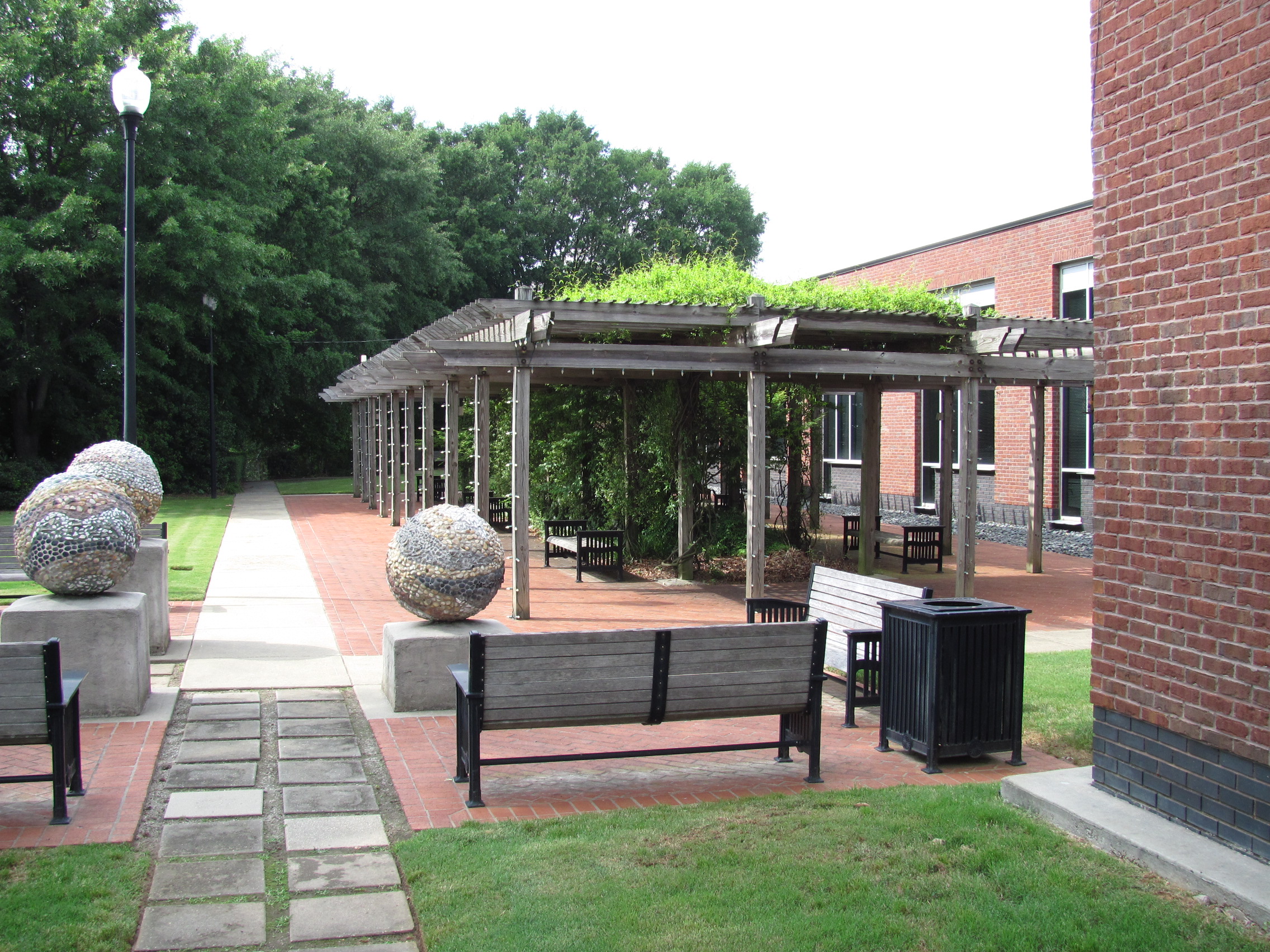
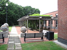 City Hall Park in Downtown Chamblee
Downtown Chamblee has been preserved has an early 20th century railroad community. Many of the buildings are of historic vintage, and the district has architectural similarities to other similar former railroad communities, such as Decatur and Norcross. Much of the downtown businesses are devoted to Chamblee's antique industry, but that has been changing. The district has attracted significant commercial development since 2000, including lofts and townhomes. The Chamblee MARTA Station and City Hall are both located downtown.[6]
Sexton Woods
Partially in Chamblee and partially in unincorporated Dekalb County, Sexton Woods is mixed neighborhood of 1950's ranch style homes and more recently new tear downs. Sexton Woods is bordered by Chamblee-Dunwoody Road, Harts Mill Road, and Ashford Dunwoody Road. Sexton Woods is also the home of Chamblee Middle School, located on Chamblee-Dunwoody Road until 2006.
Keswick Village
Adjacent to Sexton Woods, Keswick Village is next to Keswick Park in Chamblee.
Huntley Hills
Huntley Hills is a neighborhood established in the early 1960s, though the first house was built on Plantation Lane in 1950. Huntley Hills Elementary School is located in the middle of the neighborhood. Huntley Hills Elementary has a Montessori program added during the 2000-2001 school year[7] and was opened on August 21, 1964. Huntley hills also has a wide range of special needs programs for children ranging from high to low disorders.[8]
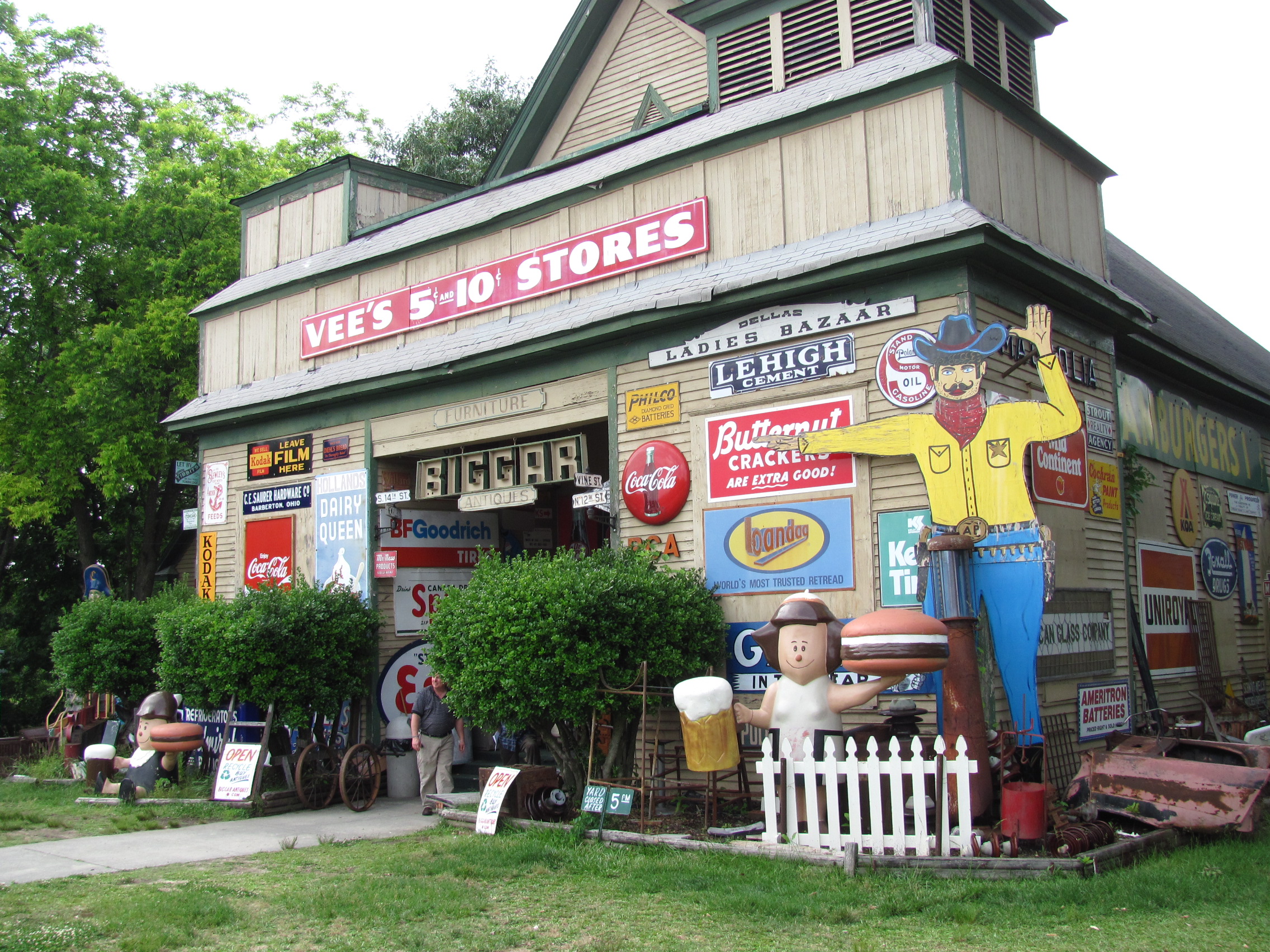
 Biggar Antiques on Antique Row
Education
 Chamblee High School
Primary and secondary schools
Public schools
DeKalb County School System serves Chamblee.
Elementary
- Ashford Park Elementary School
- Dresden Elementary School
- Montgomery Elementary School
- Huntley Hills Elementary School, a public Montessori school
- Kittredge Magnet School for High Achievers
All of the elementary schools are in unincorporated areas.
Middle schools
- Chamblee Middle School
- Sequoyah Middle School (Doraville, serves a section of southern Chamblee)
High schools
- Chamblee Charter High School
- Cross Keys High School (unincorporated area, serves a section of southern Chamblee)
- Henderson High School served residents of Chamblee until closed in mid-1990s
Private schools
- Cross and Crown School
Public libraries
DeKalb County Public Library operates the Chamblee Branch. Embry Hills Library is located in Chamblee.[9]
In popular culture
Chamblee is sometimes referred to as "Chambodia" due to its high Asian population and the concentration of Asian restaurants along Buford Highway in Chamblee. A chapter of Tom Wolfe's novel A Man in Full is titled "Chambodia".[10][11]
See also
References
- ^ a b "American FactFinder". United States Census Bureau. http://factfinder.census.gov. Retrieved 2008-01-31.
- ^ "US Board on Geographic Names". United States Geological Survey. 2007-10-25. http://geonames.usgs.gov. Retrieved 2008-01-31.
- ^ "Race, Hispanic or Latino, Age, and Housing Occupancy: 2010 Census Redistricting Data (Public Law 94-171) Summary File (QT-PL), Chamblee city, Georgia". U.S. Census Bureau, American FactFinder 2. http://factfinder2.census.gov. Retrieved October 28, 2011.
- ^ "US Gazetteer files: 2010, 2000, and 1990". United States Census Bureau. 2011-02-12. http://www.census.gov/geo/www/gazetteer/gazette.html. Retrieved 2011-04-23.
- ^ 2010 general profile of population and housing characteristics of Chamblee from the US Census]
- ^ http://www.chambleega.com/About/PrivateDevelopment.aspx
- ^ Huntley Hills Montessori program http://schools.dekalb.k12.ga.us/huntleyhills/about/montessori.html
- ^ Special needs programs http://www.redfin.com/school/29842/GA/Chamblee/Huntley-Hills-Elementary-School
- ^ "Library Locations & Hours." DeKalb County Public Library. Retrieved on February 24, 2010.
- ^ Neal Becton, "Atlanta's 'Chambodia,' a 'Burb With a Global Flavor", Washington Post, April 18, 1999
- ^ Cliff Bostock, We heart Chambodia", Creative Loafing, January 8, 2004
External links
- City of Chamblee official website
- Official Income Data for Chamblee as reported by the 2000 US Govt. Census
Metro Atlanta Counties 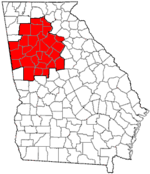
Major city Municipalities & communities 100k-250k 25k-100k Alpharetta • Brookhaven • Candler-McAfee • Duluth • Dunwoody • East Point • Gainesville • Johns Creek • Lawrenceville • Mableton • Marietta • Milton • Newnan • Peachtree City • Peachtree Corners • Redan • Smyrna • Tucker10k-25k Acworth • Belvedere Park • Buford • Carrollton • Cartersville • Chamblee • College Park • Conyers • Covington • Decatur • Doraville • Druid Hills • Douglasville • Fayetteville • Forest Park • Griffin • Kennesaw • Suwanee • Lilburn • Monroe • Mountain Park • North Decatur • North Druid Hills • Panthersville • Powder Springs • Riverdale • Snellville • Stockbridge • Sugar Hill • Union City • Vinings • Winder • WoodstockTopics Architecture • Culture • History • Media • Neighborhoods • People • Tourism • Transportation Georgia ·  United States
Municipalities and communities of DeKalb County, Georgia County seat: Decatur Cities Atlanta‡ | Avondale Estates | Chamblee | Clarkston | Decatur | Doraville | Dunwoody | Lithonia | Pine Lake | Stone Mountain
CDPs Unincorporated
communitiesBrookhaven | Embry Hills | Lenox Park | Northlake | Pittsburg | Smoke Rise | Vista Grove
Ghost town Footnotes ‡This populated place also has portions in an adjacent county or counties
Categories:- Atlanta metropolitan area
- Cities in Georgia (U.S. state)
- Populated places in DeKalb County, Georgia
- Populated places in the United States with Hispanic majority populations


Wikimedia Foundation. 2010.