- Conyers, Georgia
-
"Conyers" redirects here. For other uses, see Conyers (disambiguation).
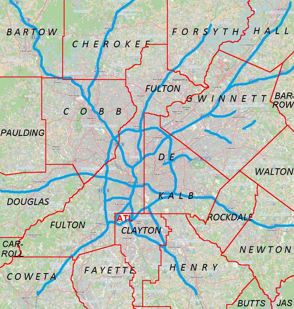
Conyers, Georgia — City — Location in Rockdale County and the state of Georgia Location of Conyers in Metro Atlanta
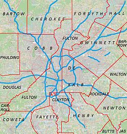
 Conyers
Coordinates: 33°39′59″N 84°0′27″W / 33.66639°N 84.0075°WCoordinates: 33°39′59″N 84°0′27″W / 33.66639°N 84.0075°W Country United States State Georgia County Rockdale Area - Total 11.9 sq mi (30.9 km2) - Land 11.8 sq mi (30.5 km2) - Water 0.1 sq mi (0.4 km2) Elevation 899 ft (274 m) Population (2009) - Total 13,941 Time zone Eastern (EST) (UTC-5) - Summer (DST) EDT (UTC-4) ZIP codes 30012, 30013, 30094 Area code(s) 470/678/770 FIPS code 13-19336[1] GNIS feature ID 0312910[2] Conyers is the only city in Rockdale County, Georgia, USA. It is twenty-four miles east of Atlanta. As of the 2000 census, the city population was 10,689. Census estimates of 2005 indicate a population of 12,205. The city is the county seat of Rockdale County.[3] By 2009, the reported population was 13,941.[4] The formerly separate town of Milstead is now part of Conyers. Conyers is the self-proclaimed "Crab Apple Capital of the World."[citation needed]
Contents
History
Before European settlement, the area which is now Conyers, along with the surrounding county of Rockdale, was occupied by mound-building Native Americans. As time progressed, the Muscogee (or Creek) and Cherokee natives shared a common border here. This border was known as the "Great Indian Road," and is known now as the "Hightower Trail". This trail was used by white settlers following the American Revolution.
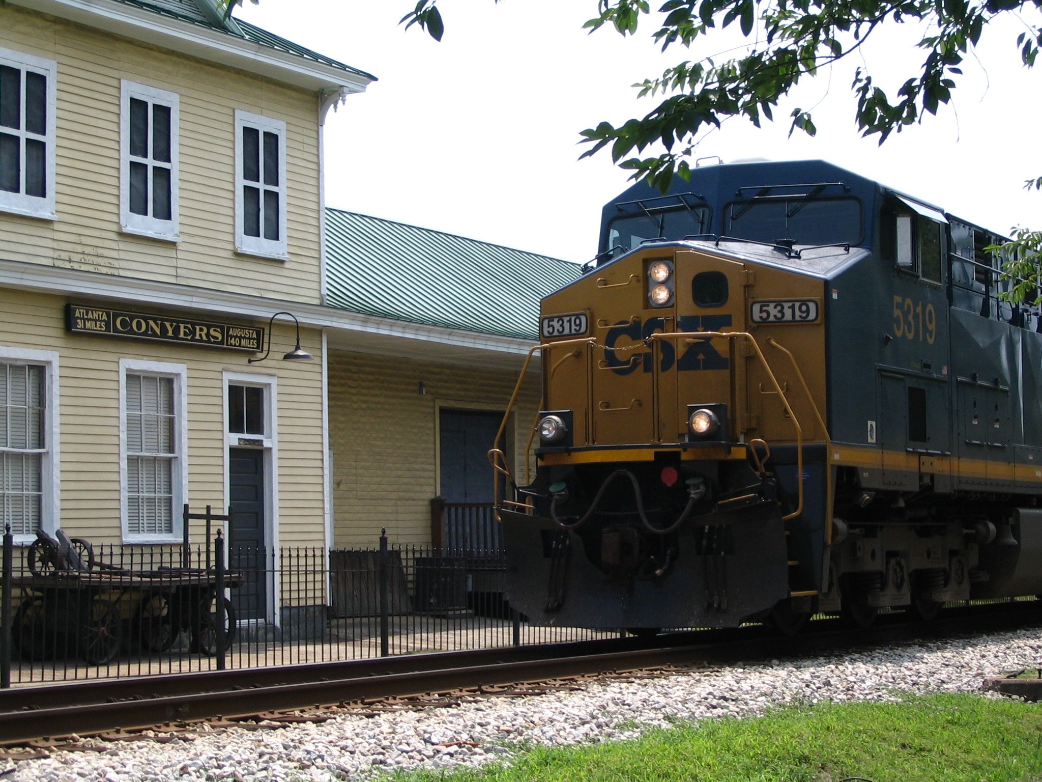
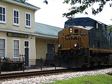 Conyers Depot
 A 1905 Rogers Steam Locomotive, named "Dinky", on display in Conyers. The engine carried freight between Conyers and Milstead until 1961.
Between 1816 and 1821, the area known as Rockdale was open for settlement. John Holcomb, a blacksmith, was the first settler in what is now Conyers. He settled where the current Rockdale County Courthouse is located, in the middle of Conyers on Main Street.
Eventually, there was pressure for a railroad to cross Georgia; the railroad was intended to run from Augusta, through neighboring Covington to Marthasville (now known as Atlanta). John Holcomb was against the railroad and refused to sell his land, and threatened to shoot anyone from the railroad who came onto his property.
Dr. W. D. Conyers, a banker from Covington, eventually persuaded John Holcomb into selling his land for $700. Dr. Conyers then sold the land to the Georgia Railroad. What is now Conyers began as a watering post along this line, named after Dr. Conyers. By 1845, the railroad was in full operation. By 1854, nearly 400 residents lived around the watering post, and Conyers was incorporated.
Conyers has been nearly destroyed several times by fire. It is said[who?] that it survived Sherman's March to the Sea thanks to a friend of Sherman's who lived in the area between Conyers and Covington. The story goes that the houses were spared because Sherman was uncertain where his friend lived.[citation needed]
In 1870, the surrounding area was incorporated into Rockdale County out of Newton County, Georgia, and Conyers became the county seat.
Over the next decade, Conyers grew into a wild town. It had twelve saloons and five brothels. The more reputable side of the town had 40 stores, Conyers College, a hotel, a carriage manufacturer and good schools.
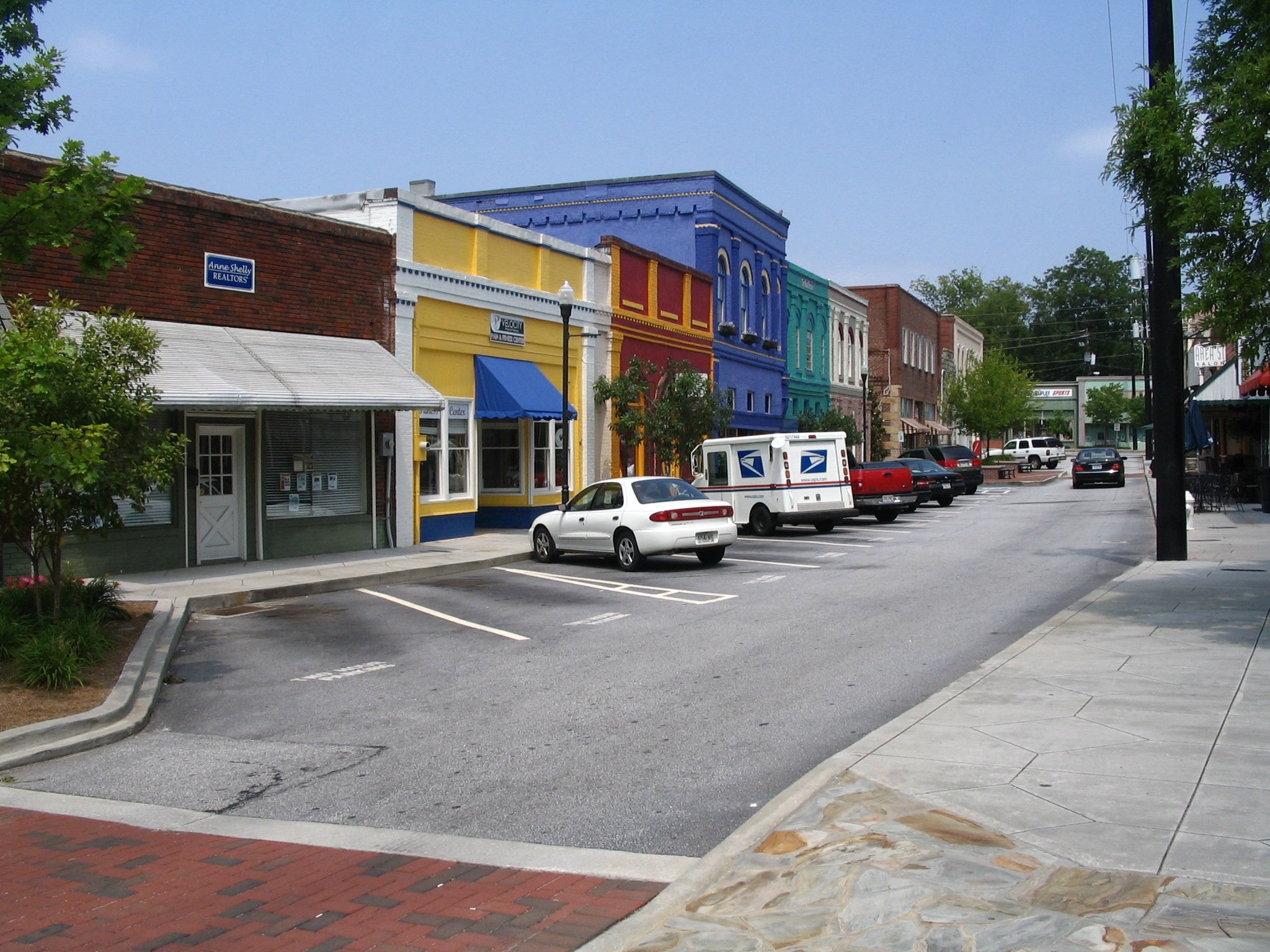
 Olde Town Conyers, Georgia
 Rockdale County Courthouse
Conyers was also home to "sidewalk churches". Along Main Street grew First Methodist, Conyers Presbyterian, and First Baptist. It is said that at some point the congregants persuaded the brothels and saloons to close and leave Conyers for Covington, having persuaded them with a mob. This rose out of revivals began in 1878 with the Methodist and Presbyterian churches. First Baptist Church of Conyers moved out of downtown in late 2000, moving about two miles or three kilometers south of the Georgia International Horse Park to their current location.
Tightly connected to Conyers is Milstead, a mill town now incorporated into Conyers. At its peak, Milstead and Conyers had a private railroad which delivered products, such as cotton, from the mill to Conyers for shipping to the textile mills. In the 1960s, the mill closed.
In 1944, a Trappist monastery (a Catholic order), Abbey of the Holy Spirit, was established south of the city by Dom Frederic Dunne. The Protestant community of Rockdale County helped with the completing of the current structure. M. Basil Pennington, one of the founders of the Centering Prayer movement, was abbot of the monastery from 2000 to 2002.
In the 1950s, Conyers had a Coca-Cola bottling facility. In 1957, Lithonia Lighting moved from Lithonia.
In the 1960s, Interstate 20 was built through the county. Gus Barksdale, Clarence Vaughn, Roland Reagan, and Harry Downs helped establish the community for the future by pushing for business expansion.
In the 1970s, parts of the first five episodes of the Dukes of Hazzard were filmed in the town.
In the 1980s, Conyers became known for "White Road", where resident Nancy Fowler claimed to have seen apparitions of the Virgin Mary. Throughout the late 1980s and early 1990s, Conyers played host to pilgrims.
In 1996 Conyers hosted the equestrian and mountain biking events for the 1996 Olympic Games held in Atlanta. For this, Conyers built the Georgia International Horse Park.
On May 20, 1999 a school shooting took place known as the Heritage High School shooting. Six students were injured before the 15-year-old gunman surrendered to the police.
In October 1999 Rockdale county, and by extension the county seat of Conyers gained substantial notoriety when the Public Broadcasting Service aired a nationwide documentary entitled The Lost Children of Rockdale County detailing a syphilis outbreak among middle and high school aged teenagers within the county. The documentary was well received outside of Conyers, with rave reviews from such outlets as the Wall Street Journal and Entertainment Weekly.[5]
Geography
Conyers is located at 33°39′59″N 84°0′27″W / 33.66639°N 84.0075°W (33.666360, -84.007574)[6].
According to the United States Census Bureau, the city has a total area of 11.9 square miles (31 km2), of which 11.8 square miles (31 km2) is land and 0.1 square miles (0.26 km2) (1.17%) is water.
Demographics
As of the census[1] of 2000, there were 10,689 people, 3,910 households, and 2,557 families residing in the city. The population density was 907.3 people per square mile (350.3/km²). There were 4,183 housing units at an average density of 355.1 per square mile (137.1/km²). The racial makeup of the city was 58.29% White, 33.42% African American, 0.32% Native American, 2.60% Asian, 0.05% Pacific Islander, 3.78% from other races, and 1.54% from two or more races. Hispanic or Latino of any race were 10.79% of the population.
There were 3,910 households out of which 34.2% had children under the age of 18 living with them, 37.5% were married couples living together, 21.0% had a female householder with no husband present, and 34.6% were non-families. 26.4% of all households were made up of individuals and 7.9% had someone living alone who was 65 years of age or older. The average household size was 2.67 and the average family size was 3.17.
In the city the population was spread out with 27.3% under the age of 18, 12.6% from 18 to 24, 33.1% from 25 to 44, 17.4% from 45 to 64, and 9.6% who were 65 years of age or older. The median age was 30 years. For every 100 females there were 94.5 males. For every 100 females age 18 and over, there were 91.1 males.
The median income for a household in the city was $35,789, and the median income for a family was $38,255. Males had a median income of $29,991 versus $24,879 for females. The per capita income for the city was $15,805. About 13.7% of families and 16.9% of the population were below the poverty line, including 24.5% of those under age 18 and 9.1% of those age 65 or over.
Education
Rockdale County School District
The Rockdale County School District holds grades pre-school to grade twelve, that consists of eleven elementary schools, four middle schools, and three high schools.[7] The district has 889 full-time teachers and over 13,801 students.[8]
Sports
In 2011 in Conyers, Georgia, the Rockdale Youth Soccer Association formed a Semi-Professional soccer team called the Georgia Revolution.
Notable residents
- Billy Buckner, MLB pitcher
- Ashley Scott, Artist and writer
- Dakota Fanning, actress
- Elle Fanning, actress
- Jill Arrington, ESPN former college football reporter
- DeForest Kelley, Dr. Leonard "Bones" McCoy, of TV's "Star Trek: The Original Series"
- Jesse Baker, former NFL defensive end with the Houston Oilers and Dallas Cowboys
- Jerome Boger, NFL referee
- Matt Kennon, singer
- Cartel's Will Pugh, Joseph Pepper, Jeff Lett, Nic Hudson, and Kevin Sanders - rock band
- David Elder, Former Major League Baseball Player
- Holly Hunter, actress
- Ben L. Jones, "Crazy" Cooter Davenport in The Dukes of Hazzard and politician
- Clint Mathis, World Cup soccer player
- Jack McBrayer, actor
- James C. Miller III, former U.S. government official and economist
- Dave Willis, co-creator of Aqua Teen Hunger Force and Squidbillies
- Jim Fortier, co-creator of The Brak Show and Squidbillies
- Gorilla Zoe, Rapper
- Derek St. Holmes, musician
References
- ^ a b "American FactFinder". United States Census Bureau. http://factfinder.census.gov. Retrieved 2008-01-31.
- ^ "US Board on Geographic Names". United States Geological Survey. 2007-10-25. http://geonames.usgs.gov. Retrieved 2008-01-31.
- ^ "Find a County". National Association of Counties. http://www.naco.org/Counties/Pages/FindACounty.aspx. Retrieved 2011-06-07.
- ^ Conyers at City-Data
- ^ http://www.pbs.org/wgbh/pages/frontline/shows/georgia/etc/press.html
- ^ "US Gazetteer files: 2010, 2000, and 1990". United States Census Bureau. 2011-02-12. http://www.census.gov/geo/www/gazetteer/gazette.html. Retrieved 2011-04-23.
- ^ Georgia Board of Education, Retrieved June 26, 2010.
- ^ School Stats, Retrieved June 26, 2010.
See also
- The Rockdale News
- The Rockdale Citizen
External links
Metro Atlanta Counties 
Major city Municipalities & communities 100k-250k 25k-100k Alpharetta • Brookhaven • Candler-McAfee • Duluth • Dunwoody • East Point • Gainesville • Johns Creek • Lawrenceville • Mableton • Marietta • Milton • Newnan • Peachtree City • Peachtree Corners • Redan • Smyrna • Tucker10k-25k Acworth • Belvedere Park • Buford • Carrollton • Cartersville • Chamblee • College Park • Conyers • Covington • Decatur • Doraville • Druid Hills • Douglasville • Fayetteville • Forest Park • Griffin • Kennesaw • Suwanee • Lilburn • Monroe • Mountain Park • North Decatur • North Druid Hills • Panthersville • Powder Springs • Riverdale • Snellville • Stockbridge • Sugar Hill • Union City • Vinings • Winder • WoodstockTopics Architecture • Culture • History • Media • Neighborhoods • People • Tourism • Transportation Georgia ·  United States
Municipalities and communities of Rockdale County, Georgia County seat: Conyers City Conyers

CDP Categories:- Atlanta metropolitan area
- Cities in Georgia (U.S. state)
- Populated places in Rockdale County, Georgia
- County seats in Georgia (U.S. state)


Wikimedia Foundation. 2010.