- Cobb County, Georgia
-
Cobb County, Georgia 
Seal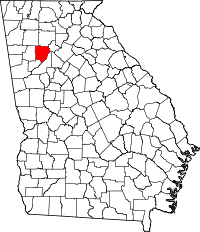
Location in the state of Georgia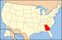
Georgia's location in the U.S.Founded 1832 Seat Marietta Largest city Marietta Area
- Total
- Land
- Water
344.51 sq mi (892 km²)
340.15 sq mi (881 km²)
4.36 sq mi (11 km²), 1.27%PopulationEst.
- (2009)
- Density
701,325
1,952/sq mi (763/km²)Website www.cobbcounty.org Cobb County is a county located in the U.S. state of Georgia. Its county seat and largest city is Marietta,[1] which is located in the center of the county. The county was named for Thomas Willis Cobb, who in the early 19th century was a United States representative and senator from Georgia. Marietta was named for his wife, Mary.[2]
Cobb, along with several other counties in the same bill, was created December 3, 1832, by the Georgia General Assembly from the huge Cherokee "county" territory — land northwest of the Chattahoochee River which the state confiscated from the Cherokee Nation and redistributed to settlers via lottery, following the passage of the federal Indian Removal Act.[3]
As of the 2000 census, the population was 607,751. The county's population has continued to grow. The 2009 estimate from the U.S. Census Bureau was 714,692 people.[4] The county is part of the original and core (five-county) Atlanta metropolitan area, which is included in the Atlanta–Sandy Springs–Marietta, Georgia metropolitan statistical area.
The U.S. Census Bureau ranks Cobb County as the most-educated in the state of Georgia and 12th among all counties in the United States.[5][dead link] It has ranked among top 100 wealthiest counties in the United States.[6]
Contents
Geography
According to the 2000 census, the county has a total area of 344.51 square miles (892.3 km2), of which 340.15 square miles (881.0 km2) (or 98.73%) is land and 4.36 square miles (11.3 km2) (or 1.27%) is water.[7]
The county is divided between two major basins. Most runoff flows into the Chattahoochee River along the southeastern border, directly via Willeo Creek, Sope Creek (Sewell Creek), Rottenwood Creek (Powers Creek), and others. The large Sweetwater Creek is the other major stream, carrying the waters of Noses Creek (Ward Creek, Olley Creek, and Mud Creek), Nickajack Creek, Powder Springs Creek (Rakestraw Creek, Mill Creek) and others into the Chattahoochee. A ridge from Lost Mountain in the west, to Kennesaw Mountain in the north-central, to Sweat Mountain in the extreme northeast, divides the far north-northwest of the county into the Etowah River basin, which includes Lake Allatoona. Noonday Creek (Little Noonday Creek) flows northward into the lake, as does Allatoona Creek, which forms a major arm of the lake. Proctor Creek forms the much older Lake Acworth, which in turn empties directly into Lake Allatoona under the Lake Acworth Drive (Georgia 92) bridge.
There are several high points in Cobb County.
- Sweat Mountain, in the extreme northeast portion, runs along the border with Cherokee County, and is the metro area's major antenna farm
- Blackjack Mountain, a low ridge between central and east Cobb
- Kennesaw Mountain: the highest point in the county and in the entire suburban area of metro Atlanta, located in the north-northwest between Kennesaw and Marietta
- Little Kennesaw Mountain: an offshoot of Kennesaw
- Lost Mountain, in western Cobb
- Pine Mountain, west-northwest of Kennesaw Mountain, between Kennesaw and Due West
- Brushy Mountain, near Kennesaw Mountain, just southeast of Barrett Parkway at Cobb Parkway
- Vinings Mountain or Mount Wilkinson, overlooks the town of Vinings
Adjacent counties
- Cherokee County, Georgia – north
- Fulton County, Georgia – east, southeast
- former Milton County (prior to 1932), northeast
- Douglas County, Georgia (originally part of Campbell) – southwest
- Paulding County, Georgia – west
- Bartow County, Georgia (originally named Cass) – northwest
Part of Cobb was given to create part of Milton in 1857.
Addressing
Despite the lack of a grid system of city blocks though the county, all street addresses have their numeric origin at the southwest corner of the town square in Marietta.
From here, the north/south boundary heads west on Georgia 120, which is Whitlock Avenue and Dallas Highway. All addresses actually on this road are considered "southwest", even on the north side of the street. To the east, it follows former 120 (South Park Square, Roswell Street, and Roswell Road), then onto Lower Roswell Road, and finally skipping to Paper Mill Road across a roadless strip, and down a small section of Johnson Ferry Road to the river.
The east/west boundary follows Church Street and its extension north to Bell's Ferry Road, with all addresses on it being "northwest", even on the east side of the street. To the south, it follows an arbitrary path toward Mableton, usually running between roads instead of along them.
Because the USPS delivers mail from post offices in other counties in some places, it has assigned the names and ZIP codes of those cities to areas in Cobb. This creates a situation where an address can appear to be in Atlanta, but is actually northwest of Atlanta in southeast Cobb, for example. This is the case with 30339, which is "Atlanta" by default, while Vinings is listed as "not acceptable". This area includes the Cumberland/Galleria area.
ZIP codes
- Marietta
- central and south – 30060 (Marietta main on Lawrence Street)
- southeast – 30067 (Windy Hill Road branch)
- east-southeast – 30068 (Mount Bethel branch on Lower Roswell Road)
- east – 30064,30062 (Gresham Road branch)
- northeast – 30066 (Sprayberry branch in Sandy Plains)
- Dobbins Air Reserve Base – 30069 (Dobbins AFB is acceptable)
- Lockheed Martin plant – 30063
- others – 30008, 30090
- PO boxes (at above post offices) – 30006, 30007, 30061, 30065
- Other
- Kennesaw – 30144, 30152 (new), 30156 (PO box), 30160 (PO box at Cobb Place)
- Acworth – 30101, 30102
- Smyrna – 30080, 30082 (30081 for PO boxes)
- Mableton – 30126
- Austell – 30106, 30168
- Powder Springs – 30127
Other geocodes
Originally in area code 404, the county was moved into area code 770 in 1995, and overlaid by area code 678 in 1998. Prior to 1995, those with phones tied to the Woodstock telephone exchange (prefixes 924, 926, 928, later 516 and 591) could also call the Canton exchange (479, later 445, then 704) as a local call. This became moot, along with other dual-zone exchanges in metro Atlanta, when the exurban exchanges (including Canton) were fully made a part of what was already the world's largest toll-free calling zone.
Cobb's FIPS county code is 13067. Because the National Weather Service has not subdivided the county, its WRSAME code is 013067, for receiving targeted weather warnings from NOAA Weather Radio. The county is primarily within the broadcast range of one weather radio station: KEC80, on 162.550 MHz,[8] transmitted to all of metro Atlanta and broadcast from NWSFO Peachtree City. The secondary station is the much newer WWH23 on 162.425 from Buchanan, which also transmits warnings for Cobb but has reception mainly in the western part of the county.[9]
Cobb is county 033 on driver's licenses.
History
Cobb County was created from Cherokee County, originally part of the Cherokee Indian Nation.[citation needed] It was the 81st county in Georgia and named for Judge Thomas Willis Cobb of Virginia, who served as a U.S. Senator, state congressman and Superior Court Judge.[citation needed]
Marietta was named for Judge Cobb's wife.[citation needed] The city's downtown was destroyed by Sherman's troops in 1864.[citation needed]
In 1915, convicted murderer Leo Frank was kidnapped from his jail cell and brought to Frey's Gin, two miles (3 km) east of Marietta. There he was lynched. The case was widely perceived as a miscarriage of justice.
When home rule was enacted statewide by amendment to the Georgia state constitution in the early 1960s, Ernest W. Barrett became the first chairman of the new county commission. The county courthouse, built in 1888, was demolished.
Demographics
Historical populations Census Pop. %± 1900 24,664 — 1910 28,397 15.1% 1920 30,437 7.2% 1930 35,408 16.3% 1940 38,272 8.1% 1950 61,830 61.6% 1960 114,174 84.7% 1970 196,793 72.4% 1980 297,718 51.3% 1990 447,745 50.4% 2000 607,751 35.7% 2010 688,078 13.2% As of 2006, there were 679,325 people, 248,303 households, and 169,178 families residing in the county. The population density was 1,998 people per square mile (763/km²). There were 261,659 housing units at an average density of 770 per square mile (301/km²). The racial makeup of the county in 2006 was 56.0% White, 29.6% Black, 0.5% Native American, 4.1% Asian, 0.0% Pacific Islander, 8.8% from other races, and 1.4% from two or more races. 11.1% of the population were Hispanic or Latino of any race.
There were 248,303 households out of which 35.80% had children under the age of 18 living with them, 54.30% were married couples living together, 10.70% had a female householder with no husband present, and 31.20% were non-families. 23.20% of all households were made up of individuals and 4.10% had someone living alone who was 65 years of age or older. The average household size was 2.71 and the average family size was 3.25.
In the county the population was spread out with 26.10% under the age of 18, 9.00% from 18 to 24, 36.50% from 25 to 44, 21.50% from 45 to 64, and 6.90% who were 65 years of age or older. The median age was 33 years. For every 100 females there were 98.50 males. For every 100 females age 18 and over, there were 95.90 males.
As of 2007, the median income was $70,472. The per capita income for the county was $32,740. About 6.0% of families and 9.4% of the population were below the poverty line, including 9.1% of those under age 18 and 7.8% of those age 65 or over.
Education
Colleges and universities
- Chattahoochee Technical College
- Kennesaw State University
- Life University
- Southern Polytechnic State University
Schools
Public schools
- Cobb County School District (serves all county locations except the city of Marietta)
- Marietta City Schools (serves city of Marietta locations)
Private schools
- Faith Lutheran Church and School, Marietta (preK-8)
- Shreiner Academy, Marietta (preK-8)
- Cumberland Christian Academy, Austell (K-12)
- Mount Paran Christian School, Kennesaw (preK-12)
- Dominion Christian High School, Marietta
- East Cobb Christian School, Marietta (K-8)
- North Cobb Christian School, Kennesaw (K-12)
- St. Joseph's Catholic School, Marietta (K-8)
- St. Catherine of Siena Catholic School, Kennesaw (K-8)
- The Walker School, Marietta (preK-12)
- Whitefield Academy, Mableton (preK-12)
- Creative Montessori School[10] Marietta
- Ambleside Academy, West Cobb (Pre-K-12)
- Mt. Bethel Christian Academy[11] Marietta (preK-8)
Grace Baptist Christian School, Powder Springs, (preK-12)
Libraries
Cobb County maintains the Cobb County Public Library System.[12] The libraries provide resources such as books, videos, internet access, printing, and computer classes. The libraries in the CCPLS are:
- Acworth Library
- Central Library
- East Cobb Library
- East Marietta Library
- Gritters Library
- Hattie G. Wilson Library
- Kemp Memorial Library
- Kennesaw Library
- Lewis A. Ray Library
- Mountain View Regional Library
- Powder Springs Library
- Sibley Library
- South Cobb Regional Library
- Stratton Library
- Sweetwater Valley Library
- Vinings Library
- West Cobb Regional Library
Government and elections
Under Georgia's home rule provision, county governments have free rein to legislate on all matters within the county, provided that such legislation does not conflict with state or federal laws or constitutions.
Cobb County is governed by a five-member board of commissioners, which has both legislative and executive authority within the county. The chairman of the board is elected county-wide. The current Chairman is Tim Lee. The other four commissioners are elected from single-member districts. The board hires a county manager who oversees day-to-day operations of the county's executive departments.
County residents also elect a sheriff, district attorney, probate court judge, clerk of superior court, clerk of the state court, state court solicitor, chief magistrate judge (who then appoints other magistrate court judges), superior court judges, state court judges, tax commissioner, surveyor, and a seven-member board of education. The following is a table of those currently holding office as of September 2007:
Office Holder Office Holder Sheriff Neil Warren State Court Solicitor Barry E. Morgan District Attorney Pat Head Chief Magistrate Judge Frank Cox Probate Court Judge Kelli Wolk Tax Commissioner Gail Downing Clerk of the Superior Court Jay Stephenson Clerk of the State Court Diane Webb In addition to the county sheriff, the constitutional chief law enforcement officer of the county, Cobb County has a separate police department under the authority of the Board of Commissioners. The current Police Chief is J.R. Houser. The sheriff oversees the jail, to which everyone arrested under state law is taken, regardless of the city or other area of the county where it happens, or what police department makes the arrest.
Each city has a separate police department, answerable to its governing council. Marietta, Smyrna, and Austell have separate fire departments, with the Cobb County Fire Department being the authority having jurisdiction over Kennesaw, Acworth, Powder Springs, and unincorporated areas. Cobb 911 covers unincorporated areas and the cities of Marietta and Powder Springs. Kennesaw and Acworth jointly operate a small 911 call center (PSAP) upstairs in Kennesaw city hall, dispatching the police departments in both cities, and forwarding fire calls to Cobb. Austell and Smyrna operate their own separate 911 systems.
Taxes
In addition to the 4% statewide sales tax, Cobb County levies an additional 2% for special projects, each 1% subject to separate renewal every few years by countywide referendum (including within its cities). This funds mainly transportation and parks. Cobb levies a 1% tax to lower property taxes, but only for the public school budget, and not the additional 1% HOST homestead exemption for general funds. It has also voted not to pay the extra 1% to join MARTA.
At the beginning of 2006, Cobb County became the last county in the state to raise the tax to 6%, which also doubled the tax on food to 2%. The SPLOST barely passed by a 114 vote margin, or less than one-quarter of a percent, in a September 2005 referendum. The revenue will go to a new county courthouse, expanded jail, various transportation projects, and the purchasing of property for parks and green space.[13] In 2008, the school tax was renewed for a third term, funding the Marietta and Cobb school systems.
Communities
Cities
Census-designated places
- Mableton (CDP, town incorporated 1912~1916)
- Vinings (CDP and town)
- Fair Oaks (CDP, but was never a town)
Unincorporated communities
- Cumberland
- East Cobb
Formerly part of Cobb
- Roswell, ceded to Fulton in 1932
Existing communities:
- East Cobb – (E)
- Sandy Plains – (NE)
- Blackwells – (N)
- Clarkdale – (S)
- Noonday – (N)
- Mount Bethel – (E)
- Powers Park – (SE)
- Due West – (W)
- Lost Mountain – (W)
- Mars Hill – (WNW)
- Macland – (WSW)
- Westoak – (NE)
Economy
The Cobb County School District is Cobb County's largest employer, employing over 15,000 people.[14] Private corporations include:
- The Home Depot Atlanta Store Support Center, world headquarters[15]
- The Weather Channel headquarters[16]
- InTown Suites headquarters[17]
- Lockheed Martin Aeronautical Plant, located next to Dobbins Air Reserve Base in unincorporated Cobb.[citation needed]
- Lectra, North American headquarters located in Marietta[citation needed]
Diplomatic missions
The Consulate-General of Costa Rica in Atlanta is located in Suite 100 at 1870 The Exchange in an unincorporated section of Cobb County.[18]
Transportation
Major highways
 Interstate 20
 Interstate 75
 Interstate 285
 Interstate 575
 U.S. Route 41
 U.S. Route 78
 U.S. Route 278
 State Route 3
 State Route 5
 State Route 6
 State Route 8
 State Route 92
 State Route 120
 State Route 176
 State Route 280
 State Route 360
Airports
- Cobb County Airport at McCollum Field
- Dobbins Air Reserve Base (where the U.S. President usually arrives when visiting Atlanta)
Rail
- Norfolk Southern through Mableton, Austell railyard, Powder Springs
- CSX Transportation through Acworth, Kennesaw, Marietta, Smyrna, and Vinings
- Georgia Northeastern Railroad spur line north from Marietta
- Cobb Community Transit (CCT)
Recreation
- American Adventures (Marietta)
- Chattahoochee River National Recreation Area
- Kennesaw Mountain National Battlefield Park (Kennesaw to Marietta)
- Lake Acworth/Acworth Beach(Acworth)
- Lake Allatoona (near Acworth)
- Mable House (Mableton)
- Marietta Confederate Cemetery (Marietta)
- Marietta Museum of History (Marietta)
- Marietta/Cobb Museum of Art (Marietta)
- Marietta National Cemetery (Marietta)
- Silver Comet Trail (Smyrna, Mableton, Powder Springs)
- Six Flags Over Georgia (Unincorporated Cobb)
- Six Flags White Water (Marietta)
- Southern Museum of Civil War and Locomotive History (Kennesaw)
- Sun Valley Beach (near Powder Springs)
Venues
- Cobb County Civic Center
- Cobb Energy Performing Arts Center
- Mable House Amphitheater
Public libraries
Sister cities
 Seongdong-gu, South Korea[19]
 Linz, Germany
 Heredia, Costa Rica
See also
References
- ^ "Find a County". National Association of Counties. http://www.naco.org/Counties/Pages/FindACounty.aspx. Retrieved 2011-06-07.
- ^ "New Georgia Encyclopedia: Marietta". Georgiaencyclopedia.org. 2003-09-30. http://www.georgiaencyclopedia.org/nge/Article.jsp?id=h-765. Retrieved 2010-07-22.
- ^ Cobb County, Georgia
- ^ http://www.census.gov/popest/counties/files/CO-EST2009-ALLDATA.csv
- ^ ACS: Ranking Table – Percent of People 25 Years and Over Who Have Completed a Bachelor's Degree
- ^ bizjournals: How 100 counties ranked in wealth
- ^ "Census 2000 U.S. Gazetteer Files: Counties". United States Census. http://www.census.gov/tiger/tms/gazetteer/county2k.txt. Retrieved 2011-02-13.
- ^ "NOAA Weather Radio KEC80". Nws.noaa.gov. 2009-05-14. http://www.nws.noaa.gov/nwr/Maps/PHP/site.php?State=GA&Site=KEC80. Retrieved 2010-07-22.
- ^ "NOAA Weather Radio WWH23". Nws.noaa.gov. 2009-05-14. http://www.nws.noaa.gov/nwr/Maps/PHP/site.php?State=GA&Site=WWH23. Retrieved 2010-07-22.
- ^ Creative Montessori School
- ^ Mt. Bethel Christian Academy
- ^ Cobb County Public Library System
- ^ "Cobb Local Sales Tax for Public Safety and Transportation". Cobbcip.org. 2005-09-20. http://www.cobbcip.org. Retrieved 2010-07-22.
- ^ "[1]." Cobb County School District. Retrieved on July 28, 2009.
- ^ "Corporate and Financial Overview." The Home Depot. Retrieved on April 24, 2009.
- ^ "Video Submission Agreement." The Weather Channel. Retrieved on November 18, 2009.
- ^ "Low Weekly Rates!." InTown Suites. Retrieved on November 18, 2009.
- ^ "Consulates in the United States." Embassy of Costa Rica. Retrieved October 26, 2008.
- ^ "Cobb County Delegation Visits South Korea". Global Atlanta Works. Atlanta Regional Commission. http://www.globalatlantaworks.com/html/214.htm. Retrieved 2008-10-26.
External links
- Cobb County government
- [2] see C-Span talk at 54min 57sec in

Bartow County Cherokee County Paulding County 
Fulton County  Cobb County, Georgia

Douglas County Fulton County Municipalities and communities of Cobb County, Georgia County seat: Marietta Cities 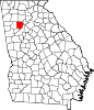
CDPs Unincorporated
communitiesChattahoochee Plantation | Clarkdale | Cumberland | East Cobb | Powers Park | Spring Hill
Footnotes ‡This populated place also has portions in an adjacent county or counties
Metro Atlanta Counties 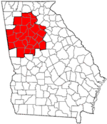
Major city Municipalities & communities 100k-250k 25k-100k Alpharetta • Brookhaven • Candler-McAfee • Duluth • Dunwoody • East Point • Gainesville • Johns Creek • Lawrenceville • Mableton • Marietta • Milton • Newnan • Peachtree City • Peachtree Corners • Redan • Smyrna • Tucker10k-25k Acworth • Belvedere Park • Buford • Carrollton • Cartersville • Chamblee • College Park • Conyers • Covington • Decatur • Doraville • Druid Hills • Douglasville • Fayetteville • Forest Park • Griffin • Kennesaw • Suwanee • Lilburn • Monroe • Mountain Park • North Decatur • North Druid Hills • Panthersville • Powder Springs • Riverdale • Snellville • Stockbridge • Sugar Hill • Union City • Vinings • Winder • WoodstockTopics Architecture • Culture • History • Media • Neighborhoods • People • Tourism • Transportation Georgia ·  United StatesCategories:
- Georgia (U.S. state) counties
- Atlanta metropolitan area
- Cobb County, Georgia
- 1832 establishments in the United States
- Populated places established in 1832


Wikimedia Foundation. 2010.