- Fair Oaks, Georgia
Infobox Settlement
official_name = Fair Oaks, Georgia
other_name =
native_name =
nickname =
settlement_type = CDP
motto =
imagesize =
image_caption =
flag_size =
image_
seal_size =
image_shield =
shield_size =
image_blank_emblem =
blank_emblem_type =
blank_emblem_size =
imagesize =
image_caption =
flag_size =
image_
seal_size =
image_shield =
shield_size =
image_blank_emblem =
blank_emblem_type =
blank_emblem_size =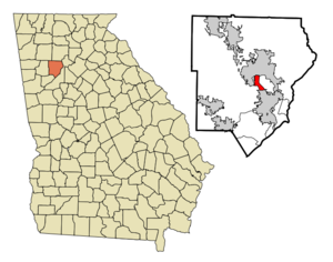
mapsize = 250px
map_caption = Location in Cobb County and the state of Georgia
mapsize1 =
map_caption1 =
image_dot_
dot_mapsize =
dot_map_caption =
dot_x =
dot_y =
pushpin_
pushpin_label_position =
pushpin_map_caption =
pushpin_mapsize =
subdivision_type = Country
subdivision_name =United States
subdivision_type1 = State
subdivision_name1 = Georgia
subdivision_type2 = County
subdivision_name2 = Cobb
subdivision_type3 =
subdivision_name3 =
subdivision_type4 =
subdivision_name4 =
government_footnotes =
government_type =
leader_title =
leader_name =
leader_title1 =
leader_name1 =
leader_title2 =
leader_name2 =
leader_title3 =
leader_name3 =
leader_title4 =
leader_name4 =
established_title =
established_date =
established_title2 =
established_date2 =
established_title3 =
established_date3 =
area_magnitude =
unit_pref = Imperial
area_footnotes =
area_total_km2 = 5.1
area_land_km2 = 5.1
area_water_km2 = 0
area_total_sq_mi = 2
area_land_sq_mi = 2
area_water_sq_mi = 0
area_water_percent =
area_urban_km2 =
area_urban_sq_mi =
area_metro_km2 =
area_metro_sq_mi =
area_blank1_title =
area_blank1_km2 =
area_blank1_sq_mi =
population_as_of = 2000
population_footnotes =
population_note =
population_total = 8443
population_density_km2 = 1655.5
population_density_sq_mi = 4221.5
population_metro =
population_density_metro_km2 =
population_density_metro_sq_mi =
population_urban =
population_density_urban_km2 =
population_density_urban_sq_mi =
population_blank1_title =
population_blank1 =
population_density_blank1_km2 =
population_density_blank1_sq_mi =
timezone = Eastern (EST)
utc_offset = -5
timezone_DST = EDT
utc_offset_DST = -4
latd = 33 |latm = 55 |lats = 11 |latNS = N
longd = 84 |longm = 32 |longs = 40 |longEW = W
elevation_footnotes =
elevation_m = 336
elevation_ft = 1102
postal_code_type =
postal_code =
area_code =
blank_name = FIPS code
blank_info = 13-28520GR|2
blank1_name = GNIS feature ID
blank1_info = 0331684GR|3
website =
footnotes =Fair Oaks is a
census-designated place (CDP) in Cobb County, Georgia,United States . The population was 8,443 at the 2000 census.The
USPS and most locals consider Fair Oaks to be a part ofMarietta, Georgia . Except for actual residents of Fair Oaks, very few locals even know it exists as a separately-counted area. The name is also rarely used by localbusiness es, even in the immediate area. Mableton, the only other CDP in the county, is far more well-known, being much larger and not immediately next to an incorporated city.The area was named for its many mature native
oak tree s. This however is threatened by nearbyDobbins Air Reserve Base , and excessive newFederal Aviation Administration regulation s regardingflight path s fortakeoff andlanding . In 2005, thelower house of theGeorgia General Assembly passed a resolution in support of thecommunity , which was built in the early 20th century, well before themilitary base . [http://www.legis.state.ga.us/legis/2005_06/fulltext/hr908.htm]Geography
Fair Oaks is located at coor dms|33|55|11|N|84|32|40|W|city (33.919802, -84.544507)GR|1.
According to the
United States Census Bureau , the CDP has a total area of 2.0 square miles (5.1 km²), of which, 2.0 square miles (5.1 km²) of it is land and 0.51% is water.Demographics
As of the
census GR|2 of 2000, there were 8,443 people, 2,952 households, and 1,791 families residing in the CDP. Thepopulation density was 4,325.4 people per square mile (1,671.7/km²). There were 3,136 housing units at an average density of 1,606.6/sq mi (620.9/km²). The racial makeup of the CDP was 50.76% White, 23.83% African American, 0.72% Native American, 0.98% Asian, 0.01% Pacific Islander, 20.43% from other races, and 3.26% from two or more races. Hispanic or Latino of any race were 36.54% of the population.There were 2,952 households out of which 33.7% had children under the age of 18 living with them, 35.7% were married couples living together, 15.8% had a female householder with no husband present, and 39.3% were non-families. 28.4% of all households were made up of individuals and 6.5% had someone living alone who was 65 years of age or older. The average household size was 2.80 and the average family size was 3.32.
In the CDP the population was spread out with 25.7% under the age of 18, 15.6% from 18 to 24, 37.6% from 25 to 44, 14.6% from 45 to 64, and 6.5% who were 65 years of age or older. The median age was 28 years. For every 100 females there were 123.6 males. For every 100 females age 18 and over, there were 128.5 males.
The median income for a household in the CDP was $31,766, and the median income for a family was $34,491. Males had a median income of $22,401 versus $21,491 for females. The
per capita income for the CDP was $13,245. About 11.9% of families and 15.0% of the population were below thepoverty line , including 11.1% of those under age 18 and 15.7% of those age 65 or over.References
External links
Wikimedia Foundation. 2010.