- Georgia State Route 280
Infobox road
state=GA
type=
route=280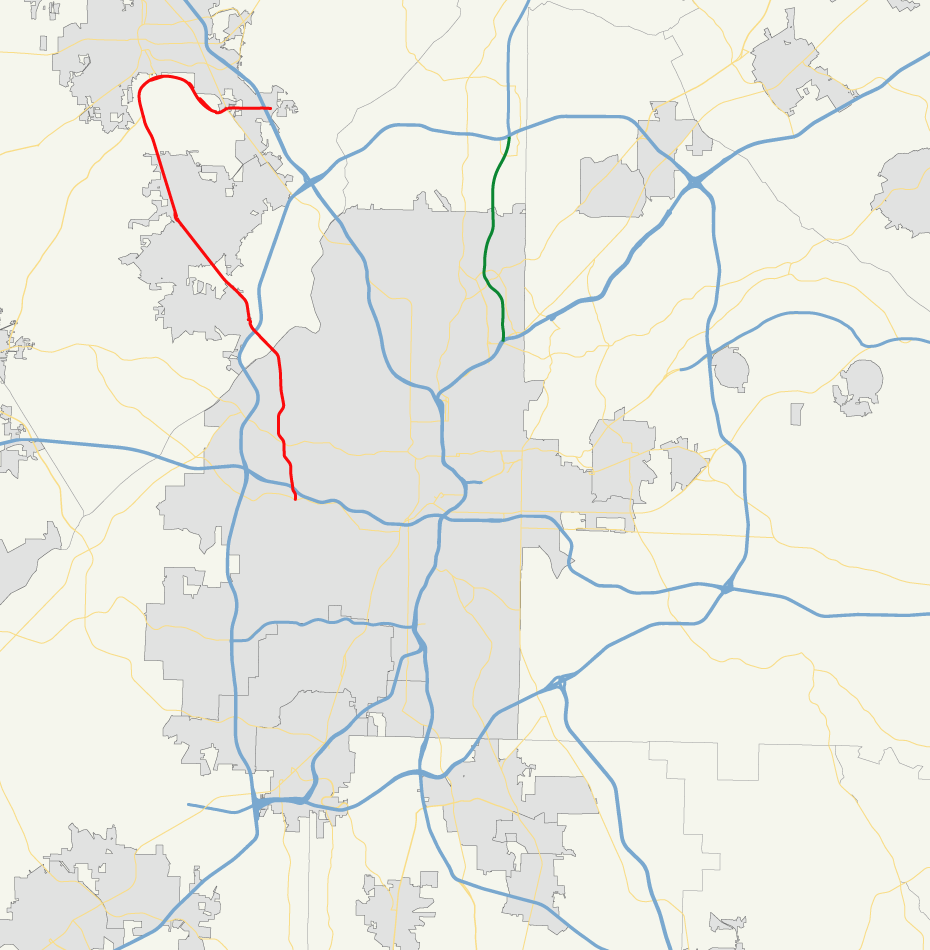
length_mi=19
length_ref= [http://www.dot.state.ga.us/DOT/plan-prog/transportation_data/400reports/2002/dpp444_2002.pdf]
length_round=0
established=
direction_a=South
direction_b=North
starting_terminus= in northwest Atlanta
junction=
ending_terminus=
previous_route=279
next_route=281State Route 280 is a state route located in the
Atlanta Metropolitan Area in theU.S. state of Georgia.Routing
State Route 280 begins in northwest Atlanta at Martin Luther King Jr. Drive (S.R. 139) The route travels north along Hamilton E. Holmes Parkway, meeting
Interstate 20 at an interchange, then continues north, across theChattahoochee River into Cobb County, where it is known as South Cobb Drive. The route continues north, then northwest, and has an interchange at Interstate 285 in Vinings. The route continues northwest out of Vinings and passes through the western portions of Smyrna. In the community of Fair Oaks, the route becomes cosigned with S.R. 5. After arcing back to the north, then to the east as Delk Road, S.R. 5 departs, and S.R. 280 continues east, pastLockheed-Martin and throughDobbins Air Reserve Base . After an interchange withU.S. 41 , the route meets its northern terminus at I-75, exit 261 (Delk Road), in Marietta.In northwest Atlanta, S.R. 280 was known as Hightower Road, but was renamed to honor Hamilton E. Holmes.
The route has at least four lanes for its entire length, and has 6 lanes in Marietta and between U.S. 41 and I-75.
ignificance
State Route 280 is a major urban arterial, with portions of the route seeing an Average Annual Daily Traffic of over 30,000 vehicles, especially around Dobbins Air Reserve Base. It serves as a major commuter route for commuters in southern Cobb County and for those communting to Dobbins Air Reserve Base and the Lockheed-Martin plant in Marietta.
Wikimedia Foundation. 2010.