- Georgia State Route 520
-
State Route 520
South Georgia Parkway 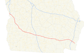
Route information Maintained by GDOT Length: 261 mi[citation needed] (420 km) Major junctions West end: 
 US-280 / SR-38 at the Alabama state line at the Chattahoochee River, Columbus/Phenix City
Columbus, Albany, Tifton, Waycross, Brunswick (via 
 US 17 / SR 25)
East end: Beach View Drive on Jekyll Island, Glynn County Highway system Georgia State Routes
Former SR←  SR 515
SR 540  →
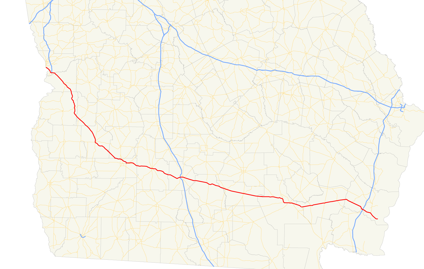
→State Route 520, also known as the South Georgia Parkway, is a state route in southern Georgia. Its western terminus occurs at the Alabama state line on a bridge over the Chattahoochee River that also carries U.S. Highway 280. Georgia 520 becomes unsigned State Route 38 upon crossing the border. The route follows U.S. 280 southeast to Richland, then runs independently to Dawson. The route joins U.S. Highway 82 there and overlaps it throughout much of southern Georgia all the way to Interstate 95. Georgia 520 then runs concurrently with U.S. Highway 17 for a few miles before departing the U.S. highway and proceeding to Jekyll Island, where it ends.
While not part of the Appalachian Development Highway System, Georgia 520 is nevertheless designated as Corridor Z. To emphasize the special designation, Georgia 520 route markers have a green background and numbers as opposed to black, which is normally used on State Route markers. Some markers also feature the small abbreviation "CORR Z" near the top of the state outline, though this practice is being phased out.
See also
- U.S. Highway 82
- U.S. Highway 280
Categories:- State highways in Georgia (U.S. state)

Wikimedia Foundation. 2010.