- Appalachian Development Highway System
-
 Map of the Appalachian Development Highway System
The Appalachian Development Highway System (ADHS) is part of the Appalachian Regional Commission in the United States. See: current map of the ADHS.
History
 1966 map
In 1964, the President’s Appalachian Regional Commission (PARC) reported to Congress that economic growth in Appalachia would not be possible until the region’s isolation had been overcome. Because the cost of building highways through Appalachia’s mountainous terrain was high, the region's local residents had never been served by adequate roads. The existing network of narrow, winding, two-lane roads, snaking through narrow stream valleys or over mountaintops, was slow to drive, unsafe, and in many places worn out. The nation's Interstate Highway System, though extensive through the region, was designed to serve cross-country traffic rather than local residents.
The PARC report and the Appalachian governors placed top priority on a modern highway system as the key to economic development. As a result, Congress authorized the construction of the Appalachian Development Highway System (ADHS) in the Appalachian Development Act of 1965. The ADHS was designed to generate economic development in previously isolated areas, supplement the interstate system, and provide access to areas within the Region as well as to markets in the rest of the nation. The system has served its intended purpose to varying degrees of success.
Currently, the ADHS is authorized at 3,090 miles (4,970 km), including 65 miles (105 km) added in January 2004 by Public Law 108-199. By the end of FY 2004, 2,627 miles (4,228 km)—approximately 85 percent of the 3,090 miles (4,970 km) authorized—were complete or under construction. Many of the remaining miles will be among the most expensive to build.[1]
Corridor Z across southern Georgia is not part of the official system, but has been assigned by the Georgia Department of Transportation.
List of ADHS corridors
Corridor A
Corridor A Location: Atlanta, GA – Clyde Corridor A is a highway in the states of Georgia and North Carolina. It is part of the Appalachian Development Highway System, running from Interstate 285 north of Atlanta northeasterly to Interstate 40 near Clyde, North Carolina. I-40 continues easterly past Asheville, where it meets Interstate 26 and Corridor B.
In Georgia, Corridor A travels along the State Route 400 freeway from I-285 to the State Route 141 interchange southwest of Cumming.[2] From there northwest between Ball Ground and Nelson, near the north end of Interstate 575, Corridor A has not been constructed; its proposed path is near that of the cancelled Northern Arc. It begins again with a short piece of State Route 372, becoming State Route 515 when it meets I-575. SR 515 is a four-lane divided highway all the way to Blairsville. From Blairsville to North Carolina, the corridor has not been built, and SR 515 is a two-lane road.[citation needed]
The short North Carolina Highway 69 takes Corridor A north to U.S. Highway 64 near Hayesville. Corridor A turns east on US 64, and after some two-lane sections, it becomes a four-lane highway.[citation needed] Corridor A switches to U.S. Highway 23 near Franklin, and meets the east end of Corridor K near Sylva. From Sylva to its end at Interstate 40 near Clyde, Corridor A uses the Great Smoky Mountains Expressway, which carries US 23 most of the way and U.S. Highway 74 for its entire length.
Corridor A-1 uses Georgia State Route 400 from the point that Corridor A leaves it, at State Route 141 near Cumming, northeast to State Route 53 near Bright. SR 400 continues northeast as a four-lane highway from SR 53 to State Route 60 south of Dahlonega; this section was built "with APL funds as a local access road".[2]
Corridor B
Corridor B Location: Asheville, NC – Portsmouth, OH Corridor B is a highway in the states of North Carolina, Tennessee, Virginia, Kentucky, and Ohio. It is part of the Appalachian Development Highway System, and generally follows U.S. Route 23 from Interstate 26 and Interstate 40 near Asheville, North Carolina, north to Corridor C north of Portsmouth, Ohio.[3]
Corridor B uses Interstate 240 from its south end into downtown Asheville, where it uses US 23 (current and future Interstate 26) to Kingsport, Tennessee. The US 23 freeway ends at the Tennessee/Virginia state line, but US 23 is a four-lane divided highway all the way through Virginia and into northeastern Kentucky.[4]
At Grays Branch, Kentucky, Corridor B leaves US 23 to turn east on Kentucky Route 10 over the two-lane Jesse Stuart Memorial Bridge into Ohio. The short Ohio State Route 253 connects the bridge to U.S. Route 52, a freeway that takes Corridor B north to Wheelersburg. US 52 continues west to Portsmouth, but the proposed alignment of Corridor B continues north and northwest along the planned Portsmouth Bypass to US 23 near Lucasville. The part of Corridor B north of SR 253 is also part of the I-73/74 North–South Corridor.[5]
Corridor B-1 runs from Kentucky Route 10 to the north end of the Portsmouth Bypass. In Kentucky, it follows US 23 and U.S. Highway 23 Truck; after crossing the two-lane Carl Perkins Bridge into Ohio, it uses current and planned State Route 852—a western bypass of Portsmouth—and US 23. Corridors B and B-1 both end near Lucasville, where Corridor C continues north along US 23 to Columbus.[5]
Corridor C
Corridor C Location: Portsmouth, OH – Columbus, OH Corridor C is a highway in the U.S. state of Ohio. It is part of the Appalachian Development Highway System, as well as part of U.S. Route 23, running from the north end of Corridor B near Lucasville north to Interstate 270 south of Columbus.[3] As of 2005[update], most of the road is a four-lane divided highway, but there are a few gaps yet to be built.[4] Corridor C is part of the I-73/74 North–South Corridor.
Corridor C-1 is a connection from Corridor C near Chillicothe southeast to Corridor D near Jackson, Ohio, along U.S. Route 35. It has been completed as a four-lane highway.[4]
Corridor D
- Corridor D: Cincinnati, OH - Bridgeport, WV
Corridor E
Main article: Interstate 68
Corridor E
Location: Morgantown, WV – Hancock, MD Length: 112.9 mi[6][7][8][9] (182 km) Interstate 68 (I-68) is a 112.6-mile (181.2 km) Interstate highway in the U.S. states of West Virginia and Maryland, connecting Interstate 79 in Morgantown to Interstate 70 in Hancock. I-68 is also Corridor E of the Appalachian Development Highway System. From 1965 until the freeway's construction was completed in 1991, it was designated as U.S. Route 48 (US 48). In Maryland, the highway is known as the National Freeway, an homage to the historic National Road, which I-68 parallels between Keysers Ridge and Hancock. The freeway mainly spans rural areas, and crosses numerous mountain ridges along its route. A road cut constructed for it through Sideling Hill exposed geological features of the mountain and has become a tourist attraction.
U.S. Route 219 and U.S. Route 220 overlap with I-68 in Garrett County and Cumberland, Maryland, respectively, and U.S. Route 40 overlaps with the freeway from Keysers Ridge to the eastern end of the freeway at Hancock.
The construction of I-68 began in 1965 and lasted for about 25 years, being completed on August 2, 1991. While the road was being built, it was predicted that the completion of the road would improve the economic situation along the corridor. The two largest cities connected by the highway are Morgantown and Cumberland, both with populations of fewer than 30,000 people. Despite the fact that the freeway serves no large metropolitan areas, I-68 provides a major transportation route in western Maryland and northern West Virginia and also provides an alternative to the Pennsylvania Turnpike for westbound traffic from Washington, D.C. and Baltimore.
There have been several major planned road projects that would affect the freeway's corridor. These include a plan to extend I-68 to Moundsville, West Virginia, which, due to major funding issues, is unlikely to be completed, and the plan to construct the Mon–Fayette Expressway, a toll highway which, when completed, will meet I-68 east of Morgantown.
Corridor F
Corridor F Location: Caryville, TN – Jenkins, KY Corridor F is a highway in the states of Tennessee and Kentucky. It is part of the Appalachian Development Highway System, running from Interstate 75 in Caryville, Tennessee, northeasterly to Corridor B (U.S. Highway 23) near Kentucky. Corridor F uses U.S. Highway 25W and Tennessee State Route 63 from I-75 to Corridor S (U.S. Highway 25E) in Harrogate, Tennessee. There it turns northwest along US 25E, passing through the Cumberland Gap Tunnel into Kentucky. It leaves US 25E in Pineville, Kentucky, turning northeasterly along U.S. Highway 119, past an intersection with Corridor I (Kentucky Route 15) in Whitesburg, to its end at Corridor B.
Corridor G
Corridor G
Location: Pikeville, KY – Charleston, WV Main article: Corridor GCorridor G is a highway in Kentucky and West Virginia that follows the route of U.S. Route 119 from Pikeville, Kentucky, to Charleston, West Virginia. Construction on the road began in 1972 in West Virginia and 1974 in Kentucky, but it was more than two decades before the road was completed in either state. The full length of Corridor G in West Virginia was completed in 1997, but Kentucky's last segment was not opened until 2008.
Corridor H
- Corridor H: Weston, WV - Strasburg, VA
Corridor I
Corridor I Location: Winchester, KY – Whitesburg, KY Corridor I is a highway in the U.S. state of Kentucky. It is part of the Appalachian Development Highway System, running from Interstate 64 southeasterly along the Mountain Parkway and Kentucky Route 15 to Corridor F (U.S. Highway 119) in Whitesburg. Corridor I meets Corridor R (Mountain Parkway) near Campton and future Interstate 66 (Hal Rogers Parkway and Kentucky Route 80) in Hazard.
Corridor J
Corridor J Location: Chattanooga, TN – London, KY Corridor J is a highway in the states of Tennessee and Kentucky. It is part of the Appalachian Development Highway System, running from the end of Interstate 24 in Chattanooga, Tennessee, north to Interstate 75 in London, Kentucky.[3]
Corridor J uses U.S. Highway 27 from Chattanooga north to Soddy-Daisy. There it turns northwest on State Route 111, eventually curving to the north via Dunlap, Sparta, and Cookeville to Livingston. Then it turns northwest on State Route 52 to Celina and northeast on State Route 53 to Kentucky.
Upon crossing into Kentucky, Corridor J becomes Kentucky Route 61, heading north to Burkesville. There it turns east on Kentucky Route 90, which it follows to Burnside. Corridor J turns north on U.S. Highway 27 at Burnside, quickly turning northeast on Kentucky Route 914 to bypass downtown Somerset[citation needed] and then east on Kentucky Route 80 to London.
The proposed Interstate 175 would follow Corridor J.
Until late 2005, Corridor J was to turn west just north of Cookeville along the planned State Route 451 to State Route 56 north of Baxter and then use SR 56 and SR 53 via Gainesboro.[10][11]
Corridor K
Corridor K Location: Cleveland, TN – Sylva, NC Corridor K is a highway in the states of Tennessee and North Carolina. It is part of the Appalachian Development Highway System and part of U.S. Routes 64 and 74. Corridor K runs from Interstate 75 near Cleveland, Tennessee, northeast of Chattanooga, easterly to Corridor A (U.S. Highway 23) near Sylva, North Carolina.[3]
Corridor L
- Corridor L: Beckley, WV - Sutton, WV
Corridor L
Location: Beckley, WV – Sutton, WV Corridor L is part of the Appalachian Development Highway System in the U.S. state of West Virginia. It follows the path of U.S. Route 19 between Beckley and Sutton. By exiting onto Corridor L from Interstate 79 at milepost 57, a southbound traveler can eliminate 40 miles (64 km), and $2.25 in tolls, re-entering the interstate system at the West Virginia Turnpike (Interstate 64 and Interstate 77) at milepost 48.
Originally this corridor was built as a four-lane divided highway for only the half south of U.S. Route 60; however, the large amount of traffic (as part of the direct route from the cities of Toronto, Buffalo, and Pittsburgh to Florida) forced the state to rethink this plan and upgrade the northern half to four lanes as well.[citation needed]
High vehicle accident rates and potential revenues led to strict enforcement of traffic speed limits. The town of Summersville has been identified as a speed trap by the National Motorists Association.[citation needed]
Corridor M
Corridor M
Location: New Stanton, PA – Harrisburg, PA Corridor M extends 200.1 miles (322.0 km) (including 29.9 miles (48.1 km) that are ineligible), with 102.1 miles (164.3 km) completed, from the I-70/I-76 interchange at New Stanton to a junction at I-81 near the Pennsylvania Turnpike at Harrisburg. The estimated cost to complete this corridor is $1.40 billion, including $42 million for prefinanced projects. The remaining work includes the construction of four lanes generally paralleling U.S. Route 22.
Projects currently under way in Pennsylvania include:
- A 1.8-mile (2.9 km) section from SR982 to Auction Barn Road
- A 2.3-mile (3.7 km) section from Auction Barn Road to west of Blairsville
- A 4.2-mile (6.8 km) section from approximately 5 miles (8 km) east of U.S. Route 119N to east of Clyde
- A location study on a 59.8-mile (96.2 km) section to provide four lanes between Hollidaysburg and Lewistown
Corridor N
This article is about the section of Appalachian Development Highway System. For the entire length of the highway, see U.S. Route 219.Corridor N Location: Grantsville, MD – Ebensburg, PA Corridor N runs through Maryland and Pennsylvania. It is part of the Appalachian Development Highway System and is a designated portion of U.S. Route 219, running from Corridor E (Interstate 68/U.S. Route 40) near Grantsville, Maryland, north to Corridor M (U.S. Route 22 near Ebensburg, Pennsylvania. There is currently an attempt in the U.S. House of Representatives to extend this corridor, in the form of House bill H.R.1544 - Corridor N Extension Act of 2011. The act would extend Corridor N north from its current terminus at Corridor M to Corridor T in southwestern New York. The bill has not yet been brought before Congress for debate. Currently (2011), Corridor N has been completed as a controlled-access highway from just north of Ebensburg to Somerset, Pennsylvania, with a small additional portion completed in the form of the Meyersdale bypass. No portion of the route has been improved in Maryland.
Corridor O
Corridor O Location: Scherr, WV – Bellefonte, PA Corridor O is a highway in West Virginia, Maryland, and Pennsylvania. It is part of the Appalachian Development Highway System, as well as part of U.S. Route 220, running from Corridor H (U.S. Route 48) to Corridor E (Interstate 68/U.S. Route 40) near Cumberland, Maryland. The route then extends north to Interstate 80 near Bellefonte, Pennsylvania. The part north of the Pennsylvania Turnpike (I-70/I-76) near Bedford is also Interstate 99.[13]
Corridor O-1 begins at Corridor O at Port Matilda, Pennsylvania, and runs northwesterly along U.S. Route 322 to Interstate 80 near Clearfield.[13]
Corridor P
Corridor P Location: Mackeyville, PA – Milton, PA Length: 39.6 mi[1] (63.7 km) Corridor P is a highway in Pennsylvania. It is part of the Appalachian Development Highway System, running from near Mackeyville, eastward to Milton.[3]
Corridor P-1 begins at Corridor P in Milton and runs south along U.S. Route 11/U.S. Route 15 to their interchange with U.S. Route 22/U.S. Route 322 north of Harrisburg.[14]
Corridor Q
- Corridor Q: Pikeville, KY - Christiansburg, VA
Corridor R
Corridor R Location: Campton, KY – Prestonsburg, KY Corridor R is a highway in Kentucky. It is part of the Appalachian Development Highway System, running from Corridor I at the junction of the Mountain Parkway and Kentucky Route 15 near Campton east along the Mountain Parkway and Kentucky Route 114 to Corridor B (US 23/US 460) in Prestonsburg.[3] It forms part of a route from Lexington, Kentucky to Roanoke, Virginia using Interstate 64, Corridor I, Corridor R, Corridor B, Corridor Q, and Interstate 81.
Corridor S
Main article: U.S. Route 25ECorridor T
Main article: Interstate 86 (east)Corridor T runs through the states of New York and Pennsylvania, west of Binghamton, and corresponds to Interstate 86, an upgrade of the existing New York State Route 17. An extension of the U.S. 219 Southern Expressway will also join I-86.
Known as the Southern Tier Expressway and Quickway (split by Interstate 81 at Binghamton, New York), Interstate 86 will connect Interstate 90 near Erie, Pennsylvania, with Interstate 87 (the New York State Thruway) near Harriman, New York. As of August 2008, it runs east from I-90 to New York State Route 352 in Elmira, bringing the total length of highway designated as I-86 to 200 miles (322 km) (and 181 miles (291 km) remaining to be designated).[15] Once completed, I-86 will stretch 388 miles (624 km) across the Southern Tier of New York from I-90 to I-87,[16] shorter than the 460 miles (740 km) along the flatter New York State Thruway to the north.
Several sections of NY 17 are not up to freeway or Interstate Highway standards, and need to be upgraded before I-86 can be designated along its full length. These substandard sections are located near Elmira, Binghamton, and the Catskill Mountains.
I-86 currently travels 6.99 miles (11.25 km)[17] in Pennsylvania and 190 miles (306 km) in New York.[16] Except for a section of about 1.5 miles (2.4 km) that dips into Pennsylvania near Waverly, New York but is maintained by the New York State Department of Transportation, the rest of I-86 will be in New York.
Corridor U
Corridor U Location: Williamsport, PA–Elmira, NY Length: 84.9 mi[18] (136.6 km) Corridor U begins at Corridor P (U.S. Route 220) near Williamsport, Pennsylvania, and proceeds generally northward through Pennsylvania and New York to Corridor T (Interstate 86) in Elmira, New York. The corridor follows U.S. Route 15 northward from Williamsport to Tioga Junction, where it turns northeastward to follow Pennsylvania Route 328 and New York State Route 328 to Elmira.[3]
Corridor V
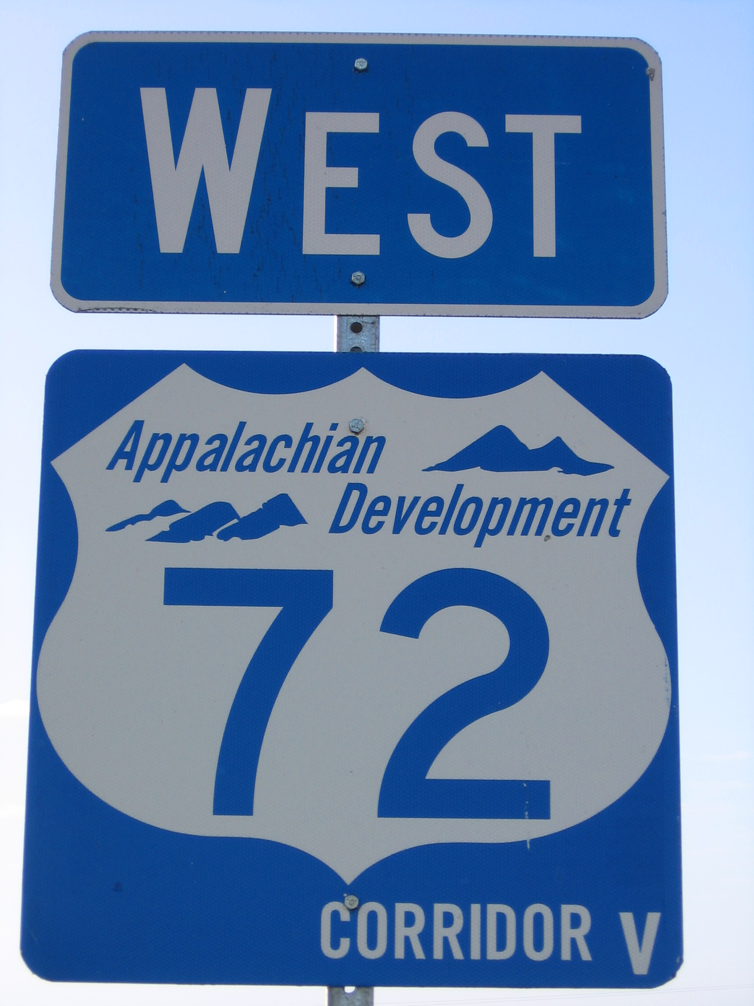
Corridor V Location: Batesville, MS – Chattanooga, TN Corridor V is part of the Appalachian Development Highway System. It is located in the states of Mississippi, Alabama, and Tennessee. Its termini are Interstate 55 in Batesville, Mississippi, and Interstate 24 west of Chattanooga, Tennessee.
 Sign for Corridor V and U.S. Highway 72 in Alabama
As of 2010, the following portions of Corridor V are not completed:
- Between Red Bay, Alabama and Fulton, Mississippi (designated MS 76)
- Relocated US 278/MS 6 between Tupelo and Pontotoc, Mississippi, which is projected to be complete in 2013.
Both sections of highway are currently under design by the Mississippi Department of Transportation, with the portion that will overlap MS 25 already under construction near Fulton.
Sections of Alabama State Route 24 in Red Bay and just west of Russellville are under construction, with completion dates for the Red Bay bypass set near the end of 2010.
Corridor V between Batesville and Fulton was also designated as National Highway System High Priority Corridor 42 and a Future Interstate Corridor as part of the 1998 Transportation Equity Act for the 21st Century; originally, Corridor 42 also included an overlap with Corridor X between Fulton and Birmingham, Alabama, but this overlap was removed in subsequent legislation.[19][20] However, the portion of the route between Batesville and Tupelo is only being constructed to four-lane divided highway standards, making Interstate highway designation unlikely in the near future.
Corridor V was also designated as High Priority Corridor 11 in the National Highway System Designation Act of 1995.[21]
Corridor W
Main article: U.S. Route 25Corridor X
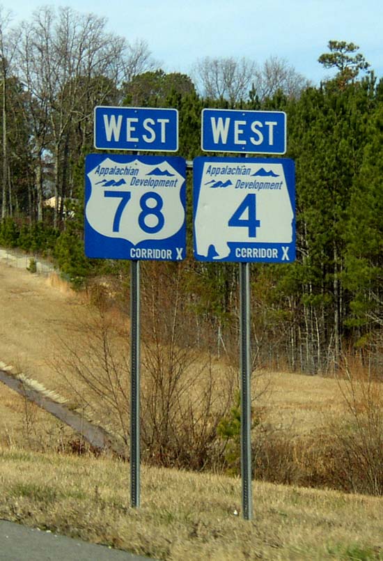
Main article: Interstate 22 Corridor X shields in Marion County
See also
- Appalachian Trail (Appalachian National Scenic Trail in the eastern U.S.)
- Appalachian Trail Conservancy (formerly the Appalachian Trail Conference)
References
- ^ Appalachian Regional Commission (September 30, 2004). "ARC|ADHS Approved Corridors and Termini". Retrieved 16 April 2010.
- ^ a b Appalachian Development Highways Economic Impact Studies, Chapter 3: Highway and Traffic Analysis
- ^ a b c d e f g ADHS Approved Corridors and Termini
- ^ a b c Map of the Appalachian Development Highway System, September 30, 2005
- ^ a b Portsmouth Bypass Purpose and NeedPDF (2.05 MiB)
- ^ Carol Melling (2003-10-31). "I-68 Extension Now Eligible for Federal Funding". West Virginia Department of Transportation. http://www.wvdot.com/13_news/13_news_dtl.cfm?s=456. Retrieved 2009-01-17.
- ^ "Highway Location Reference: Garrett County" (PDF). Maryland State Highway Administration. 2007. http://apps.roads.maryland.gov/KeepingCurrent/performTrafficStudies/dataAndStats/hwyLocationRef/2007_hlr_all/co11.pdf. Retrieved 2009-01-17.
- ^ "Highway Location Reference: Allegany County" (PDF). Maryland State Highway Administration. 2007. http://apps.roads.maryland.gov/KeepingCurrent/performTrafficStudies/dataAndStats/hwyLocationRef/2007_hlr_all/co01.pdf. Retrieved 2009-01-17.
- ^ "Highway Location Reference: Washington County" (PDF). Maryland State Highway Administration. 2007. http://apps.roads.maryland.gov/KeepingCurrent/performTrafficStudies/dataAndStats/hwyLocationRef/2007_hlr_all/co21.pdf. Retrieved 2009-01-17.
- ^ Stop Corridor J (SR451)
- ^ Tennessee Department of Transportation, Appalachian Development Highway System Corridor J
- ^ http://www.arc.gov/images/programs/transp/adhs_status_report_2009/ADHSFY2009StatusReportPennsylvania.pdf
- ^ a b Library of Congress, Thomas
- ^ CSVT News
- ^ "State Route 17 Becomes Interstate 86 From Kirkwood (Exit 75) To Windsor (Exit 79) (Broome County)" (Press release). New York State Department of Transportation. October 11, 2006. https://www.nysdot.gov/news/press-releases/2006/111. Retrieved September 13, 2007.
- ^ a b MapQuest driving directions: part 1 and part 2
- ^ Main Routes of the Dwight D. Eisenhower National System Of Interstate and Defense Highways as of October 31, 2002
- ^ Google, Inc. Google Maps – Appalachian Development Highway System (Map). Cartography by Google, Inc. http://maps.google.com/maps?f=d&hl=en&saddr=Williamsport,+Pennsylvania&daddr=Elmira,+New+York&sll=41.04853,-77.149645&sspn=0.467086,0.933838&layer=&ie=UTF8&z=9&ll=41.693424,-76.648865&spn=0.924945,1.867676&om=1. Retrieved April 19, 2007.
- ^ Federal Highway Administration, "NHS High Priority Corridors designated as Future Interstates", retrieved 16 September 2007
- ^ Federal Highway Administration, "FHWA Route Log and Finder List", retrieved 16 September 2007
- ^ Appalachian Regional Commission (September 30, 2004). "ARC|ADHS Approved Corridors and Termini". Retrieved 28 July 2005.
External links
Categories:- Appalachian Development Highway System
- Roads in the United States
Wikimedia Foundation. 2010.