- Mon–Fayette Expressway
-
"Pennsylvania Route 43" redirects here. For the 1920s to 1940s road, see U.S. Route 22 in Pennsylvania.
Mon–Fayette Expressway


Route information Maintained by WVDOH, PennDOT, & PTC Length: 70 mi (112.7 km) Existed: 1977 – present Southern section South end:  I-68 in Cheat Lake
Major
junctions: US 119 in Uniontown
North end:  US 40 near Brownsville
Northern section South end:  US 40 / PA 88 near West Brownsville
Major
junctions: I-70 in Fallowfield Township
 PA 136 near New Eagle
North end:  PA 51 in Jefferson Hills
Location Counties: Monongalia, Fayette, Washington, Allegheny Highway system West Virginia Routes
State • County
Roads in Pennsylvania
Interstate • US • State • Legislative←  WV 42
WV 42WV WV 44  →
→←  PA 42
PA 42PA PA 44  →
→The Mon–Fayette Expressway is an interstate tolled freeway that is planned to eventually link Interstate 68 near Morgantown, West Virginia with two branches to Interstate 376 near Pittsburgh, Pennsylvania. The ultimate goal of the highway is to provide a high speed north-south connection between Morgantown and the eastern side of Pittsburgh while revitalizing the economically distressed towns in Fayette and Washington counties, serving as an alternative to Interstate 79 to the west. In addition, the two branches in Allegheny County would provide a bypass to the Squirrel Hill Tunnel.
Although it is being built to Interstate Highway standards, most of the freeway is not expected to become part of the Interstate Highway System.[1] As a result, the highway uses state highway monikers instead, as it does not parallel an existing U.S. Route for its entire length, though it does parallel U.S. Route 40 and U.S. Route 119 for portions of its length. The route, in its three jurisdictions, uses the number 43 for familiarity-based reasons, and is thusly known as West Virginia Route 43, Pennsylvania Route 43, and PA Turnpike 43. Most of the route is maintained by the Pennsylvania Turnpike Commission, while the Pennsylvania Department of Transportation maintains small portions of the highway near Uniontown, and the West Virginia Division of Highways maintains the short section in West Virginia. Despite the numerous agencies overseeing the highway, it is effectively one highway. South of Jefferson Hills, the Mon-Fayette Expressway is complete except for a short segment south of Brownsville, which is planned to open in 2012. Construction on the final 24-mile (39 km) stretch that will connect the highway's current northern terminus at Jefferson Hills to Pittsburgh and Monroeville is pending due to funding limitations.[1]
Contents
History
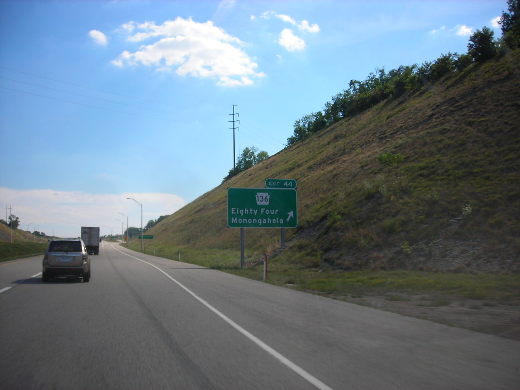
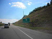 PA 136 exit sign.
The Mon–Fayette Expressway designation is derived from the Monongahela River and Fayette County because initially, the highway was proposed in the 1950s as a way to link the coke- and steel-producing towns situated in the Monongahela River Valley. The coke and steel industry waned in the 1970s and nearly collapsed in the early 1980s. Today, the Monongahela River Valley considers the expressway to be an important tool for economic redevelopment.
The construction history of the Mon–Fayette Expressway is complex. PennDOT initiated construction in 1973, and the first segment opened in 1977.[1] This segment consisted of a partial cloverleaf interchange at U.S. Route 40 and a 2-mile (3.2 km) stretch of four-lane highway that spurred south of the new interchange toward Fredericktown. Despite severe financial constraints, PennDOT built the remainder of the ramps at the U.S. 40 cloverleaf along with a separate 2-mile (3.2 km) stretch of highway near California in the early 1980s.[1] Once construction stalled, the project was transferred to the Pennsylvania Turnpike Commission (PTC) under Act 61 legislation in 1985.[1] While PennDOT assessed preliminary engineering and right-of-way options in the 1970s and early 1980s, the PTC accelerated design work and began unveiling detailed plans in earnest by the late 1980s.[1] Funding appropriated through the PTC allowed construction to resume in 1988, and on October 12, 1990, the entire stretch from U.S. Route 40 to Interstate 70 opened to traffic.[1] Initially, the PTC did not have adequate funding to construct new sections, but Representative Austin Murphy secured congressional funds that directed PennDOT to build a 4-mile (6.4 km) stretch of the expressway south of Uniontown.[1] Aside from being part of a larger project, the new segment was designed to provide high speed access between the Uniontown bypass, Fairchance, and a new business park. This section, dubbed the Chadville Demonstration Project, opened in November 1992.
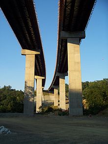 Ground level view under Morgan Run Bridge looking northbound.
In the early 1990s, the Pennsylvania State Legislature passed a bill that hypothecated a portion of the state’s fuel excise revenue to the PTC. This new revenue stream initially provided the funding to complete an 8-mile (13 km) section from the southern terminus of the Chadville Demonstration Project to the West Virginia state line as well as a 17-mile (27 km) section from the Interstate 70 interchange to Pennsylvania Route 51 in Jefferson Hills. On March 1, 2000, most of the section between the Chadville Demonstration Project and the West Virginia state line opened to traffic.[1] The entire segment from Interstate 70 to Route 51 was open by April 12, 2002,[1] which included the Joe Montana Bridge, named after the Pro Football Hall of Fame quarterback who grew up in the immediate area in nearby Monongahela, Pennsylvania.[2]
In 2006, construction began on a 17-mile (27 km) stretch that will connect the oldest section of the expressway near Fredericktown to the northern terminus of the Chadville Demonstration Project. This is known locally as the "Uniontown-to-Brownsville Project". Due to limited funding, construction on this section was split into two phases. The first phase involved construction of an 8-mile (13 km) section of expressway running parallel to a hazardous stretch of U.S. Route 40 between Brownsville and Uniontown. Phase 1 opened on October 23, 2008.[1] The second phase consists of a 9-mile (14 km) section that will connect the first phase of this project to the oldest portion of the expressway near Fredericktown. Additionally, the second phase includes a directional T interchange at U.S. Route 119 in Uniontown. Construction on phase 2 is nearing completion, and the new interchange at U.S. Route 119 opened on December 13, 2010[8] while the remainder of phase 2 is planned to be open by mid-2012. The connection to the northern end of the Chadville Demonstration Project has been accomplished via U.S. 119, and U.S. 119 between the new interchange and the Chadville Demonstration Project received a dual PA 43 route designation (even though it is poorly signed).
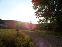 Sunset view of Rubles Run Bridge, the northernmost bridge on WV 43. The Mason–Dixon Line runs across the northern point of the bridge.
In West Virginia, construction commenced in 2000 but progressed slowly due to limited funding. By the end of 2003, only the Rubles Run Bridge and two pieces of highway totaling little more than 2.5 miles (4.0 km) were completed. Over the next few years, construction inched ahead. By 2009, the Morgan Run Bridge was finished, and local roads near Cheat Lake were re-built to accommodate the expressway. The final contracts to build the Cheat Lake and Interstate 68 interchanges were respectively awarded in December 2008 and July 2009, partly as a result of an ARRA fund infusion.[3][4] On July 11, 2011, officials in West Virginia opened their 4-mile (6.4 km) section of the Mon-Fayette Expressway. Likewise, the PTC opened the southernmost 1.7 miles (2.7 km) in Pennsylvania, which sat unused for over a decade. Noteworthy features on the West Virginia section include two high-level bridges, along with the I-68 interchange, which is a hybrid design that utilizes both high-speed ramps and at-grade intersections. A second phase for this interchange is planned, but that project will not be undertaken until traffic volumes merit.[5] If the second phase is built, the I-68 interchange will be upgraded to a directional T.
The connection between Jefferson Hills and I-376 is in limbo.[1] All environmental clearances have been obtained, and right-of-way acquisition has begun. However, construction is expected to cost at least $3.6 billion, and funding has not been identified. A public-private partnership was explored but nothing feasible resulted. It is unlikely that any new construction will commence in the near future unless a new tax is imposed or private funding identified.
Toll configuration
The Mon–Fayette Expressway is a toll road for much of its length. Unlike the Pennsylvania Turnpike mainline and the Northeast Extension, which uses long-distance tickets, the Mon–Fayette Expressway collects fixed tolls at regular intervals. In addition, auxiliary toll plazas exist on certain on- and off-ramps. In 2008, the PTC retrofitted all toll plazas to accept E-ZPass, and Express E-ZPass lanes are available at the newer toll plazas.[6]
In West Virginia, legislators have flip-flopped a few times regarding whether their section will be a toll road. When tolls were first proposed, West Virginia had planned to work with the Pennsylvania Turnpike Commission to collect tolls at the existing Pennsylvania mainline plaza, but this plan was not accepted by the West Virginia Legislature. Instead, West Virginia planned to construct a toll plaza north of Goodwin Hill Road.[7][8] West Virginia officials also contemplated whether to use all-electronic tolling or a more traditional tolling scheme. In the end, tolling plans were scrapped by West Virginia's legislature. Rejection resulted from concerns related to camera enforcement, billing, and operational costs. However, West Virginia reserves the right to levy tolls in the future if these issues are settled.[9]
Exit list
County Location Mile Exit Destinations Notes Monongalia Cheat Lake 0.0 — I-68 – Cumberland, MD, Morgantown0.7 1  To CR 857 (Fairchance Road) – Cheat Lake
Last exit northbound in West Virginia Mason–Dixon Line 4.2 West Virginia – Pennsylvania state line Fayette Springhill Township 5.9 2 To US 119 (Gans Road) – Point MarionFirst exit in Pennsylvania; northern end of toll-free section 8.0 4  To PA 857 (Rubles Mill Road) – Haydentown, Smithfield
Toll plaza for motorists exiting northbound and entering southbound Fairchance 9.9 Fairchance mainline toll plaza 12.2 8 To US 119 to PA 857 (Big Six Road) – Fairchance, SmithfieldSouthern end of Uniontown toll-free section 15.9 US 119 south / Morgantown RoadSouthern end of concurrency with US 119 16.3 US 40 east – HopwoodLeft exit southbound; eastern end of concurrency with US 40 Uniontown 17.1 Walnut Hill Road 18.5  PA 21 / McClellandtown Road
19.2 US 40Western end of concurrency with US 40 20.1 US 119 north – Connellsville, New StantonSemi-directional T interchange; northern end of concurrency with US 119; northern end of Uniontown toll-free section 21.1 15 To US 40 to PA 51 / Northgate HighwayToll plaza for northbound exit and southbound entrance New Salem 24.7 18 To US 40 – New Salem, WaltersburgToll plaza for northbound exit and southbound entrance Redstone 27.9 Redstone mainline toll plaza Brownsville 28.7 22 US 40 – Brownsville, Brier HillNorthbound exit and southbound entrance; temporary northern terminus of segment, remainder of interchange is under construction as part of phase 2 of the Uniontown-to-Brownsville project Luzerne Township 32.7 26 Republic, Brownsville Interchange under construction as part of phase 2 of Uniontown-to-Brownsville project Washington Centerville 34.7 28 PA 88Southbound exit and northbound entrance; southern end of concurrency with PA Route 88; temporary southern terminus of segment, remainder of interchange is under construction as part of phase 2 of the Uniontown-to-Brownsville project 36.7 30A US 40 east / PA 88 north, BrownsvilleNorthern end of concurrency with PA 88 36.7 30B US 40 west – CentervilleCalifornia 38.1 32 
PA 88 Truck – California (SR 2073, SR 2083)40.4 34 Elco (SR 2033) 41.5 California mainline toll plaza Fallowfield Township 41.8 36 I-70 – New Stanton, WashingtonSigned as exits 36A (east, New Stanton) and 36B (west, Washington) 45.1 39 Charleroi, Donora (SR 2025) Toll plaza for northbound exit and southbound entrance Carroll Township 49.8 44 PA 136 – Eighty Four, MonongahelaToll plaza for northbound exit and southbound entrance Union Township 54.3 48  Orange Belt – Finleyville, West Elizabeth (SR 1006)
Toll plaza for northbound exit and southbound entrance Allegheny Jefferson Hills 57.7 Jefferson Hills mainline toll plaza 59.4 54 PA 51 – Pittsburgh, Elizabeth (SR 2030)Northbound exit and southbound entrance; temporary northern terminus 1.000 mi = 1.609 km; 1.000 km = 0.621 mi
Concurrency terminus • Closed/Former • Incomplete access • UnopenedCriticism
The roadway has generated controversy in Allegheny County.[10] Critics often point to the low traffic volumes on the existing segments to help justify their dissent. Critics claim that such low volumes prove that the expressway is unfeasible. Supporters also consider the low traffic volume, but they claim that traffic volumes are low because of the segmented nature of the overall highway.[11]
Related roads
In the 1990s, the Mon–Fayette Expressway project was expanded to include another highway, which is commonly referred to as the Southern Beltway. The Southern Beltway is planned to be a high-speed east-west link between the Mon–Fayette Expressway, Interstate 79, U.S. Route 22, Interstate 376, and Pittsburgh International Airport. A 6-mile (9.7 km) section of the beltway between Pittsburgh International Airport/Interstate 376 and U.S. Route 22 opened to traffic in 2006.[12] The new road has been designated as Pennsylvania Route 576.
The PTC built several non-tolled roads in conjunction with the Uniontown-to-Brownsville project. One such road outside of Brownsville extended a four-lane section of U.S. Route 40, eliminating a forty-year-old freeway stub in the process. Another road connecting U.S. Route 40 and Pennsylvania Route 51 was built near Uniontown. These roads were necessary to provide access to Exits 22 and 15 respectively, but the access routes were also designed to improve local connections and foster economic development.
References
- ^ a b c d e f g h i j k l Kitsko, Jeffrey J. (March 14, 2010). "PA Turnpike 43: Mon-Fayette Expressway". PA Highways. http://www.pahighways.com/toll/PATurnpike43.html. Retrieved June 25, 2011.
- ^ "The Mingo Creek Viaduct (Joe Montana Bridges) Washington County, PA" (PDF). Modern Steel Construction (Chicago: American Institute of Steel Construction). November 2003. ISSN 0026-8445. http://www.modernsteel.com/Uploads/Issues/November_2003/30723_Mingo.pdf.
- ^ "Mon-Fayette Expressway Moves Closer to Cheat". Dominion Post (Morgantown, WV): p. 4A. July 6, 2009. http://ee.dominionpost.com/Repository/ml.asp?Ref=RFBvc3QvMjAwOS8wNy8wNiNBcjAwNDAw&Mode=Gif&Locale=english-skin-custom. Retrieved July 6, 2009.
- ^ Robbins, Richard (March 4, 2009). "Expressway Plan Hailed for W. Pa.". Pittsburgh Tribune-Review. Archived from the original on March 5, 2009. http://www.webcitation.org/5f2iNThOd. Retrieved March 5, 2009.
- ^ Shaner, Cassie (January 11, 2010). "W.Va. Could Open Mon-Fayette this Year". Dominion Post. http://ee.dominionpost.com/Repository/ml.asp?Ref=RFBvc3QvMjAxMC8wMS8xMSNBcjAwNTAz&Mode=Gif&Locale=english-skin-custom. Retrieved December 10, 2010.
- ^ "Express E-ZPass Lanes to Open June 8 on Mon-Fayette Expressway" (Press release). Pennsylvania Turnpike Commission. June 4, 2010. http://readme.readmedia.com/Express-E-ZPass-Lanes-to-Open-June-8-on-Mon-Fayette-Expressway/1356419. Retrieved June 25, 2011.
- ^ Beard, David (June 24, 2010). "Expressway to Open in Spring 2011". Dominion Post (Morgantown, WV). http://ee.dominionpost.com/Olive/ODE/DominionPost/LandingPage/LandingPage.aspx?href=RFBvc3QvMjAxMC8wNi8yNA..&pageno=MQ..&entity=QXIwMDEwMw..&view=ZW50aXR5. Retrieved June 24, 2010.
- ^ "Traffic May Move in November on Road". Dominion Post (Morgantown, WV): p. 1B. http://ee.dominionpost.com/Olive/ODE/DominionPost/LandingPage/LandingPage.aspx?href=RFBvc3QvMjAxMC8wOS8xNg..&pageno=Nw..&entity=QXIwMDcwNA..&view=ZW50aXR5. Retrieved September 16, 2010.
- ^ Staff (June 13, 2011). "New Toll Roads Less Likely". MetroNews (Charleston, WV). http://www.wvmetronews.com/news.cfm?func=displayfullstory&storyid=46032. Retrieved June 13, 2011.
- ^ Grata, Joe (April 13, 2002). "Mon-Fay Expressway now 13 Miles Longer". Pittsburgh Post-Gazette. http://www.post-gazette.com/localnews/20020413monfay3.asp. Retrieved June 25, 2011.
- ^ Vellucci, Justin (December 8, 2008). "Expressway to a Battleground". Pittsburgh Tribune-Review. http://www.pittsburghlive.com/x/pittsburghtrib/news/s_601958.html. Retrieved June 25, 2011.
- ^ "PA Route 60 to U.S. Route 22—Welcome". Pennsylvania Turnpike Commission. September 2010. http://www.paturnpike.com/monfaysb/60to22/60to22.htm. Retrieved June 25, 2011.
External links
- Mon-Fayette Expressway MapPDF
- Interstate 68 & Cheat Neck Interchange VisualPDF
- WV 43 Remaining WorkPDF
- Pennsylvania Highways – PA Turnpike 43
- What is a megaproject?
- Interstate 79 to Mon/Fayette Expressway Pennsylvania Turnpike Commission
- CONSAD Report to the Urban Land Institute on the Financing of the Mon/Fayette and Southern Beltway Toll RoadsPDF (May 10, 2006)
- Mon/Fayette Expressway, Uniontown to Brownsville Project
Pennsylvania Turnpike Commission Completed highways 
Partially-completed highways Mon–Fayette Expressway (Turnpike 43) • Southern Beltway (Turnpike 576)Tunnels Aborted expansion plans Historical Tolling systems Categories:- State highways in Pennsylvania
- Toll roads in Pennsylvania
- Limited access Pennsylvania state routes
- Transportation in Allegheny County, Pennsylvania
- Transportation in Washington County, Pennsylvania
- Transportation in Fayette County, Pennsylvania
- State highways in West Virginia
- Transportation in Monongalia County, West Virginia


Wikimedia Foundation. 2010.