- Charleroi, Pennsylvania
-
Charleroi Borough 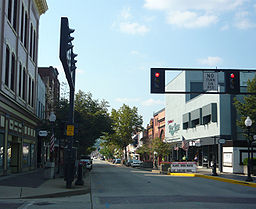 McKean Avenue
Named for: Charleroi, Belgium Country United States State Pennsylvania County Washington Coordinates 40°8′17″N 79°54′5″W / 40.13806°N 79.90139°W Area 0.9 sq mi (2 km2) - land 0.8 sq mi (2 km2) - water 0.1 sq mi (0 km2) Population 4,871 (2000) Density 6,308.6 / sq mi (2,436 / km2) Established 1890 - Incorporated 1891 Mayor Frank Paterra Timezone EST (UTC-4) - summer (DST) EDT (UTC-5) Zip code 15022 Area code 724  Location of Charleroi in Washington County
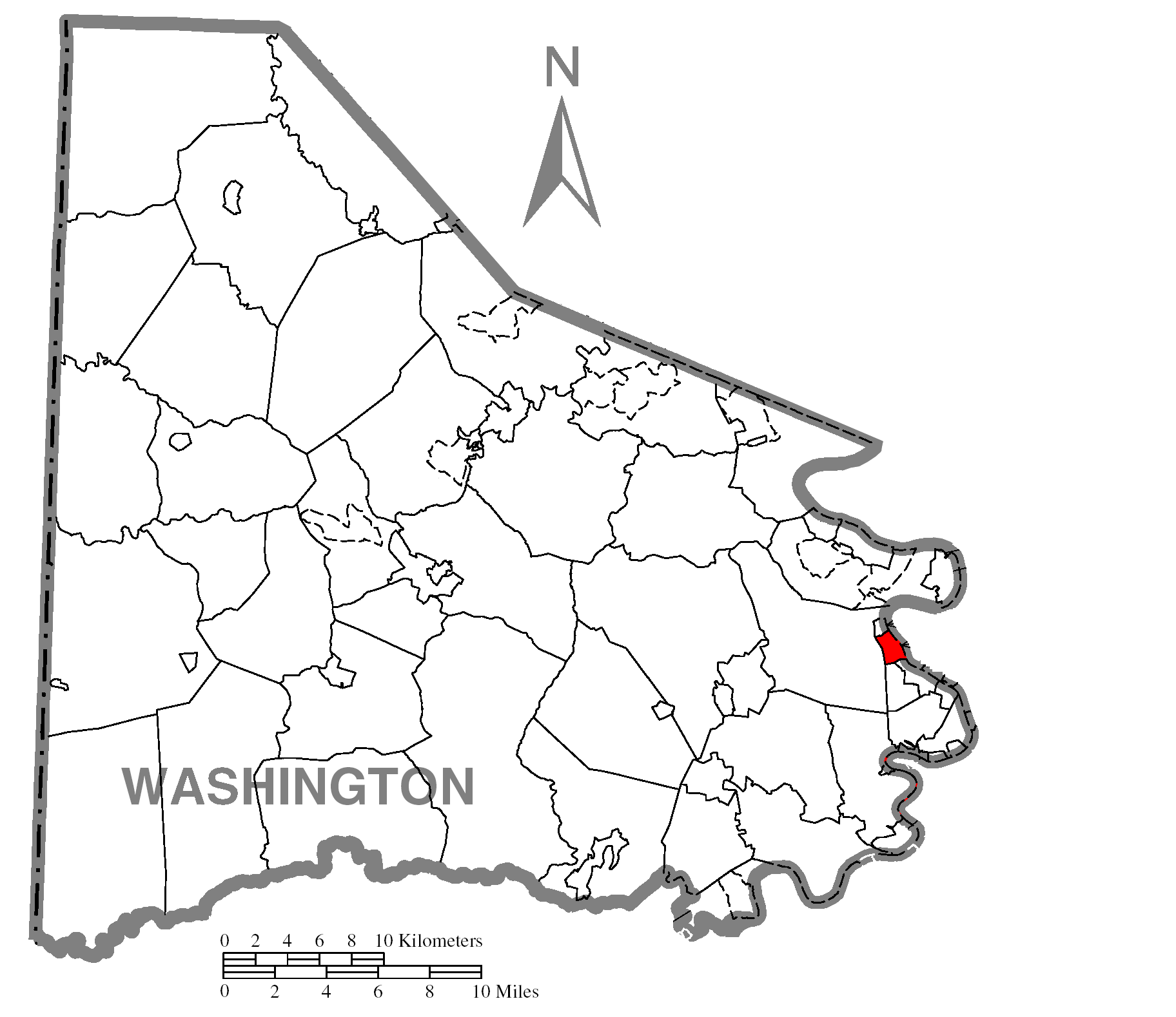
 Location of Charleroi in Pennsylvania
 Location of Pennsylvania in the United States
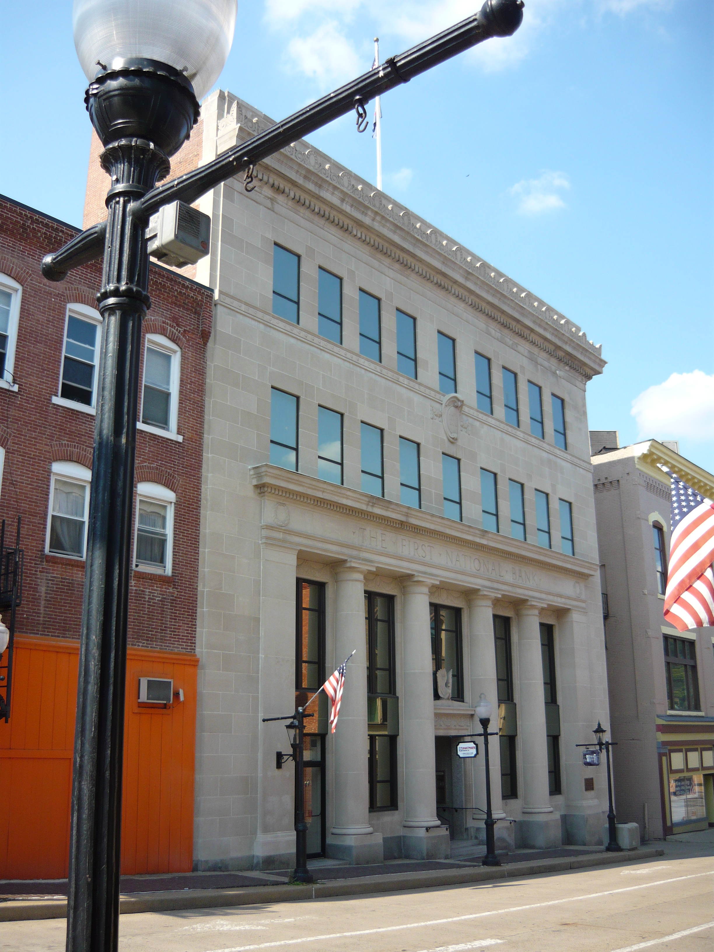
 First National Bank (1922)
National Register of Historic PlacesCharleroi (
 /ˈʃɔːlərɔɪ/ shaw-lə-roy) is a borough in Washington County, Pennsylvania, along the Monongahela River, 25 miles south of Pittsburgh. Charleroi was settled in 1890 and incorporated in 1891. The population in 1900 stood at 5,930; in 1910, 9,615; in 1920, 11,516, and in 1940, 10,784. The population was 4,871 at the 2000 census.
There has been a large-scale cessation of industrial activities in the region. The decrease in the population is associated with the decline of the steel-making industry in the "Mon Valley" which extends from Charleroi to the mouth of the Monongahela at Pittsburgh.
Contents
History
Charleroi is a namesake and Sister city of Charleroi, Belgium. The name is French for "Charles [the] King" (referring to King Charles II of Spain). Charleroi was home to one of the first movie theatres in the nation, the electric theatre which opened in October 1905. The Pittsburgh Plate Glass Company, today PPG Industries, had one of its major factories located at the current chamber plaza, at one point employing up to a thousand employees, making it one of the largest glass factories in the world at the time. For years it was the home to one of Corning Glass Companies leading employers. Today it is home to World Kitchen, which makes pyrex, giving it the distinction of being the only plant in the United States to make it.
Geography
Charleroi is located at 40°8′17″N 79°54′5″W / 40.13806°N 79.90139°W (40.138088, -79.901333)[1].
According to the United States Census Bureau, the borough has a total area of 0.9 square miles (2.3 km2), of which, 0.8 square miles (2.1 km2) of it is land and 0.1 square miles (0.26 km2) of it is water. The total area is 10.47% water.
Demographics
As of the census[2] of 2000, there were 4,871 people, 2,258 households, and 1,208 families residing in the borough. The population density was 6,308.6 people per square mile (2,442.5/km²). There were 2,656 housing units at an average density of 3,439.9 per square mile (1,331.8/km²). The racial makeup of the borough was 95.3% White, 3.2% African American, 0.1% Native American, 0.3% Asian, 0.2% from other races, and 0.8% from two or more races. Hispanic or Latino of any race were 0.7% of the population.
There were 2,258 households out of which 22.3% had children under the age of 18 living with them, 35.5% were married couples living together, 13.7% had a female householder with no husband present, and 46.5% were non-families. 41.8% of all households were made up of individuals and 21.9% had someone living alone who was 65 years of age or older. The average household size was 2.11 and the average family size was 2.88.
In the borough the population was spread out with 20.5% under the age of 18, 7.1% from 18 to 24, 27.1% from 25 to 44, 20.2% from 45 to 64, and 25.0% who were 65 years of age or older. The median age was 41 years. For every 100 females there were 81.4 males. For every 100 females age 18 and over, there were 77.1 males.
The median income for a household in the borough was $23,593, and the median income for a family was $31,699. Males had a median income of $30,093 versus $23,873 for females. The per capita income for the borough was $13,752. About 16.1% of families and 21.3% of the population were below the poverty line, including 36.2% of those under age 18 and 13.7% of those age 65 or over.
Notable people
- Olive Thomas born Oliveretta Elaine Duffy. Ziegfeld Follies Girl and Silent Film Star, the original Flapper girl. (i.e. The Flapper 1920). She was billed as "Everybody's Sweetheart". She was married to Jack Pickford and died of accidental self-induced poisoning by Mercury Bichloride at the age of 25 while on vacation in Paris, the first of many fatal Hollywood scandals of the 1920s.
- Craig McCracken, animator and creator of The Powerpuff Girls and Foster's Home for Imaginary Friends.
- John K. Tener, Major League Baseball player and former Republican governor of Pennsylvania from 1911 to 1915
- Frank Mascara, former Democratic member of the House of Representatives from 1995 to 2003
- Hardie Albright, actor
- Lisa Kirk, actress-singer
- Deborah Jeane Palfrey, a former Charleroi resident, and so-called "DC Madame"
- Mitchell Paige, WWII Medal of Honor recipient
- Shirley Jones, actress The Partrige Family, and The Music Man was born and lived in the nearby town of Smithton, Pennsylvania about 10 miles away
- Myron Pottios, former national football league player, graduated from Charleroi High School
- Barbara Bosson, actress Hill Street Blues; Hooperman; Cop Rock
- Ron Hughes, scout and executive with NFL's Pittsburgh Steelers and Detroit Lions
- Natalie Raitano, actress, most known for her role on syndicated television show V.I.P. with Pamela Anderson.
- Demi Moore, actress, attended local school district.
- Joe Rudolph, NFL player
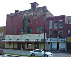 Coyle Theater (1895)
In popular culture
A large part of the plot of the alternate history novel The Two Georges, by Harry Turtledove and Richard Dreyfuss, takes place in Charleroi, Pennsylvania. In the alternate history of this book, North America remains part of the British Empire. Charleroi is described as a large coal-mining town filled with embittered coal miners of mainly Irish descent living under conditions of poverty, exploitation and pollution, who end up supporting radical underground political movements.
References
- ^ "US Gazetteer files: 2010, 2000, and 1990". United States Census Bureau. 2011-02-12. http://www.census.gov/geo/www/gazetteer/gazette.html. Retrieved 2011-04-23.
- ^ "American FactFinder". United States Census Bureau. http://factfinder.census.gov. Retrieved 2008-01-31.
Categories:- Boroughs in Washington County, Pennsylvania
- Populated places established in 1890
- Pittsburgh metropolitan area


Wikimedia Foundation. 2010.