- Charleroi
-
For other uses, see Charleroi (disambiguation).
Charleroi Charles II Square

Flag
Coat of armsLocation in Belgium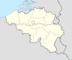
 Charleroi
Coordinates: 50°24′N 04°26′E / 50.4°N 4.433°E Country Belgium Region Wallonia Community French Community Province Hainaut Arrondissement Charleroi Government - Mayor Jean-Jacques Viseur (CDH) - Governing party/ies PS, CDH, MR Area - Total 102.08 km2 (39.4 sq mi) Population (1 January 2010)[1] - Total 202,598 - Density 1,984.7/km2 (5,140.3/sq mi) Demographics - Foreigners 14.01% (7 January 2005) Postal codes 6000, 6001, 6010, 6020,
6030-6032, 6040-6044, 6060, 6061Area codes 071 Website www.charleroi.be Map of Charleroi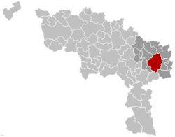
Charleroi (French pronunciation: [ʃaʁləʁwa], "King Charles", Walloon: Tchålerwè) is a city and a municipality of Wallonia, located in the province of Hainaut, Belgium. As of 1 January 2008[update], the total population of Charleroi was 201,593.[2] The metropolitan area, including the outer commuter zone, covers an area of 1,462 square kilometres (564 sq mi) and had a total population of 522,522 as of 1 January 2008, ranking it as the fourth most populous in Belgium.[2][3] The inhabitants are called Carolorégiens or simply Carolos.
Contents
Geography
The municipality of Charleroi straddles both banks of the river Sambre in an area marked by industrial activities (coal mining and steel industry): the so-called Pays Noir ("black country"), part of the larger sillon industriel. Although most of the factories have closed since the 1950s, the landscape remains dotted with spoil tips and old industrial buildings.
Charleroi lies around 50 kilometres (31 mi) south of Brussels.
 Municipality of Charleroi.
The municipality comprises:
- I. the central city of Charleroi
and the following former municipalities, merged into Charleroi in 1977:
- II. Dampremy
- III. Lodelinsart
- IV. Gilly
- V. Montignies-sur-Sambre
- VI. Couillet
- VII. Marcinelle
- VIII. Mont-sur-Marchienne
- IX. Marchienne-au-Pont
- X. Monceau-sur-Sambre
- XI. Goutroux
- XII. Roux
- XIII. Jumet
- XIV. Gosselies
- XV. Ransart
Neighbouring :
- a. Les Bons Villers
- b. Fleurus
- c. Châtelet
- d. Gerpinnes
- e. Ham-sur-Heure-Nalinnes
- f. Montigny-le-Tilleul
- g. Fontaine-l'Évêque
- h. Courcelles
- i. Pont-à-Celles
History
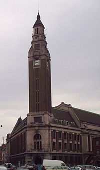 Belfry of Charleroi
Origins
The Charleroi area was already settled in the Prehistoric period, with traces of metallurgical and commercial activities along the Sambre. Several public buildings, temples and villas were built in that area in the Roman period. Burying places, with jewels and weapons, were also found. The first written mention of a place called Charnoy dates from a 9th-century offering in the Lobbes abbey, which lists various neighbouring towns and related tithe duties. During the Middle Ages, Charnoy was just one of the many small hamlets in the area, with no more than about 50 inhabitants, part of the County of Namur.
Foundation
The history of the city of Charleroi starts in 1666. In the spring of that year, Francisco Castel Rodrigo, Governor of the Netherlands at the service of the five-year-old Charles II of Spain, expropriated the area from the local lords to build a fortress near the Sambre. In September of that same year, the name Charnoy was officially replaced by that of the newly founded city of Charles-Roy (King Charles), so named in honour of Charles II. The chronogram FVNDATVR CAROLOREGIVM (MLCDVVVI), can be found in the register of the parish of Charnoy for the year 1666. A year later, Louis XIV’s armies under the command of Turenne besieged the unfinished fortress. Vauban completed the fortification work; the future city was granted its privileges; a bridge was built over the river; and free land was distributed to the inhabitants.
From 1666 to the Belgian Revolution
Shortly after its foundation, the new city was in turn besieged by the Dutch, ceded to the Spanish in 1678 (Treaty of Nijmegen), taken by the French in 1693, ceded again to the Spanish in 1698 (Treaty of Rijswijk), then taken by the French, the Dutch, and the Austrians in 1714 (Treaty of Baden). The French Prince of Conti took the city again in 1745, but it was ceded back to Austria in 1748, starting a period of prosperity under Joseph II. The glass, steel and coal industries, which had already sprung up a century earlier, could now flourish.
Trouble started again in 1790, year of the civil uprising that eventually led to the United States of Belgium. The Austrians occupied the city, were forced out by the French after the Battle of Jemappes on November 6, 1792, but took it back again four months later. On June 12, 1794, the French revolutionary Army of Sambre-et-Meuse under the command of Jean-Baptiste Jourdan, invested Charleroi and won a decisive victory in the ensuing Battle of Fleurus. The city took the revolutionary name of Libre-sur-Sambre until 1800. Napoleon stayed in Charleroi for a couple of days in June 1815, just before the Battle of Waterloo. After his defeat, the whole area was annexed to the Netherlands and new walls were built around the city.
 Orleans street on market day (sunday)
1830 to present
The Belgian Revolution of 1830 gave the area its freedom from the Netherlands and ushered in a new era of prosperity, still based mostly on glass, metallurgy, and coal, hence the area’s name of “Black Country” (in French Pays Noir). After the Industrial Revolution, Charleroi benefited from the increased use of coke in the metallurgical industry. People from all over Europe were attracted by the economic opportunities and the population grew rapidly.
Strikes, riots, exile, rise of the labour radicalism
Charleroi was since the 1850s and 1860s after the Industrial revolution in Wallonia one of the most important places where the strikes broke out. In 1886, twelve strikers were killed by the Belgian army in Roux. In the 1880s, miners in Hainaut were recruited by Dominion Coal Company in Glace Bay, Nova Scotia.[4] These miners were anxious to flee the repression following bloody strikes and riots in Liège and Charleroi[5] during the Walloon Jacquerie of 1886. Walloon miners from Charleroi also emigrated to Alberta.[6] The workingmen in Charleroi had always an important role in the Belgian general strikes and particularly during the Belgian general strike of 1936, the General strike against Leopold III of Belgium and the 1960-1961 Winter General Strike.
World War I and World War II
By 1871, the fortified walls around the city were completely torn down. Heavy fighting took place in World War I because of the city’s strategic location on the Sambre. After World War II, Charleroi witnessed a general decline of its heavy industry. Following the merger with several surrounding municipalities in 1977, the city is today the largest city in Wallonia and the fourth largest in Belgium.
Politics
The Socialist Party (Parti Socialiste or PS) has had a stronghold in Charleroi for some time. However, in October 2006, PS mayor Jacques Van Gompel was jailed on fraud and forgery charges.[7] Léon Casaert, also of the PS, became the new mayor, with a PS, MR, cdH majority. The MR stepped down from the coalition just before the 2007 general election, citing official charges of corruption levelled against a PS alderman in Charleroi.[8] After the 2007 general election, the PS put its local party office under full confinement,[clarification needed] with the city executive resigning.[9] Mayor Casaert was charged with fraud on June 18, 2007, but will only step down after a new city executive has been formed.[10] In April 2010, the director of technical services of Charleroi, Henri Stassens, was convicted in court of fraud and corruption *[1]
Municipal elections
Party 2000 (%) 2006 (%) Socialist Party (Parti Socialiste) 51.4 38.4 Reformist Movement (Mouvement Réformateur) 16.1 24.6 Humanist Democratic Centre (Centre Démocrate Humaniste) 9.6 14.4 National Front (Front National) 6.9 9.5 Ecolo 11.4 8.1 Economy
The municipality contains an industrial area, iron and steel industry, glassworks, chemicals, and electrical engineering. Charleroi is in the center of a coal basin, called Pays noir.[citation needed] Many slag heaps still surround the city. Dupuis is a publisher of Franco-Belgian comics, located in Marcinelle.
Crime
Charleroi was notorious for violent crimes during the 90's.*[2] Marc Dutroux, nicknamed "The Monster from Charleroi" actually lived in Marcinelle a municipality within the Charleroi borders.*[3]
Landmarks
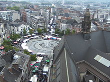 View of the Charles II square from the belfry on market day.
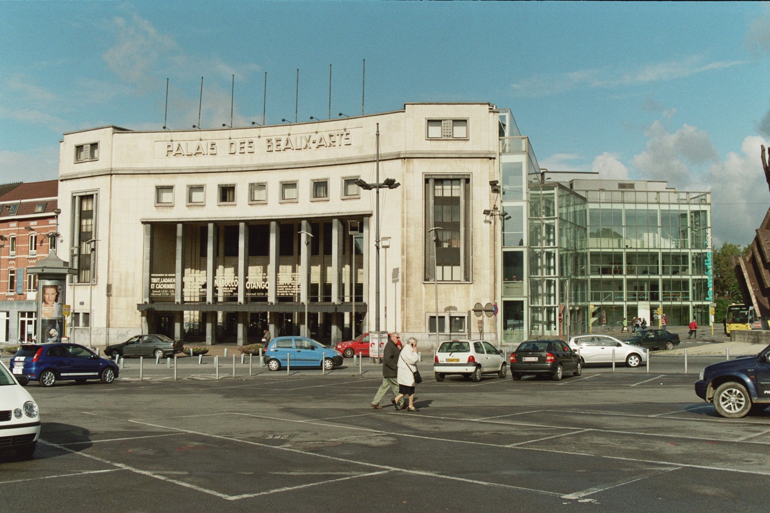
 Palais des Beaux-Arts
- The belfry is included in the list of World Heritage Sites.
- The Maison Dorée was built in 1899 by the Art Nouveau architect Alfred Frère. The name of this masterpiece comes from the golden sgraffiti that adorn the façade.
- The city is also the home of several museums (fine arts, glass, photography, ...)
Sports
Charleroi has many Belgian champion teams in various sports. Spirou Charleroi in basketball has been 8 times winner of the Basketball League Belgium. La Villette Charleroi in table tennis is the most successful club in the Champions League ever with 5 titles and has been Belgian champion multiple times. Action 21 Charleroi in futsal has won 1 UEFA Futsal Cup and 9 Belgian Division 1 titles. In football, R Charleroi SC and ROC Charleroi have finished once second in the Belgian First Division.
Transport
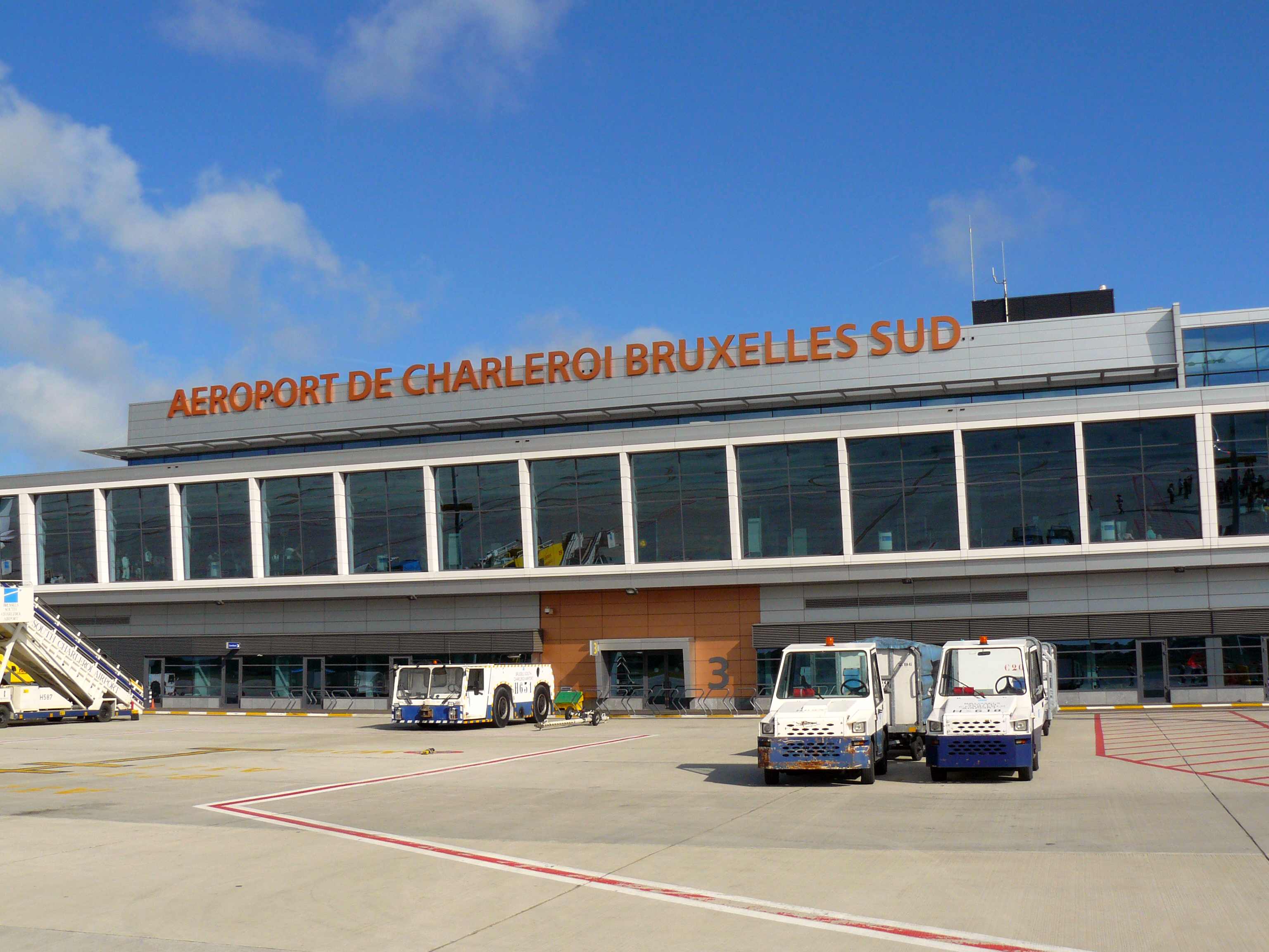
 Charleroi Airport
Air
The Brussels South Charleroi Airport in Gosselies, 7 km north of the centre, opened in 1919 as a flight school.[11] Later, it housed a factory building Fairey aircraft under licence.[12]
Gosselies is now used as an alternate airport for Brussels. Low-cost carrier Ryanair is the largest airline, along with flights by Wizz Air, Jet4you and (in the summer only) On Air. Seasonal holiday charters also use the airport.
A new terminal opened in January 2008,[13] replacing a much smaller building which had exceeded capacity.
Brussels is 47 kilometres (29 mi) north of Charleroi Airport.
Rail
Charleroi is connected by train to other Belgian major cities through the main Charleroi-South railway station. The city also has a secondary railway station, Charleroi-West, on the Charleroi to Ottignies line.
Public transport
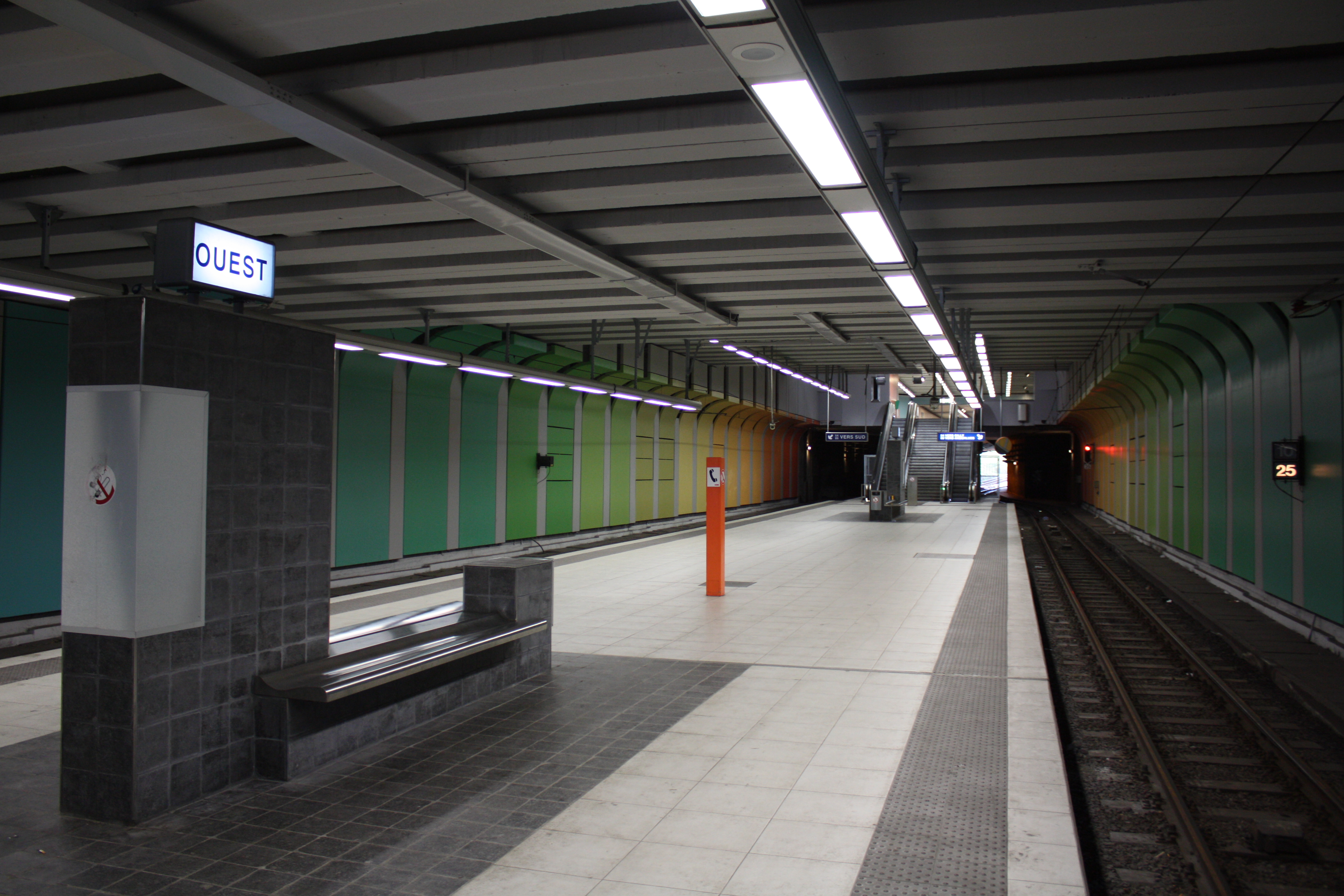
Public transport is run by TEC (Transport En Commun), the Walloon public transport company. The greater Charleroi region is served by bus lines and a light rail Metro system (Métro Léger de Charleroi). Part of the latter is famous for incorporating one of the few remnants of the Vicinal, the former Belgian national tramway network.
Métro léger de Charleroi (MLC)
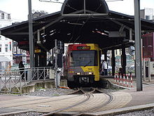 Charleroi Pré-Métro
 West Station (MLC)
The TEC Light Rail Métro is equally famous for the parts of it which were never built, partially built, or fully completed but not opened. It was planned in the 1960s as a 48 kilometres (30 mi) light rail network, operating on heavy rail metro infrastructure, consisting of eight branch lines radiating from a central loop downtown.[14] However only one line (to Petria), part of another line (to Gilly), and three-quarters of the loop were actually built and opened to traffic, all between 1976 and 1996. Another branch line towards the suburb of Châtelet (Châtelineau) was almost fully built, to the extent of installing power cables, escalators and still-working electric signals in the first three stations,[15] but never opened as passenger numbers would be too low to pay for the extra staff. The high costs of construction, together with a decline in Charleroi's traditional "smokestack" industries, and questioning of the scope of the whole project in proportion to the actual demand for it, are all cited as reasons for the original plan going unfulfilled.
Completion of the central loop and the Gilly branch as far as Soleilmont are planned within the next five years, with funding from the European Investment Bank.[16] The Gosselies branch will also open as a street-level tramline. There are no plans to open any part of the Chatelet branch.[17]
People born in Charleroi
- Jean-Marie Andre, scientist
- Pierre Carette, extreme-left terrorist
- Alexandre Czerniatynski, football player
- Jules Delhaize, 19th century Businessman, founder of Delhaize Group
- Jules Destrée, lawyer and politician (born in Marcinelle, 19th century)
- Albert Frère, Businessman and the richest man in Belgium
- Régis Genaux, football player
- Arthur Grumiaux, violinist
- Axel Hervelle, Real Madrid basketball player
- Georges Lemaître, priest and astronomer (20th century)
- Fabrice Lig, music producer (20th century)
- Joseph Maréchal, Jesuit priest, philosopher (20th century)
- Didier Matrige, painter and draughtsman, (20th century)
- Joëlle Milquet, politician (20th century)
- Chantal Mouffe, political theorist (20th century)
- François-Joseph Navez, painter (18th century)
- Paul Pastur, lawyer and politician
- Marcel Thiry, poet (19th century)
- Raymond Troye, wartime writer, (20th century)
- Annette Vande Gorne, composer
- Fernand Verhaegen, painter and etcher (born in Marchienne-au-Pont, 19th century)
- Paul-François Huart-Chapel, 19th century industrialist
Other people who lived in Charleroi
- Paul Cuvelier, painter and comics artist
- Muriel Degauque, suicide bomber in Iraq
- Marc Dutroux, serial killer
- Arthur Rimbaud, poet
- Paul Verlaine, poet
- René Magritte, painter
Twin cities
 Hirson, France
- Saint-Junien, France
 Schramberg, Germany
- Waldkirch, Germany
 Manoppello, Italy
- Casarano, Italy
- Follonica, Italy
 Himeji, Japan
 Donetsk, Ukraine
 Pittsburgh, USA
- Charleroi, Pennsylvania, USA
See also
- Aéropole Science Park
- Dauphines Charleroi
- ICDI affair
- List of municipalities in Wallonia
- Municipalities of Belgium
- R. Charleroi S.C.
- R.O.C. Charleroi
References
- ^ Population per municipality on 1 January 2010 (XLS; 221 KB)
- ^ a b Statistics Belgium; Population de droit par commune au 1 janvier 2008 (excel-file) Population of all municipalities in Belgium, as of 1 January 2008. Retrieved on 2008-10-19.
- ^ Statistics Belgium; De Belgische Stadsgewesten 2001 (pdf-file) Definitions of metropolitan areas in Belgium. The metropolitan area of Charleroi is divided into three levels. First, the central agglomeration (agglomeratie) with 288,549 inhabitants (2008-01-01). Adding the closest surroundings (banlieue) gives a total of 405,236. And, including the outer commuter zone (forensenwoonzone) the population is 522,522. Retrieved on 2008-10-19.
- ^ But a consular report indicated they were dissatisfied with wages and working conditions and they moved to other mining centers. These Walloon miners were experienced in organizing unions and workingmen's associations. They immigrated also in Vancouver Island collieries. See Louis Balthazar,Leen Haenens,International Council for Canadian Studies Images of Canadianness: visions on Canada's politics, culture, economics, University of Ottawa Press, 1998, ISBN 0-7766-0489-9.
- ^ Louis Balthazar, Leen Haenens, International Council for Canadian Studies Images of Canadianness: visions on Canada's politics, culture, economics, University of Ottawa Press, 1998, p. 73
- ^ miners from Wallonia began arriving at the colleries in Alberta to work for West Canadian Collieries, founded in 1903 by a group of French and Belgian entrepreneurs, and for 'Canadian Coal Consolidated', a Paris-based firm. Léon Cabeaux, a well-known union leader who had organized a particularly violent strike in Hainaut in 1886, settled in Lethbridge and soon attracted disgruntled compatriots from the collieries in Pennsylvania. The miners soon became deeply involved in labour radicalism, since in Alberta the mine disasters were among the worst anywhere, and there no provisions for the welfare of families of the miners maimed or killed on the workplace. Frank Soulet, Joseph Lothier and Gustave Henry emerged as dedicated socialist union leaders. in Louis Balthazar,Leen Haenens,International Council for Canadian Studies Images of Canadianness: visions on Canada's politics, culture, economics, University of Ottawa Press, 1998, p.75
- ^ "Discredited Charleroi mayor steps down". http://www.vrtnieuws.net/cm/flandersnews.be/News/1.1265.
- ^ (French) "Le MR quitte la majorité à Charleroi". La Dernière Heure. 2007-05-28. http://www.dhnet.be/infos/belgique/article/173839/le-mr-quitte-la-majorite-a-charleroi.html. Retrieved 2007-06-10.
- ^ (French) "Le collège carolo démissionnera ce mardi". Le Soir. 2007-06-11. http://www.lesoir.be/la_une/le-college-carolo-demissionne-2007-06-11-533907.shtml. Retrieved 2007-06-12.
- ^ (French) "Casaert reste bourgmestre". La Libre. 2007-06-19. http://www.lalibre.be/article.phtml?id=10&subid=90&art_id=355092. Retrieved 2007-06-19.
- ^ How it all started
- ^ Avions Fairey Gosselies
- ^ Tuesday 29 January 2008: Opening of the new Terminal at Charleroi Brussels South airport User guide
- ^ Urbanrail.net
- ^ Diggelfjoer: Abandoned
- ^ Railway Gazette: EIB loan for Charleroi light metro
- ^ UrbanRail.Net > Europe > Belgium > Charleroi Prémétro (Belgium)
External links
- Official web site
- Unofficial history of tramways in Charleroi (in French)
- Urban adventurers explore and photograph an unused Métro line
- "Welcome to Charleroi: Tourism trebles in the world's ugliest town" Scotsman newspaper, 7 April 2009
Ath 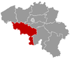
Charleroi Aiseau-Presles · Chapelle-lez-Herlaimont · Charleroi · Châtelet · Courcelles · Farciennes · Fleurus · Fontaine-l'Évêque · Gerpinnes · Les Bons Villers · Manage · Montigny-le-Tilleul · Pont-à-Celles · SeneffeMons Mouscron Soignies Thuin Anderlues · Beaumont · Binche · Chimay · Erquelinnes · Estinnes · Froidchapelle · Ham-sur-Heure-Nalinnes · Lobbes · Merbes-le-Château · Momignies · Morlanwelz · Sivry-Rance · ThuinTournai Antoing · Brunehaut · Celles · Estaimpuis · Leuze-en-Hainaut · Mont-de-l'Enclus · Pecq · Péruwelz · Rumes · TournaiCategories:- Charleroi
- Populated places in Hainaut
- Municipalities of Hainaut
- World Heritage Sites in Belgium


Wikimedia Foundation. 2010.