- Pennsylvania Route 68
-
PA Route 68
Route information Maintained by PennDOT Length: 90.3 mi[1] (145 km) Existed: 1927 – present Major junctions West end:  SR 39 near Glasgow
East end:  US 322 in Clarion
Location Counties: Beaver, Butler, Armstrong, Clarion Highway system Roads in Pennsylvania
Interstate • US • State • Legislative←  PA 67
PA 67PA 69  →
→←  PA 965
PA 967  →
→Pennsylvania Route 68 is a 90.3-mile (145.3 km) long east–west state highway located in western Pennsylvania in the United States. The western terminus of the route is at the Ohio state line west of Glasgow, where PA 68 continues into Ohio as State Route 39. The eastern terminus is at U.S. Route 322 in Clarion.
Contents
Route description
Beaver County
PA 68 begins at the Ohio border in Ohioville, Beaver County, where the road continues west into that state as SR 39. From the state line, the route heads east-northeast on two-lane undivided Midland Road, passing between wooded areas to the north and a Norfolk Southern railroad line to the south with industrial areas and the Ohio River farther south. The road crosses the Little Beaver Creek into Glasgow and passes north of residential areas. PA 68 heads back into Ohioville and runs east through forested areas immediately to the north of the railroad tracks and the Ohio River. The road curves east-southeast and enters Midland, becoming Midland Avenue and passing homes. The route comes to an intersection with PA 168, where that route turns southeast to form a concurrency with PA 68, running through residential areas before heading through the commercial downtown of Midland. The road heads into industrial areas and becomes Midland Beaver Road, with PA 168 splitting to the south at an interchange to cross the Ohio River on the Shippingport Bridge. Past this, PA 68 continues northeast through more forests with the Norfolk Southern line and the river to the southeast. The road heads into residential areas with some industry, heading farther from the railroad line and the Ohio River. The route curves east past more homes, crossing over the Norfolk Southern line as it continues into more wooded areas. PA 68 turns northeast and runs between the railroad tracks to the northwest and the Ohio River to the southeast, crossing into Vanport Township and entering industrial areas as State Street. The road passes over the railroad tracks and runs past more commercial establishments before widening into a four-lane divided highway and coming to an interchange with I-376. After this interchange, the route becomes a two-lane undivided road again and continues through residential areas with some businesses. PA 68 becomes the border between Vanport Township to the north and Beaver to the south, where the name becomes 3rd Street. The road fully enters Beaver and runs through the commercial downtown. The route heads past homes before passing under a CSX railroad line and crossing into Bridgewater, where it reaches an interchange with PA 51. At this point, PA 68 heads east to form a concurrency with PA 51 on a four-lane divided highway, crossing the Beaver River into Rochester.[1][2]
Here, the road passes over a Norfolk Southern railroad line and comes to an interchange with PA 18/PA 65, at which point PA 51 heads east along with PA 65 and PA 18 splits from PA 65 to head south and cross the Ohio River on the Rochester–Monaca Bridge. Here, PA 68 splits into a one-way pair, with the eastbound direction following a ramp to Pleasant Street before heading north on Rhode Island Avenue and westbound PA 68 following Adams Street. Both directions of the route rejoin on two-lane undivided Adams Street and the route heads through residential areas with some businesses. PA 68 turns northwest onto Virginia Avenue and passes more homes, becoming the border between Rochester to the west and Rochester Township to the east. The road fully enters Rochester Township and passes through North Rochester before turning northeast and becoming Sunflower Road. The route curves east and enters Daugherty Township, winding northeast through more rural areas of homes. PA 68 runs through more rural residential areas with some fields and woods, turning east before heading southeast into New Sewickley Township. The road reaches the community of Sunflower, turning northeast to run through more wooded areas with some farms and homes. The route passes through Unionville before passing under I-76 (Pennsylvania Turnpike) and intersecting the northern terminus of PA 989. PA 68 winds northeast through more farmland and woodland with some residences, crossing into Marion Township.[1][2]
Butler County
PA 68 enters Zelienople in Butler County and becomes West Beaver Street, heading into residential areas. The road curves east and reaches an intersection with US 19, where PA 68 turns north to join that route on South Main Street, passing through the commercial downtown. The road intersects the eastern terminus of PA 288, where it becomes North Main Street, before PA 68 splits from US 19 by heading east on East Grandview Avenue. The route runs past homes, crossing into Harmony and becoming Evans City Road. PA 68 heads through residential and commercial areas a short distance to the south of Connoquenessing Creek a Buffalo and Pittsburgh Railroad line, crossing into Jackson Township and becoming a four-lane divided highway as it comes to an interchange with access to and from the southbound direction of I-79. The road becomes two lanes and undivided again as it continues southeast into wooded areas with some development, passing through Eldenau and Harmony Junction. The route continues to the southwest of the railroad tracks and Breakneck Creek, reaching an intersection with PA 528. [1][3]
Here, PA 528 turns southeast to form a concurrency with PA 68. The road passes through woods before heading into Evans City, where it becomes West Main Street and runs past homes and businesses. The two routes curve to the east and cross the Buffalo and Pittsburgh Railroad line and the Breakneck Creek into the commercial downtown of Evans City, becoming East Main Street. PA 528 splits from PA 68 by turning north onto Franklin Street and PA 68 passes more residences, turning to the northeast. The road enters Forward Township and becomes Evans City Road again, running through farmland and woodland with some residential and commercial buildings. The route passes over Connoquenessing Creek and a Buffalo and Pittsburgh Railroad line, heading through woodland and turning north. PA 68 heads into farmland with some woods and residences, crossing into Connoquenessing, where it passes to the east of the residential center of town. The road heads into Connoquenessing Township and curves northeast, running through more agricultural and wooded areas with a few homes. The route passes through increasing areas of residential and commercial development, heading north of Butler Farm Show Airport before continuing into Butler Township. Here, PA 68 curves east and heads past more areas of housing, coming to an intersection with PA 356.[1][3]
Here, PA 68 heads southeast along with PA 356 on New Castle Road, a three-lane road with a center left-turn lane that runs through wooded areas and commercial development. The road enters Butler and becomes New Castle Street, running through residential areas with some businesses. PA 68/PA 356 heads east onto West Cunningham Street before splitting into a one-way pair, with eastbound PA 68/southbound PA 356 following West Cunningham Street and westbound PA 68/northbound PA 356 following West Jefferson Street. The two routes head into the commercial downtown of Butler, coming to an intersection with PA 8 at which point PA 356 splits from PA 68 by heading south along that route. The one-way pair carrying PA 68 becomes East Cunningham Street eastbound and East Jefferson Street westbound, with eastbound PA 68 turning north onto South McKean Street to rejoin westbound PA 68 on two-way East Jefferson Street. The road heads east through commercial areas with some homes, turning northeast into residential areas as it becomes the border between Butler to the northwest and Butler Township to the southeast. The route fully enters Butler Township again as it passes near Butler Memorial Hospital before coming to a bridge that carries the route over two Bessemer and Lake Erie Railroad lines and Connoquenessing Creek, crossing into Summit Township. PA 68 comes to an interchange with the US 422 freeway, where it also intersects the southern terminus of PA 38; here, the road is a four-lane divided highway.[1][3]
Past this, the road becomes two lanes and undivided, with the name becoming Chicora Road as it enters wooded areas with some homes. The route heads into a mix of farms and woods with some residences as it crosses into Oakland Township. PA 68 winds northeast through more wooded areas with some homes, passing through Woodbine. The road runs through more farmland and woodland with scattered residences, heading through North Oakland. The route crosses into Donegal Township and turns north, at which point it begins to run to the west of a Buffalo and Pittsburgh Railroad line. PA 68 curves northeast and east, heading into Chicora and crossing under the railroad tracks. The road curves northeast and becomes South Main Street, passing homes before becoming North Main Street in the center of town, where it passes a few businesses. After running past more residences, the route curves northeast and crosses into Fairview Township, becoming Chicora Road again and winding through agricultural and wooded areas with some homes. The road turns east and crosses PA 268 in Kepples Corners.[1][3]
Armstrong and Clarion counties
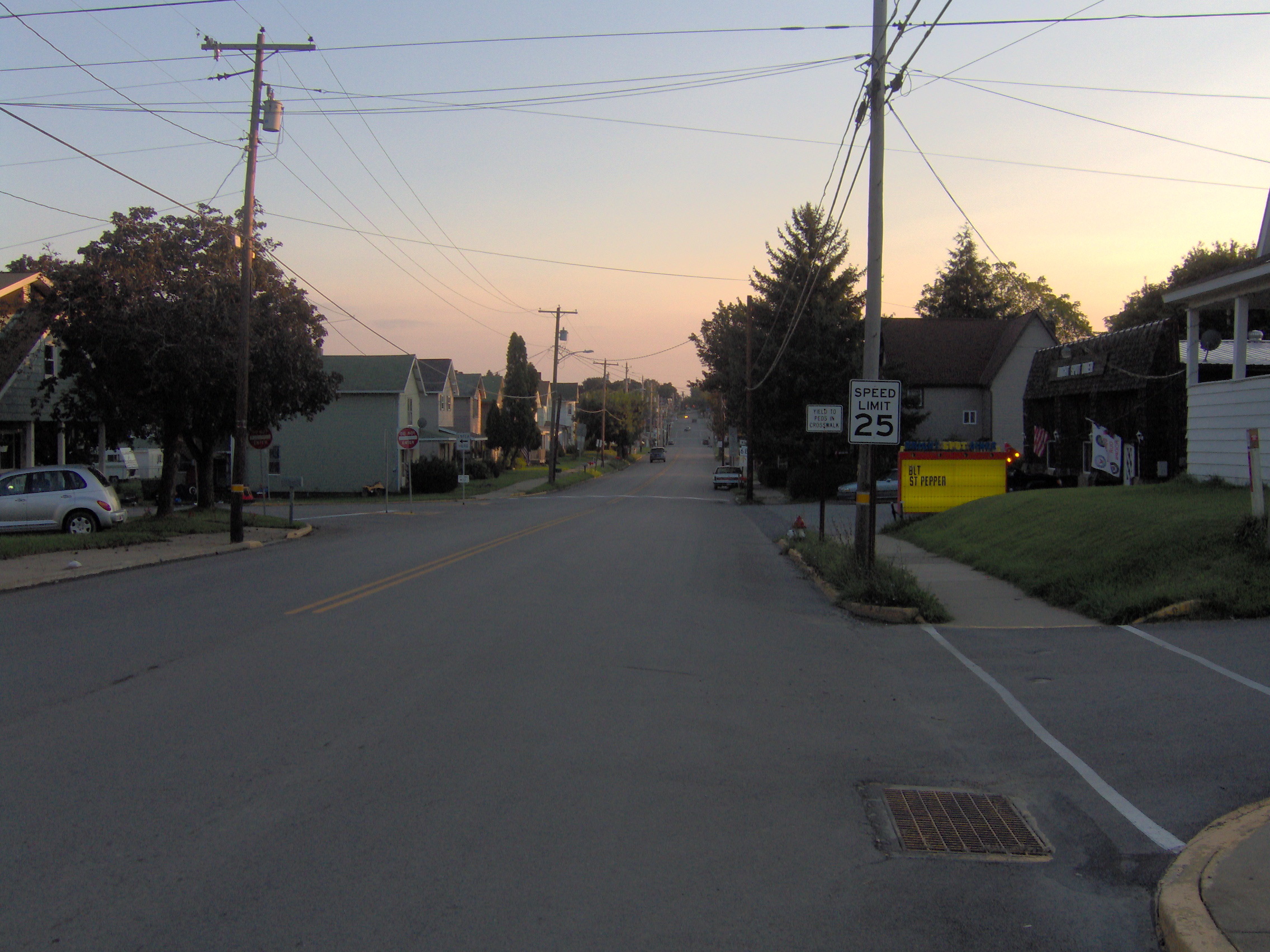
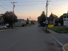 PA 68 in Rimersburg
PA 68 heads into Bradys Bend Township in Armstrong County and becomes an unnamed road, heading through forested areas with some homes, passing through Kaylor. The road turns east before a curve to the north, coming to the residential community of Brady's Bend. Past this, the route turns southeast through more forests.[1][4]
PA 68 crosses the Allegheny River into East Brady, Clarion County, becoming Bridge Street. The route turns southwest onto Kellys Way and passes homes with some businesses. PA 68 turns southeast onto 3rd Street and runs through residential areas before curving east as Simpson Road and heading through wooded areas. The road enters Brady Township and runs northeast through more woodland with some fields and homes. The route continues into Madison Township and runs through more rural areas, passing through New Athens and Maple Grove. PA 68 heads into Rimersburg and becomes Main Street, passing homes. The road intersects the western terminus of PA 861, where it becomes the border between Rimersburg to the west and Toby Township to the east before fully entering Toby Township and passing through Rimersburg Station.[1][5]
The route becomes unnamed as it passes through wooded areas with some farm fields and homes, heading to the north. PA 68 briefly heads through Piney Township before entering Sligo and passing homes on Colerain Street. The route intersects the eastern terminus of PA 58 and turns east onto Front Street, running past more residences. The road heads back into Piney Township and becomes unnamed, continuing through agricultural areas with some woods and homes, turning northeast into Monroe Township. The route runs through more farmland and woodland with some residences, turning north and heading through Reidsburg, where it crosses an abandoned railroad line and Piney Creek. PA 68 runs north through more rural areas before passing through Williamsburg and becoming a four-lane divided highway as it reaches an interchange with I-80/PA 66. Past this, the road heads through business areas before becoming undivided and heading into wooded areas with some homes in Clarion Township as South 5th Avenue. PA 68 enters Clarion and runs north-northeast past more residences before ending at US 322 in the commercial downtown.[1][5]
Major intersections
County Location Mile Destinations Notes Beaver Glasgow 0.0 SR 39 west (Harvey Avenue)Ohio state line, western terminus Midland 3.0  PA 168 north (Spring Lane Road)
West end of PA 168 overlap Industry 4.9 PA 168 south (Shippingport Bridge)East end of PA 168 overlap Vanport Township 11.5-11.7  I-376 (Beaver Valley Expressway)
I-376 exit 38 Beaver 14.0  PA 51 north
West end of PA 51 overlap Rochester 14.3 
 PA 18 north / PA 51 south / PA 65 (65th Infantry Division Memorial Highway)
Interchange, east end of PA 51 overlap 14.6 PA 18 south (Rochester–Monaca Bridge)New Sewickley Township 22.2  PA 989 south (Glen Eden Road)
Butler Zelienople 27.1  US 19 south (South Main Street)
West end of US 19 overlap 27.3  PA 288 west (West New Castle Street)
27.4 US 19 north (North Main Street)East end of US 19 overlap Jackson Township 28.4  I-79
I-79I-79 exit 87 31.6  PA 528 south (Lindsey Road)
West end of PA 528 overlap Evans City 32.5 PA 528 north (Franklin Street)East end of PA 528 overlap Butler Township 43.3 
 PA 356 north (New Castle Road) to US 422
West end of PA 356 overlap Butler 45.0  PA 8 / PA 356 south (Main Street) to US 422
East end of PA 356 overlap Butler Township 46.6 US 422 east (Benjamin Franklin Highway)Interchange 46.8  PA 38 north (Oneida Valley Road) to US 422 west
Fairview Township 59.1  PA 268 (Kittanning Pike)
Clarion Rimersburg 74.7  PA 861 east
Sligo 79.4  PA 58 west (Front Street)
Monroe Township 88.1-88.2 
 I-80 / PA 66
I-80/PA 66 exit 62 Clarion 90.3 US 322 (Main Street)Eastern terminus Related routes
- Pennsylvania Route 168
- Pennsylvania Route 268
- Pennsylvania Route 368
- Pennsylvania Route 468 (former)
- Pennsylvania Route 968 (former)
References
- ^ a b c d e f g h i j Google, Inc. Google Maps – overview of Pennsylvania Route 68 (Map). Cartography by Google, Inc. http://maps.google.com/maps?saddr=OH+39+and+PA+68&daddr=40.69868,-80.29393+to:40.7275187,-80.2706216+to:40.7899671,-80.0937936+to:40.8947325,-79.8488612+to:US+322+and+PA+68&hl=en&sll=41.191056,-79.376392&sspn=0.062651,0.169086&geocode=FR4obAIdx2Az-ylR3tkHcxQ0iDF5A0LhUo6PCw%3BFTgDbQId1s82-yll-PQn6W80iDEfTzXHpPm62Q%3BFd5zbQId4yo3-ynTaiaBoXo0iDFx99paZo-ccQ%3BFc9nbgIdn905-yk30zYdpIA0iDFQqu0GSfDhkw%3BFQwBcAIdY5o9-ymJKEaS6mMziDFAepwzFoh9CA%3BFSDjdAIdhKtE-ykzhAsDNDMziDEiTIDy2aTvgQ&vpsrc=0&mra=ls&via=1,2,3,4&t=h&z=9. Retrieved October 4, 2011.
- ^ a b PennDOT (2011). Beaver County, Pennsylvania Highway Map (Map). ftp://ftp.dot.state.pa.us/public/pdf/BPR_pdf_files/Maps/GHS/Roadnames/beaver_GHSN.PDF. Retrieved May 14, 2011.
- ^ a b c d PennDOT (2011). Butler County, Pennsylvania Highway Map (Map). ftp://ftp.dot.state.pa.us/public/pdf/BPR_pdf_files/Maps/GHS/Roadnames/butler_GHSN.PDF. Retrieved March 3, 2011.
- ^ PennDOT (2011). Armstrong County, Pennsylvania Highway Map (Map). ftp://ftp.dot.state.pa.us/public/pdf/BPR_pdf_files/Maps/GHS/Roadnames/armstrong_GHSN.PDF. Retrieved April 30, 2011.
- ^ a b PennDOT (2011). Clarion County, Pennsylvania Highway Map (Map). ftp://ftp.dot.state.pa.us/public/pdf/BPR_pdf_files/Maps/GHS/Roadnames/clarion_GHSN.PDF. Retrieved June 1, 2011.
Categories:- State highways in Pennsylvania
- Transportation in Beaver County, Pennsylvania
- Transportation in Butler County, Pennsylvania
- Transportation in Clarion County, Pennsylvania

Wikimedia Foundation. 2010.