- Cheat Lake, West Virginia
-
Cheat Lake, West Virginia — CDP — Location within the state of West Virginia
 Cheat Lake, West Virginia
Coordinates: 39°40′0″N 79°51′10″W / 39.666667°N 79.85278°WCoordinates: 39°40′0″N 79°51′10″W / 39.666667°N 79.85278°W Country United States State West Virginia County Monongalia Area[1] – Total 15.8 sq mi (41.0 km2) – Land 14.3 sq mi (37.1 km2) – Water 1.5 sq mi (3.9 km2) Elevation 997 ft (304 m) Population (2010) – Total 7,988 – Density 505.6/sq mi (194.8/km2) Time zone Eastern (EST) (UTC-5) – Summer (DST) EDT (UTC-4) ZIP codes 26507-26508 Area code(s) 304 FIPS code 54-14775[2] GNIS feature ID 1867648[3] Cheat Lake is a census-designated place (CDP) in Monongalia County, West Virginia, United States. The population was 7,988 at the 2010 census.[4] It is included in the Morgantown, West Virginia Metropolitan Statistical Area.
Geography
Cheat Lake is located at 39°40′0″N 79°51′10″W / 39.666667°N 79.85278°W (39.666538, -79.852683)[1].
According to the United States Census Bureau, the Cheat Lake CDP has a total area of 15.8 square miles (41.0 km²), of which 14.3 square mile (37.1 km²) is land and 1.5 square miles (3.9 km²) (10.3%) is water.
Cheat Lake is typically viewed as an affluent suburb of nearby Morgantown, though in terms of per capita income, it ranks as fourth-highest in West Virginia.
Demographics
As of the census[2] of 2000, there were 6,396 people, 2,511 households, and 1,822 families residing in the community. The population density was 442.9 people per square mile (171.0/km²). There were 2,802 housing units at an average density of 194.0/sq mi (74.9/km²). The racial makeup of the community was 95.61% White, 1.20% African American, 0.09% Native American, 1.88% Asian, 0.08% Pacific Islander, 0.05% from other races, and 1.09% from two or more races. Hispanic or Latino of any race were 0.55% of the population.
There were 2,511 households out of which 35.4% had children under the age of 18 living with them, 63.8% were married couples living together, 6.6% had a female householder with no husband present, and 27.4% were non-families. 23.3% of all households were made up of individuals and 5.9% had someone living alone who was 65 years of age or older. The average household size was 2.55 and the average family size was 3.03.
The age distribution of the community is 25.8% under the age of 18, 7.3% from 18 to 24, 30.1% from 25 to 44, 27.7% from 45 to 64, and 9.1% who were 65 years of age or older. The median age was 38 years. For every 100 females there were 98.0 males. For every 100 females age 18 and over, there were 96.3 males.
The median income for a household in the community was $48,594, and the median income for a family was $58,778. Males had a median income of $48,661 versus $28,920 for females. The per capita income for the community was $30,210. About 4.8% of families and 6.0% of the population were below the poverty line, including 6.7% of those under age 18 and 3.2% of those age 65 or over.
References
- ^ a b "US Gazetteer files: 2010, 2000, and 1990". United States Census Bureau. 2011-02-12. http://www.census.gov/geo/www/gazetteer/gazette.html. Retrieved 2011-04-23.
- ^ a b "American FactFinder". United States Census Bureau. http://factfinder.census.gov. Retrieved 2008-01-31.
- ^ "US Board on Geographic Names". United States Geological Survey. 2007-10-25. http://geonames.usgs.gov. Retrieved 2008-01-31.
- ^ "American FactFinder". United States Census Bureau. http://factfinder2.census.gov. Retrieved 2011-05-14.
Municipalities and communities of Monongalia County, West Virginia Cities 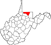
Towns CDPs Brookhaven | Cassville | Cheat Lake | Pentress
Other
localitiesArnettsville | Baker Ridge | Behler | Bertha Hill | Booth | Bowlby | Browns Chapel | Bula | Canyon | Cheat Neck | Chestnut Ridge | Clinton Furnace | Core | Crossroads | Crown | Daybrook | Dellslow | Delmar | Easton | Edna | Everettsville | Fieldcrest | Flaggy Meadow | Fort Grand | Fort Martin | Georgetown | Greer | Greystone | Gum Spring | Hagans | Halleck | Harmony Grove | Hilderbrand | Hoard | Hog Eye | Holman | Hunting Hills | Jaco | Jakes Run | Jere | Kimberly | Klondike | Laurel Point | Little Falls | Lowsville | Macdale | Maidsville | Maple | McCurdyville | McMellin | Miracle Run | Mooresville | Morgan Heights | National | New Hill | Opekiska | Osage | Osgood | Pedlar | Pierpont | Pioneer Rocks | Price | Price Hill | Pursglove | Ragtown | Randall | Richard | Ridgedale | Ringgold | Rock Forge | Rosedale | Sabraton | Saint Cloud | Saint Leo | Sandy | Smithtown | Stewartstown | Suncrest Lake | Sunset Beach | Sturgisson | The Mileground | Triune | Tyrone | Uffington | Van Voorhis | Wadestown | Wana | West Sabraton | West Van Voorhis | Worley
Categories:- Populated places in Monongalia County, West Virginia
- Census-designated places in West Virginia
- Morgantown metropolitan area


Wikimedia Foundation. 2010.