- Morgantown metropolitan area
-
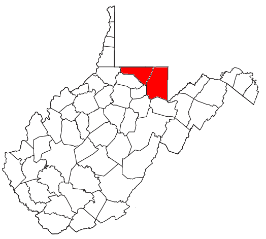
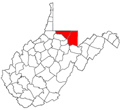 Map of West Virginia highlighting the Morgantown Metropolitan Statistical Area.
The Morgantown Metropolitan Statistical Area, as defined by the United States Census Bureau, is an area consisting of two counties in north-central West Virginia, anchored by the city of Morgantown. As of the 2000 census, the MSA had a population of 111,200 (though a July 1, 2009 estimate placed the population at 120,327).[1]
Contents
Counties
Communities
Incorporated places and CDPs
- Places with more than 20,000 inhabitants
- Morgantown (Principal city)
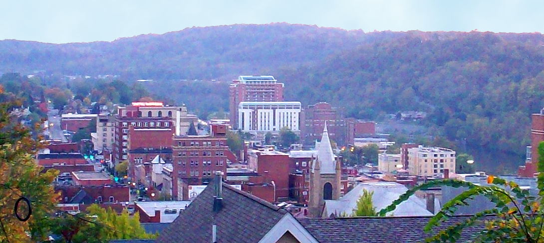
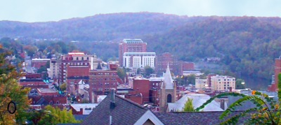 Downtown Morgantown.
- Places with 5,000 to 10,000 inhabitants
- Places with 1,000 to 5,000 inhabitants
- Brookhaven (census-designated place)
- Cassville (census-designated place)
- Kingwood
- Terra Alta
- Star City
- Westover
- Places with 500 to 1,000 inhabitants
- Places with less than 1,000 inhabitants
Unincorporated places
- Afton
- Alpine Lake
- Amboy
- Arnettsville
- Arthurdale
- Aurora
- Austen
- Baker Ridge
- Behler
- Bertha Hill
- Booth
- Borgman
- Bowlby
- Bretz
- Brewer Hill
- Browns Chapel
- Bula
- Canyon
- Cascade
- Cheat Neck
- Chestnut Ridge
- Clifton Mills
- Clinton Furnace
- Core
- Corinth
- Crossroads
- Crown
- Cuzzart
- Daybrook
- Dellslow
- Delmar
- Denver
- Easton
- Edna
- Eglon
- Evansville
- Everettsville
- Fellowsville
- Fieldcrest
- Flaggy Meadow
- Fort Grand
- Fort Martin
- Georgetown
- Gladefarms
- Greer
- Greystone
- Gum Spring
- Hagans
- Halleck
- Harmony Grove
- Hazelton
- Hilderbrand
- Hoard
- Hog Eye
- Holman
- Hopemont
- Hopewell
- Horse Shoe Run
- Howesville
- Hunting Hills
- Independence
- Israel
- Jaco
- Jakes Run
- Jere
- Kimberly
- Klondike
- Laurel Point
- Little Falls
- Little Sandy
- Lowsville
- Macdale
- Maidsville
- Manheim
- Manown
- Maple
- Marquess
- McCurdyville
- McMellin
- Miracle Run
- Mooresville
- Morgan Heights
- Mount Olivet
- Mount Vernon
- National
- New Hill
- Opekiska
- Orr
- Osage
- Osgood
- Pedlar
- Pentress
- Pierpont
- Pioneer Rocks
- Pisgah
- Pleasantdale
- Preston
- Price Hill
- Price
- Pursglove
- Ragtown
- Randall
- Richard
- Ridgedale
- Ringgold
- Rock Forge
- Rockville
- Rodemer
- Rohr
- Rosedale
- Ruthbelle
- Sabraton
- Saint Cloud
- Saint Joe
- Saint Leo
- Sandy
- Scotch Hill
- Sell
- Silver Lake
- Sinclair
- Smithtown
- Snider
- Stevensburg
- Stewartstown
- Sturgisson
- Sugar Valley
- Suncrest Lake
- Sunset Beach
- The Mileground
- Threefork Bridge
- Triune
- Turner Douglass
- Tyrone
- Uffington
- Valley Point
- Van Voorhis
- Victoria
- Wadestown
- Wana
- West End
- West Sabraton
- West Van Voorhis
- White Oak Springs
- Worley
- Zevely
Demographics
As of the census[2] of 2000, there were 111,200 people, 44,990 households, and 26,852 families residing within the MSA. The racial makeup of the MSA was 93.97% White, 2.56% African American, 0.17% Native American, 1.85% Asian, 0.04% Pacific Islander, 0.25% from other races, and 1.16% from two or more races. Hispanic or Latino of any race were 0.89% of the population.
The median income for a household in the MSA was $28,276, and the median income for a family was $38,266. Males had a median income of $29,777 versus $20,867 for females. The per capita income for the MSA was $15,351.
See also
References
- ^ "Table 1. Annual Estimates of the Population of Metropolitan and Micropolitan Statistical Areas: April 1, 2000 to July 1, 2009 (CBSA-EST2009-01)" (CSV). 2009 Population Estimates. United States Census Bureau, Population Division. 2010-03-23. http://www.census.gov/popest/metro/tables/2009/CBSA-EST2009-01.csv. Retrieved 2010-03-25.
- ^ "American FactFinder". United States Census Bureau. http://factfinder.census.gov. Retrieved 2008-01-31.
- Places with more than 20,000 inhabitants
Wikimedia Foundation. 2010.