- Osage, West Virginia
-
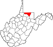
Osage — Unincorporated community — Location within the state of West Virginia Coordinates: 39°39′31″N 80°00′27″W / 39.65861°N 80.0075°WCoordinates: 39°39′31″N 80°00′27″W / 39.65861°N 80.0075°W Country United States State West Virginia County Monongalia Time zone Eastern (EST) (UTC-5) – Summer (DST) EDT (UTC-4) ZIP codes FIPS code GNIS feature ID Osage is an unincorporated community in Monongalia County, West Virginia, United States. It lies across the Monongahela River from Morgantown.
Municipalities and communities of Monongalia County, West Virginia Cities Towns CDPs Other
localitiesArnettsville | Baker Ridge | Behler | Bertha Hill | Booth | Bowlby | Browns Chapel | Bula | Canyon | Cheat Neck | Chestnut Ridge | Clinton Furnace | Core | Crossroads | Crown | Daybrook | Dellslow | Delmar | Easton | Edna | Everettsville | Fieldcrest | Flaggy Meadow | Fort Grand | Fort Martin | Georgetown | Greer | Greystone | Gum Spring | Hagans | Halleck | Harmony Grove | Hilderbrand | Hoard | Hog Eye | Holman | Hunting Hills | Jaco | Jakes Run | Jere | Kimberly | Klondike | Laurel Point | Little Falls | Lowsville | Macdale | Maidsville | Maple | McCurdyville | McMellin | Miracle Run | Mooresville | Morgan Heights | National | New Hill | Opekiska | Osage | Osgood | Pedlar | Pierpont | Pioneer Rocks | Price | Price Hill | Pursglove | Ragtown | Randall | Richard | Ridgedale | Ringgold | Rock Forge | Rosedale | Sabraton | Saint Cloud | Saint Leo | Sandy | Smithtown | Stewartstown | Suncrest Lake | Sunset Beach | Sturgisson | The Mileground | Triune | Tyrone | Uffington | Van Voorhis | Wadestown | Wana | West Sabraton | West Van Voorhis | Worley
Categories:- Mountaineer Country geography stubs
- Morgantown metropolitan area
- Populated places in Monongalia County, West Virginia
- Unincorporated communities in West Virginia
Wikimedia Foundation. 2010.


