- Interstate 95 in Pennsylvania
-
This article is about the section of highway in Pennsylvania. For the entire length of highway, see Interstate 95.
Interstate 95
Delaware Expressway 
Route information Maintained by PennDOT Length: 51.08 mi[1] (82.21 km) Major junctions South end:  I-95 at Delaware state line
 US 322 in Chester
 I-476 in Woodlyn
 I-76 (Schuylkill Expressway) in Philadelphia

 I-676 / US 30 in Philadelphia
 US 1 in Woodbourne
North end: I-95 on Scudder Falls Bridge at New Jersey state line in Lower Makefield TownshipHighway system Main route of the Interstate Highway System
Main • Auxiliary • BusinessRoads in Pennsylvania
Interstate • US • State • Legislative←  PA 94
PA 94PA 95  →
→Interstate 95 is an Interstate highway running from Miami, Florida north to Houlton, Maine. In the U.S. state of Pennsylvania, the route is known by many as the Delaware Expressway, but is officially named The Vietnam Veterans Memorial Highway.[2] and locally known as "95".[3] It runs 51 miles (82 km) from the Delaware state line near Marcus Hook to the New Jersey state line crossing the Delaware River near Yardley on the Scudder Falls Bridge. It parallels its namesake Delaware River for its entire route through the city of Philadelphia and its suburbs. It is a major route through the city and the metropolitan Delaware Valley, providing access to locally important landmarks such as Philadelphia International Airport, the Philadelphia Sports Complex, PPL Park, Penn's Landing, and Franklin Mills. Of the 15 states that Interstate 95 runs through, Pennsylvania is the only one that does not border the Atlantic Ocean.
Plans for a limited-access route along the Delaware River in the Philadelphia area originated in the 1930s when both a parkway and elevated highway were proposed; neither of these were built. The Delaware Expressway was approved in 1945 as a toll road that was to be part of the Pennsylvania Turnpike system until the project was turned to the Pennsylvania Department of Highways in 1956, with the expressway to be included in the Interstate Highway System as part of I-95. Construction on I-95 began in 1959 and was mostly complete by 1979, with the final portion near the Philadelphia International Airport finished in 1985. The route was originally projected to run through the center of Trenton, New Jersey, but was rerouted to the Scudder Falls Bridge due to limited capacity in Trenton. In March 2008, large cracks were discovered on a bridge support column in Philadelphia, requiring a two-mile section of the route to be closed for two days. Bridges are planned to be rebuilt along the section of I-95 between Center City and Woodhaven Road (Pennsylvania Route 63) and an interchange is planned to be built with the Pennsylvania Turnpike (Interstate 276) where I-95 will be rerouted to follow the Pennsylvania Turnpike to the New Jersey Turnpike and Interstate 195 will be extended along the current portion of I-95 north of the proposed interchange.
Contents
Route description
Interstate 95 enters Delaware County, Pennsylvania, from Delaware near Marcus Hook, just north of its junction with the northern end of Interstate 495. The route interchanges with Chichester Avenue and Pennsylvania Route 452 before meeting U.S. Route 322. I-95 forms a concurrency with US 322 that lasts until that route heads east for the Commodore Barry Bridge. I-95 continues through Chester, interchanging with Kerlin Street and Pennsylvania Route 320/Pennsylvania Route 352 before coming to the southern end of Interstate 476 at the edge of the city. It continues in an eastward direction paralleling Pennsylvania Route 291 through the suburbs of Essington and Tinicum, interchanging with Stewart Avenue and Pennsylvania Route 420. The road enters Philadelphia, where it comes to an interchange with PA 291 that has access to the Philadelphia International Airport. East of the airport, I-95 crosses the Schuylkill River on the double-decker Girard Point Bridge.[4][5]
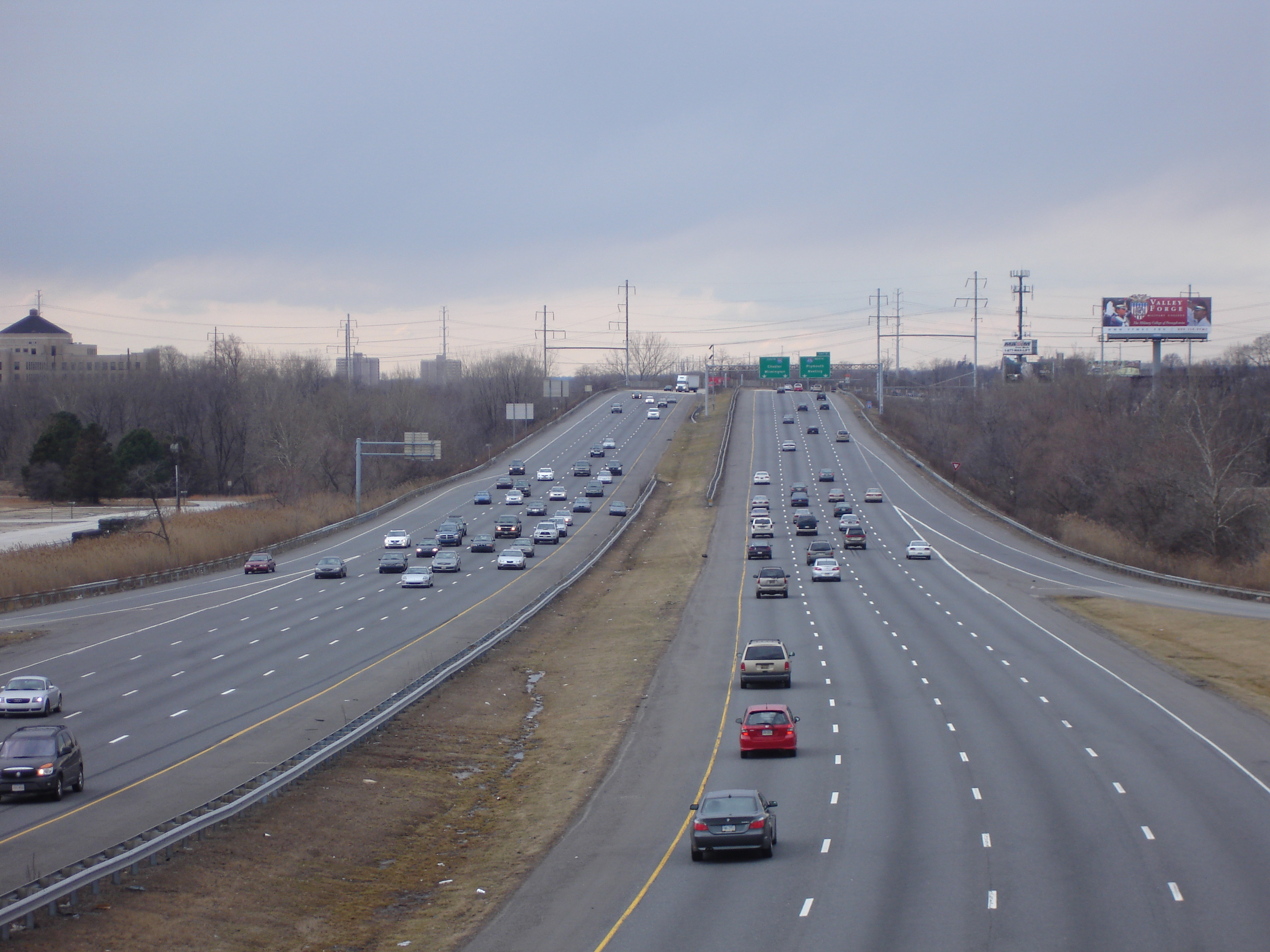
 I-95 southwest of Philadelphia
Past the Schuylkill River, I-95 continues east into South Philadelphia as an elevated freeway, passing south of the Philadelphia Sports Complex and north of the Philadelphia Navy Yard, interchanging with Pennsylvania Route 611 (Broad Street). The road curves north, following the bend in the Delaware River, and runs along the waterfront, interchanging with Interstate 76 west of the Walt Whitman Bridge. The elevated roadway gradually lowers to a depressed level approaching Center City, where it passes through several short tunnels at Penn's Landing, passes under the Ben Franklin Bridge, and interchanges with the Vine Street Expressway (Interstate 676 and U.S. Route 30). North of Center City, the SEPTA Market-Frankford Line rises up from the Market Street subway into I-95's median as the highway returns to an elevated alignment, entering one station (Spring Garden) before diverging once more. I-95 continues through Northeast Philadelphia, interchanging with the Betsy Ross Bridge, Pennsylvania Route 73 at the Tacony-Palmyra Bridge, and the Woodhaven Road expressway (Pennsylvania Route 63) before crossing the county line into Bucks County.[4][5]
North of the city, I-95 interchanges with Pennsylvania Route 132 in Bensalem Township before heading into Bristol Township, where it comes to an interchange with a short expressway stub to Pennsylvania Route 413, a remnant of the unbuilt Interstate 895.[6] It continues north past the future site of the Pennsylvania Turnpike/Interstate 95 Interchange Project, where it currently passes over the Pennsylvania Turnpike (Interstate 276); the two highways were not built to connect with one another. North of I-276, I-95 interchanges with U.S. Route 1 Business/Pennsylvania Route 413 and U.S. Route 1. The route heads into Lower Makefield Township, where it has interchanges with Pennsylvania Route 332 and Taylorsville Road (which provides access to Pennsylvania Route 32) before crossing the Delaware River into New Jersey on the Scudder Falls Bridge.[4][5] This current bridge structure, while structurally sufficient, is functionally obsolete due to high traffic levels and is slated to be improved.[7] An estimated 169,000 motorists utilize the road daily.[8]
History
Plans for a limited-access highway along the Delaware River originated in 1932, as part of a proposed cars-only parkway system for the Philadelphia area similar to the contemporary system being built in New York City. However, planning for the proposed parkway system stalled and the plan was eventually abandoned. In 1937, plans for the highway were revived as the "Delaware Skyway", a planned elevated highway along the waterfront similar in design to the West Side Highway in New York, though these plans were also scrapped due to concerns that the supports would hinder access to port operations on the waterfront.[2][9]
 I-95 southbound through Center City Philadelphia.
In 1945, the city approved the current routing as the Delaware Expressway, envisioned to link all the industrial areas along the river with the Industrial Highway and the Trenton-Morrisville Toll Bridge to New Jersey. The planned highway was incorporated into the Pennsylvania Turnpike system, and was planned to be built as a toll road. However, with the advent of the Interstate Highway System in 1956, the project was turned over to the Pennsylvania Department of Highways and incorporated into Interstate 95. Construction on the road commenced in 1959.[2][9]
Original plans called for the expressway to follow the U.S. Route 13 corridor to the Trenton-Morrisville Toll Bridge, where I-95 would continue north along today's Trenton Freeway. However, due to limited capacity of the highway through Trenton, planners instead opted to build a new alignment bypassing Trenton to the west, incorporating the existing Scudder Falls Bridge.[2][9]
Controversy erupted in the early 1960s over the planned eight-lane elevated segment of the highway along the Center City waterfront; residents of the upscale Society Hill neighborhood objected to the highway on the grounds that it would cut off the neighborhood from the river. State highway officials reached a compromise by opting for an alternative depressed design with an overhead concrete deck connecting Center City to a planned redeveloped waterfront today known as Penn's Landing. By 1979, the entire length of the expressway was open to traffic with the exception of a four-mile (6 km) segment near Philadelphia International Airport.[2][9]
Completion of the final section of the highway faced considerable difficulty, as the road was to be built on a layer of clay separating the city's water supply from the output of its sewage treatment plant. Matters were complicated by a two-year suspension of federal highway funding while the state failed to implement a federally mandated emissions testing program. This final segment was opened to traffic in 1985, marking the completion of the 35-year project.[2][9]
On March 18, 2008, two miles (3 km) of I-95 within Philadelphia were forced to be closed when PennDOT discovered large cracks in a support column underneath the highway. In order to prevent possible collapse, I-95 was closed between Exit 23 (Girard Avenue) and Exit 25 (Allegheny Avenue). PennDOT worked quickly to stiffen the support beams to allow the road to be raised off the column, using 16 jacks, early on March 20. PennDOT reopened the road shortly thereafter, and plans to replace the cracked column.[10]
Future
 I-95, looking south toward the Interstate 476 interchangeFurther information: Pennsylvania Turnpike/Interstate 95 Interchange Project
A project is currently underway to build an interchange between I-95 and the Pennsylvania Turnpike (Interstate 276) where the two highways cross but do not currently interchange with each other.[11] Following the completion of the project, the Pennsylvania Turnpike east of the interchange will be redesignated I-95 to connect with the New Jersey Turnpike portion of the route, while the current I-95 north of the interchange will become part of an extended Interstate 195.[12] The interchange between the Pennsylvania Turnpike and I-95 is to be completed in 2017.[13] In addition, PennDOT is currently rebuilding all of the I-95 bridges in Philadelphia between Cottman Avenue (PA Rt. 73) and the Benjamin Franklin Bridge, in which I-95 will have a total of eight lanes between Central Philadelphia and the Woodhaven Road (PA Rt. 63) exit. The project was planned well in advance of the I-35W Bridge Collapse and will replace bridge spans that were built in the 1960s.[14]
Exit list
County Location Mile[15] Exit Destinations Notes Delaware Boothwyn 1.16 1 Chichester Avenue Linwood 1.72 2  PA 452 (Market Street)
Chester 2.85 3A US 322 west – West ChesterSouth end of US 322 overlap; southbound exit and northbound entrance 3 Highland Avenue 3.62 4 US 322 east (Commodore Barry Bridge) - New JerseyNorth end of US 322 overlap 4.50 5 Kerlin Street Northbound exit and southbound entrance 5.62 6 
 PA 320 (Providence Avenue) / PA 352 (Edgmont Avenue, Avenue of the States)
6.64 7 I-476 north – Plymouth MeetingSouthern terminus of Interstate 476 Ridley Park 7.78 8 Ridley Park To Harrah's Chester Tinicum Township[disambiguation needed  ]
]9  PA 420 – Essington, Prospect Park
Signed as exits 9A (south) and 9B (north) 10.25 12B  PA 291 (Bartram Avenue) – Cargo City
Signed as exit 10 northbound Philadelphia Philadelphia 12.17 12A Philadelphia International Airport Signed as exit 12 northbound 13.14 13 PA 291 north to I-76 west – Valley ForgeNorthbound exit and southbound entrance 13.71 14 Bartram Avenue, Essington Avenue Southbound exit and northbound entrance 14.56 15 Enterprise Avenue, Island Avenue Southbound exit and northbound entrance 16.74 17  PA 611 (Broad Street) / Pattison Avenue
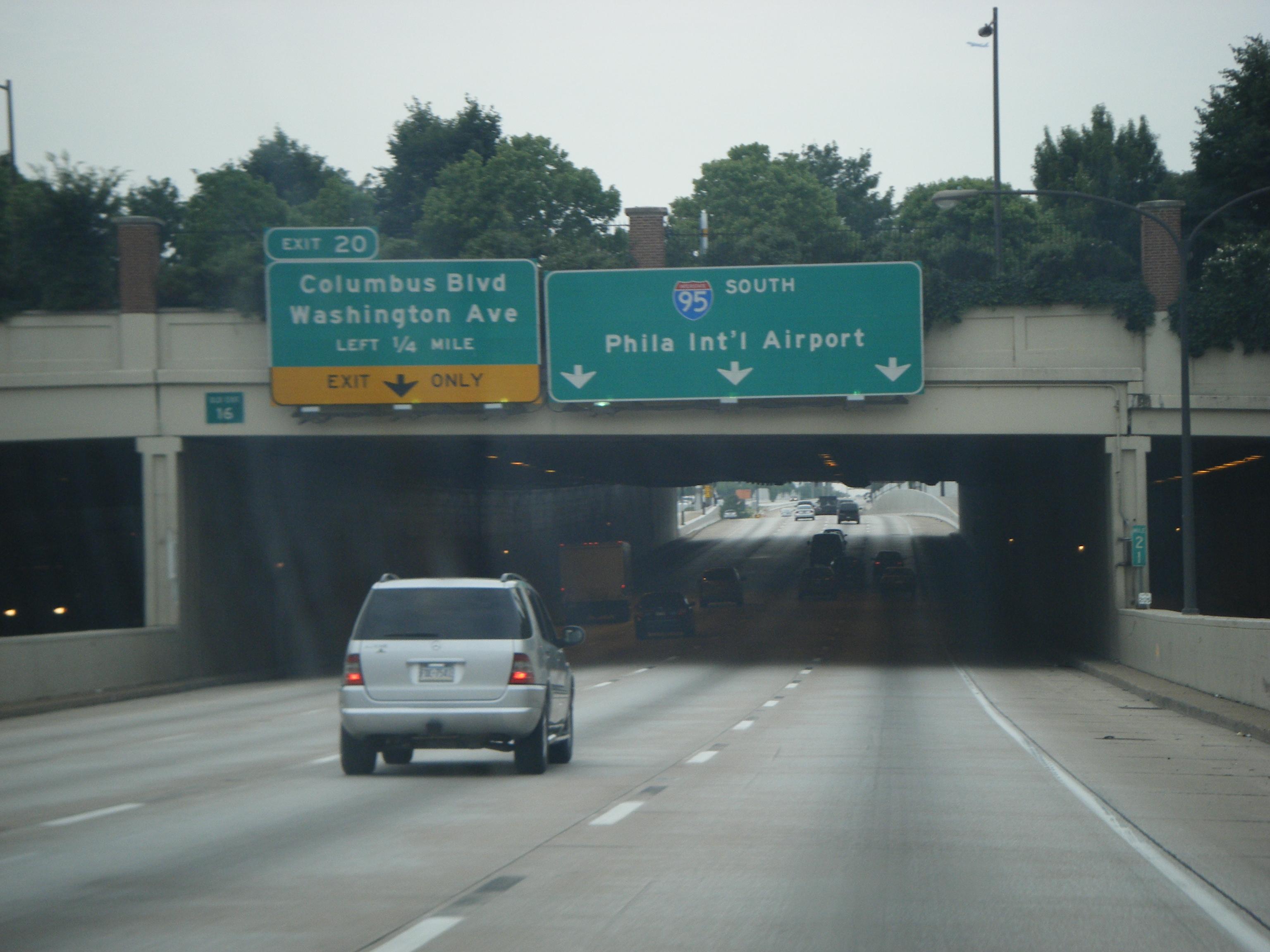
18.51 19 I-76 east (Walt Whitman Bridge) / Packer Avenue20.43 20 Columbus Boulevard, Washington Avenue 21.89 22 I-676 / US 30 / Callowhill Street – Central Philadelphia, Independence Hall, Ben Franklin Bridge23.38 23 Girard Avenue, Lehigh Avenue 24.87 25 Allegheny Avenue, Castor Avenue 26.15 26  Route 90 (Betsy Ross Bridge) / Aramingo Avenue
27.18 27 Bridge Street, Harbison Avenue 29.80 30 To  PA 73 Cottman Avenue, Rhawn Street
32.06 32 Academy Road, Linden Avenue Bucks Andalusia 34.66 35  PA 63 west (Woodhaven Road)
 Cornwells Heights Park & Ride
Southbound exit and northbound entrance Eddington 36.35 37 
 PA 132 west (Street Road) to US 13 (Bristol Pike)
Bristol Township 39.48 40 
 PA 413 (Burlington Bristol Bridge) to I-276 – Bristol
Penndel 43.31 44 

US 1 Bus. / PA 413 – Penndel, LevittownMiddletown Township[disambiguation needed ]46 US 1 – Morrisville, LanghorneSigned as exits 46A (north) and 46B (south) Lower Makefield Township 48.49 49  PA 332 – Newtown, Yardley
50.75 51 New Hope, Yardley Signed as exits 51A (Yardley) and 51B (New Hope) southbound Scudder Falls Bridge over the Delaware River References
- ^ "Route Log - Main Routes of the Eisenhower National System Of Interstate and Defense Highways - Table 1". http://www.fhwa.dot.gov/reports/routefinder/table1.htm. Retrieved 2007-03-26.
- ^ a b c d e f "The Roads of Metro Philadelphia: Delaware Expressway (I-95)". http://www.phillyroads.com/roads/delaware/. Retrieved 2007-03-26.
- ^ ""Accidents, delayed flights and travel headaches across the region," The Philadelphia Inquirer, March 16, 2007". http://www.philly.com/philly/news/20070316_Philadelphia_Weather__Accidents__delayed_flights_and_travel_headaches_across_the_region.html. Retrieved 2007-03-24.[dead link]
- ^ a b c "Pennsylvania Official Tourism and Transportation Map 2006" (PDF). ftp://ftp.dot.state.pa.us/public/pdf/BPR_PDF_FILES/MAPS/Statewide/otm/2006/otm_2006.PDF. Retrieved 2007-03-26.
- ^ a b c Google, Inc. Google Maps – overview of Interstate 95 in Pennsylvania (Map). Cartography by Google, Inc. http://maps.google.com/maps?f=d&source=s_d&saddr=I-95+and+I-495+claymont,+de&daddr=Scudder+Falls+Bridge&geocode=%3BCRRP7OV_BF07FTNMZgIdCuyJ-yElnbFVyq71lQ&hl=en&mra=pe&mrcr=0&sll=40.175726,-74.884186&sspn=0.463786,0.878906&ie=UTF8&ll=40.037078,-75.150604&spn=0.464732,0.878906&t=h&z=10. Retrieved 2009-06-06.
- ^ "The Roads of Metro Philadelphia: Interstate 895 (NJ-PA, unbuilt)". http://www.phillyroads.com/roads/I-895_NJ/. Retrieved 2007-03-26.
- ^ "I-95/Scudder Falls Bridge Improvement Project - Project Background". Delaware River Joint Toll Bridge Commission. http://www.scudderfallsbridge.com/background.htm. Retrieved 2009-06-06.
- ^ "Interstate 95 - Annual Average Daily Traffic @ Interstate-Guide.com". http://www.interstate-guide.com/i-095_aadt.html. Retrieved 2007-03-24.
- ^ a b c d e "Pennsylvania Highways: Interstate 95". http://www.pahighways.com/interstates/I95.html. Retrieved 2007-03-26.
- ^ "Closed Section of I-95 in Pa. Reopens". AP. 20 March 2008. http://ap.google.com/article/ALeqM5hZVC3hXyVXkw7fYNFMJKI5V4BCHQD8VH8B700. Retrieved 2008-03-20.
- ^ "PA Turnpike / I-95 Interchange Project: Selected Alternative". Pennsylvania Turnpike Commission. http://www.paturnpikei95.com/rod.htm. Retrieved 2009-06-06.
- ^ "Design Advisory Committee Meeting #2 Summary". PA Turnpike / I-95 Interchange Project. 2005-09-14. http://www.paturnpikei95.com/pdf/DACMeeting050914.pdf. Retrieved 2006-08-08.
- ^ Frassinelli, Mike (September 7, 2010). "N.J., Pennsylvania officials plan to close longtime gap on Route 95". The Star-Ledger. http://www.nj.com/news/index.ssf/2010/09/nj_pa_officials_plan_to_close.html. Retrieved 2010-09-20.
- ^ "95 Revive - Overview". Pennsylvania Department of Transportation. http://www.95revive.com/reviving-interstate-95-overview.aspx. Retrieved 2009-06-06.
- ^ DeLorme Street Atlas USA 2007
External links
Interstate 95Previous state:
DelawarePennsylvania Next state:
New JerseyInterstate Highways in Pennsylvania Current Unbuilt 695 • 895Former Future Road transportation infrastructure of the metro Philadelphia area Interstates U.S. Routes Pennsylvania Routes New Jersey Routes Delaware Routes Named roads/streets Benjamin Franklin Parkway · Broad Street · City Avenue · Front Street · Girard Avenue · Market Street · Roosevelt Boulevard · South Street · Chestnut Street · Walnut Street
Pennsylvania Turnpike · New Jersey Turnpike · Delaware Turnpike · Atlantic City Expressway · Schuylkill Expressway · Delaware Expressway · Blue Route · Vine St Expressway · North South Freeway · Lancaster Avenue · Bethlehem Pike · Baltimore Pike · Black Horse PikeBridges Delaware Memorial Bridge · Commodore Barry Bridge · Walt Whitman Bridge · Ben Franklin Bridge · Betsy Ross Bridge · Tacony–Palmyra Bridge · Burlington–Bristol Bridge · Delaware River – Turnpike Toll BridgePennsylvania Turnpike Commission Completed highways 
Partially-completed highways Tunnels Aborted expansion plans Chester Extension • Erie Extension • Gettysburg Extension • Keystone Shortway • Northwest & Southwest Extension • Philadelphia Loop Extension • Scranton ExtensionHistorical Tolling systems Categories:- Interstate 95
- Interstate Highways in Pennsylvania
- Transportation in Philadelphia, Pennsylvania
- Transportation in Bucks County, Pennsylvania
- Transportation in Delaware County, Pennsylvania


Wikimedia Foundation. 2010.