- Northeast Philadelphia
-
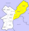
 Map of Philadelphia County with Northeast highlighted. Click for larger image.
Northeast Philadelphia, nicknamed Northeast Philly, the Northeast and the Great Northeast, is a section of the city of Philadelphia, Pennsylvania. According to the 2000 Census, the Northeast has a sizable percentage of the city's 1.547 million people[1] — a population of between 300,000 and 450,000, depending on how the area is defined. Beginning in the 1980s, many of the Northeast's middle class children graduated from college and settled in suburbs, especially nearby Bucks County. Whites were once predominant in northeastern Philadelphia. However, with the emigration of older populations and white flight a new influx of Hispanics have settled in the Northeast, while African Americans and Asian immigrants have purchased homes in northeast Philadelphia. The Northeast is now both racially and ethnically diverse and has a large immigrant population.
Contents
Geography
Due to the size of the Northeast, the Philadelphia City Planning Commission divides it into two regions called "Near Northeast" and "Far Northeast", the names being derived from their distance from Center City. The term "Near Northeast" is not used colloquially ("Lower Northeast" is more commonly used), but the term "Far Northeast" is in widespread use. The demarcation line between the two sections is typically given as Cottman Avenue.[2]
Northeast Philadelphia is bounded by the Delaware River on the east, Bucks County on the north, and Montgomery County on the west. The southern limit is given as Frankford/Tacony Creek or Adams Avenue.[3]
The neighborhoods that make up Northeast Philadelphia include Lawncrest, Rhawnhurst, Tacony, Frankford, Holme Circle, Holmesburg, Upper Holmesburg, Mayfair, Morrell Park, Oxford Circle, Bustleton, Torresdale, Parkwood, Somerton, Fox Chase, Pine Valley, Castor Gardens, Northwood, Burholme, Bell's Corner, Normandy, Summerdale, Modena Park, Pennypack Woods, Winchester Park, and others. It is sometimes said to include the neighborhoods of Bridesburg, Port Richmond, and Fishtown, however, they are located south of the Frankford/Tacony Creek boundary.[3]
History
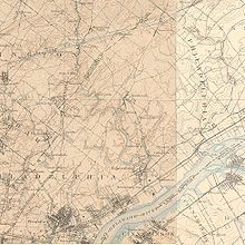 The Northeast in 1900, showing the region still to be a collection of towns and farms. Click for larger image.
Early settlement
The first European settlement in the Northeast was by Swedish farmers, who emigrated there when the area was a part of the New Sweden colony.[4] They were followed by English Quakers, including Thomas Holme, who came to begin the settlement of William Penn's Pennsylvania colony in the late 1680s. In the years to follow, Northeast Philadelphia developed as a scattering of small towns and farms that were a part of the county, but not the city, of Philadelphia. Before consolidation with the city, what is now the Northeast consisted of the townships of Byberry, Delaware, Lower Dublin, Moreland, and Oxford, (largely rural areas); and the boroughs of Bridesburg, Frankford, and White Hall, which were more urbanized.[5]
Growth in industry and farming
While most of the land in what is now the Northeast was dedicated to farming, the presence of many creeks, along with proximity to Philadelphia proper, made the towns of the Northeast suitable for industrial development. The Northeast's first factory was the Rowland Shovel Works on the Pennypack Creek. In 1802, it produced the first shovel made in the United States.[6] More mills and factories followed along the Pennypack and Frankford Creeks, and traces of the mill races and dams remain to this day. The most famous of these factories was the Disston Saw Works in Tacony, founded by English industrialist Henry Disston, whose saw blades were world-renowned.[6][7]
Consolidation and population increase
By 1854, the entire County of Philadelphia was incorporated into the City.[5] In spite of the political incorporation, the Northeast retained its old development patterns for a time, and the dense populations and urban style of housing that marked older, more traditional sections of the city had not yet found their way there.[8] In the first three decades of the 20th century, rapid industrialization led to the growth of industrial sections of the northeast and the neighborhoods surrounding them.[9] These demographic changes, along with the building of the Market-Frankford Line train and new arterial highways, such as the Roosevelt Boulevard, brought new middle class populations to the lower half of the Northeast.[10] Vast tracts of row homes were built in that section of the Northeast for new arrivals in the 1920s and 1930s, typically with small, but valued front lawns, which impart a "garden suburb" quality to much of the Northeast, reducing the sense of physical density felt elsewhere in the city.[11] Much of this development occurred east of Roosevelt Boulevard (Mayfair, Torresdale) and in Oxford Circle.[10]
Post-war growth
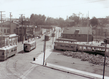 Frankford Terminal in 1918, before the construction of the Frankford El.
After World War II, newer arrivals, armed with the mortgage benefits of the GI Bill, brought the baby boom to the Northeast. This newer population was heavily Jewish or ethnic Catholic[12] (including Irish-, Italian-, Polish-, and German-Americans) and completed the development of the region, filling in undeveloped areas of Rhawnhurst and Bell's Corner and developing the previously rural Far Northeast. As older sections of the city lost populations of young families, the Northeast's school-age population swelled, requiring rapid expansion of schools, libraries, cinemas, shopping, transportation, restaurants and other needed amenities.[13]
The period from 1945 through the 1970s was marked in many American cities by urban decline in older, more industrial areas. This was especially true in Philadelphia, in which much of the city's North, West and South sections lost population, factories, jobs and commerce, especially associated with "white flight." During the postwar period, the Northeast experienced a heavy influx of growing middle class families, and had become an almost exclusively white community. This aroused controversy in the 1960s and '70s, as passions for and against school busing were focused on the Northeast, to address racial imbalances, especially in the city's public schools. That racial imbalance was ultimately addressed by the upward mobility enjoyed by many of the graduates of the Northeast's excellent public and parochial school systems, who made their way out of the Northeast and into the suburbs from the 1980s onward, making room for new arrivals from the city's Latino, African American and Asian populations.[14]
A separate identity
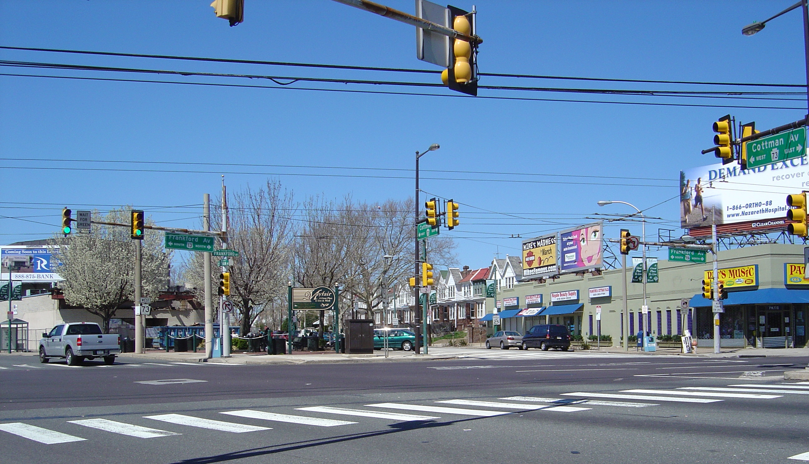
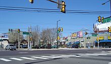 Frankford and Cottman Avenues, a central location in the Northeast
In the 1980s, the Northeast developed along a separate path from much of the rest of the city. In addition to the racial differences mentioned above, the political climate in the Northeast was balanced evenly between Republicans and Democrats, while the rest of the city almost uniformly voted for the latter party.[15] As a result, many Northeasters became more and more discontented with the high city taxes and a perceived imbalance in the services they received for them.[16] This discontent grew to give rise to a secessionist movement, led by State Senator Hank Salvatore, among others. Salvatore introduced a bill in the State Senate to allow the Northeast to become a separate county called Liberty County, but the bill failed to progress beyond this stage.[16] As the Philadelphia economy grew stronger, and the most discontented people fled to the suburbs, and a new, more popular mayor, Ed Rendell, was elected the call for secession waned, and the section settled back into life as a part of the city.
Today, the Northeast enjoys greater racial balance and relative stability. The region is uniformly developed, but like many American urban communities, it has witnessed the loss of manufacturing, factory conversions to marginal retail "outlets," and growing vacancies along shopping avenues, especially in the southern part of the region. During the housing boom of the first decade of the 21st century, favorable property tax advantages granted to new construction within the city limits led to a growth in residential units and an escalation of existing home prices in the Northeast.[17]
Demographics
According to the 2010 census, 400,179 people live in the Northeast section of Philadelphia.[18] (Map)
Racial demographics
- Non-Hispanic White: 216,496 (54.1%)
- Non-Hispanic Black: 68,430 (17.1%)
- Hispanic or Latino: 44,820 (11.2%)
- Asian: 39,217 (9.8%)
- Two or more races: 18,008 (4.5%)
- Other race: 4,802 (1.2%)
- American Indian or Alaska Native: 3,601 (0.9%)
- Native Hawaiian or Other Pacific Islander: 800 (0.2%)[19]
Political representation and government
Unlike the rest of Philadelphia (a solidly Democratic city) there is lively competition between Republicans and Democrats in some parts of the Northeast. For example, Republicans currently hold three of the State Representative seats in the Northeast and one non at-large Philadelphia City Council seat. As of 2011, no Republican represents any part of the Northeast in the United States Congress except for the small portion within the 8th district.[20]
U.S. House of Representatives
Almost all of Northeast Philadelphia is in the 13th Congressional District of Pennsylvania, and is currently represented by Allyson Schwartz.[21] Some small parts of the section fall into the 1st, 2nd, or 8th districts.[22]
Pennsylvania legislature
Senate
In the Pennsylvania State Senate, most of the Northeast is in the 5th district, represented by Michael J. Stack, III, (D).[23] Smaller parts are represented by Shirley Kitchen (D), 3rd district,[24] or Christine Tartaglione (D),[25] 2nd district.[26]
House of Representatives
The Northeast is represented by several members in the House including that of Dennis M. O'Brien (R), former Speaker of the Pennsylvania House of Representatives. Other State Representatives whose districts are in all or part of the Northeast are John Taylor (R), Brendan F. Boyle (D), Kevin J. Boyle (D), Michael McGeehan (D), John Sabatina, Jr. (D), Tony Payton (D), Mark B. Cohen and Dwight E. Evans (D).[27]
Philadelphia City Council
In the Philadelphia City Council, the Far Northeast is represented by the 10th district councilman and City Council Minority (Republican) Leader, Brian J. O'Neill.[28] The Lower Northeast is divided among five other council districts, including the 1st, represented by Frank DiCicco; 5th, Darrell Clarke; 6th, Joan L. Kajewski;[29] 7th, Maria D. Quiñones-Sánchez;[30] and 9th, Marian B. Tasco.[31]
Jack Kelly, an at-large member, is also from the Northeast.[32] The Republican candidate for mayor of Philadelphia in 2007, Al Taubenberger resides in the Northeast and is president of the Greater Northeast Philadelphia Chamber of Commerce.[33]
Public safety
The Philadelphia Police Department patrols four districts within its Northeast Division, including the 7th and 8th districts in the Far Northeast, and the 2nd and 15th in the Near Northeast. The police department's East Division includes the 24th, 25th, and 26th districts which patrol Kensington, Port Richmond, Fishtown, parts of North Philadelphia and other neighborhoods.[34] Neighborhoods in the East Division are sometimes mistakenly considered part of Northeast Philadelphia.
Economy and attractions
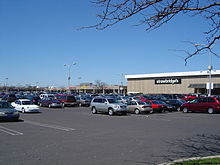 The Roosevelt Mall on Cottman Avenue
Northeast Philadelphia is home to Franklin Mills, a shopping mall that was built on what was once Liberty Bell Park Racetrack, and is one of the most visited attractions in the state.[35] The lower sections of the Northeast still boast pleasant shopping avenues lined by stores and restaurants, such as Castor Avenue. Major shopping centers along Cottman Avenue include, the Cottman-Bustleton Center, and the Roosevelt Mall which opened in 1964 at Cottman Avenue and the Roosevelt Boulevard.[36]
Also present in the Northeast are two nationally recognized medical establishments, Friends Hospital[37] and Fox Chase Cancer Center.[38]
Prior to its disestablishment, Ransome Airlines had its headquarters on the grounds of Northeast Philadelphia Airport.[39]
Education
The first school was founded in the Northeast in 1723 by Silas Crispin, Thomas Holme's son-in-law.[40] The Northeast is home to Fox Chase Farm, an educational facility that is the only working farm left in the Philadelphia city limits.[41]
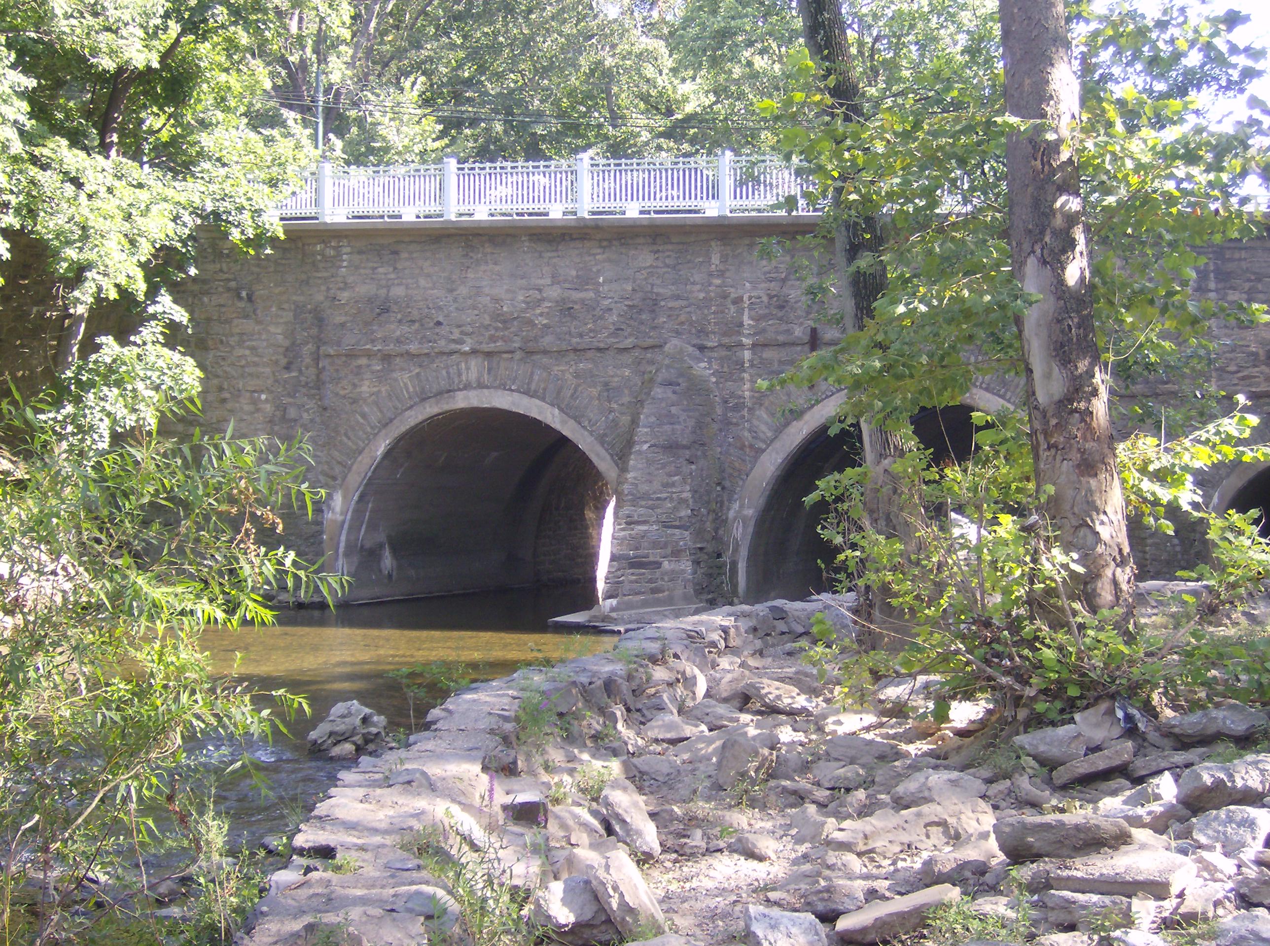
 Frankford Avenue bridge over the Pennypack in Holmesburg
Colleges and universities
The main campus of Holy Family University is located in Northeast Philadelphia. The university, founded in 1954, has more than two thousand students.[42]
Primary and secondary schools
The School District of Philadelphia operates public schools in the area. Public high schools in the area include Northeast, Abraham Lincoln, Samuel S. Fels High School, Frankford, George Washington.[43] and Swensen. Several publicly-funded charter high schools also operate in Northeast Philadelphia, including Philadelphia Academy, MaST, Franklin Towne and Maritime Academy Charter High School. Northeast Philadelphia is also home to a public magnet school, The Arts Academy at Benjamin Rush.
The Roman Catholic Archdiocese of Philadelphia operates Catholic schools. Catholic high schools in Northeast Philadelphia include Archbishop Ryan, Father Judge, Cardinal Dougherty, Northeast Catholic, and St. Hubert Catholic High School for Girls.[44] It was announced in October 2009 that both Cardinal Dougherty and Northeast Catholic would be closed due to decreasing enrollments.[citation needed] Nazareth Academy is an independent Catholic high school founded and operated by the Sisters of the Holy Family of Nazareth.
News media
A free weekly newspaper, the Northeast Times, is distributed throughout the Northeast. A second free newspaper, the Northeast News Gleaner, was also printed there until it closed December 11, 2008. Two city-wide newspapers, The Philadelphia Inquirer and Philadelphia Daily News, both dailies, also cover the Northeast.
Recreation
A prominent geographic feature and recreation destination in Northeast Philadelphia is Pennypack Creek, which runs through Pennypack Park. The park's 1,600 acres (6.5 km2) of woodlands span the width of the Northeast, and serve as a natural oasis amid urban development. The park is home to the oldest stone arch bridge still in use in the United States, built in 1697 on what is now Frankford Avenue.[45][46] The section is also home to many playgrounds and smaller parks, including Burholme Park.
Transportation
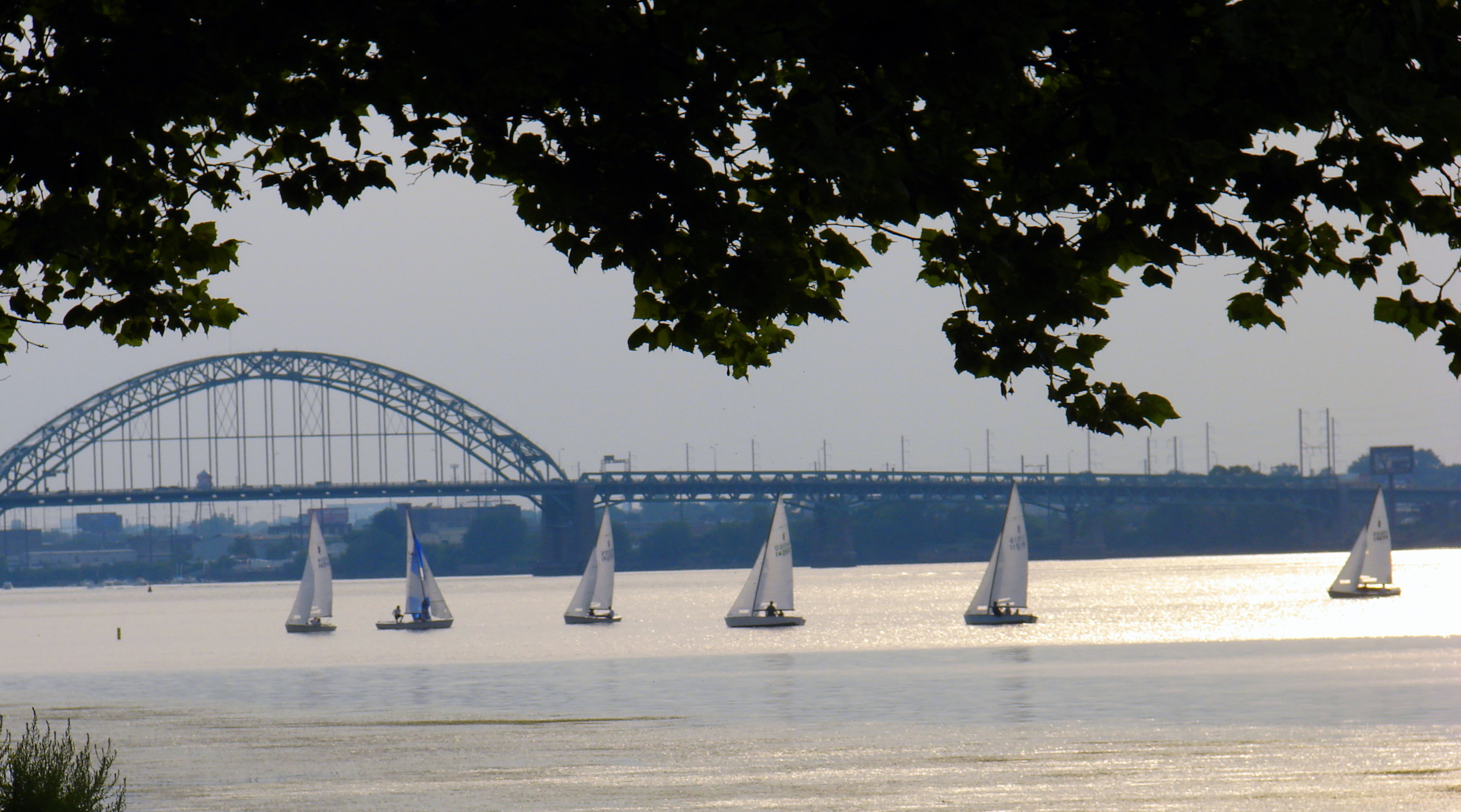
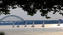 The Tacony-Palmyra bridge connects the Northeast with New Jersey.
The Northeast's main highways are Interstate 95 (Delaware Expressway).[12] and Roosevelt Boulevard (U.S. 1)[12] Secondary major arteries include Cottman Avenue (PA 73), Frankford Avenue (US 13), Woodhaven Road (PA 63), Grant Avenue, Oxford Avenue (PA-232), State Road, Bustleton Avenue (PA-532), Bridge Street, Harbison Avenue, and Academy Road.
The Tacony-Palmyra Bridge, the only Delaware River crossing in Philadelphia not operated by the Delaware River Port Authority (thus resulting in a cheaper toll), allows one to drive between the Tacony section of the city and Palmyra, New Jersey.[47]
The Northeast is also served by SEPTA's Market-Frankford Line, often called the "Frankford El" or "the El" because portions of the rail line are elevated above streets below, including Frankford and Kensington avenues. The northernmost and easternmost terminus of the line is at the Frankford Transportation Center, Frankford Avenue and Bridge Street. Three commuter rail lines also serve the Northeast. An extension of the Broad Street Line along Roosevelt Boulevard has been proposed. Many SEPTA bus routes and all three of its trackless trolley routes run through the Northeast, although north-south buses run more frequently than west-east ones. Most north-south routes terminate at the Frankford Transportation Center.[48]
One of two airports that serve Philadelphia, Northeast Philadelphia Airport (PNE), is located in this section of the city. PNE is the sixth busiest airport in Pennsylvania.[49]
Notable persons
- Rubén Amaro, Jr., MLB baseball player and general manager
- Bill Keane, creator of Family Circus comic strips
- Rich Gannon, Former NFL Quarterback and 2002 NFL MVP
See also
- Historical Society of Frankford, founded 1905
- National Register of Historic Places listings in Northeast Philadelphia
References
- ^ "Philadelphia County Quick Facts". US Census Bureau Official Website. US Census Bureau. August 16, 2009. http://quickfacts.census.gov/qfd/states/42/42101.html. Retrieved August 16, 2009.
- ^ "Far NE". City of Philadelphia. Archived from the original on September 30, 2007. http://web.archive.org/web/20070930195239/http://www.phila.gov/neighborhoods/Neighborhoods-Phila/Far_NE/far_ne.html. Retrieved August 13, 2009.
- ^ a b See "Boundaries have evolved with the times". Archived from the original on December 9, 2004. http://web.archive.org/web/20041209144527/http://www.philly.com/mld/inquirer/news/special_packages/northeast_phila/10199740.htm. Philadelphia Inquirer, Nov. 17, 2004
- ^ Martindale, Joseph C. (1867). A History of the Townships of Byberry and Moreland in Philadelphia, Pa.: From Their Earliest Settlement by Whites to the Present Time. Philadelphia, Pa.: T. Ellwood Zell. p. 15. http://books.google.com/?id=lWsU4C4d54wC&pg=PA267&lpg=PA267&dq=Frankford+Philadelphia+History. Retrieved September 20, 2009.
- ^ a b "Chronology of Philadelphia County Subdivisions, 1683–1854". City of Philadelphia. http://www.phila.gov/phils/Docs/Inventor/graphics/wards/wards1.htm. Retrieved August 13, 2009.
- ^ a b "Neighborhood history predates Philadelphia's founding father". Archived from the original on December 9, 2004. http://web.archive.org/web/20041209144546/http://www.philly.com/mld/inquirer/news/special_packages/northeast_phila/10199743.htm., Philadelphia Inquirer, Nov. 17, 2004
- ^ A Brief History of Tacony, Louis M. Iatarola
- ^ Weigley (Editor), Russell; Joseph S. Clark, Jr. and Dennis J. Clark (1982). 'Philadelphia, A 300-Year History'. New York, NY: W.W. Norton. p. 312. ISBN 0393016102.
- ^ Silcox, Harry C. (2009). Remembering Northeast Philadelphia. Charleston, South Carolina: The History Press. pp. 46–54. ISBN 9781596296152.
- ^ a b Silcox, Harry C. (2009). Remembering Northeast Philadelphia. Charleston, South Carolina: The History Press. pp. 43–45. ISBN 9781596296152.
- ^ Silcox, Harry C. (2009). Remembering Northeast Philadelphia. Charleston, South Carolina: The History Press. pp. 61–63. ISBN 9781596296152.
- ^ a b c Weigley (Editor), Russell; Joseph S. Clark, Jr. and Dennis J. Clark (1982). 'Philadelphia, A 300-Year History'. New York, NY: W.W. Norton. p. 699. ISBN 0393016102.
- ^ Silcox, Harry C. (2009). Remembering Northeast Philadelphia. Charleston, South Carolina: The History Press. pp. 67–68. ISBN 9781596296152.
- ^ Thomas Ginsburg. "Quietly, quickly, diversity moves in". Archived from the original on December 9, 2004. http://web.archive.org/web/20041209144518/www.philly.com/mld/inquirer/news/special_packages/northeast_phila/10199737.htm. Philadelphia Inquirer, Nov. 17, 2004
- ^ See, e.g., "1976 Presidential General Election Results by Ward". Committee of Seventy. http://www.seventy.org/Downloads/Election_Returns_&_Data/1976_Presidential_Election.pdf. Retrieved September 19, 2009.; or "1980 Presidential General Election Results by Ward". Committee of Seventy. http://www.seventy.org/Downloads/Election_Returns_&_Data/1980_Presidential_General_Election_Results_by_Ward.pdf. Retrieved September 19, 2009.
- ^ a b See, e.g., "Secede? The idea is faint, but not yet dead". Archived from the original on March 13, 2007. http://web.archive.org/web/20070313151215/http://www.philly.com/mld/inquirer/news/special_packages/northeast_phila/10199741.htm. Philadelphia Inquirer, Nov. 17, 2004
- ^ Tom Waring (June 12, 2008). "Butkovitz on taxes: Where’s the emergency?". Northeast Times. http://www.northeasttimes.com/2008/0612/butkovitz.html. Retrieved September 19, 2009.
- ^ http://factfinder.census.gov/servlet/SAFFFacts?_event=ChangeGeoContext&geo_id=86000US19104&_geoContext=01000US%7C86000US19131&_street=&_county=&_cityTown=&_state=04000US42&_zip=19104&_lang=en&_sse=on&ActiveGeoDiv=geoSelect&_useEV=&pctxt=fph&pgsl=010&_submenuId=factsheet_1&ds_name=DEC_2000_SAFF&_ci_nbr=null&qr_name=null®=null%3Anull&_keyword=&_industry=
- ^ Factfinder at census.gov
- ^ See United States congressional delegations from Pennsylvania
- ^ "Allyson Schwartz, 13th Congressional District of Pennsylvania". Official U.S. House of Representatives. U.S. House of Representatives. http://schwartz.house.gov/. Retrieved October 28, 2009.
- ^ This National Atlas map shows the district boundaries.
- ^ Pennsylvania Senate (August 15, 2009). "Michael J. Stack (D) Senate District 5 Philadelphia (part) County.". PA Senate Official Website. Pennsylvania Senate. http://www.legis.state.pa.us/cfdocs/legis/home/member_information/senate_bio.cfm?id=280. Retrieved August 15, 2009.
- ^ "Shirley M. Kitchen, District 3". Pennsylvania State Senate official website. Pennsylvania State Senate. http://www.legis.state.pa.us/cfdocs/legis/home/member_information/senate_bio.cfm?id=278. Retrieved October 29, 2009.
- ^ "Christine M. Tartaglione, District 2". Pennsylvania State Senate official website. Pennsylvania State Senate. http://www.legis.state.pa.us/cfdocs/legis/home/member_information/senate_bio.cfm?id=277. Retrieved October 29, 2009.
- ^ This Pennsylvania Department of State map shows the state Senate district boundaries.
- ^ This Pennsylvania Department of State map shows the state House district boundaries.
- ^ City of Philadelphia. "PHILADELPHIA 10th CITY COUNCIL DISTRICT". City of Philadelphia, City Council. http://www.phila.gov/citycouncil/maps/dist10map.html. Retrieved August 15, 2009.
- ^ City of Philadelphia. "PHILADELPHIA 6th CITY COUNCIL DISTRICT". City of Philadelphia, City Council. Archived from the original on June 24, 2008. http://web.archive.org/web/20080624153047/http://www.phila.gov/citycouncil/krajewski/index.html. Retrieved August 15, 2009.
- ^ City of Philadelphia. "PHILADELPHIA 7th CITY COUNCIL DISTRICT". City of Philadelphia, City Council. http://www.phila.gov/citycouncil/maps/dist7map.html. Retrieved August 15, 2009.
- ^ City of Philadelphia. "PHILADELPHIA 9th CITY COUNCIL DISTRICT". City of Philadelphia, City Council. http://www.phila.gov/citycouncil/maps/dist7map.html. Retrieved October 29, 2009.
- ^ This map shows the district boundaries.
- ^ Eichel, Larry (April 30, 2007). "Sure winner faces long odds". Philadelphia Inquirer. Archived from the original on October 10, 2007. http://web.archive.org/web/20071010002903/http://www.philly.com/inquirer/home_top_stories/20070430_Sure_winner_faces_long_odds.html. Retrieved April 30, 2007.
- ^ PPD Online Patrol Districts, Philadelphia Police Department.
- ^ "Franklin Mills information". Simon Malls. http://www.simon.com/mall/default.aspx?ID=1245. Retrieved August 13, 2009.
- ^ "Roosevelt Mall". Centro Properties Group. http://www.centroprop.com/PropertyProfile_short.asp?ProjectID=PPAROOSM1. Retrieved August 13, 2009.
- ^ "Directions to Friends Hospital". Friends Hospital. Archived from the original on May 16, 2008. http://web.archive.org/web/20080516235246/http://www.friendshospitalonline.org/directions.htm. Retrieved October 19, 2009.
- ^ "Directions to Fox Chase Cancer Center". Fox Chase Cancer Center. http://www.fccc.edu/information/directions/index.html. Retrieved October 19, 2009.
- ^ "World Airline Directory." Flight International. March 30, 1985. 111." Retrieved on July 23, 2009.
- ^ Thomson, John (June 1907). "Descriptive Account of the Lower Dublin Academy and of the Thomas Holme Branch of the Free Library of Philadelphia". Bulletin of the Free Library of Philadelphia (n.s.) 7: 5. http://books.google.com/?id=PC8ZAAAAMAAJ&pg=PA7&lpg=PA7&dq=Holmesburg+Philadelphia+History. Retrieved September 20, 2009.
- ^ Friends of Fox Chase Farm website
- ^ "Holy Family University homepage". Archived from the original on October 9, 2007. http://web.archive.org/web/20071009214859/http://www.holyfamily.edu/abouthf/index.shtml.
- ^ "Regional Offices & School Information". School District of Philadelphia. https://sdp-webprod.phila.k12.pa.us/OnlineDirectory/schools.jsp. Retrieved August 13, 2009.
- ^ "Philadelphia Office of Catholic Education Website". Archdiocese of Philadelphia. http://www.catholicschools-phl.org/findschool/highschools.htm. Retrieved August 13, 2009.
- ^ "Historic Pennypack Park: An oasis for all seasons". Archived from the original on December 5, 2004. http://web.archive.org/web/20041205084959/http://www.philly.com/mld/inquirer/news/special_packages/northeast_phila/10199683.htm., Philadelphia Inquirer, Nov. 17, 2004.
- ^ "The Frankford Avenue Bridge: Bridging the Past to the Future for 300 Years". Balford.com. http://balford.com/fopp/bridge.html. Retrieved January 29, 2011.
- ^ Burlington County Bridge Commission "webpage". Archived from the original on January 22, 2008. http://web.archive.org/web/20080122120715/http://www.bcbridges.org/bridge_info/tacony.asp. about the Tacony-Palmyra Bridge.
- ^ See this SEPTA map of the Frankford Transportation Center
- ^ Philadelphia Airport System. "Philadelphia Northeast Airport". City of Philadelphia. http://www.phl.org/pne/pne.html. Retrieved September 20, 2009.
External links
Neighborhoods of the Northeast section of Philadelphia, Pennsylvania Academy Gardens • Ashton-Woodenbridge • Bridesburg • Burholme • Bustleton • Byberry • Castor Gardens • Crescentville • Crestmont Farms • Fishtown • Fox Chase • Frankford • Harrowgate • Holme Circle • Holmesburg • Juniata • Kensington • Lawndale • Lexington Park • Mayfair • Millbrook • Modena Park • Morrell Park • Normandy • Oxford Circle • Parkwood • Pennypack • Port Richmond • Rhawnhurst • Ryers • Somerton • Tacony • Torresdale • Upper Holmesburg • Winchester Park • Wissinoming
 Center City • North Philadelphia • Northwest Philadelphia • Northeast Philadelphia • South Philadelphia • Southwest Philadelphia • West PhiladelphiaCategories:
- Neighborhoods in Philadelphia, Pennsylvania


Wikimedia Foundation. 2010.