- Pennypack Creek
-
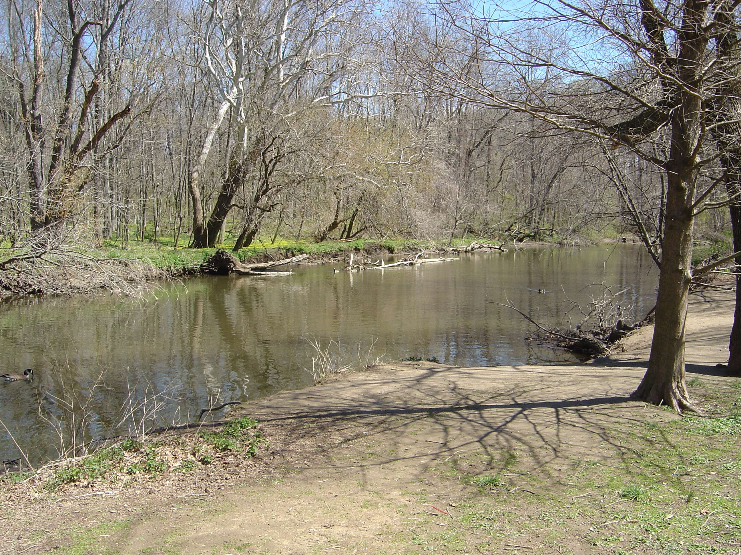
 Pennypack Creek near Pine Road in Fox Chase
Pennypack Creek is a 22.6-mile-long (36.4 km)[1] creek in southeastern Pennsylvania in the United States. It runs southeast through eastern Montgomery County, lower Bucks County, and the northeast section of Philadelphia, before emptying into the Delaware River.
Contents
Name
The creek draws its name from the Lenape word pënëpèkw meaning "downward-flowing water" or "deep, dead water; water without much current." Early cartographers gave various spellings for the name, including Pennishpaska, La Riviere de Pennicpacka, and Pennishpacha Kyl. In early Swedish patents it was called Pemipacka. Thomas Holme called it Dublin Creek, while in later maps it is called Pennypack and Pennepack.[2]
Course
The Pennypack was first surveyed by Thomas Holme in 1687. The creek begins in two branches, one in Horsham, the other in Warminster, joining in Bryn Athyn. The creek then flows through Lower Moreland, Abington and Northeast Philadelphia.
Early use as an industrial waterway
Pennypack Creek was once the site of several mills.[3] When William Penn founded the province of Pennsylvania in 1682, the Pennypack valley was occupied by Swedish colonists, who continued to live as English settlement began.[3] Penn ordered the first bridge built across the creek along the King's Highway (now Frankford Avenue) in 1697; the bridge still stands. Despite the lack of navigability beyond the fall line (near the Frankford Avenue bridge), several early settlers built mills along the Pennypack, including Penn's "Pemmapecka Mill," built in 1701.[3] The mills contributed to the growth of Holmesburg, the neighborhood near the mouth of the creek, and provided local farmers a place to sell their grain that was nearer than the city of Philadelphia.
Conversion to parkland
With the development of steam power in the Industrial Revolution, water power's influence on industry declined. As a result, many of the mills on the Pennypack closed, and by 1905 the land around it was acquired by the city for parkland. The creek now runs through Pennypack Park in Philadelphia and Lorimer Park in Montgomery County.
Historic bridges
Several historic bridges cross Pennypack Creek and its tributaries.
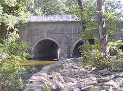
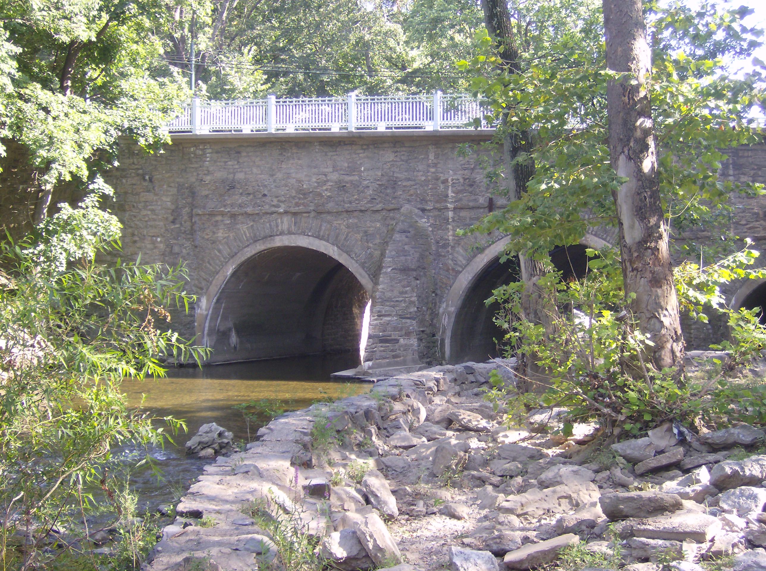
- The Frankford Avenue Bridge, a triple-span stone-arch bridge built in 1697, carries Frankford Avenue. It is the oldest bridge in the United States still in use.[4]
- The Fetters Mill Road Bridge, a Pratt through-truss bridge built in 1883, is still in use.[5]
- The Krewstown Road Bridge, a stone arch bridge built in 1907, is still in use.[6]
- The Holme Avenue Bridge, a closed-spandrel concrete arch bridge built in 1918, is still in use.[7]
- The Roosevelt Boulevard Bridge, a closed-spandrel concrete arch bridge built in 1920, is still in use.[8]
- The Holme Avenue Bridge, a closed-spandrel concrete arch bridge across Wooden Bridge Run built in 1921, is still in use.[9]
- The Ryan Avenue Bridge, a closed-spandrel concrete arch bridge over Sandy Run built in 1929, is still in use.[10]
- The Rhawn Street Bridges, two closed-spandrel concrete arches bridge built in 1930, are still in use.[11][12]
See also
- List of Pennsylvania rivers
External links
- U.S. Geological Survey: PA stream gaging stations
- A picture of Pennypack Creek from Windows Live Local. This scene shows the creek as it flows beneath the bridge on Frankford Avenue in Holmesburg, believed to be the oldest stone arch bridge in use in the United States.
- Pennypack in art: William Thompson Russell Smith (1812–1896) painted Jarrett Hallowell's Meadow on the Pennypack in 1880 link to Smith's Meadow
- Pennypack in art: Xanthus Russell Smith (1839–1929) painted Turnpike Bridge on the Pennypack in 1881 link to Smith's Bridge
- Pennypack Creek Watershed Study
- Friends of Pennypack Park
- Photographs - mostly of Pennypack Creek - from the Lincoln Cartledge Collection of the Historical Society of Frankford
- The Pennepack in Lower Dublin Township (now part of Philadelphia: see Act of Consolidation, 1854)
- Holme's map of 1687
- Headquartered at 2955 Edgehill Road in Huntingdon Valley, the Pennypack Ecological Restoration Trust manages the 725-acre (2.93 km2) Pennypack Preserve which is open to the public and includes 10 miles (16 km) of pedestrian, equestrian, and bicycle trails.
References
- ^ U.S. Geological Survey. National Hydrography Dataset high-resolution flowline data. The National Map, accessed April 1, 2011
- ^ Philly H2O, "Changes in the Names of Streams In and About Philadelphia." Public Ledger Almanac: 1879. Pages 3, 5, 7, 9, 11, & 13. (Accessed 2008-08-18)
- ^ a b c Willits, I. Pearson (1911). "The Pennepack in Lower Dublin Township". The City History Society of Philadelphia. http://www.phillyh2o.org/backpages/pennypack1911.htm. Retrieved 2008-08-18.
- ^ Frenkford Avenue Bridge at bridgehunter.com
- ^ Fetters Mill Road Bridge at bridgehunter.com
- ^ Krewstown Road Bridge at bridgehunter.com
- ^ Holme Avenue Bridge at bridgehunter.com
- ^ Roosevelt Boulevard Bridge at bridgehunter.com
- ^ Holme Avenue Bridge at bridgehunter.com
- ^ Ryan Avenue Bridge at bridgehunter.com
- ^ Rhawn Street Bridge at bridgehunter.com
- ^ Rhawn Street Bridge at bridgehunter.com
Categories:- Rivers of Pennsylvania
- Tributaries of the Delaware River
- Geography of Philadelphia, Pennsylvania
- Geography of Montgomery County, Pennsylvania
- Geography of Bucks County, Pennsylvania
Wikimedia Foundation. 2010.