- Pennsylvania Route 263
-
PA Route 263

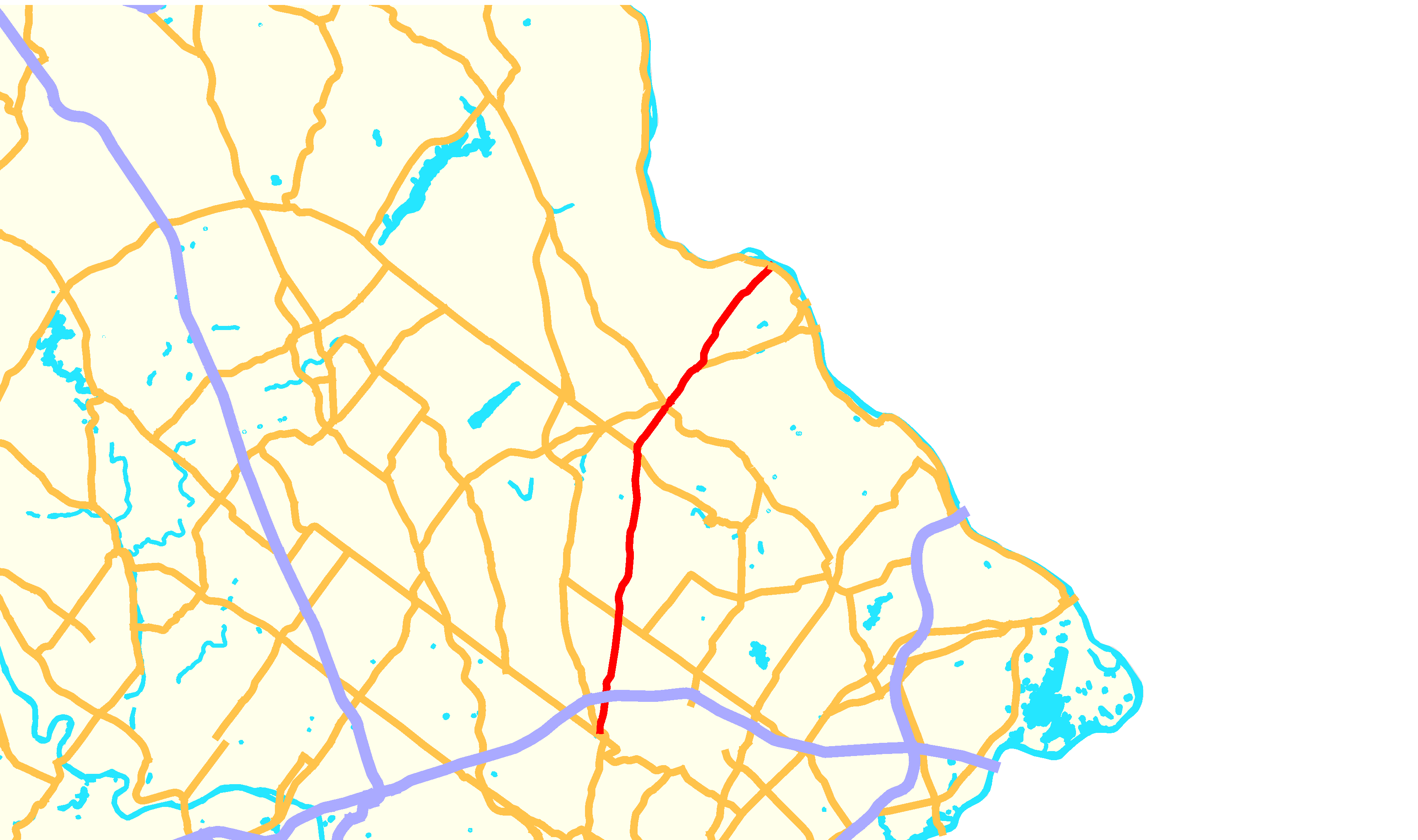
Map of southeastern Pennsylvania with PA 263 highlighted in redRoute information Maintained by PennDOT Length: 20.0 mi[2] (32.2 km) Existed: by 1930[1] – present Major junctions South end:  PA 611 in Willow Grove
 US 202 in Buckingham Township
North end:  PA 32 in Centre Bridge
Location Counties: Montgomery, Bucks Highway system Roads in Pennsylvania
Interstate • US • State • Legislative←  PA 262
PA 264  →
→Pennsylvania Route 263 (PA 263) is a north–south state highway located in southeast Pennsylvania. The southern terminus of the route is at PA 611 in Willow Grove, Montgomery County. The northern terminus is at PA 32 in Centre Bridge, Bucks County on the banks of the Delaware River near the Centre Bridge-Stockton Bridge. It follows the routing of Old York Road, a historic road that connected Philadelphia to New York City, and carries the name York Road from the southern terminus to Lahaska and Upper York Road north of there. From Willow Grove to Buckingham, PA 263 runs mostly through suburban areas as a four-lane road, passing through Hatboro, Warminster, and Jamison. The route forms a concurrency with U.S. Route 202 (US 202) and narrows to a two-lane road, splitting with that route in Lahaska. From here, the route continues through rural areas to Centre Bridge.
PA 263 follows a part of the alignment of Old York Road, which was laid out in 1711. In 1911, the portion of the current route south of Lahaska became part of Legislative Route 155. When Pennsylvania designated its state highways, PA 263 was assigned to its current alignment between Willow Grove and Centre Bridge.
Contents
Route description
Montgomery County
PA 263 starts as York Road at its southern terminus at PA 611 (Easton Road) in the unincorporated village of Willow Grove in Upper Moreland Township, Montgomery County.[3] At the southern terminus, the route is split into a one-way pair, with the route carrying two lanes in each direction. The northbound lanes split north from northbound PA 611 while the southbound lanes head west and meet PA 611 at the Center Avenue intersection. At the end of the one-way pair, PA 263 continues north as a four-lane undivided road, passing through commercial areas with a few homes. The road passes under Norfolk Southern's Morrisville Line and becomes a divided highway as it passes under the Pennsylvania Turnpike (I-276). Upon intersecting Mill Road/Warminster Road, PA 263 becomes undivided again as it heads into more residential surroundings.[3][4]
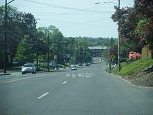
The route briefly forms the border between Hatboro to the east and Upper Moreland Township to the west before fully entering Hatboro past the Newington Drive intersection. Here, PA 263 heads north prior to turning northeast and intersecting Horsham Road.[3] At this point, the route crosses the Pennypack Creek and heads into the commercial downtown of Hatboro as a three-lane road with a center left-turn lane.[3][4] The route turns north at Byberry Road and comes to a junction with the western terminus of PA 332 (Montgomery Avenue).[3] After passing Summit Avenue, PA 263 leaves the downtown area and becomes a four-lane undivided road again, passing residential areas with a few businesses.[3][4] Through Hatboro, PA 263 is also called the Roy W. Cornell Memorial Highway.[5]
Bucks County
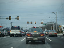
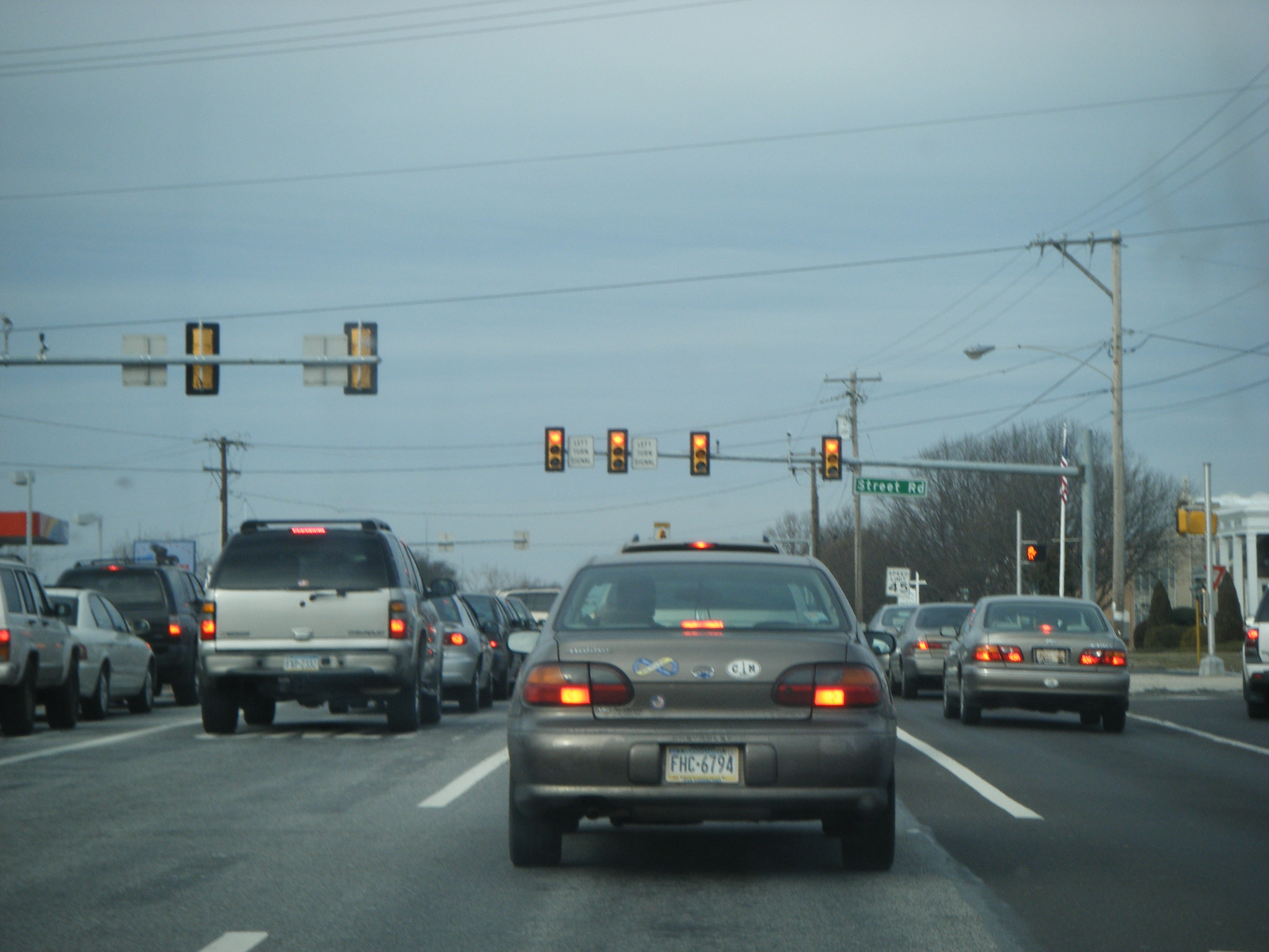
At the intersection with County Line Road, PA 263 crosses the Bucks County line and enters Warminster Township.[6] In this area, the route is a five-lane road with a center left-turn lane and passes several suburban businesses as it comes to the PA 132 (Street Road) intersection, where it becomes a four-lane divided highway. The road passes more commercial surroundings until the divided highway ends at Roberts Road.[4][6] PA 263 gains a center left-turn lane again as it continues north through more residential areas with a few businesses.[4] Just before Bristol Road, Old York Road splits off from the route and PA 263 curves more to the northeast, retaining the name York Road.[6]
At Bristol Road, PA 263 enters Warwick Township and becomes a four-lane divided highway as it turns north near residential subdivisions. The surroundings become more wooded as the route crosses the Little Neshaminy Creek. The road continues into areas of farm fields and residential and commercial development and regains a center left-turn lane as it reaches an intersection with Almshouse Road in the community of Jamison.[4][6] At this intersection, the route is briefly a divided highway. After Almshouse Road, PA 263 continues north through business areas before heading past residential developments.[4] The route turns back into a divided highway as it crosses over the Neshaminy Creek and passes through areas woodland and homes.[4][6] The road leaves Warwick Township for Buckingham Township at the Sugar Bottom Road intersection.[6]
In Buckingham Township, PA 263 becomes a four-lane undivided road passes a mix of farmland and homes as it comes to the community of Furlong. Here, the road intersects Edison Furlong Road/Forest Grove Road and forms the border between Doylestown Township to the west and Buckingham Township to the east, passing a few businesses. At the intersection with the eastern terminus of PA 313 (Swamp Road), the route fully enters Buckingham Township again and turns northeast past wooded areas of homes. Farther to the northeast, the route runs between a farm to the southeast and more wooded development to the northwest as it reaches the residential and commercial community of Buckingham and crosses PA 413 (Durham Road).[4][6]
PA 263 narrows to two lanes past this intersection and forms a concurrency with US 202 a short distance later. The two routes run along a two-lane undivided road that passes areas of farms and woods with some homes and businesses, passing through the community of Holicong.[4][6] Past this area, the development decreases as US 202/PA 263 continues northeast through more rural surroundings.[4] Upon reaching the unincorporated village of Lahaska, the two routes split, with PA 263 bearing off to the left and becoming Upper York Road, a two-lane undivided road. The route passes through Peddler's Village before coming to an intersection with Street Road.[4][6] At Street Road, PA 263 exits Buckingham Township and enters Solebury Township.[6]
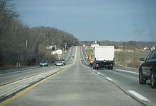
The road continues north into farm fields and woods with a few homes, curving more to the northeast.[4] At the Aquetong Road intersection, PA 263 turns north and back to the northeast as it passes to the west of a residential development. The route passes more rural development as it reaches the community of Solebury, where the road intersects Sugan Road.[4][6] In this area, the road passes a few homes. Past this area, the road continues through wooded areas of homes, with the forests become denser as the road heads more to the northeast.[4] In the village of Centre Bridge, PA 263 ends at PA 32 (River Road) just before Upper York Road crosses the Centre Bridge-Stockton Bridge over the Delaware River and into Stockton, New Jersey, where the road continues to an intersection with Route 29 near the southern terminus of County Route 523.[6]
History
What is now PA 263 was originally built as part of the Old York Road, a road established in the 18th century to connect Philadelphia to New York City. The portion of the road encompassing all of PA 263 was planned in 1711 to run from Philadelphia to Centre Bridge. The Old York Road would later exist as a turnpike.[7] In 1911, the part of PA 263 between the southern terminus and Lahaska was designated as part of Legislative Route 155, a route that ran from Willow Grove to New Hope.[8]
By 1930, PA 263 was designated to run from US 611 in Willow Grove to PA 32 in Centre Bridge.[1] The Upper York Road portion of PA 263 was paved by 1940.[9] By 1970, the route was widened into a four-lane highway between County Line Road and PA 413 in Buckingham.[10] In 2006, the portion of PA 263 through Hatboro was named the Roy W. Cornell Memorial Highway in honor of Roy Cornell, a member of the Pennsylvania General Assembly who had represented Hatboro for over 30 years.[5]
Major intersections
County Location Mile[2] Destinations Notes Montgomery Willow Grove 0.0 PA 611 (Easton Road)Hatboro 2.5  PA 332 east (Montgomery Avenue)
Bucks Warminster Township 4.4  PA 132 (Street Road)
Buckingham Township 11.0  PA 313 west (Swamp Road)
13.0  PA 413 (Durham Road)
13.3 US 202 south (Doylestown-Buckingham Pike)Southern terminus of concurrency 15.0 US 202 north (Lower York Road)Northern terminus of concurrency Centre Bridge 20.0 PA 32 (River Road)1.000 mi = 1.609 km; 1.000 km = 0.621 mi References
- ^ a b Pennsylvania Department of Highways (1930). Tourist Map of Pennsylvania (Map). ftp://ftp.dot.state.pa.us/public/pdf/BPR_pdf_files/Maps/Statewide/Historic_OTMs/1930fr.pdf. Retrieved 2010-06-24.
- ^ a b DeLorme Street Atlas USA 2007
- ^ a b c d e f ADC Map (2006). Montgomery County, Pennsylvania (Map). 1"=2000' (18th ed.). ISBN 0-87530-775-2.
- ^ a b c d e f g h i j k l m n o Google, Inc. Google Maps – overview of Pennsylvania Route 263 (Map). Cartography by Google, Inc. http://maps.google.com/maps?f=d&source=s_d&saddr=york+road+and+easton+road+willow+grove,+pa&daddr=PA+32+and+PA+263+centre+bridge,+pa&geocode=FTyLZAId5tOF-ykTSUMnLrDGiTHNAi4CkLt5GQ%3BFYd4aAIdXOSH-ylTsPtPbwfEiTHDrTP4SxtuJg&hl=en&mra=ls&sll=40.144633,-75.115285&sspn=0.003527,0.010568&ie=UTF8&t=h&z=10. Retrieved 2010-06-29.
- ^ a b SENATE BILL No. 1206, General Assembly of Pennsylvania, 2006, http://www.legis.state.pa.us/cfdocs/legis/PN/Public/btCheck.cfm?txtType=HTM&sessYr=2005&sessInd=0&billBody=S&billTyp=B&billNbr=1206&pn=2253, retrieved 2010-08-03
- ^ a b c d e f g h i j k l ADC Map (2006). Bucks County, Pennsylvania (Map). 1"=2000' (19th ed.). ISBN 0-87530-774-4.
- ^ Hotchkin, S.F. (1892). The York Road, old and new. Binder & Kelly. http://books.google.com/books?id=VMI_AAAAYAAJ&pg=PA215&dq=old+york+road&hl=en&ei=-bAqTPz8MoH68AbxmtzTCA&sa=X&oi=book_result&ct=result&resnum=4&ved=0CDwQ6AEwAw#v=onepage&q&f=false. Retrieved 2010-06-30.
- ^ Pennsylvania Department of Highways (1911). Map of Pennsylvania Showing State Highways (Map). ftp://ftp.dot.state.pa.us/public/pdf/BPR_pdf_files/Maps/Statewide/Historic_OTMs/1911.pdf. Retrieved 2010-06-24.
- ^ Pennsylvania Department of Highways (1940). Official Road Map of Pennsylvania (Map). ftp://ftp.dot.state.pa.us/public/pdf/BPR_pdf_files/Maps/Statewide/Historic_OTMs/1940fr.pdf. Retrieved 2010-06-24.
- ^ Pennsylvania Department of Transportation (1970). Official Map of Pennsylvania (Map). ftp://ftp.dot.state.pa.us/public/pdf/BPR_pdf_files/Maps/Statewide/Historic_OTMs/1970fr.pdf. Retrieved 2010-06-30.
Road transportation infrastructure of the metro Philadelphia area Interstates U.S. Routes Pennsylvania Routes New Jersey Routes Delaware Routes Named roads/streets Benjamin Franklin Parkway · Broad Street · City Avenue · Front Street · Girard Avenue · Market Street · Roosevelt Boulevard · South Street · Chestnut Street · Walnut Street
Pennsylvania Turnpike · New Jersey Turnpike · Delaware Turnpike · Atlantic City Expressway · Schuylkill Expressway · Delaware Expressway · Blue Route · Vine St Expressway · North South Freeway · Lancaster Avenue · Bethlehem Pike · Baltimore Pike · Black Horse PikeBridges Delaware Memorial Bridge · Commodore Barry Bridge · Walt Whitman Bridge · Ben Franklin Bridge · Betsy Ross Bridge · Tacony–Palmyra Bridge · Burlington–Bristol Bridge · Delaware River – Turnpike Toll BridgeCategories:- State highways in Pennsylvania


Wikimedia Foundation. 2010.