- Pennsylvania Route 291
-
PA Route 291
Route information Maintained by PennDOT Length: 14.15 mi[1] (22.77 km) Existed: 1928 – present Major junctions West end:  US 13 in Trainer
 I-95 in Philadelphia
East end:  I-76 in Philadelphia
Location Counties: Delaware, Philadelphia Highway system Roads in Pennsylvania
Interstate • US • State • Legislative←  PA 290
PA 292  →
→Pennsylvania Route 291 is an east–west route that connects U.S. Route 13 in the Trainer/Marcus Hook area to Interstate 76 in Southwest Philadelphia near the Walt Whitman Bridge and the South Philadelphia Sports Complex. Except for a short 1-mile (1.6 km) section between U.S. Route 13 and the Chester/Trainer line, PA Route 291 is mostly a four-lane highway. It runs parallel to the Delaware River.
Contents
Route description
Trainer to Tinicum
PA Route 291 starts in Trainer, a small borough that is home to a Conoco-Phillips oil refinery (BP and Tosco prior to its present ownership) and after bearing left on a sharp curve, the road becomes 2nd Street. Upon entering Chester, the road widens to a five-lane road and proceeds east along the Delaware River waterfront, passing under the Commodore Barry Bridge at Flower Street (the old access road to the former Chester-Bridgeport Ferry) until it reaches Concord Avenue. At Concord Avenue, the roadway, now called "Industrial Highway" curves to the left, crossing over the Chester Creek near Chester's new City Hall and then, past Welsh and Crosby Streets, aligns itself on a pre-1994 alignment that was widened in the late 1990s as part of a total rebuild project in Chester in an attempt to bring more businesses into the economically depressed city.
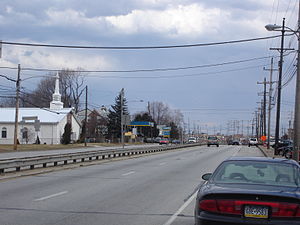 Industrial Highway (PA 291) in Essington, facing east
Past Morton Avenue, which connects PA Route 291 with U.S. Route 13, the road crosses over the Ridley Creek near the new Harrah's Chester Downs Casino, a harness racing track and gambling parlor (featuring slot machines and table games) that opened in 2006 (for racing only), upon which the casino came into full operation in January, 2007. The race track/casino, along with a Pennsylvania Department of Corrections facility, were built on land once occupied by the Sun Ship and Drydock Company that went out of business in 1990. It is also at Ridley Creek that the PA Route 291 leaves Chester and enters Eddystone, Pennsylvania and at the same time, becoming a physically divided highway that was built in the 1970s.
Past the Ridley Creek bridge, PA Route 291 passes two major facilities; Boeing's Helicopter Facility and Exelon's Eddystone Generation Facility. While the former is well-known for building helicopters for the military, especially the V-22 Osprey and Chinook helicopters, while the latter, opened in 1975, was the site of the massive Eddystone Munitions Plant that exploded in 1914, in which the cause was never determined, but speculated that it was an act of sabotage due to the explosion occurring during the early years of World War I.
After crossing the Darby Creek, PA Route 291 then enters the community of Tinicum, one of the first areas that were occupied by the Swedes prior to the British takeover of colonial Pennsylvania. This portion of the road is dotted by hotels throughout.
Tinicum to Philadelphia
Past Tinicum, PA Route 291 draws up next to Interstate 95, which has a one-way exit going from the northbound lanes of I-95 to the eastbound lanes of PA Route 291. Prior to 2001, this ramp was the main access to the Philadelphia International Airport, but a new exit connecting the highway directly to the airport terminals has since eased traffic congestion.
After crossing over a small tributary, PA Route 291, now in Philadelphia, then turns left off Industrial Highway and onto Bartram Avenue. Prior to October, 2006, the road continued on Industrial Highway past the Airport, but a project to extend a north–south runway has closed off the highway, thus requiring the Pennsylvania Department of Transportation (PennDOT) to reroute the highway into the present configuration. After the left turn, PA Route 291 then draws up next to the SEPTA Regional Rail Airport Line, then diverges from the railroad alignment just before the Eastwick train station, which was constructed in the late 1990s primarily for people employed at the PNC Bank office building located adjacent to the Airport. Past S. 84th Street, the road then turns right onto Island Avenue, goes under I-95, and then turns left back onto Industrial Highway.
After returning onto Industrial Highway, the road then ducks under I-95 for a second time, before crossing over the Schuylkill River on the George C. Platt Memorial Bridge, a four-lane high-level canteliever bridge which opened to traffic in 1951. At the same time the road crosses over the Schuylkill River, it also crosses over the massive Sunoco Oil Refinery that provides Sunoco (along with its operations in Marcus Hook), with the majority of the gasoline used in the Northeast U.S. After crossing the Schuylkill River, PA Route 291 then turns left onto S. 26th Street, and paralleling the main CSX (former Pennsylvania Railroad) freight line to the Delaware Waterfront, PA Route 291 ends with the roadway merging onto I-76 at the Passyunk Avenue/Oregon Avenue interchange.
Major intersections
County Location Mile[1] Destinations Notes Delaware Trainer 0.00 US 13 (Post Road) – Chester, Marcus HookChester  To US 322 / I-95 / Highland Avenue To US 322 / Flower Street
Former US 322 3.17  PA 320 north (Madison Street) To US 13 / Morton Avenue
Ridley Township To I-95 / Stewart AvenueTinicum Township 6.41  PA 420 north (Wanamaker Avenue) to I-95 – Morton
Industrial Highway, Scott Way – Philadelphia International Airport, Cargo City Former PA 291 east Philadelphia Philadelphia I-95 southNo westbound entrance 84th Street – John Heinz National Wildlife Refuge To I-95 north / Island Avenue, Bartram Avenue I-95 south – ChesterInterchange Island Avenue Former PA 291 west I-95 south – Philadelphia International AirportInterchange; westbound exit and eastbound entrance George C. Platt Memorial Bridge over the Schuylkill River To I-76 east (Whitman Bridge) / Penrose Avenue – Sports ComplexPassyunk Avenue, Oregon Avenue Interchange; no eastbound exit I-76 west (Schuylkill Expressway) – Valley ForgeInterchange References
- Yellow Pages Directory
External links
- PA State Route 291 ends
- PA Routes 291-300 - Central PA/MD Roads
- Industrial Expressway (unbuilt)
- Pennsylvania @ NorthEastRoads.com - Pennsylvania 291
Road transportation infrastructure of the metro Philadelphia area Interstates U.S. Routes Pennsylvania Routes New Jersey Routes Delaware Routes Named roads/streets Benjamin Franklin Parkway · Broad Street · City Avenue · Front Street · Girard Avenue · Market Street · Roosevelt Boulevard · South Street · Chestnut Street · Walnut Street
Pennsylvania Turnpike · New Jersey Turnpike · Delaware Turnpike · Atlantic City Expressway · Schuylkill Expressway · Delaware Expressway · Blue Route · Vine St Expressway · North South Freeway · Lancaster Avenue · Bethlehem Pike · Baltimore Pike · Black Horse PikeBridges Delaware Memorial Bridge · Commodore Barry Bridge · Walt Whitman Bridge · Ben Franklin Bridge · Betsy Ross Bridge · Tacony–Palmyra Bridge · Burlington–Bristol Bridge · Delaware River – Turnpike Toll BridgeCategories:- State highways in Pennsylvania


Wikimedia Foundation. 2010.