- Pennsylvania Route 663
-
PA Route 663
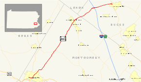
Map of northern Montgomery County and western Bucks County with PA 663 highlighted in redRoute information Maintained by PennDOT Length: 22.67 mi[2] (36.48 km) Existed: by 1930[1] – present Major junctions South end:  PA 100 in Pottstown
 I-476 / Penna. Tpk. near Quakertown
North end: 
 PA 309 / PA 313 in Quakertown
Location Counties: Bucks, Montgomery Highway system Roads in Pennsylvania
Interstate • US • State • Legislative←  PA 662
PA 664  →
→Pennsylvania Route 663 (PA 663) is a 22.98-mile (36.98 km) long state highway in Bucks and Montgomery counties in southeast Pennsylvania. Its northern terminus is at PA 309 and PA 313 in Quakertown, where it continues eastward as PA 313, and its southern terminus is at PA 100 in Pottstown. Along the way, PA 663 also passes through the town of Pennsburg. It is called John Fries Highway between Pennsburg and Quakertown. It has its own interchange with the Northeast Extension of the Pennsylvania Turnpike at exit 44 west of Quakertown. The route was assigned in 1930, and it has had several realignments since its commissioning, including two major ones.
Contents
Route description
Pottstown to Hoffmansville
PA 663 begins at an intersection on PA 100 in Pottstown. The route progresses eastward, passing to the south of Memorial Park and crossing over the Manatawny River. At Manatawny Street, PA 663 goes from the moniker of West King Street to King Street and continues as a borough street. The highway passes north of the Pottstown Borough Hall and turns onto North Charlotte Street soon after. The route turns to the northeast, passing Pottstown Cemetery's eastern segment. The highway continues through the rest of the town as North Charlotte Street. As PA 663 begins to leave Pottstown, the surroundings become less populated. Just north of the borough line, Orlando Road, which split off in Pottstown, merges back in. About a mile north, PA 663 intersects with a road that connects to a housing complex.[2]
Just farther up the road, there is another housing complex, which connects to Buchert Road. North of the housing complexes, the road becomes less populated, with homes and fields surrounding the highway. PA 663 intersects with the Swamp Pike soon after. The route continues into the lowlands of Montgomery County, where it retains the North Charlotte Street moniker. However, the name changes as soon as the highway becomes concurrent with PA 73 (Big Road). During the concurrency, PA 663 and PA 73 cross a river (as Big Road) and split. No longer on PA 73, PA 663 continues to the northeast, using the street moniker of Layfield Road. The population that had surrounded the highway south of PA 73 is gone, and the route heads northeastward, where it passes several fields. There is a small bounce in population when PA 663 enters Hoffmansville. However, PA 663 leaves Hoffmansville and continues back into the rural area.[2]
Hoffmansville to Quakertown
Continuing to the northeast, PA 663 intersects with Schultz Road, which is a connector to Pleasant Run Park, a local park in New Hanover Township. The highway heads through some light forest and enters the municipality of Pleasant Run soon after. The route leaves quickly for Halegrass, a more populated municipality, and some homes are found along the highway. PA 663 continues northward, using Layfield Road into Green Lane Reservoir Park. The route then crosses the reservoir soon after on two causeways (each with a small bridge) and a hilly island between them, where PA 663 crosses Kutztown Rd. While following the reservoir, PA 663 passes some homes. To the west, there is an intersection with Montgomery Avenue, which connects to a housing complex. The route, however, continues into Pennsburg, where the highway becomes populated once again.[2]
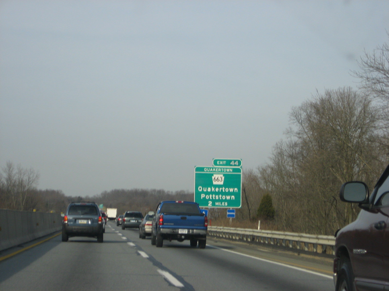
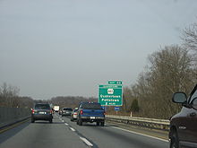 Two mile sign for Exit 44 on Interstate 476 (Northeast Extension) leading to PA 663
SR 663 continues into Pennsburg, intersecting with PA 29. However, not far after the intersection with PA 29, PA 663 leaves Pennsburg and gains the John Fries Highway moniker. The route continues northeastward, passing the Holy Cross Cemetery. The population that once surrounded the highway is now gone, and the route continues steadily eastward, intersecting with Geryville Pike. North of Geryville Pike, there is a small stretch where signs of an aborted widening project can be found, including rock cuts and guard rails that are rather far from the right-of-way. The route progresses into Mumbauersville, and continues to the northeast. PA 663 continues into Milford Township, where it interchanges with Interstate 476 (I-476), or the Pennsylvania Turnpike's Northeastern Extension. A park and ride is to the south of the interchange ramps, and the route continues eastward (although the highway is signed as north/south) into farther parts of Milford Township.[2]
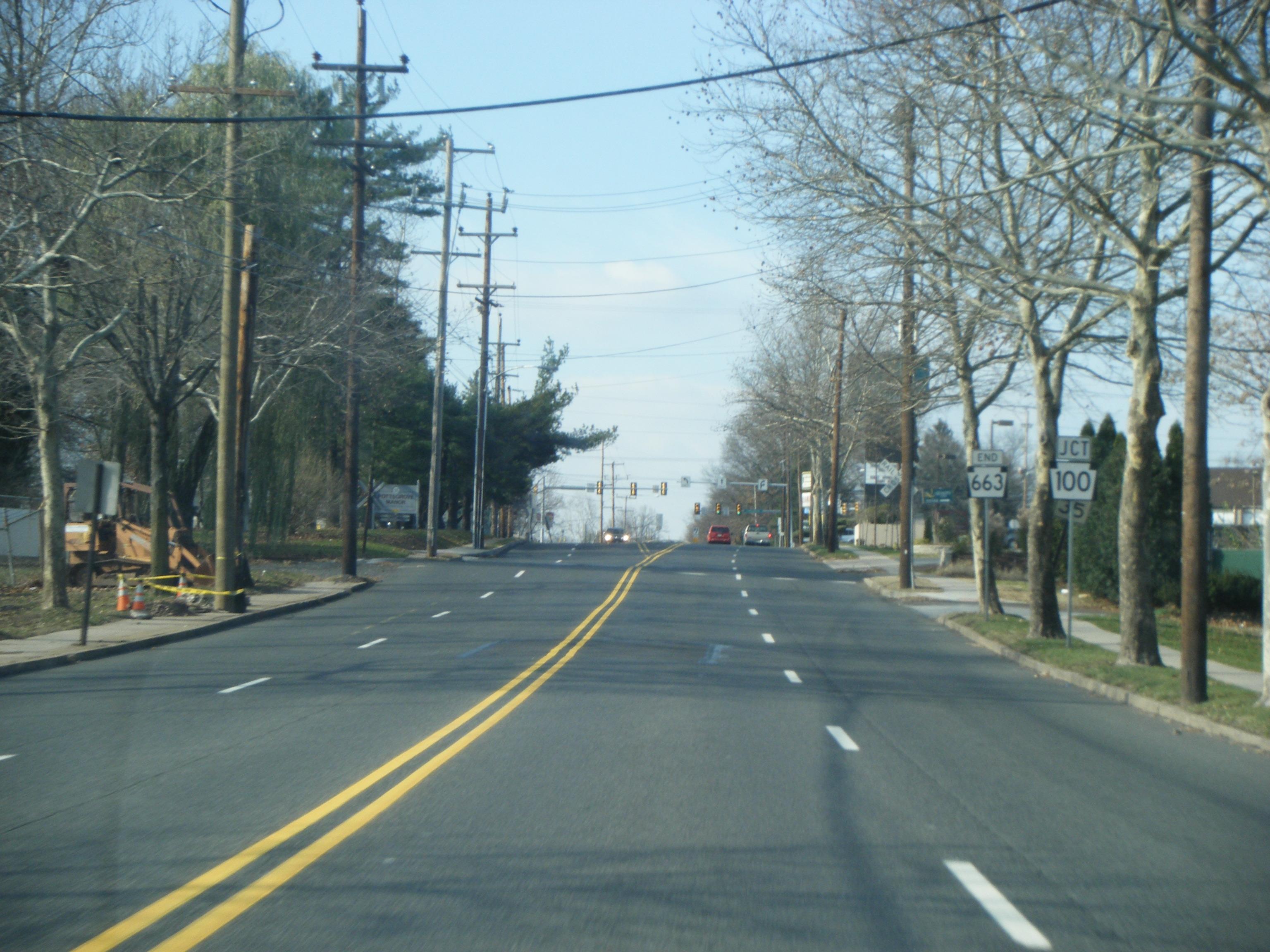
The route leaves Milford Township after passing through Milford Square, a small village in the township. To the south of PA 663 are buildings and to the north are fields and trees. The highway enters Quakertown, and the area becomes more populated once again. After the intersection with Old Bethlehem Pike, PA 663 terminates at an intersection with PA 309 and PA 313.[2]
History
PA 663 was once part of the Steinsburg and Milford Square Turnpike. The turnpike was chartered in March 1858.[3] The "PA 663" designation first appeared on maps in 1930.[1] At that time, the northern terminus of PA 663 was at the PA 73 intersection with New Hanover Township, although that was changed in 1936. In 1936, PA 663 was extended to an intersection with PA 309 and PA 313 in Quakertown.[4] In 1950, the segment of PA 663 from Spinnerstown to Milford Square was given pavement.[5] After construction began in 1973, a new alignment of PA 663 from Pennsburg to the Northeast Extension opened a year later.[6][7]
Major intersections
County Location Mile[2][8] Destinations Notes Montgomery Pottstown 0.00 PA 100 (Pottstown Pike)New Hanover Township 7.4  PA 73 west (Big Road)
Southern terminus of concurrency. 7.7 PA 73 east (Big Road)Northern terminus of concurrency. Pennsburg 14.4  PA 29 (Main Street)
Bucks Milford Township 19.2 I-476 / Penna. Tpk.Exit 44 (I-476/PA Turnpike). 20.4 Allentown Road Quakertown 22.67 PA 309 (Bethlehem Pike) / PA 313 east (West Broad Street)Western terminus of PA 313. 1.000 mi = 1.609 km; 1.000 km = 0.621 mi References
- ^ a b Pennsylvania Department of Highways (1930). Map Showing Pennsylvania State Highways (Map).
- ^ a b c d e f g Yahoo! Inc. Yahoo! Maps – overview map of PA 663 (Map). Cartography by NAVTEQ. http://maps.yahoo.com/#mvt=h&lat=40.444339&lon=-75.360563&zoom=18&q1=RT-663%2C%20PA&q2=40.442881%2C-75.358352&w0=40.246368200877185%2C-75.6473708152771%3B40.26829488509456%2C-75.62475442886352. Retrieved 2008-10-01.
- ^ Calvin Gustavus Beitel (1874). A Digest of Titles of Corporations Chartered by the Legislature of Pennsylvania, Between the Years 1700 and 1873 Inclusive: Giving the Dates of Acts of Incorporation, with the Several Supplements Thereto, with a Reference to the Pages of the Pamphlet Laws, where They May be Found. J. Cambbell & son. p. 439. http://books.google.com/books?id=Zr0ZAAAAYAAJ&pg=PA437&dq=Olean+Plank+Road&ei=b8bfSJWyEYzAzATpuMmVDw#PPA439,M1. Retrieved 2008-10-01.
- ^ Pennsylvania Scenic and Historic Commission (1936). Carefree Holidays About You in Pennsylvania (Map).
- ^ Pennsylvania Department of Highways (1950). Official Road Map of Pennsylvania (Map).
- ^ Pennsylvania Department of Transportation (1973). Pennsylvania Official Transportation Map (Map).
- ^ Pennsylvania Department of Transportation (1974). Pennsylvania Official Transportation Map (Map).
- ^ DeLorme (2008). Street Atlas (Map). Cartography by DeLorme.
External links
Road transportation infrastructure of the metro Philadelphia area Interstates U.S. Routes Pennsylvania Routes New Jersey Routes Delaware Routes Named roads/streets Benjamin Franklin Parkway · Broad Street · City Avenue · Front Street · Girard Avenue · Market Street · Roosevelt Boulevard · South Street · Chestnut Street · Walnut Street
Pennsylvania Turnpike · New Jersey Turnpike · Delaware Turnpike · Atlantic City Expressway · Schuylkill Expressway · Delaware Expressway · Blue Route · Vine St Expressway · North South Freeway · Lancaster Avenue · Bethlehem Pike · Baltimore Pike · Black Horse PikeBridges Delaware Memorial Bridge · Commodore Barry Bridge · Walt Whitman Bridge · Ben Franklin Bridge · Betsy Ross Bridge · Tacony–Palmyra Bridge · Burlington–Bristol Bridge · Delaware River – Turnpike Toll BridgeCategories:- State highways in Pennsylvania


Wikimedia Foundation. 2010.