- Pennsylvania Route 662
-
PA Route 662

Route information Maintained by PennDOT Length: 26 mi[1] (42 km) Existed: 1930 – present Major junctions South end:  US 422 in Douglassville
 US 222 in Richmond Township
North end:  PA 61 in Shoemakersville
Location Counties: Berks Highway system Roads in Pennsylvania
Interstate • US • State • Legislative←  PA 660
PA 663  →
→Pennsylvania Route 662 is a 26-mile (42 km) long road located in eastern Pennsylvania. Its northern terminus is at Pennsylvania Route 61 in Shoemakerville and its southern terminus is at U.S. Route 422 in Douglassville. The entire route is in Berks County. The portion north of PA 73 is also known as Moselem Springs Road and the portion south of it is also known as Memorial Highway.
Route description
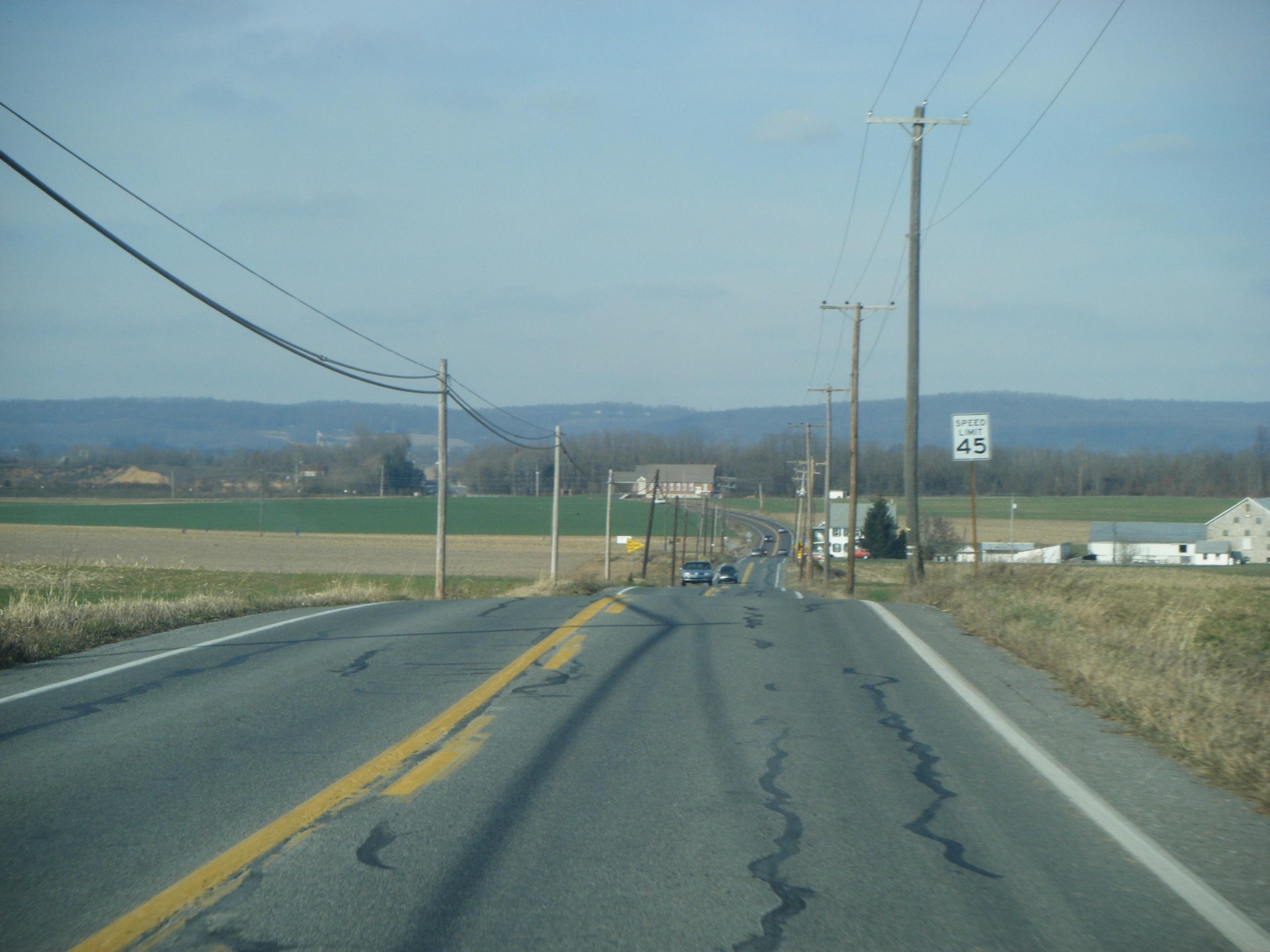
 PA 662 northbound in Oley Township.
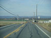
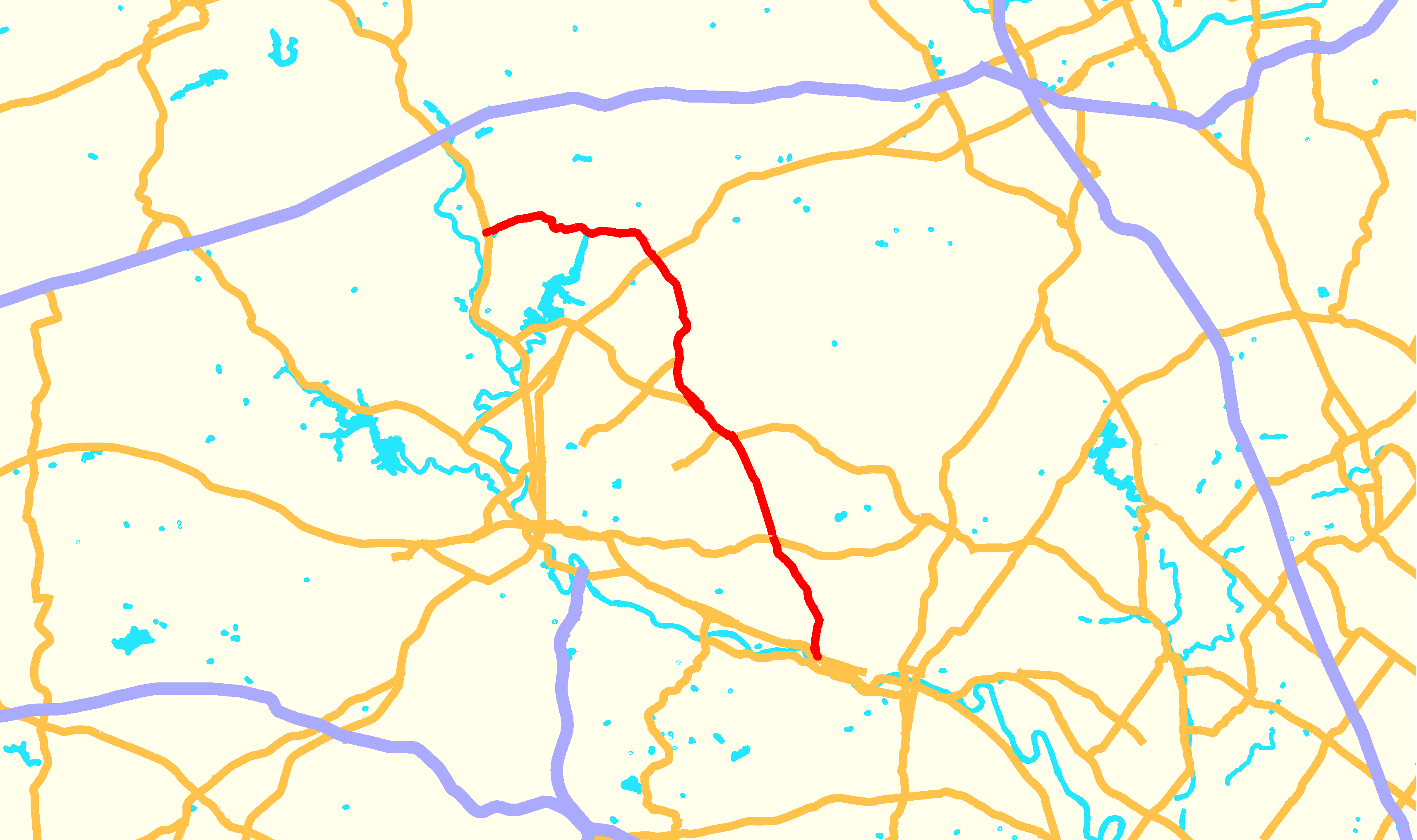
PA 662 begins at an intersection with US 422 in the community of Douglassville in Amity Township, Berks County. The road heads to the north on two-lane undivided Old Swede Road, passing residential neighborhoods to the west and industrial development to the east. The route passes more homes as it turns northwest and passes through the community of Amityville. Past Amityville, PA 662 enters more agricultural surroundings with a few residences. In Yellow House, the road crosses PA 562 and enters Oley Township, where the name of the road becomes Memorial Highway. The route heads north-northwest through farmland before reaching an intersection with PA 73 in the community of Oley. At this point, PA 662 forms a concurrency with PA 73 by turning northwest onto that road. The two routes pass a few businesses in Oley before heading into areas of farms and woods.[2][3]
PA 662 splits from PA 73 by making a turn to the north. Immediately following, the route makes a left turn and enters Ruscombmanor Township. The road heads northwest and then north over a wooded mountain prior to coming to the community of Pricetown. In this area, the road passes a few homes and businesses at the intersection with the eastern terminus of PA 12. Past this area, PA 662 crosses over wooded South Mountain, where there are a few homes. After crossing the mountain, the route heads north into Fleetwood, where it becomes South Richmond Street and passes through residential areas. After crossing Norfolk Southern's Reading Line, the route turns east onto West Main Street and enters the commercial downtown of Fleetwood. A short distance later, PA 662 turns north onto North Franklin Street, passing more homes. The road leaves Fleetwood for Richmond Township, at which point the name becomes Moselem Springs Road. PA 662 heads northwest through agricultural areas prior to reaching the intersection with US 222 in the community of Moselem Springs.[2][3]
Following this intersection, the route heads through more farmland prior to reaching the southern terminus of PA 143. At this point, PA 662 turns west into woodland, crossing the Maiden Creek into Perry Township. Upon entering Perry Township, the road heads into farmland, making a few sharp turns to the north before heading to the west. PA 662 passes through agricultural areas with some homes before coming to its northern terminus at PA 61 in Shoemakersville.[2][3]
Major intersections
The entire route is in Berks County.
Location Mile Destinations Notes Douglassville 0.00 US 422 (Benjamin Franklin Highway)Amity Township  PA 562 (Boyertown Pike)
Amity/Oley township line. Oley Township  PA 73 (Philadelphia Avenue)
Eastern terminus of concurrency. PA 73 (Blandon Road)Hamlet of Oley. Western terminus of concurrency. Ruscombmanor Township  PA 12 (Pricetown Road)
Eastern terminus of PA 12. To the Warren Street Bypass. Richmond Township US 222 (Kutztown Road) PA 143 (Hard Hill Road)
Southern terminus of PA 143. To I-78/US 22. Shoemakersville PA 61 (Pottsville Pike)To I-78/US 22. 1.000 mi = 1.609 km; 1.000 km = 0.621 mi References
- ^ Pennsylvania Highways - Pennsylvania Route 662
- ^ a b c Google, Inc. Google Maps – overview of Pennsylvania Route 662 (Map). Cartography by Google, Inc. http://maps.google.com/maps?f=d&source=s_d&saddr=US+422+and+PA+662&daddr=40.4249625,-75.8228563+to:PA+61+and+PA+662&hl=en&geocode=FUZKZgIdDoJ8-ykpnptCb33GiTFdWYp4RAJ0Rw%3BFQLWaAId-Ah7-ymPQ13HbNbFiTFE14hTjoBy6Q%3BFXsEagIdFON4-ykL40Wz2NvFiTHqpH_AdLxg7w&mra=ls&sll=40.683339,-75.759444&sspn=0.01497,0.042272&ie=UTF8&ll=40.382121,-75.859222&spn=0.477017,1.352692&t=h&z=10&via=1. Retrieved 2010-11-25.
- ^ a b c PennDOT (2010). Berks County, Pennsylvania Highway Map (Map). ftp://ftp.dot.state.pa.us/public/pdf/BPR_pdf_files/Maps/GHS/Roadnames/berks_GHSN.PDF. Retrieved 2010-11-25.
Categories:- State highways in Pennsylvania

Wikimedia Foundation. 2010.