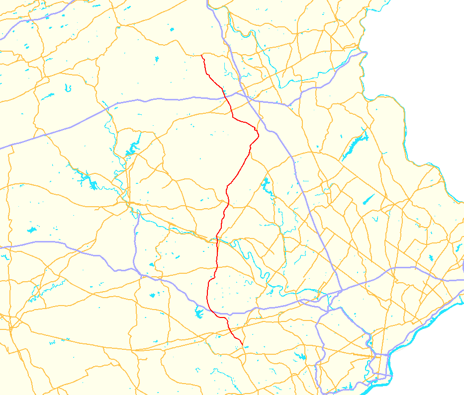
- Pennsylvania Route 100
-
PA Route 100

Route information Maintained by PennDOT Length: 58.8 mi[1] (94.63 km) Major junctions South end:  US 202 in West Chester
 US 30 at Exton

 I-76/PA Tpk. near Lionville
 US 422 near Pottstown
 US 222 near Lower Macungie

 I-78/US 22 near Breinigsville
North end:  PA 309 in Pleasant Corners
Location Counties: Chester, Montgomery, Berks, Lehigh Highway system Roads in Pennsylvania
Interstate • US • State • Legislative←  PA 99
PA 99PA 101  →
→←  US 62
US 62
PA 63  →
→Pennsylvania Route 100 is a state highway in the U.S. state of Pennsylvania that runs from U.S. Route 202 in West Chester, Pennsylvania to Pennsylvania Route 309 in Pleasant Corners, Pennsylvania.
The highway replaced Pennsylvania Route 62 in the 1930s, although most spur routes of PA 62 still retain their numbers.
Contents
Route description
Chester County
PA 100 begins as an expressway in West Goshen Township north of West Chester at an interchange with U.S. Route 202. Only northbound lanes of US 202 have access to PA 100, and only PA 100 southbound has access to South US 202. In 2008, this section went under a $9.9 million resurfacing project to replace the badly deteriorated original concrete surface with asphalt. In West Whiteland Township, the expressway ends when PA 100 meets its old alignment that is called Pottstown Pike that was decommissioned in 2003. It then passes under U.S. 30/Exton Bypass at an interchange in the southern portion of Exton.
Just north of the US 30 interchange in the center of Exton, PA 100 intersects U.S. 30 Business also known as Lincoln Highway. In Uwchlan Township, PA 100's next major intersection is with Pennsylvania Route 113, connecting Downingtown and Phoenixville. Less than a mile north of PA 113, PA 100 intersects Interstate 76 the Pennsylvania Turnpike at the Downingtown exit (312). In West Vincent Township, PA 100 meets PA 401 in the village of Ludwigs Corner.
It's designated north into South Coventry Township meeting Pennsylvania Route 23 in the village of Bucktown. About a mile south of Pottstown, PA 100 meets Pennsylvania Route 724 at an interchange. In North Coventry Township, PA 100 meets U.S. Route 422 also known as the Pottstown Expressway. US 422 and PA 100 meet at a full Cloverleaf interchange.
Eagle Bypass
The Eagle Bypass is an alternative to current Pennsylvania Route 100 through the area near Eagle, PA. Graphite Mine Road, when completed, was originally anticipated to be a new alignment to Route 100 through Eagle. In August 2009 the southern half of the road opened, finally completing the roadway through the area (the northern half had been completed and opened since June 2005). To the surprise of many in the area PA 100 has remained on its former alignment (Pottstown Pike) through the village center. Traveling Northbound on PA 100 past the Turnpike, the roadway's layout is designed to make Graphite Mine Road appear as the default straight ahead road. While signage points drivers into a left turn lane to continue on PA-100/Pottstown Pike North at the newly constructed intersection. As for the northern Pottstown Pike/Graphite Mine Rd intersection on the opposite side of town, travelers on Route 100 South find PA-100/Pottstown Pike as the straight ahead route still, although there is a text sign just before the intersection that reads, "Graphite Mine Road to PA-100 South: Keep Left." As of June 2010 it is still unclear whether PENNDOT plans to keep 100 on its current alignment or move it to the new roadway.
Montgomery County
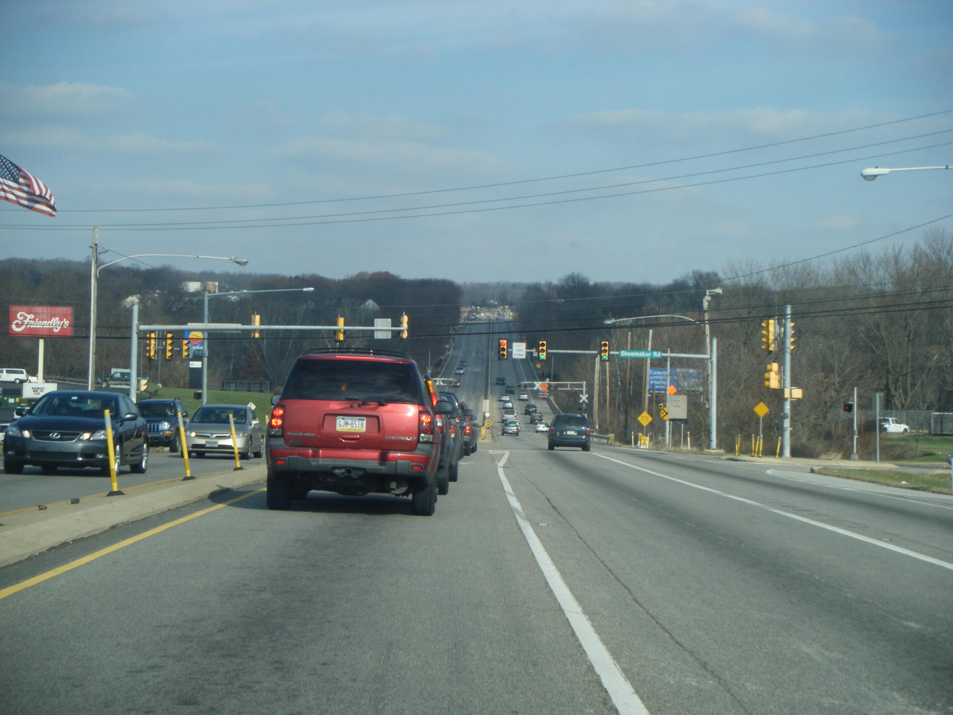
 PA 100 northbound at Shoemaker Road in Pottstown
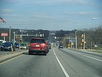
After crossing the Schuylkill River, PA 100 enters Montgomery and the town of Pottstown. At the southern tip of Pottstown, PA 100 intersects the southern terminus of Pennsylvania Route 663. North of Pottstown, PA 100 is multilaned and divided road with some exits but not at limited-access level. One of those exits is in Douglass Township when PA 100 meets Pennsylvania Route 73 at a Diamond interchange.
Berks County
North of the PA 73 interchange, PA 100 returns to a two laned local road in Berks County. In Berks County, PA 100 passes through the towns of Bechtelsville and Bally. PA 100 becomes Main Street in Bally. In Hereford Township Just north of Bally, PA 100 begins a long concurrency with Pennsylvania Route 29 into Lehigh County.
Lehigh County
PA 100 enters Lehigh County on a concurrency with Pennsylvania Route 29. As PA 100/PA 29 enter Lehigh County, the road is known as Chestnut Street. In Upper Milford Township marks the northern terminus of the concurrency with Pennsylvania Route 29. As of July 1, 2011, PennDOT created a truck route to bypass the sharp curves on PA 100. The truck route begins at the intersection with PA 29 and runs concurrent with it. It then turns to the west along Buckeye Road before rejoining PA 100 in Macungie.[2] Northwest of the concurrency with PA 29, PA 100 is called Kings Highway. PA 100 enters Macungie as Main Street. A mile south of Trexlertown, PA 100 becomes a newly formed 4 lane divided highway around Trexlertown called Trexlertown Bypass. The Highway was completed on 2005 and the US 222 segment was completed in 2007.
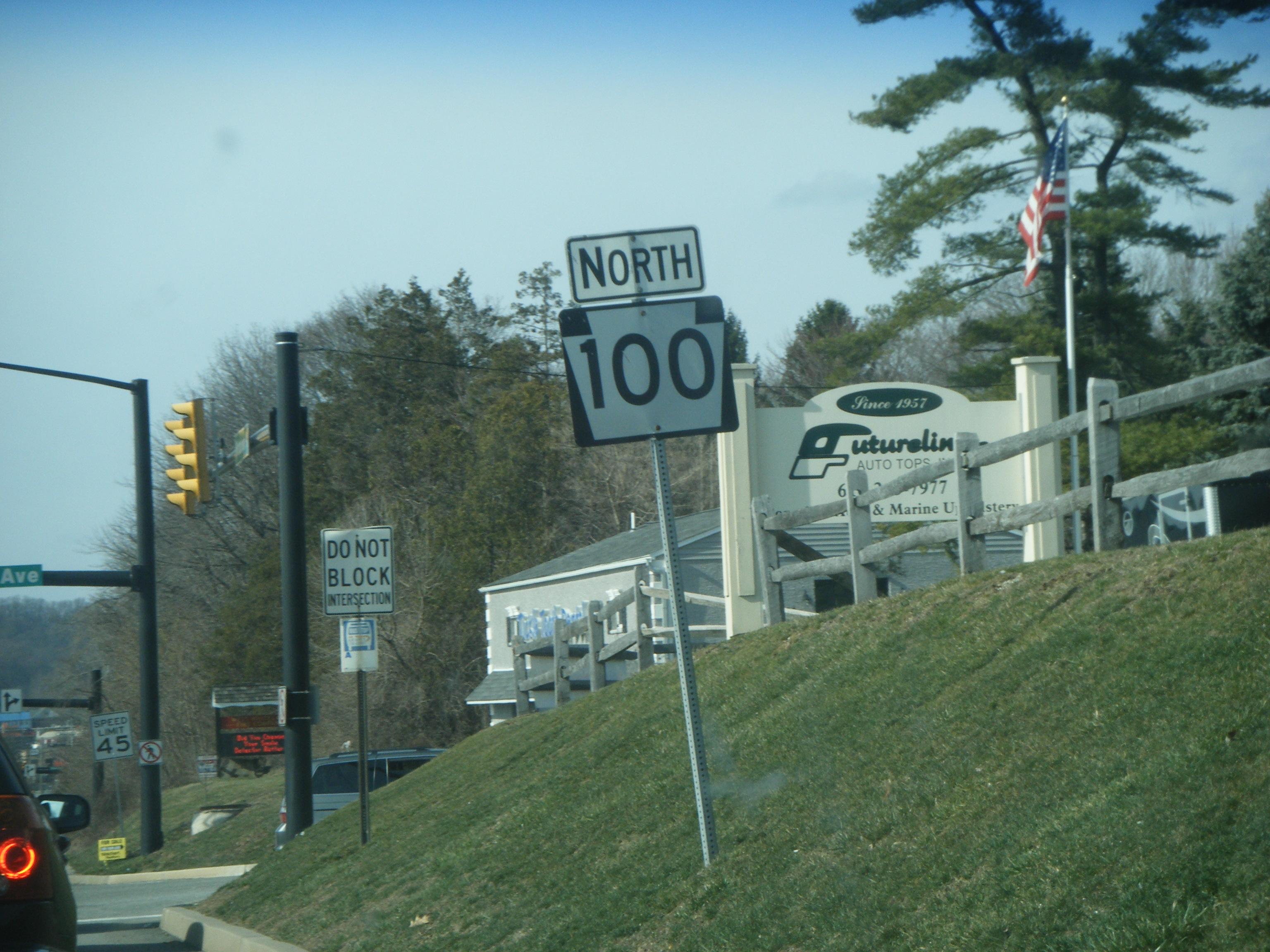
In Upper Macungie Township, PA 100 intersects U.S. Route 222 at an interchange. US 222 merges with PA 100 on the eastern segment of the highway. North of Trexlertown, PA 100 passes by an area with a lot of factories and companies like Nestle and Shop Rite. in Fogelsville, PA 100 intersect Interstate 78 and U.S. Route 22 at exits 49A-B north of the industrial area. North of the I-78 interchange, PA 100 meets Tilghman Street/Main Street the former segment of US 22. For more than 10 miles (16 km) north of the I-78 interchange, PA 100 is a two-laned local road running through many farms and rivers. In Heidelberg Township, PA 100 terminates (ends) at a "T" intersection with Pennsylvania Route 309.
History
PA 100 was originally signed as Pennsylvania Route 62, for its entire length. By 1940, PA 100 was commissioned although the PA 62 spurs of PA 162, PA 262, PA 562, and PA 662 still remained.
Before 2003, south of Exton, PA 100 used to continue south along Pottstown Pike towards West Chester; the connector expressway (to US 202) split from it just south of Exton. Once PA 100 entered West Chester it became High Street, the main north–south artery route through the town, and it picked up a concurrency with Business U.S. 322. Several blocks north of West Chester University it turned right onto Price Street, leaving the US 322 Business concurrency picking up the beginning of PA 52. At the Brandywine Picnic Park in Pocopson it forked to the left onto Creek Road, leaving the PA 52 concurrency. It continued south winding through southern Chester and Delaware Counties following the Brandywine Creek into Delaware, with a very short wrong-way concurrency with U.S. 1/Baltimore Pike, then becoming Delaware Route 100. The alignment was changed due to local complaints about long-distance and freight traffic mistakenly traveling through West Chester via High Street to get to US 202 towards Delaware on the south side of West Chester, instead of the more appropriate path of travel along the spur to US 202 that matches the current alignment of PA 100. The old alignment of PA 100 south of Exton to the Delaware border is still driveable, although there was a slight traffic-pattern change northbound just before US 1 so that northbound traffic would have a traffic light, not a stop sign (this eliminates the northbound wrong-way concurrency with US 1 southbound).
In 2007, The Jaindl Highway (Trexlertown Bypass) opened and rerouted Route 100 onto the western loop instead of continuing on Trexlertown Road through Trexlertown.
Major intersections
County Location Mile[1] Destinations Notes Chester West Goshen Township 0.0 US 202 southInterchange West Whiteland Township 2.2 Pottstown Pike Interchange, former routing of PA 100 2.8 US 30 (Exton Bypass)Interchange 3.4 
US 30 Bus. (Lincoln Highway)Uwchlan Township 6.4  PA 113 (Uwchlan Avenue)
7.3 I-76 / Penna. Tpk.Exit 312 (Downingtown Exit) (I-76/PA Turnpike). 8.4 Graphite Mine Road Southern terminus of Eagle Bypass. 9.3 Graphite Mine Road Northern terminus of Eagle Bypass. West Vincent Township 11.3  PA 401 (Conestoga Road)
South Coventry Township 16.1  PA 23 (Ridge Road)
North Coventry Township 20.3  PA 724 (Schuylkill Road)
Interchange 20.7 US 422Interchange Montgomery Pottstown 21.2  PA 663 (West King Street)
Southern terminus of PA 663 Douglass Township 27.3  PA 73 (East Philadelphia Avenue)
Interchange Berks Hereford Township 37.1  PA 29 south (Gravel Pike)
Southern terminus of concurrency Lehigh Upper Milford Township 41.2 PA 29 north (Chestnut Street)Northern terminus of concurrency Trexlertown Weilers Rd Access to Hamilton Blvd. At-grade intersection. US 222 south (Hamilton Boulevard) – Kutztown, ReadingSouthbound exit. Southern terminus of US 222 concurrency. Grim Road/Mosser Road At-grade intersection. US 222 north (Frederick J. Jaindl, Jr. Memorial Highway) – AllentownPA 100 Northbound exit. North end of US 222 concurrency. US 222 continues to Allentown. Upper Macungie Township 50.4 I-78 / US 22Exit 49 (I-78/US 22). Heidelberg Township 58.8 PA 309 (Appalachian Thruway)1.000 mi = 1.609 km; 1.000 km = 0.621 mi References
- ^ a b DeLorme Street Atlas USA 2007 software
- ^ http://lowermacungie.patch.com/articles/penndot-updates-truck-signs-in-macungie
External links
Road transportation infrastructure of the metro Philadelphia area Interstates U.S. Routes Pennsylvania Routes New Jersey Routes Delaware Routes Named roads/streets Benjamin Franklin Parkway · Broad Street · City Avenue · Front Street · Girard Avenue · Market Street · Roosevelt Boulevard · South Street · Chestnut Street · Walnut Street
Pennsylvania Turnpike · New Jersey Turnpike · Delaware Turnpike · Atlantic City Expressway · Schuylkill Expressway · Delaware Expressway · Blue Route · Vine St Expressway · North South Freeway · Lancaster Avenue · Bethlehem Pike · Baltimore Pike · Black Horse PikeBridges Delaware Memorial Bridge · Commodore Barry Bridge · Walt Whitman Bridge · Ben Franklin Bridge · Betsy Ross Bridge · Tacony–Palmyra Bridge · Burlington–Bristol Bridge · Delaware River – Turnpike Toll BridgeTransportation infrastructure of the Lehigh Valley Interstates U.S. Routes Pennsylvania Routes New Jersey Routes County Routes Named roads/streets Bridges Albertus L. Meyers Bridge · Hill to Hill Bridge · Philip J. Fahy Memorial Bridge · Minsi Trail Bridge · Easton–Phillipsburg Toll Bridge · Northampton Street Bridge · Interstate 78 Toll Bridge
Tunnels Public transportation Lehigh and Northampton Transportation Authority (Bethlehem Loop) · Trans-Bridge Lines · NJ Transit
Airports Waterways Rail Categories:- Lehigh Valley
- State highways in Pennsylvania

Wikimedia Foundation. 2010.