- Pennsylvania Canal (Delaware Division)
-
Delaware Division of the Pennsylvania Canal
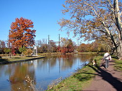

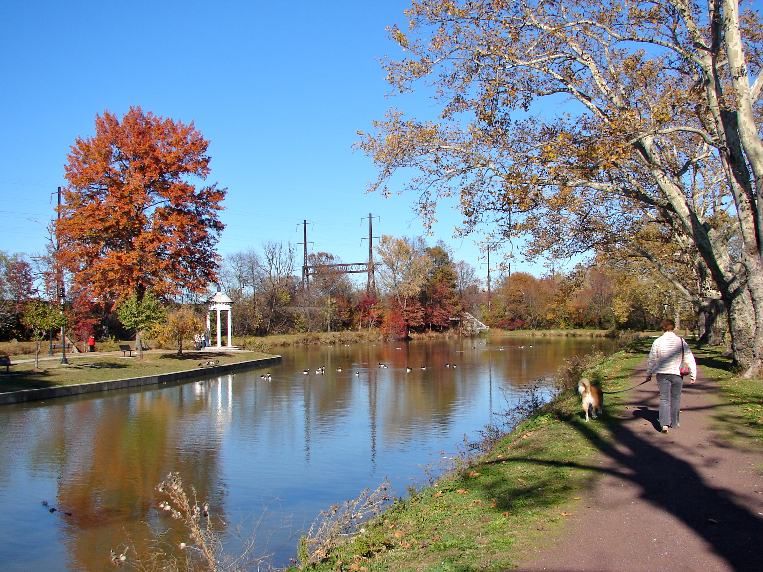
Location: Easton, Pennsylvania Coordinates: 40°41′17″N 75°12′18″W / 40.68806°N 75.205°WCoordinates: 40°41′17″N 75°12′18″W / 40.68806°N 75.205°W Built: 1831 Governing body: State MPS: Covered Bridges of the Delaware River Watershed TR (AD) NRHP Reference#: 74001756[1] Added to NRHP: October 29, 1974 The Delaware Division of the Pennsylvania Canal, more commonly called the Delaware Canal, runs from the Lehigh River at Easton (home of The National Canal Museum) south to Bristol. The canal is parallel to the Delaware River, and generally within sight of the river.
The Commonwealth of Pennsylvania built the Delaware canal as part of its Main Line of Internal Improvements to carry anthracite coal, limestone, cement, and lumber from the northeastern reaches of Pennsylvania to Philadelphia. The Pennsylvania Canal system was spurred by the success of the Erie Canal in New York State, which had opened in 1825.
The Delaware Canal originally was 60 miles (96.6 km) in length. Width is approximately 5 feet (1.5 m) and depth is approximately 3 feet (91.4 cm) Construction, which was done entirely with hand tools using primarily imported labor from Ireland, started in 1829. The state sold the canal to the Lehigh Coal and Navigation Company in 1858.
But competition from the railroad led to a decline in barge traffic. By the 1920s, anthracite coal was waning as a source of fuel. The last commercial through traffic traveled the canal in October 1931 and the bankrupt Lehigh Coal and Navigation Company sold the canal back to the state for a nominal fee.
In 1933, a private group called The Delaware Valley Protective Association[2] (DVPA) was founded to protect the canal as a historic asset. The DVPA persuaded the state to resume maintenance of the canal in 1940, when its towpath became Theodore Roosevelt State Park. The berms were restored and the canal was refilled with water.
Through the 1940s and 1950s, the canal was left mostly untouched. In the early 1960s, however, Pennsylvania officials explored plans to pave over the canal and create a road for cars. Local residents fought for the canal's protection. In 1964, Bucks County historian and DVPA member Willis M. Rivinus wrote the first Guide to the Delaware Canal[3] to call attention to the canal's value.
Through the 1960s and 1970s, the DVPA and other influential citizens sought to secure federal landmark status to protect the Canal. In 1974, the Canal was placed on the National Register of Historic Places. In 1976, it was designated a National Historic Landmark[4], helping to guarantee its preservation. The towpath itself was named an official National Recreation Trail.
In 1988, the U.S. government created the Delaware and Lehigh National Heritage Corridor, covering a 165-mile north-south swath of eastern Pennsylvania that includes the Delaware Canal[5]. In 1989, Theodore Roosevelt State Park was renamed Delaware Canal State Park.
However, public funding for the canal often has been inadequate and, as in other parts of the country, private non-profit groups have been created to fill the void. In 1983, Bucks County resident Betty Orlemann organized the Friends of the Delaware Canal (FODC)[6], now the canal's largest fund-raising and volunteer group. (The DVPA no longer exists). Under long-time executive director Susan Taylor, the FODC also functions as a watchdog group, ensuring goals are to met to make the towpath trail walkable over its entire length and to eventually get the canal fully watered from Easton to Bristol.
Portions of the Delaware Canal towpath were washed away or damaged during successive floods in 2004, 2005 and 2006. A number of sections of the towpath were closed and impassable, including a long stretch north of Washington Crossing and sections south of Riegelsville. In February 2008, a section of the towpath collapsed and 23 miles of the Canal lost water.[7]
Through funds from the Federal Emergency Management Agency, the Pennsylvania Department of Conservation and Natural Resources (PA DCNR) currently is refurbishing the washed out sections of the canal [8]. As of October 2009, according to Delaware Canal State Park manager Rick Dalton, 75% of the towpath has been restored and it is expected to be fully walkable by summer of 2010.
Contents
Mule barge tourist ride
Mule-drawn barges, operated by several private concessionaires over the years, provided rides for chartered private parties running from a landing at Lock #11 at New Hope north to a point about 1.5 miles (2.4 km) above Centre Bridge, for a total one-way ride length of 4.5 miles (7.2 km). These private parties included weddings, company parties and birthday parties.
Tourist rides were also offered, however, they stopped in the vicinity of the Rabbit Run bridge, which carries PA 32 over the canal, about 1 mile (1.6 km) north of Lock #11, which was restored circa 2005. These rides were offered from approximately 1955 to 2004. Each boat could transport between 55–80 passengers and were pulled by two mules.
Four boats, the Americana (painted red, white & blue), the Independence (painted blue), the Liberty (painted red) and the Spirit of New Hope (painted orange) were used from the inauguration of the tourist ride until a change of concessionaires was made prior to the 1997 season, as the usual ten-year contract had expired. Each of the largest three boats, made of steel and wood, displaced approximately 15 short tons empty. The Spirit of New Hope was smaller than the other three boats and was used for small chartered parties.
Two new boats, the Molly Pitcher and the Myfanwy Jenkins (pronounced "Mivanway"), were built in the winter of 1996–97 to replace the four formerly used, as the old boats were not included in the transfer of the concession. They were made of aluminum and recycled plastic lumber, both painted red with black trim, and displaced approximately 3 short tons empty.
A musician who also told the history of the canal was often on board.
It is unlikely that these rides will return to the canal, as maintenance has been limited to areas not used for barge traffic by DCNR, which is the state agency responsible for the operation of the canal. Barge ride employees jokingly referred to DCNR by two acronyms – the polite version being "Delaware Canal Needs Restoration". The "historically-authentic, canaller version" was "Damn Canal Needs Repair".
Also, since 1997, operation of the barges have been under onerous regulations by the U.S. Coast Guard (for example, steersmen on a 3 miles per hour (4.8 km/h) animal-drawn boat are required to obtain a Master Mariner's license)[POV? ] and, if reopened, would face regulations imposed in 2009 on its sister operation on the Lehigh Canal in Easton, PA by the U.S. Department of Homeland Security for crew members in "sensitive shipboard and dockside locations".[9]
See also
- Lehigh Canal – A sister canal in the Lehigh Valley that fed coal traffic to the Delaware Canal via a connection in Easton, Pennsylvania.
- Delaware and Raritan Canal – A New Jersey canal connection to the New York market across the Delaware River.
- Chesapeake and Delaware Canal – A canal crossing the Delmarva Peninsula in the states of Delaware and Maryland, connecting the Chesapeake Bay with the Delaware Bay.
External links
- Delaware Canal Photos
- PA DCNR Delaware Canal State Park
- Delaware Canal History
- Friends of the Delaware Canal
References
- ^ "National Register Information System". National Register of Historic Places. National Park Service. 2007-01-23. http://nrhp.focus.nps.gov/natreg/docs/All_Data.html.
- ^ http://74.125.93.132/search?q=cache:0n14xVmyZ70J:www.dcnr.state.pa.us/stateParks/parks/delawarecanal/landuse/u1lesson10lp.doc+delaware+valley+protective+association&cd=9&hl=en&ct=clnk&gl=us
- ^ Guide to the Delaware Canal, Willis M. Rivinus, photographs by Louis Comfort Tiffany, Route maps by Edith C. Smith, New Hope, PA, 1964, 1967, 1972, 1978, 1984, 1989, 1993, 2004
- ^ http://www.nps.gov/history/nhl/designations/Lists/PA01.pdf
- ^ The Complete Guide to the Delaware and Lehigh National Heritage Corridor, Lehigh River Foundation, Bethlehem, PA, 1994
- ^ www.fodc.org
- ^ http://infoaboutdelaware.com/general-news/23-miles-of-delaware-canal-loses-water-in-towpath-collapse-wilkes-barre-times-leader
- ^ http://www.nj.com/mercer/index.ssf/2009/03/canal_work_flows_along.html
- ^ The Morning Call article on requirements by the Transportation Security Administration
Transportation infrastructure of the Lehigh Valley Interstates U.S. Routes Pennsylvania Routes New Jersey Routes County Routes Named roads/streets Bridges Albertus L. Meyers Bridge · Hill to Hill Bridge · Philip J. Fahy Memorial Bridge · Minsi Trail Bridge · Easton–Phillipsburg Toll Bridge · Northampton Street Bridge · Interstate 78 Toll Bridge
Tunnels Public transportation Lehigh and Northampton Transportation Authority (Bethlehem Loop) · Trans-Bridge Lines · NJ Transit
Airports Waterways Lehigh Canal · Delaware Division of the Pennsylvania Canal · Lehigh River · Delaware River · Monocacy Creek · Little Lehigh Creek · Jordan Creek
Rail Categories:- Historic districts in Pennsylvania
- Canals in Pennsylvania
- National Historic Landmarks in Pennsylvania
- Canals on the National Register of Historic Places
- Transportation in Northampton County, Pennsylvania
- Transportation in Bucks County, Pennsylvania


Wikimedia Foundation. 2010.