- National Register of Historic Places listings in York County, Pennsylvania
-
 Location of York County in Pennsylvania
This is a list of the National Register of Historic Places listings in York County, Pennsylvania.
This is intended to be a complete list of the properties and districts on the National Register of Historic Places in York County, Pennsylvania, United States. The locations of National Register properties and districts for which the latitude and longitude coordinates are included below, may be seen in a Google map.[1]
There are 94 properties and districts listed on the National Register in the county.
-
- This National Park Service list is complete through NPS recent listings posted November 10, 2011.[2]
Current listings
[3] Landmark name[4] Image Date listed Location City or Town Summary 1 Ashley and Bailey Company Silk Mill February 21, 1991 1237 West Princess Street
39°57′7″N 76°45′3″W / 39.95194°N 76.75083°WWest York 2 Ashton-Hursh House November 15, 2003 204 Limekiln Road, south of New Cumberland
40°12′54″N 76°52′22.8″W / 40.215°N 76.873°WFairview Township 3 Henry and Elizabeth Berkheimer Farm November 15, 2000 240 Bentz Mill Road
40°2′26″N 77°0′50″W / 40.04056°N 77.01389°WWashington Township 4 Billmeyer House 
November 10, 1970 East Market Street
39°57′51″N 76°43′23″W / 39.96417°N 76.72306°WYork 5 Michael and Magdealena Bixler Farmstead July 27, 2000 400 Mundis Race Road
40°1′15″N 76°42′16″W / 40.02083°N 76.70444°WEast Manchester Township 6 Barnett Bobb House 
October 29, 1975 Rear of 157 West Market Street
39°57′43″N 76°43′54″W / 39.96194°N 76.73167°WYork 7 Bridge 182+42, Northern Central Railway May 4, 1995 Northern Central railroad tracks over Pennsylvania Route 616 and Codorus Creek, south of Glen Rock
39°46′39″N 76°43′25″W / 39.7775°N 76.72361°WShrewsbury Township 8 Bridge 5+92, Northern Central Railway May 4, 1995 Northern Central railroad tracks over South Main Street, north of Pennsylvania Route 214
39°51′15″N 76°46′18″W / 39.85417°N 76.77167°WSeven Valleys 9 Bridge 634, Northern Central Railway May 4, 1995 Northern Central Railroad tracks over an unnamed road and Codorus Creek, northwest of Railroad
39°46′23″N 76°43′14″W / 39.77306°N 76.72056°WShrewsbury Township 10 Bridge in Washington Township 
June 22, 1988 Legislative Route 66150 over Bermudian Creek, south of Kralltown
40°0′31″N 76°58′29″W / 40.00861°N 76.97472°WWashington Township 11 S. B. Brodbeck Housing September 6, 1990 Main Street in Brodbecks
39°46′13″N 76°49′39″W / 39.77028°N 76.8275°WCodorus Township 12 Burgholtshouse June 22, 1979 South of East Prospect on Pennsylvania Route 124
39°57′57″N 76°30′54″W / 39.96583°N 76.515°WLower Windsor Township 13 Chestnut Hill September 1, 2001 1105 Windsor Road
39°56′22″N 76°37′1″W / 39.93944°N 76.61694°WWindsor Township 14 Clear Spring Mill November 4, 1996 Western corner of the junction of Capitol Hill and Clear Spring Roads, south of Dillsburg
40°3′25″N 77°3′53″W / 40.05694°N 77.06472°WFranklin Township 15 Codorus Forge and Furnace Historic District September 6, 1991 Junction of River Farm and Furnace Roads, southeast of Saginaw
40°3′5″N 76°39′26″W / 40.05139°N 76.65722°WHellam Township 16 Consumers Cigar Box Company September 24, 1999 121 First Avenue
39°53′48″N 76°36′21″W / 39.89667°N 76.60583°WRed Lion 17 Cookes House 
October 5, 1972 438–440 Cordorus Street
39°57′18″N 76°44′8.7″W / 39.955°N 76.73575°WYork 18 Coulsontown Cottages Historic District January 31, 1985 Ridge Road and Main, east of Delta
39°43′29″N 76°18′27.6″W / 39.72472°N 76.307667°WPeach Bottom Township 19 Deer Creek Bridge, Stewartstown Railroad May 4, 1995 Stewartstown Railroad tracks over Deer Creek at Deer Creek Road, east of Shrewsbury
39°45′30″N 76°38′55″W / 39.75833°N 76.64861°WHopewell and Shrewsbury Townships 20 Delta Historic District September 15, 1983 Main Street
39°43′27″N 76°19′53″W / 39.72417°N 76.33139°WDelta 21 Delta Trestle Bridge, Maryland and Pennsylvania Railroad May 4, 1995 Maryland and Pennsylvania Railroad tracks over an unnamed stream, east of Bunker Hill Road, north of Delta
39°43′44″N 76°19′49″W / 39.72889°N 76.33028°WPeach Bottom Township 22 Diamond Silk Mill July 24, 1992 Junction of Ridge Avenue and Hay Street in East York
39°58′35″N 76°42′0″W / 39.97639°N 76.7°WSpringettsbury Township 23 Dill's Tavern March 18, 2004 227 North Baltimore Street
40°6′55″N 77°2′14″W / 40.11528°N 77.03722°WDillsburg 24 Dritt Mansion August 16, 1977 3.5 miles (5.6 km) south of Wrightsville on Pennsylvania Route 624
39°58′39″N 76°29′48″W / 39.9775°N 76.49667°WLower Windsor Township 25 East York Historic District March 12, 1999 Bounded by Oxford Street, Wallace Street, Royal Street, and Eastern Boulevard
39°58′27″N 76°41′17″W / 39.97417°N 76.68806°WSpringettsbury Township 26 Eichelberger High School April 27, 1995 195 Stock Street
39°48′21″N 76°59′11″W / 39.80583°N 76.98639°WHanover 27 Emig Mansion September 7, 1984 3342 North George Street in Emigsville
40°1′10″N 76°43′42.5″W / 40.01944°N 76.728472°WManchester Township 28 Etters Bridge February 27, 1986 Green Lane Drive and Yellow Breeches Creek
40°13′26″N 76°53′51″W / 40.22389°N 76.8975°WFairview Township Extends into Cumberland County 29 Fairmount Historic District November 30, 1999 Roughly bounded by Cherry Lane, Stevens Avenue, and Cottage Hill Road
39°58′3″N 76°43′59″W / 39.9675°N 76.73306°WYork 30 Farmers Market 
November 25, 1977 380 West Market Street
39°57′33″N 76°44′13″W / 39.95917°N 76.73694°WYork 31 Fissel's School October 24, 1997 Junction of Fissel's Church Road and Country Club Road
39°46′5″N 76°44′0″W / 39.76806°N 76.733333°WShrewsbury Township 32 Forry House 
December 27, 1977 149 North Newberry Street
39°57′46″N 76°44′9″W / 39.96278°N 76.73583°WYork 33 Gen. Horatio Gates House 
December 6, 1971 157–159 West Market Street
39°57′43″N 76°43′47″W / 39.96194°N 76.72972°WYork 34 Gilbert Bridge May 5, 1989 Bishop Road / Gilbert Road over Yellow Breeches Creek, northwest of Siddonsburg
40°9′12.9″N 76°58′52″W / 40.153583°N 76.98111°WMonaghan Township Extends into Upper Allen Township in Cumberland County 35 Glen Rock Historic District May 30, 1997 Roughly bounded by Glenvue Road and Hanover, Manchester, Valley, Church, and Center Streets
39°47′34″N 76°43′58″W / 39.79278°N 76.73278°WGlen Rock 36 Goldsboro Historic District June 14, 1984 Roughly bounded by North, 3rd, Fraser, and Railroad Streets
40°9′11″N 76°45′2″W / 40.15306°N 76.75056°WGoldsboro 37 Guinston United Presbyterian Church 
January 11, 1976 East of Laurel off Pennsylvania Route 74
39°50′4″N 76°29′30″W / 39.83444°N 76.49167°WLower Chanceford Township 38 Hammersly-Strominger House December 20, 1978 Northeast of Lewisberry on Pennsylvania Route 177
40°8′37″N 76°51′1″W / 40.14361°N 76.85028°WNewberry Township 39 Hanover Historic District January 2, 1997 Roughly bounded by Elm Avenue, Broadway, Eisenhower Drive, Hollywood Avenue, and the Hanover borough boundary line
39°48′23″N 76°58′58″W / 39.80639°N 76.98278°WHanover 40 Hanover Junction Railroad Station December 29, 1983 Pennsylvania Route 616 at Hanover Junction
39°50′37″N 76°46′38″W / 39.84361°N 76.77722°WCodorus Township 41 Howard Tunnel, Northern Central Railway May 19, 1995 Northern Central railroad tracks near the South Branch of Codorus Creek, southeast of New Salem
39°53′28″N 76°45′2″W / 39.89111°N 76.75056°WNorth Codorus Township 42 Indian Steps Cabin March 9, 1990 Indian Steps Road, north of Airville
39°51′48″N 76°22′33″W / 39.86333°N 76.37583°WLower Chanceford Township 43 Kise Mill Bridge 
June 22, 1988 Legislative Route 66003 over Bennett Run, east of Lewisberry
40°6′56″N 76°48′38″W / 40.11556°N 76.81056°WNewberry Township 44 Kise Mill Bridge Historic District October 15, 1980 Junction of Kise Mill and Roxberry Roads, east of Lewisberry
40°6′59.5″N 76°48′35.9″W / 40.116528°N 76.809972°W[5]Newberry Township 45 Laurel-Rex Fire Company House 
October 8, 1976 South Duke Street
39°57′42″N 76°43′31″W / 39.96167°N 76.72528°WYork 46 Byrd Leibhart Site (36YO170) January 14, 2009 Native Lands County Park
39°58′41.4″N 76°29′54″W / 39.978167°N 76.49833°W[6]Lower Windsor Township 47 Oscar Leibhart Site (36YO9) May 24, 1984 Along the Susquehanna River, south of Trinity Church Road and west of Long Level Road
39°59′20.4″N 76°30′1″W / 39.989°N 76.50028°W[7]Lower Windsor Township 48 McCalls Ferry Farm November 8, 2000 447 McCalls Ferry Road
39°49′30″N 76°21′22″W / 39.825°N 76.35611°WLower Chanceford Township 49 Englehart Melchinger House August 12, 1992 5 North Main Street
40°0′6″N 76°51′3″W / 40.00167°N 76.85083°WDover 50 Muddy Creek Bridge, Maryland and Pennsylvania Railroad May 4, 1995 Maryland and Pennsylvania railroad tracks over Muddy Creek, east of Creek Ridge Road, south of Sunnyburn
39°45′37″N 76°21′5″W / 39.76028°N 76.35139°WLower Chanceford and Peach Bottom Townships 51 Muddy Creek Forks Historic District April 29, 1994 Junction of Muddy Creek Forks and New Park Roads at Muddy Creek Forks
39°48′27″N 76°28′31″W / 39.8075°N 76.47528°WEast Hopewell, Fawn, and Lower Chanceford Townships 52 George Nace (Neas) House April 26, 1972 113–115 West Chestnut Street
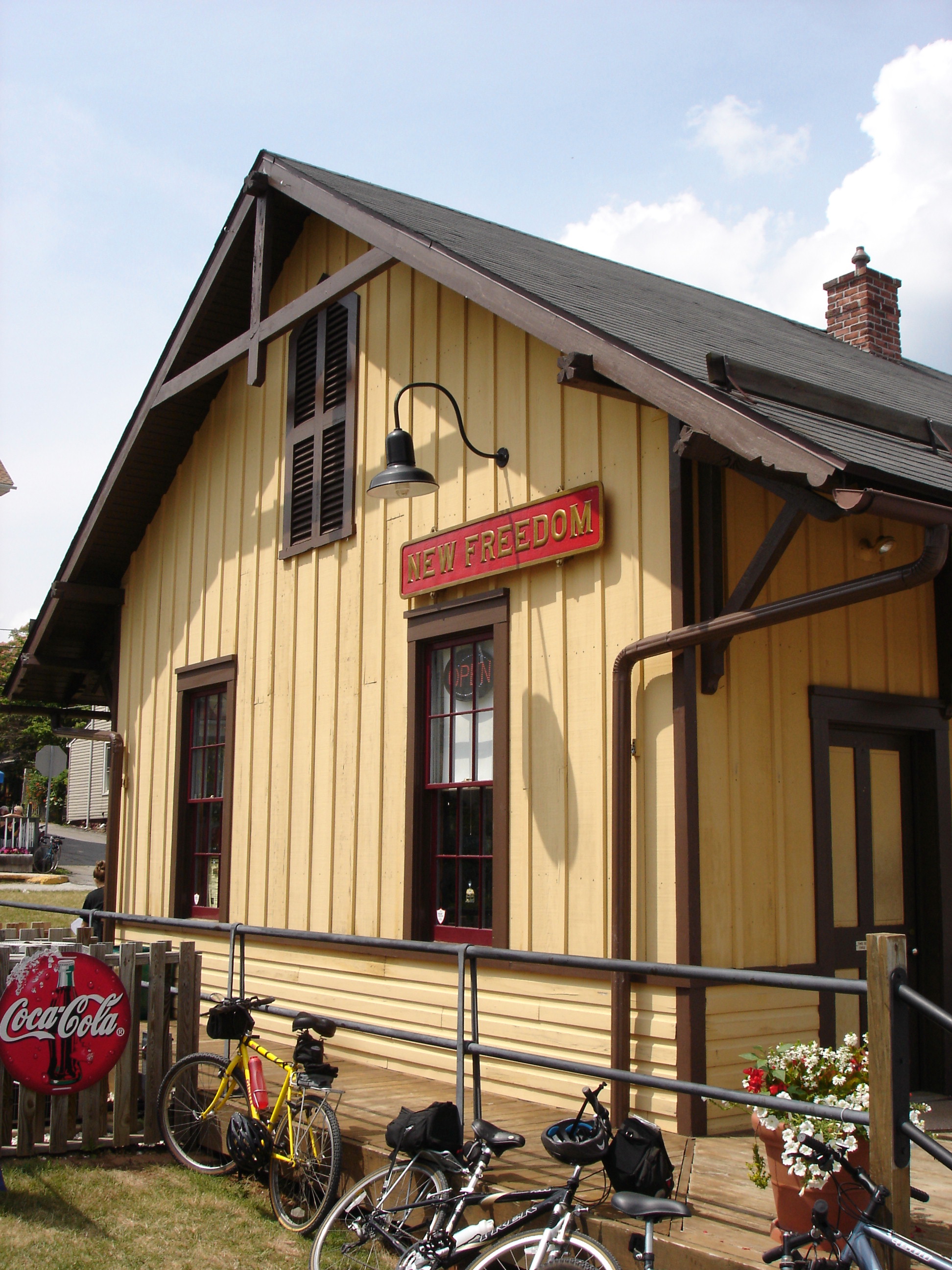
39°48′3″N 76°59′10″W / 39.80083°N 76.98611°WHanover 53 New Freedom Railroad Station, Northern Central Railway 
May 4, 1995 Front Street
39°44′24″N 76°42′4″W / 39.74°N 76.70111°WNew Freedom 54 The Nook March 1, 1982 1101 Farquhar Drive, south of York
39°56′44″N 76°43′27″W / 39.94556°N 76.72417°WSpring Garden Township 55 Northwest York Historic District September 12, 1983 Roughly bounded by Carlisle, Texas, Pennsylvania, Newberry, Park, and Linden Avenues
39°57′42″N 76°44′54″W / 39.96167°N 76.74833°WYork 56 Old Columbia-Wrightsville Bridge 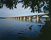
June 22, 1988 Legislative Route 128 over the Susquehanna River and a railroad line
40°1′50″N 76°30′41″W / 40.03056°N 76.51139°WWrightsville Extends into Lancaster County 57 Payne's Folly March 6, 1986 Watters Road
39°43′32″N 76°30′6″W / 39.72556°N 76.50167°WFawn Township 58 Pettit's Ford May 3, 1983 4400 Colonial Road, west of Dover
39°59′17.4″N 76°55′50.3″W / 39.988167°N 76.930639°WDover Township 59 Pleasureville Historic District February 18, 2000 Roughly along North Sherman Street between Cherry Lane and Park View Road in Springettsbury
40°0′9″N 76°42′17″W / 40.0025°N 76.70472°WSpringettsbury Township 60 Rev. Anderson B. Quay House October 24, 1997 22 North Baltimore Street
40°6′41″N 77°2′9″W / 40.11139°N 77.03583°WDillsburg 61 Railroad Borough Historic District March 22, 1984 Shaub Road North, East, and South Main Street
39°45′37″N 76°41′54″W / 39.76028°N 76.69833°WRailroad 62 Red Lion Borough Historic District August 10, 2000 Roughly bounded by Edgewood Avenue, the Windsor Township line, a Maryland and Pennsylvania line, Chestnut Road, Country Club Road, and the York Township line
39°53′55″N 76°36′35″W / 39.89861°N 76.60972°WRed Lion 63 Ridge Road Bridge, Stewartstown Railroad May 4, 1995 Stewartstown Railroad tracks over Ridge Road, west of Stewartstown
39°45′35″N 76°37′33″W / 39.75972°N 76.62583°WHopewell Township 64 Martin Schultz House 
March 11, 1993 155 Emig Street
40°0′2″N 76°36′33″W / 40.00056°N 76.60917°WHallam 65 Scott Creek Bridge-North, Maryland and Pennsylvania Railroad May 4, 1995 Maryland and Pennsylvania railroad tracks over Scott Creek, west of Watson's Corner and south of Pennsylvania Route 851
39°44′46″N 76°20′29″W / 39.74611°N 76.34139°WPeach Bottom Township 66 William Shelly School and Annex May 2, 2001 201 North Adams Street
39°57′21.6″N 76°45′39.6″W / 39.956°N 76.761°WWest York 67 Shrewsbury Historic District March 22, 1984 Roughly bounded by Highland and Sunset Drives, Park Avenue, and Church and Pine Streets
39°46′3″N 76°40′49″W / 39.7675°N 76.68028°WShrewsbury 68 Shrewsbury Railroad Station, Stewartstown Railroad May 4, 1995 South Main Street at the Stewartstown Railroad tracks
39°45′26″N 76°40′41″W / 39.75722°N 76.67806°WShrewsbury 69 Sinking Springs Farms July 27, 2000 Roughly bounded by Church Road, Sinking Springs Ln., North George Street, Locust Lane, the Susquehanna Trail, and Pennsylvania Route 238
40°0′37″N 76°44′33″W / 40.01028°N 76.7425°WManchester Township 70 South Road Bridge, Northern Central Railway May 4, 1995 Former Northern Central railroad tracks over an unnamed creek at the South Branch of the Codorus Creek, at Larue
39°49′14″N 76°45′39″W / 39.82056°N 76.76083°WSpringfield Township 71 Spring Grove Borough Historic District May 25, 1984 Roughly bounded by College Avenue and Jackson, Water, East, and Church Streets
39°52′25″N 76°51′55″W / 39.87361°N 76.86528°WSpring Grove 72 Springdale Historic District August 30, 2001 Bounded by South George Street, Lombardy Alley, South Queen Street, and Rathon Road
39°56′58″N 76°43′4″W / 39.94944°N 76.71778°WYork 73 Stevens School 
December 29, 1983 606 West Philadelphia Street
39°57′31″N 76°44′40″W / 39.95861°N 76.74444°WYork 74 Stewartstown Engine House, Stewartstown Railroad May 4, 1995 North Hill Street
39°45′16″N 76°35′47″W / 39.75444°N 76.59639°WStewartstown 75 Stewartstown Railroad Station May 18, 1995 Junction of West Pennsylvania Avenue and Hill Street
39°45′15″N 76°35′43″W / 39.75417°N 76.59528°WStewartstown 76 Stone Arch Road Bridge, Stewartstown Railroad May 4, 1995 Stewartstown Railroad tracks over Stone Arch Road, east of Railroad
39°45′1″N 76°41′14″W / 39.75028°N 76.68722°WShrewsbury Township 77 Samuel Stoner Homestead January 30, 1976 South of York off Pennsylvania Route 182
39°55′25″N 76°45′48″W / 39.92361°N 76.76333°WWest Manchester Township 78 Strickler Family Farmhouse February 21, 1991 1205 Williams Road, east of York
39°59′16″N 76°39′33″W / 39.98778°N 76.65917°WSpringettsbury Township 79 Swigart's Mill July 23, 1980 North of Hanover on Berlin Road
39°56′4.5″N 76°58′18″W / 39.934583°N 76.97167°WParadise Township 80 United Cigar Manufacturing Company 
October 28, 1999 201 North Penn Street
39°57′45″N 76°44′19″W / 39.9625°N 76.73861°WYork 81 US Post Office-Hanover December 24, 1992 141 Broadway
39°48′7″N 76°58′56″W / 39.80194°N 76.98222°WHanover 82 Valley Road Bridge, Stewartstown Railroad 
May 4, 1995 Stewartstown Railroad tracks over Valley Road, west of Stewartstown
39°45′19″N 76°36′35″W / 39.75528°N 76.60972°WHopewell Township 83 Wallace-Cross Mill December 22, 1977 South of Felton
39°47′58″N 76°32′27″W / 39.79944°N 76.54083°WEast Hopewell Township 84 Warrington Meetinghouse February 20, 1975 Pennsylvania Route 74, east of Wellsville
40°3′11″N 76°55′49″W / 40.05306°N 76.93028°WWarrington Township 85 Wellsville Historic District December 6, 1977 Pennsylvania Route 74
40°3′4″N 76°56′26″W / 40.05111°N 76.94056°WWellsville 86 West Side Sanitarium May 5, 2004 1253–1261 West Market Street
39°57′14″N 76°45′24″W / 39.95389°N 76.75667°WWest York 87 Willis House 
April 20, 1979 135 Willis Run Road, north of York
39°58′20″N 76°44′15″W / 39.97222°N 76.7375°WManchester Township 88 Wrightsville Historic District 
September 12, 1983 Roughly bounded by the Susquehanna River and Vine, 4th, and Willow Streets
40°1′26″N 76°31′41″W / 40.02389°N 76.52806°WWrightsville 89 York Armory April 18, 1990 369 North George Street
39°58′7″N 76°43′50″W / 39.96861°N 76.73056°WYork 90 York Central Market 
June 9, 1978 Philadelphia and Beaver Streets
39°57′46″N 76°43′47″W / 39.96278°N 76.72972°WYork 91 York Dispatch Newspaper Offices 
March 8, 1978 15 and 17 East Philadelphia Street
39°57′50.4″N 76°43′41.4″W / 39.964°N 76.728167°WYork 92 York Historic District August 29, 1979 Roughly bounded by railroad tracks, Hartley Street, Lilac Lane, and Cordorus Creek
39°57′30″N 76°43′34″W / 39.95833°N 76.72611°WYork 93 York Iron Company Mine March 15, 1985 North of Green Valley Road, south of Spring Grove
39°50′29″N 76°48′35″W / 39.84139°N 76.80972°WNorth Codorus Township 94 York Meetinghouse 
May 6, 1975 134 West Philadelphia Street
39°57′42″N 76°44′10″W / 39.96167°N 76.73611°WYork See also
- List of National Historic Landmarks in Pennsylvania
- National Register of Historic Places listings in Pennsylvania
- List of Pennsylvania state historical markers in York County
References
- ^ The latitude and longitude information provided in this table was derived originally from the National Register Information System, which has been found to be fairly accurate for about 99% of listings. For about 1% of NRIS original coordinates, experience has shown that one or both coordinates are typos or otherwise extremely far off; some corrections may have been made. A more subtle problem causes many locations to be off by up to 150 yards, depending on location in the country: most NRIS coordinates were derived from tracing out latitude and longitudes off of USGS topographical quadrant maps created under North American Datum of 1927, which differs from the current, highly accurate GPS system used by Google maps. Chicago is about right, but NRIS longitudes in Washington are higher by about 4.5 seconds, and are lower by about 2.0 seconds in Maine. Latitudes differ by about 1.0 second in Florida. Some locations in this table may have been corrected to current GPS standards.
- ^ "National Register of Historic Places: Weekly List Actions". National Park Service, United States Department of the Interior. Retrieved on November 10, 2011.
- ^ Numbers represent an ordering by significant words. Various colorings, defined here, differentiate National Historic Landmark sites and National Register of Historic Places Districts from other NRHP buildings, structures, sites or objects.
- ^ "NPS Focus". National Register of Historic Places. National Park Service. http://nrhp.focus.nps.gov. Retrieved November 20, 2009.
- ^ Location derived from its NRHP nomination form; the NRIS lists the site as "Address Restricted"
- ^ Location derived from this Lancaster-York Native Heritage Advisory Council document; the NRIS lists the site as "Address Restricted".
- ^ Location derived from page 13 of this Lower Windsor Township planning document and from York Daily Record. "Preserving the Oscar Leibhart site: Piece of history: $1.5M." 2007-09-21. Accessed 2009-12-19. The NRIS lists the site as "Address Restricted".
Municipalities and communities of York County, Pennsylvania County seat: York City 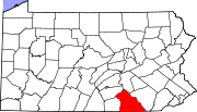
Boroughs Cross Roads | Dallastown | Delta | Dillsburg | Dover | East Prospect | Fawn Grove | Felton | Franklintown | Glen Rock | Goldsboro | Hallam | Hanover | Jacobus | Jefferson | Lewisberry | Loganville | Manchester | Mount Wolf | New Freedom | New Salem | North York | Railroad | Red Lion | Seven Valleys | Shrewsbury | Spring Grove | Stewartstown | Wellsville | West York | Windsor | Winterstown | Wrightsville | Yoe | York Haven | Yorkana
Townships Carroll | Chanceford | Codorus | Conewago | Dover | East Hopewell | East Manchester | Fairview | Fawn | Franklin | Heidelberg | Hellam | Hopewell | Jackson | Lower Chanceford | Lower Windsor | Manchester | Manheim | Monaghan | Newberry | North Codorus | North Hopewell | Paradise | Peach Bottom | Penn | Shrewsbury | Spring Garden | Springettsbury | Springfield | Warrington | Washington | West Manchester | West Manheim | Windsor | York
CDPs East York | Emigsville | Grantley | Parkville | Pennville | Queens Gate | Shiloh | Spry | Stonybrook | Susquehanna Trails | Tyler Run | Valley Green | Valley View | Weigelstown Yorklyn |
Unincorporated
communitiesAccomac | Admire | Airville | Ambau | Bandanna | Bermudian‡ | Big Mountain | Blackrock | Brogue | Bryansville | Cly | Craley | Davidsburg | Detters Mill | Fayfield | Foustown | Fuhrmans Mill | Gatchellville | Glades | Glenville | Gnatstown | Hametown | Hanover Junction | Hopewell Center | Kralltown | Leaders Heights | Mackey Ford | Mount Royal | New Bridgeville | New Market | New Park | Porters Sideling | Siddonsburg | Stoverstown | Strinestown | Sunnyburn | Tolna | Thomasville | Valley Forge | Violet Hill | Woodbine
Categories:- National Register of Historic Places in Pennsylvania by county
- York County, Pennsylvania
-


Wikimedia Foundation. 2010.