- Cross Roads, Pennsylvania
-
Cross Roads, Pennsylvania — Borough — 

Coordinates: 39°48′53″N 76°34′23″W / 39.81472°N 76.57306°WCoordinates: 39°48′53″N 76°34′23″W / 39.81472°N 76.57306°W Country United States State Pennsylvania County York Settled 1844 Incorporated 1899 Government – Type Borough Council – Mayor Area – Total 1.9 sq mi (4.9 km2) Elevation 764 ft (233 m) Population (2010) – Total 512 – Density 269.5/sq mi (104/km2) Time zone Eastern (EST) (UTC-5) – Summer (DST) EDT (UTC-4) Zip code 17322 Area code(s) 717 Cross Roads is a borough in York County, Pennsylvania, United States. The population was 512 at the 2010 census.[1]
Contents
Geography
Cross Roads is located at 39°48′53″N 76°34′23″W / 39.81472°N 76.57306°W (39.814737, -76.573146)[2].
According to the United States Census Bureau, the borough has a total area of 1.9 square miles (4.9 km2), all of it land.
Demographics
As of the census[3] of 2000, there were 518 people, 175 households, and 149 families residing in the borough. The population density was 275.5 people per square mile (106.4/km²). There were 185 housing units at an average density of 98.4 per square mile (38.0/km²). The racial makeup of the borough was 96.14% White, 2.90% African American, 0.19% Asian, and 0.77% from two or more races. Hispanic or Latino of any race were 0.39% of the population.
There were 175 households out of which 44.0% had children under the age of 18 living with them, 77.7% were married couples living together, 5.1% had a female householder with no husband present, and 14.3% were non-families. 10.3% of all households were made up of individuals and 4.0% had someone living alone who was 65 years of age or older. The average household size was 2.96 and the average family size was 3.19.
In the borough the population was spread out with 31.1% under the age of 18, 6.4% from 18 to 24, 33.6% from 25 to 44, 23.0% from 45 to 64, and 6.0% who were 65 years of age or older. The median age was 34 years. For every 100 females there were 97.0 males. For every 100 females age 18 and over, there were 96.2 males.
The median income for a household in the borough was $57,750, and the median income for a family was $60,556. Males had a median income of $40,000 versus $31,875 for females. The per capita income for the borough was $20,063. About 2.5% of families and 3.0% of the population were below the poverty line, including 3.4% of those under age 18 and none of those age 65 or over.
Education
Cross Roads Borough is served by the South Eastern School District which provides a public education.
References
- ^ "Race, Hispanic or Latino, Age, and Housing Occupancy: 2010 Census Redistricting Data (Public Law 94-171) Summary File (QT-PL), Cross Roads borough, Pennsylvania". U.S. Census Bureau, American FactFinder 2. http://factfinder2.census.gov. Retrieved October 4, 2011.
- ^ "US Gazetteer files: 2010, 2000, and 1990". United States Census Bureau. 2011-02-12. http://www.census.gov/geo/www/gazetteer/gazette.html. Retrieved 2011-04-23.
- ^ "American FactFinder". United States Census Bureau. http://factfinder.census.gov. Retrieved 2008-01-31.
Municipalities and communities of York County, Pennsylvania City 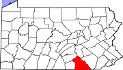
Boroughs Cross Roads | Dallastown | Delta | Dillsburg | Dover | East Prospect | Fawn Grove | Felton | Franklintown | Glen Rock | Goldsboro | Hallam | Hanover | Jacobus | Jefferson | Lewisberry | Loganville | Manchester | Mount Wolf | New Freedom | New Salem | North York | Railroad | Red Lion | Seven Valleys | Shrewsbury | Spring Grove | Stewartstown | Wellsville | West York | Windsor | Winterstown | Wrightsville | Yoe | York Haven | Yorkana
Townships Carroll | Chanceford | Codorus | Conewago | Dover | East Hopewell | East Manchester | Fairview | Fawn | Franklin | Heidelberg | Hellam | Hopewell | Jackson | Lower Chanceford | Lower Windsor | Manchester | Manheim | Monaghan | Newberry | North Codorus | North Hopewell | Paradise | Peach Bottom | Penn | Shrewsbury | Spring Garden | Springettsbury | Springfield | Warrington | Washington | West Manchester | West Manheim | Windsor | York
CDPs East York | Emigsville | Grantley | Parkville | Pennville | Queens Gate | Shiloh | Spry | Stonybrook | Susquehanna Trails | Tyler Run | Valley Green | Valley View | Weigelstown Yorklyn |
Unincorporated
communitiesAccomac | Admire | Airville | Ambau | Bandanna | Bermudian‡ | Big Mountain | Blackrock | Brogue | Bryansville | Cly | Craley | Davidsburg | Detters Mill | Fayfield | Foustown | Fuhrmans Mill | Gatchellville | Glades | Glenville | Gnatstown | Hametown | Hanover Junction | Hopewell Center | Kralltown | Leaders Heights | Mackey Ford | Mount Royal | New Bridgeville | New Market | New Park | Porters Sideling | Siddonsburg | Stoverstown | Strinestown | Sunnyburn | Tolna | Thomasville | Valley Forge | Violet Hill | Woodbine
Categories:- Populated places established in 1844
- Boroughs in York County, Pennsylvania


Wikimedia Foundation. 2010.