- National Register of Historic Places listings in Carbon County, Pennsylvania
-
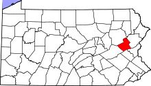 Location of Carbon County in Pennsylvania
This is a list of the National Register of Historic Places listings in Carbon County, Pennsylvania.
This is intended to be a complete list of the properties and districts on the National Register of Historic Places in Carbon County, Pennsylvania, United States. The locations of National Register properties and districts for which the latitude and longitude coordinates are included below, may be seen in a Google map.[1]
There are 11 properties and districts listed on the National Register in the county. Two sites are further designated as National Historic Landmarks.
-
- This National Park Service list is complete through NPS recent listings posted November 10, 2011.[2]
Current listings
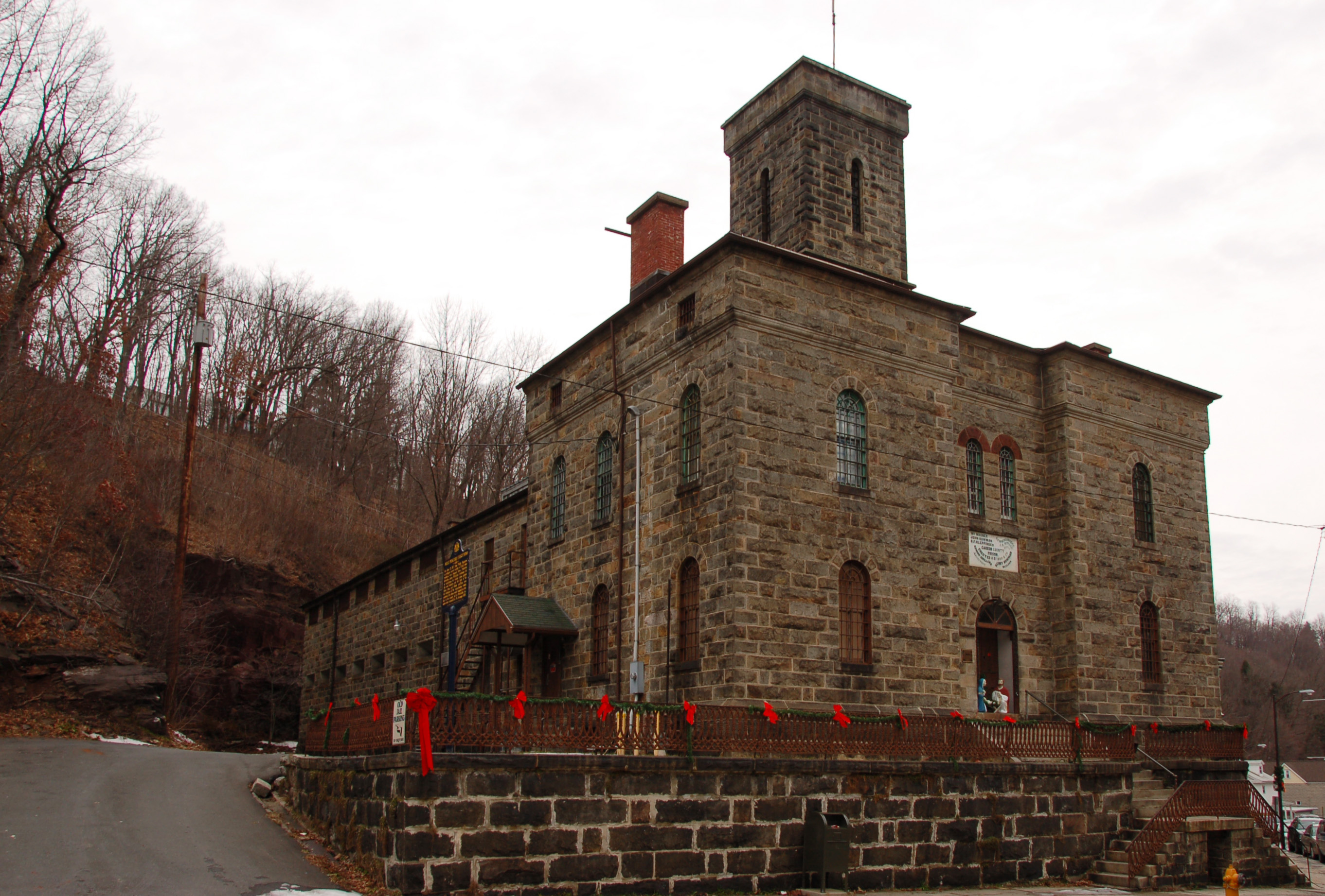
[3] Landmark name Image Date listed Location City or town Summary 1 Carbon County Jail 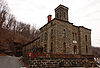
November 8, 1974 128 Broadway Street
40°51′50″N 75°44′49″W / 40.863889°N 75.746944°WJim Thorpe John Haviland & Henry Bowman, architects. 2 Carbon County Section of the Lehigh Canal 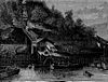
August 10, 1979 Along the Lehigh River
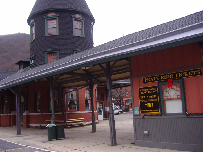
40°49′03″N 75°40′08″W / 40.8175°N 75.668889°WBowmanstown, Franklin Township, Jim Thorpe, Lower Towamensing Township, Palmerton, Parryville, and Weissport Extends into Lehigh Township and Walnutport in Northampton County 3 Central Railroad of New Jersey Station 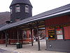
January 1, 1976 Susquehanna Street
40°51′46″N 75°44′19″W / 40.862778°N 75.738611°WJim Thorpe Wilson Brothers & Company, architects. 4 Little Gap Covered Bridge December 1, 1980 South of Little Gap on Township 376
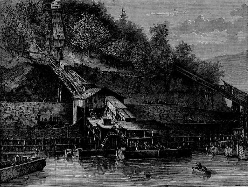
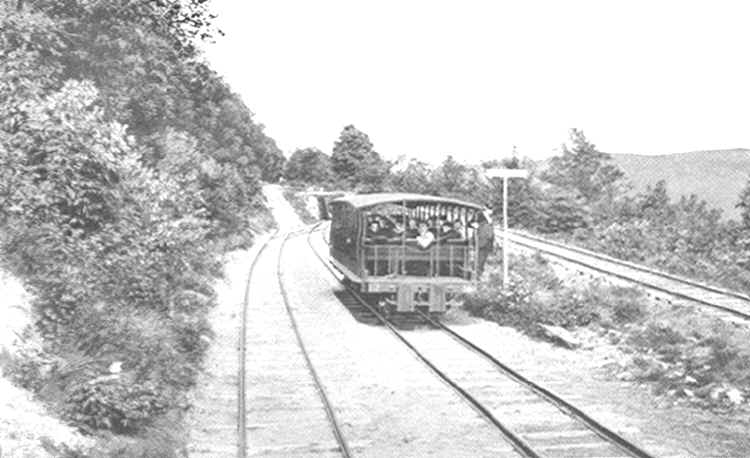
40°49′52″N 75°31′22″W / 40.831111°N 75.522778°WLower Towamensing Township 5 Mauch Chunk Switchback Railway 
June 3, 1976 Between Ludlow Street in Summit Hill and F.A.P. 209 in Jim Thorpe
40°50′58″N 75°47′46″W / 40.849444°N 75.796111°WJim Thorpe, Nesquehoning, and Summit Hill 6 Nesquehoning High School November 21, 2003 120–124 East Catawissa Street
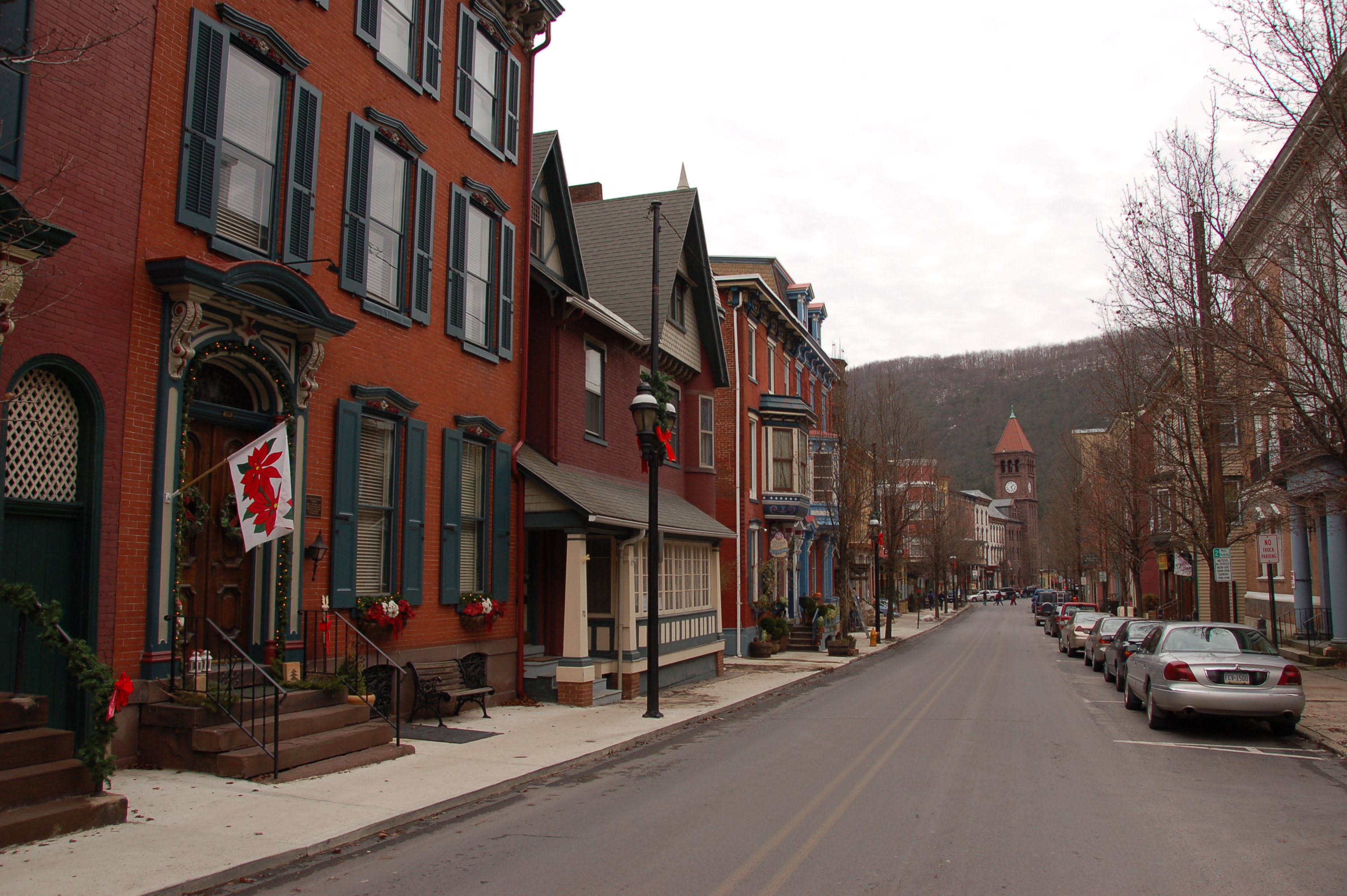
40°51′55″N 75°48′35″W / 40.865278°N 75.809722°WNesquehoning 7 Old Mauch Chunk Historic District 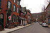
November 10, 1977 Broadway, Susquehanna, Race, and High Streets
40°51′44″N 75°44′35″W / 40.862222°N 75.743056°WJim Thorpe 8 Asa Packer Mansion 
December 30, 1974 Packer Road
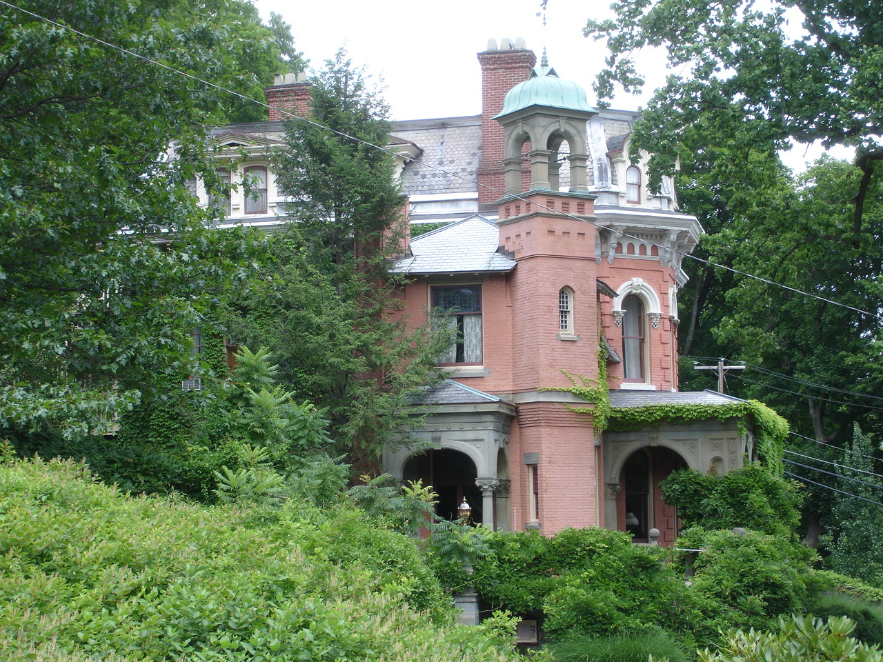
40°51′50″N 75°44′16″W / 40.863889°N 75.737778°WJim Thorpe Attributed to Samuel Sloan, architect. 9 Harry Packer Mansion 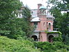
November 20, 1974 Packer Road
40°51′53″N 75°44′17″W / 40.864722°N 75.738056°WJim Thorpe Addison Hutton, architect. 10 St. Mark's Episcopal Church 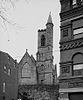
July 26, 1977 Race and Susquehanna Streets
40°51′46″N 75°44′21″W / 40.862778°N 75.739167°WJim Thorpe Richard Upjohn, architect. 11 Summit Hill High School February 16, 2001 124 West Hazard Street
40°49′34″N 75°52′29″W / 40.826111°N 75.874722°WSummit Hill See also
- List of National Historic Landmarks in Pennsylvania
- National Register of Historic Places listings in Pennsylvania
- List of Pennsylvania state historical markers in Carbon County
References
- ^ The latitude and longitude information provided in this table was derived originally from the National Register Information System, which has been found to be fairly accurate for about 99% of listings. For about 1% of NRIS original coordinates, experience has shown that one or both coordinates are typos or otherwise extremely far off; some corrections may have been made. A more subtle problem causes many locations to be off by up to 150 yards, depending on location in the country: most NRIS coordinates were derived from tracing out latitude and longitudes off of USGS topographical quadrant maps created under North American Datum of 1927, which differs from the current, highly accurate GPS system used by Google maps. Chicago is about right, but NRIS longitudes in Washington are higher by about 4.5 seconds, and are lower by about 2.0 seconds in Maine. Latitudes differ by about 1.0 second in Florida. Some locations in this table may have been corrected to current GPS standards.
- ^ "National Register of Historic Places: Weekly List Actions". National Park Service, United States Department of the Interior. Retrieved on November 10, 2011.
- ^ Numbers represent an ordering by significant words. Various colorings, defined here, differentiate National Historic Landmark sites and National Register of Historic Places Districts from other NRHP buildings, structures, sites or objects.
Municipalities and communities of Carbon County, Pennsylvania County seat: Jim Thorpe Boroughs Beaver Meadows | Bowmanstown | East Side | Jim Thorpe | Lansford | Lehighton | Nesquehoning | Palmerton | Parryville | Summit Hill | Weatherly | Weissport

Townships CDPs Unincorporated
communitiesAlbrightsville | Audenried | Forest Inn | Harrity | Lake Harmony | Little Gap | Normal Square | Packerton
Categories:- National Register of Historic Places in Pennsylvania by county
- Carbon County, Pennsylvania
-


Wikimedia Foundation. 2010.