- Tresckow, Pennsylvania
Geobox Settlement
name = Tresckow
native_name =
other_name =
other_name1 =
category =Census-designated place
image_size =
image_caption =
flag_size =
symbol =
symbol_size =
country = United States
state = Pennsylvania
region = Carbon
region_type = County
district_type = Township
district = Banks
area_imperial = 1.8
area_land_imperial = 1.8
area_water_imperial = 0.0
area_water_percentage = auto
area_percentage_round = 2
area_round = 1
location =
lat_d = 40
lat_m = 54
lat_s = 56
lat_NS = N
long_d = 75
long_m = 57
long_s = 50
long_EW = W
elevation_imperial = 1778
elevation_round = 1
population_as_of = 2000
population = 964
population_density_imperial = 530.3
population_density_round = 1
established_type =
established =
mayor =
timezone = EST
utc_offset = -5
timezone_DST = EDT
utc_offset_DST = -4
postal_code =
postal_code_type =
area_code = 570
area_code_type =
code2_type =
code2 =
free_type =
free =
free1_type =
free1 =
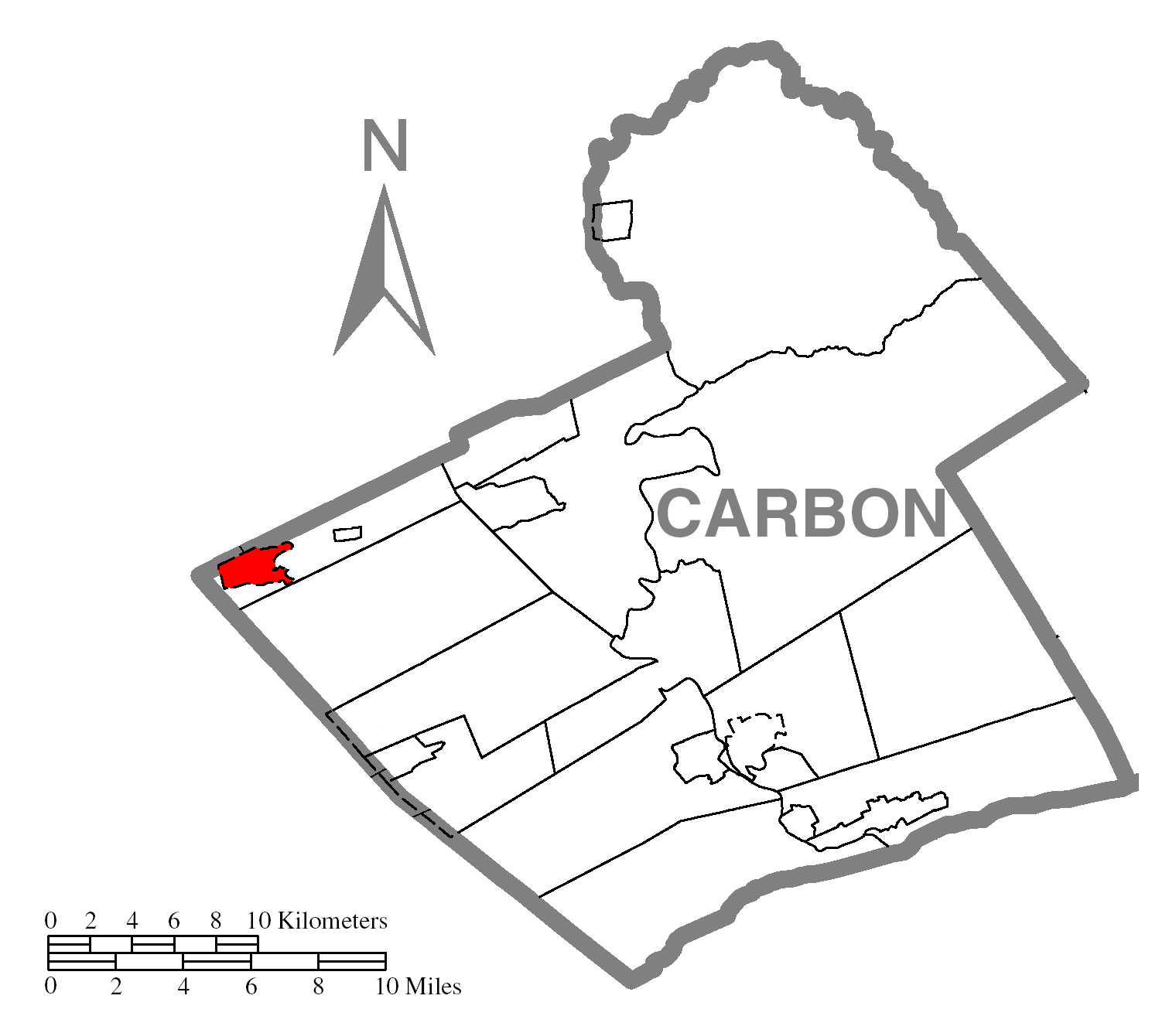
map_caption = Location of Tresckow in Carbon County
map1 = Pennsylvania Locator Map.png
map1_locator = Pennsylvania
map2 = Map of USA PA.svg
map2_caption = Location of Pennsylvania in the United States
website =Tresckow, formerly known as Dutchtown, is a
census-designated place (CDP) in Carbon County,Pennsylvania ,United States . The population was 964 at the 2000 census.Geography
Tresckow is located at coor dms|40|54|56|N|75|57|50|W|city (40.915631, -75.963881)GR|1.
According to the
United States Census Bureau , the CDP has a total area of 1.8square mile s (4.7km² ), all of it land.Tresckow is located 4 miles south of Hazleton and 2 miles west of Beaver Meadows.
Tresckow is considered the highest elevated borough/village in Carbon County at an elevation of 1778 feet
Education
Residents of Tresckow live in Carbon county, however go to school in Luzerne county. Many go to the Hazleton Area High School, located 7 miles away
Demographics
As of the
census GR|2 of 2000, there were 964 people, 384 households, and 276 families residing in the CDP. Thepopulation density was 530.3 people per square mile (204.5/km²). There were 415 housing units at an average density of 228.3/sq mi (88.0/km²). The racial makeup of the CDP was 99.48% White and 0.52% African American. Hispanic or Latino of any race were 0.83% of the population.There were 384 households out of which 25.0% had children under the age of 18 living with them, 56.0% were married couples living together, 10.9% had a female householder with no husband present, and 27.9% were non-families. 26.0% of all households were made up of individuals and 13.8% had someone living alone who was 65 years of age or older. The average household size was 2.44 and the average family size was 2.92.
In the CDP the population was spread out with 20.7% under the age of 18, 5.5% from 18 to 24, 26.2% from 25 to 44, 24.1% from 45 to 64, and 23.4% who were 65 years of age or older. The median age was 43 years. For every 100 females there were 94.4 males. For every 100 females age 18 and over, there were 90.0 males.
The median income for a household in the CDP was $35,625, and the median income for a family was $41,103. Males had a median income of $32,639 versus $26,364 for females. The
per capita income for the CDP was $16,693. About 4.8% of families and 6.4% of the population were below thepoverty line , including 6.1% of those under age 18 and 9.7% of those age 65 or over..
References
Wikimedia Foundation. 2010.