- National Register of Historic Places listings in Schuylkill County, Pennsylvania
-
 Location of Schuylkill County in Pennsylvania
This is a list of the National Register of Historic Places listings in Schuylkill County, Pennsylvania.
This is intended to be a complete list of the properties and districts on the National Register of Historic Places in Schuylkill County, Pennsylvania, United States. The locations of National Register properties and districts for which the latitude and longitude coordinates are included below, may be seen in a Google map.[1]
There are 18 properties and districts listed on the National Register in the county. Two sites are further designated as National Historic Landmarks and another is designated as a National Historic Site.
-
- This National Park Service list is complete through NPS recent listings posted November 10, 2011.[2]
Current listings
[3] Landmark name[4] Image Date listed Location Municipality Summary 1 Anthracite Bank Building 
September 13, 1978 133 West Broad Street
40°47′50″N 75°58′23″W / 40.79722°N 75.97306°WTamaqua 2 Cloud Home May 22, 1978 351 South 2nd Street
40°40′49″N 76°11′42″W / 40.68028°N 76.195°WPottsville 3 New Ringgold Gristmill December 18, 1978 Legislative Route 53062
40°41′25″N 76°0′24″W / 40.69028°N 76.00667°WEast Brunswick Township 4 Nutting Hall July 23, 1980 205 South Tulpehocken Street
40°32′48″N 76°23′5″W / 40.54667°N 76.38472°WPine Grove 5 John O'Hara House May 22, 1978 606 Mahantongo Street
40°40′58″N 76°11′59″W / 40.68278°N 76.19972°WPottsville 6 George Ormrod House June 14, 1977 218 West Broad Street
40°47′48″N 75°58′25″W / 40.79667°N 75.97361°WTamaqua 7 Burd Patterson House April 27, 1995 803 Mahantongo Street
40°40′53″N 76°12′2″W / 40.68139°N 76.20056°WPottsville 8 Pine Grove Historic District December 31, 1987 South Tulpehocken and Mill Streets, and Swatara Creek
40°32′47″N 76°23′4″W / 40.54639°N 76.38444°WPine Grove 9 Pottsville Armory November 14, 1991 502 North Centre Street
40°41′28″N 76°11′54″W / 40.69111°N 76.19833°WPottsville 10 Pottsville Downtown Historic District 
March 1, 1982 Roughly bounded by Laurel Boulevard, Railroad, Morris and 4th Streets
40°40′59″N 76°11′41″W / 40.68306°N 76.19472°WPottsville 11 Reading Railroad Passenger Station–Tamaqua 
December 26, 1985 Off West Broad Street
40°47′52″N 75°58′14″W / 40.79778°N 75.97056°WTamaqua 12 St. Paul's Union Church and Cemetery April 27, 1995 Junction of Township 798 and Legislative Route 4037, southwest corner, about 1 mile (1.6 km) east of Ringtown
40°51′33″N 76°12′38″W / 40.85917°N 76.21056°WUnion Township 13 Schuylkill County Bridge No. 113 January 3, 1978 West of Rock off Pennsylvania Route 895
40°32′42″N 76°17′43″W / 40.545°N 76.29528°WWashington Township 14 Schuylkill County Bridge No. 114 January 3, 1978 East of Rock off Pennsylvania Route 895
40°32′39″N 76°19′33″W / 40.54417°N 76.32583°WWashington Township 15 Swatara Furnace September 6, 1991 Old Forge Road east of Lebanon Reservoir, north of Suedberg
40°32′35″N 76°29′27″W / 40.54306°N 76.49083°WPine Grove Township 16 Tamaqua Historic District 
February 2, 2001 Roughly bounded by the Odd Fellows Cemetery, Rowe and Mauch Street, East End Avenue, Mountain Avenue, and West Cottage Avenue
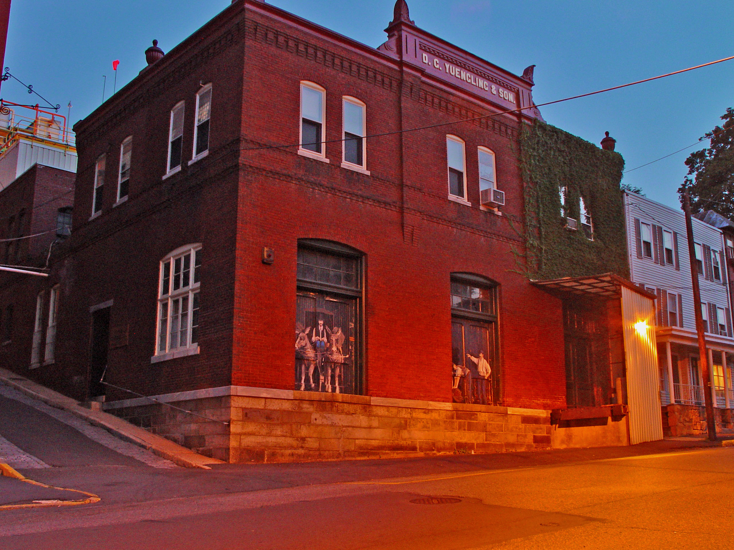
40°47′59″N 75°57′29″W / 40.79972°N 75.95806°WTamaqua 17 D.G. Yuengling and Son Brewing Complex 
February 1, 1985 5th and Mahantongo Streets
40°40′57″N 76°12′22″W / 40.6825°N 76.20611°WPottsville 18 Frank D. Yuengling Mansion April 18, 1979 1440 Mahantongo Street
40°40′44″N 76°12′32″W / 40.67889°N 76.20889°WPottsville Former listings
[3] Landmark name[4] Image Date delisted Location Municipality Summary 1 Mt. Pleasant Historic District October 28, 2010 Township Road 881 and Pennsylvania Route 901 at Mount Pleasant
40°42′39″N 76°20′19″W / 40.71083°N 76.33861°WFoster Township Listed on January 7, 1988. See also
- List of National Historic Landmarks in Pennsylvania
- National Register of Historic Places listings in Pennsylvania
- List of Pennsylvania state historical markers in Schuylkill County
References
- ^ The latitude and longitude information provided in this table was derived originally from the National Register Information System, which has been found to be fairly accurate for about 99% of listings. For about 1% of NRIS original coordinates, experience has shown that one or both coordinates are typos or otherwise extremely far off; some corrections may have been made. A more subtle problem causes many locations to be off by up to 150 yards, depending on location in the country: most NRIS coordinates were derived from tracing out latitude and longitudes off of USGS topographical quadrant maps created under North American Datum of 1927, which differs from the current, highly accurate GPS system used by Google maps. Chicago is about right, but NRIS longitudes in Washington are higher by about 4.5 seconds, and are lower by about 2.0 seconds in Maine. Latitudes differ by about 1.0 second in Florida. Some locations in this table may have been corrected to current GPS standards.
- ^ "National Register of Historic Places: Weekly List Actions". National Park Service, United States Department of the Interior. Retrieved on November 10, 2011.
- ^ a b Numbers represent an ordering by significant words. Various colorings, defined here, differentiate National Historic Landmark sites and National Register of Historic Places Districts from other NRHP buildings, structures, sites or objects.
- ^ a b "NPS Focus". National Register of Historic Places. National Park Service. http://nrhp.focus.nps.gov. Retrieved November 20, 2009.
Municipalities and communities of Schuylkill County, Pennsylvania City 
Boroughs Ashland‡ | Auburn | Coaldale | Cressona | Deer Lake | Frackville | Gilberton | Girardville | Gordon | Landingville | Mahanoy City | McAdoo | Mechanicsville | Middleport | Minersville | Mount Carbon | New Philadelphia | New Ringgold | Orwigsburg | Palo Alto | Pine Grove | Port Carbon | Port Clinton | Ringtown | Schuylkill Haven | Shenandoah | St. Clair | Tamaqua | Tower City | Tremont
Townships Barry | Blythe | Branch | Butler | Cass | Delano | East Brunswick | East Norwegian | East Union | Eldred | Foster | Frailey | Hegins | Hubley | Kline | Mahanoy | New Castle | North Manheim | North Union | Norwegian | Pine Grove | Porter | Reilly | Rush | Ryan | Schuylkill | South Manheim | Tremont | Union | Upper Mahantongo | Walker | Washington | Wayne | West Brunswick | West Mahanoy | West Penn
CDPs Altamont | Beurys Lake | Branchdale | Brandonville | Buck Run | Delano | Donaldson | Duncott | Englewood | Forrestville | Fountain Springs | Friedensburg | Grier City-Park Crest | Heckscherville | Hometown | Klingerstown | Lake Wynonah | Lavelle-Locustdale | Marlin | McKeansburg | New Boston-Morea | Newtown | Nuremberg | Oneida | Ravine | Reinerton-Orwin-Muir | Renningers | Seltzer | Shenandoah Heights | Sheppton | Summit Station | Tuscarora | Valley View
Unincorporated
communitiesAndreas | Barnesville | Glen Carbon | Llewellyn | Pitman | Rough and Ready | Sacramento | Snyders | South Tamaqua | Weishample
Footnotes ‡This populated place also has portions in an adjacent county or counties
Categories:- Schuylkill County, Pennsylvania
- National Register of Historic Places in Pennsylvania by county
-


Wikimedia Foundation. 2010.