- Wayne Township, Schuylkill County, Pennsylvania
Infobox Settlement
official_name = Wayne Township,
Schuylkill County,
Pennsylvania
settlement_type = Township
nickname =
motto =
imagesize =
image_caption =
image_
mapsize = 250x200px
map_caption = Map of Schuylkill County, Pennsylvania Highlighting Wayne Township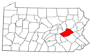
mapsize1 = 250x200px
map_caption1 = Map of Schuylkill County, Pennsylvania
subdivision_type = Country
subdivision_name =United States
subdivision_type1 = State
subdivision_name1 =Pennsylvania
subdivision_type2 = County
subdivision_name2 = Schuylkill
government_footnotes =
government_type =
leader_title =
leader_name =
leader_title1 =
leader_name1 =
leader_title2 =
leader_name2 =
established_title = Settled
established_date = 1759
established_title1 = Incorporated
established_date1 = 1827
unit_pref = Imperial
area_footnotes =
area_magnitude =
area_total_km2 =
area_land_km2 =
area_water_km2 =
area_total_sq_mi = 35.1
area_land_sq_mi = 35.0
area_water_sq_mi = 0.1
population_as_of = 2000
population_footnotes =
population_total = 4721
population_density_km2 =
population_density_sq_mi = 134.7
timezone = Eastern (EST)
utc_offset = -5
timezone_DST = EDT
utc_offset_DST = -4
postal_code_type =
postal_code =
area_code =
website =
footnotes =Wayne Township is a township in Schuylkill County,
Pennsylvania ,United States . The population was 4,721 at the 2000 census. The township includes the village of Reedsville which contains a medium size state police barracks. Children from this township attend schools in the Blue Mountain School District. The township is divided by PA Route 183 which serves as a highway connecting Schuykill and Berks Counties.Geography
According to the
United States Census Bureau , the township has a total area of 35.1square mile s (90.9km² ), of which, 35.0 square miles (90.8 km²) of it is land and 0.1 square miles (0.2 km²) of it (0.17%) is water.Demographics
As of the
census GR|2 of 2000, there were 4,721 people, 1,827 households, and 1,401 families residing in the township. Thepopulation density was 134.7 people per square mile (52.0/km²). There were 1,972 housing units at an average density of 56.3/sq mi (21.7/km²). The racial makeup of the township was 98.73% White, 0.23% African American, 0.04% Native American, 0.49% Asian, 0.23% from other races, and 0.28% from two or more races. Hispanic or Latino of any race were 0.40% of the population.There were 1,827 households out of which 31.7% had children under the age of 18 living with them, 66.9% were married couples living together, 6.1% had a female householder with no husband present, and 23.3% were non-families. 19.3% of all households were made up of individuals and 7.8% had someone living alone who was 65 years of age or older. The average household size was 2.57 and the average family size was 2.94.
In the township the population was spread out with 23.8% under the age of 18, 5.5% from 18 to 24, 30.4% from 25 to 44, 27.0% from 45 to 64, and 13.3% who were 65 years of age or older. The median age was 40 years. For every 100 females there were 99.1 males. For every 100 females age 18 and over, there were 100.8 males.
The median income for a household in the township was $45,242, and the median income for a family was $51,042. Males had a median income of $34,805 versus $24,257 for females. The
per capita income for the township was $19,335. About 1.1% of families and 2.3% of the population were below thepoverty line , including 2.3% of those under age 18 and 3.3% of those age 65 or over.References

Wikimedia Foundation. 2010.