- National Register of Historic Places listings in Beaver County, Pennsylvania
-
 Location of Beaver County in Pennsylvania
This is a list of the National Register of Historic Places listings in Beaver County, Pennsylvania.
This is intended to be a complete list of the properties and districts on the National Register of Historic Places in Beaver County, Pennsylvania, United States. The locations of National Register properties and districts for which the latitude and longitude coordinates are included below, may be seen in a Google map.[1]
There are 20 properties and districts listed on the National Register in the county. Three sites are further designated as National Historic Landmarks.
-
- This National Park Service list is complete through NPS recent listings posted November 10, 2011.[2]
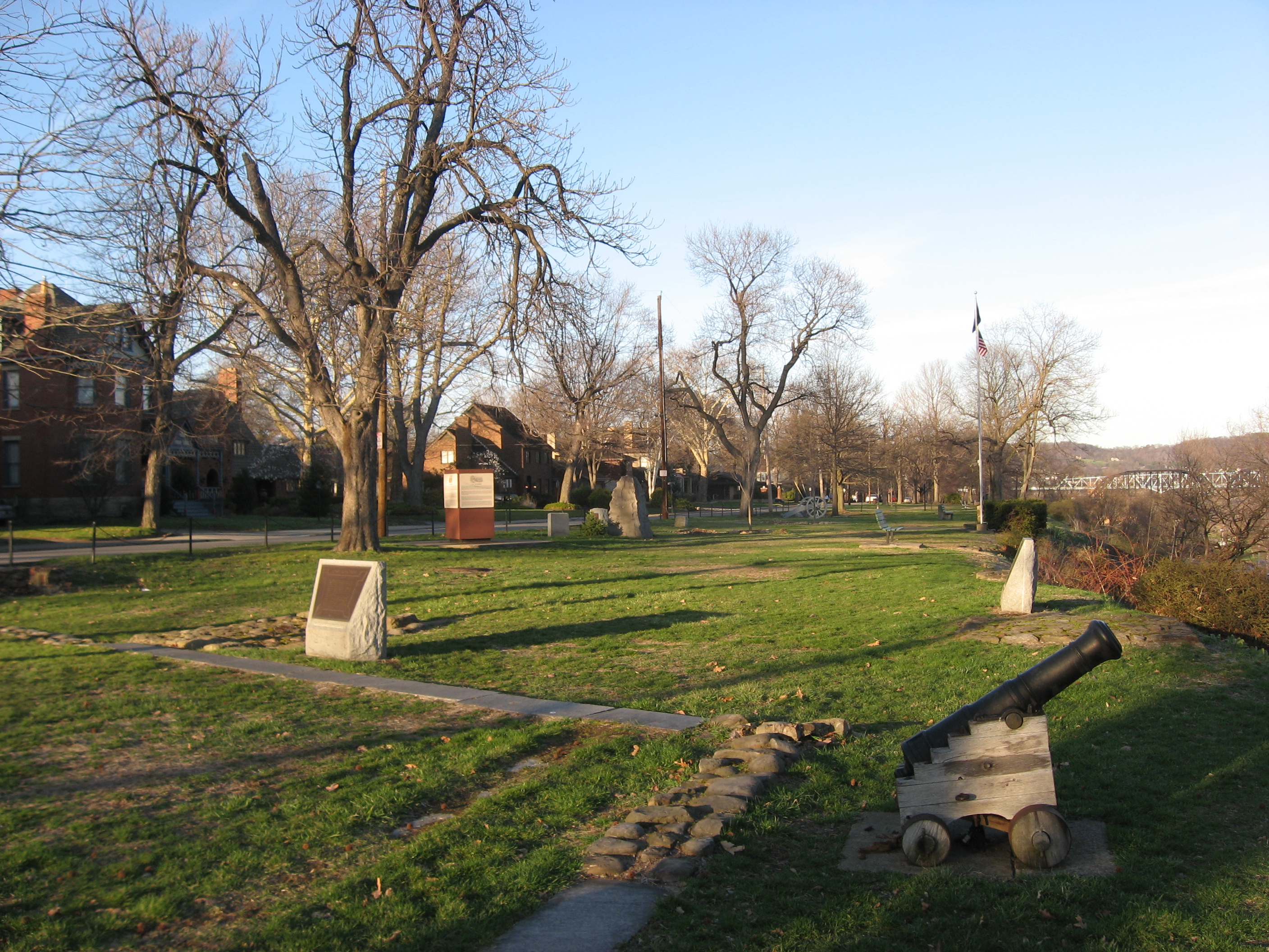
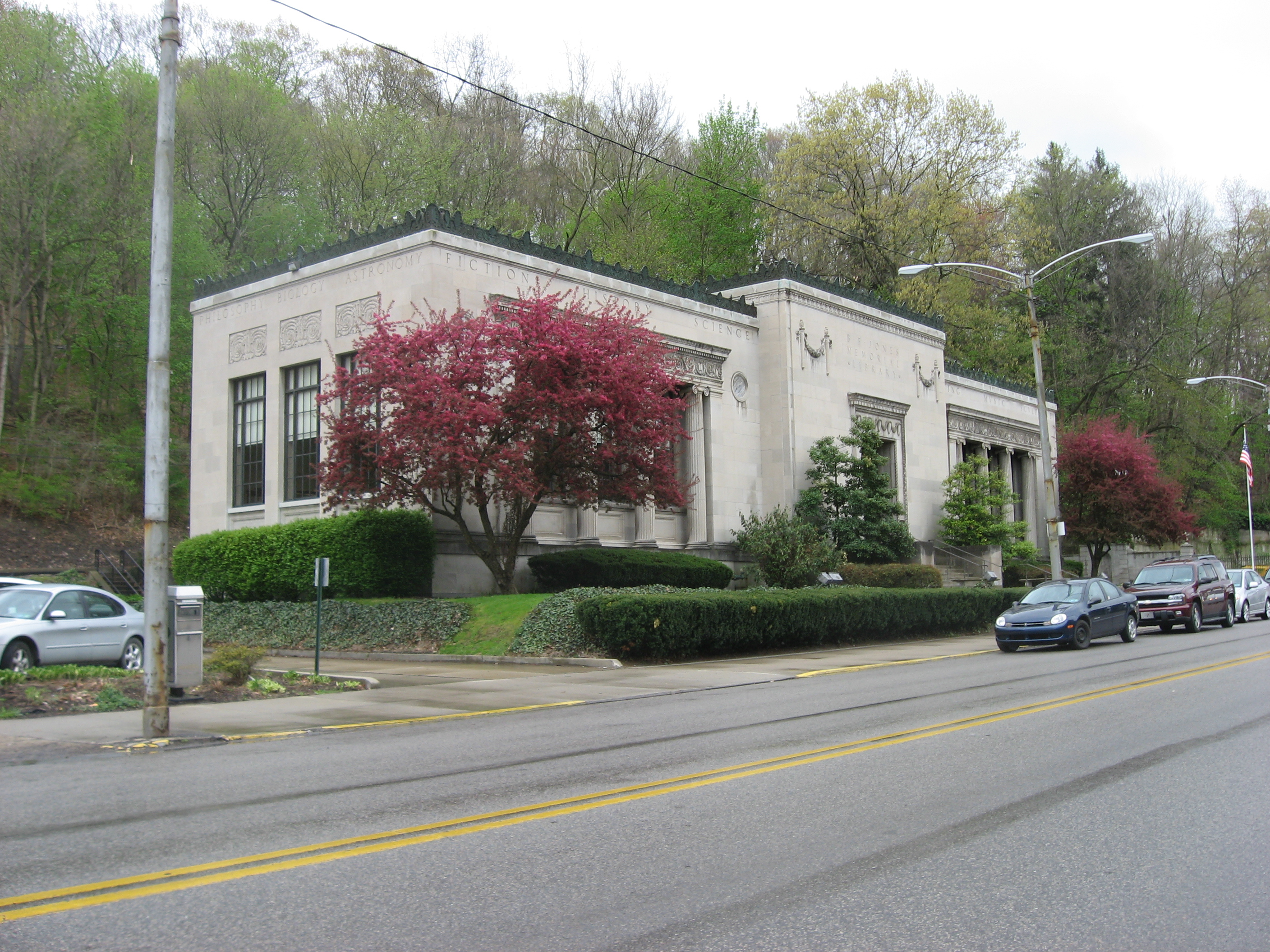
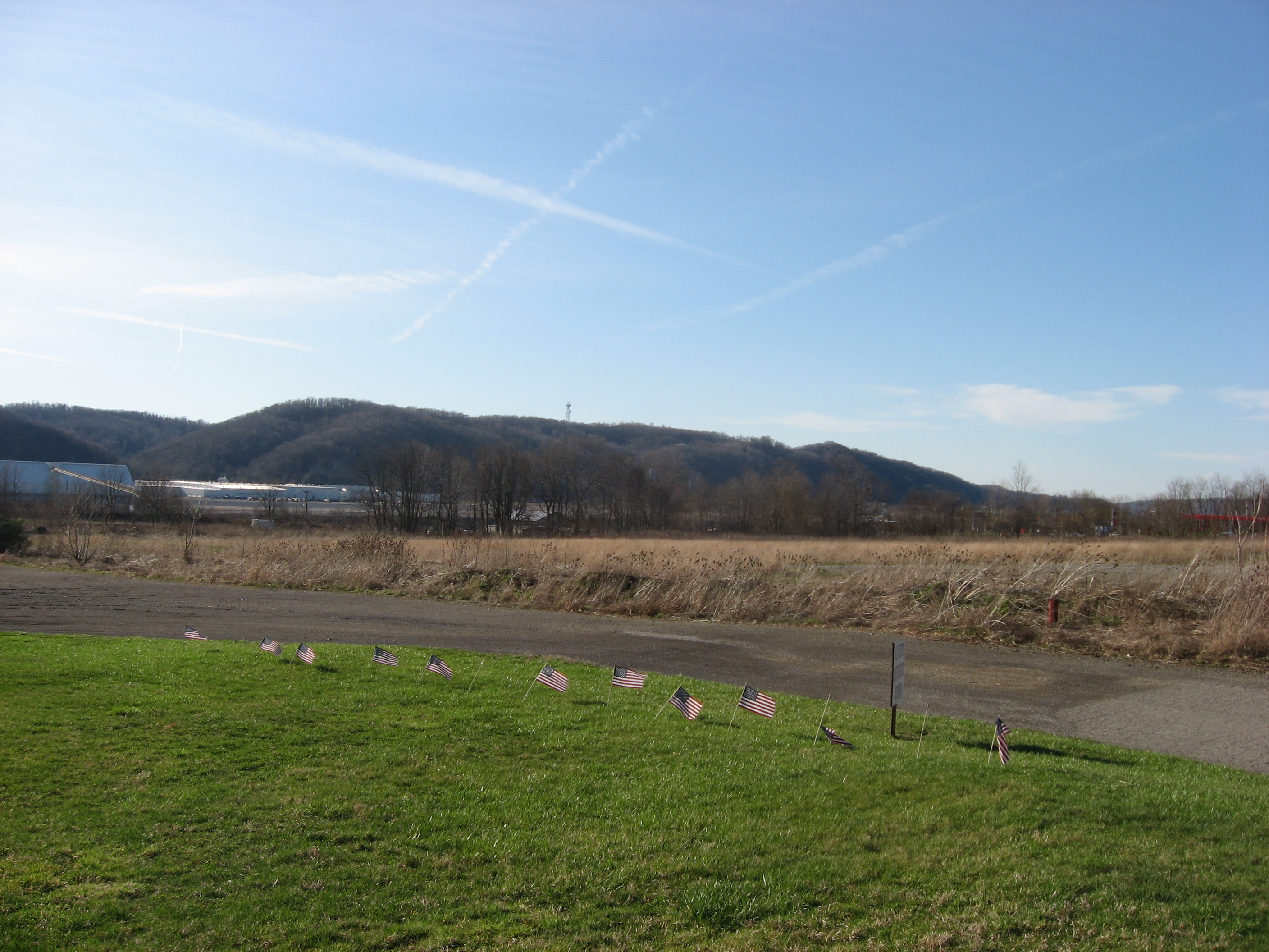
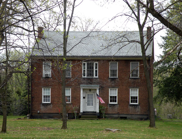
Current listings
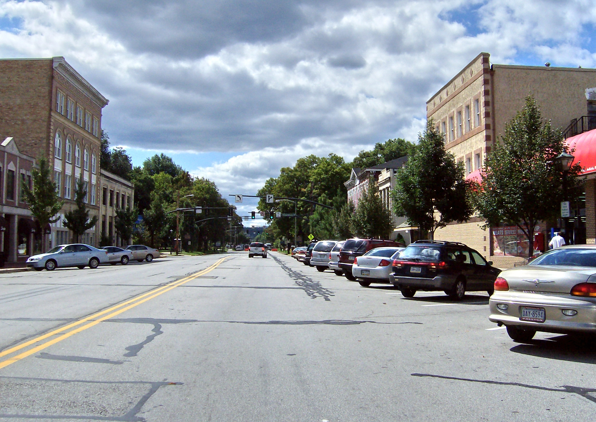
[3] Landmark name Image Date listed Location City or town Summary 1 Beaver Historic District 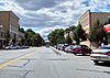
October 24, 1996 Roughly bounded by the Cumberland and Pennsylvania Railroad tracks, Fair Avenue, 5th Street, 3rd Street, and Sassafras Lane
40°41′41″N 80°18′27″W / 40.694722°N 80.3075°WBeaver Encompasses virtually the entire community of Beaver 2 Beginning Point of the U.S. Public Land Survey 
October 15, 1966 On the Ohio/Pennsylvania border, east of East Liverpool
40°38′33″N 80°31′10″W / 40.6425°N 80.519444°WOhioville Location from which most of the United States, other than the original colonies, was surveyed 3 Bridge in South Beaver Township 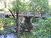
June 22, 1988 Watts Mill Road over the Little Beaver Creek
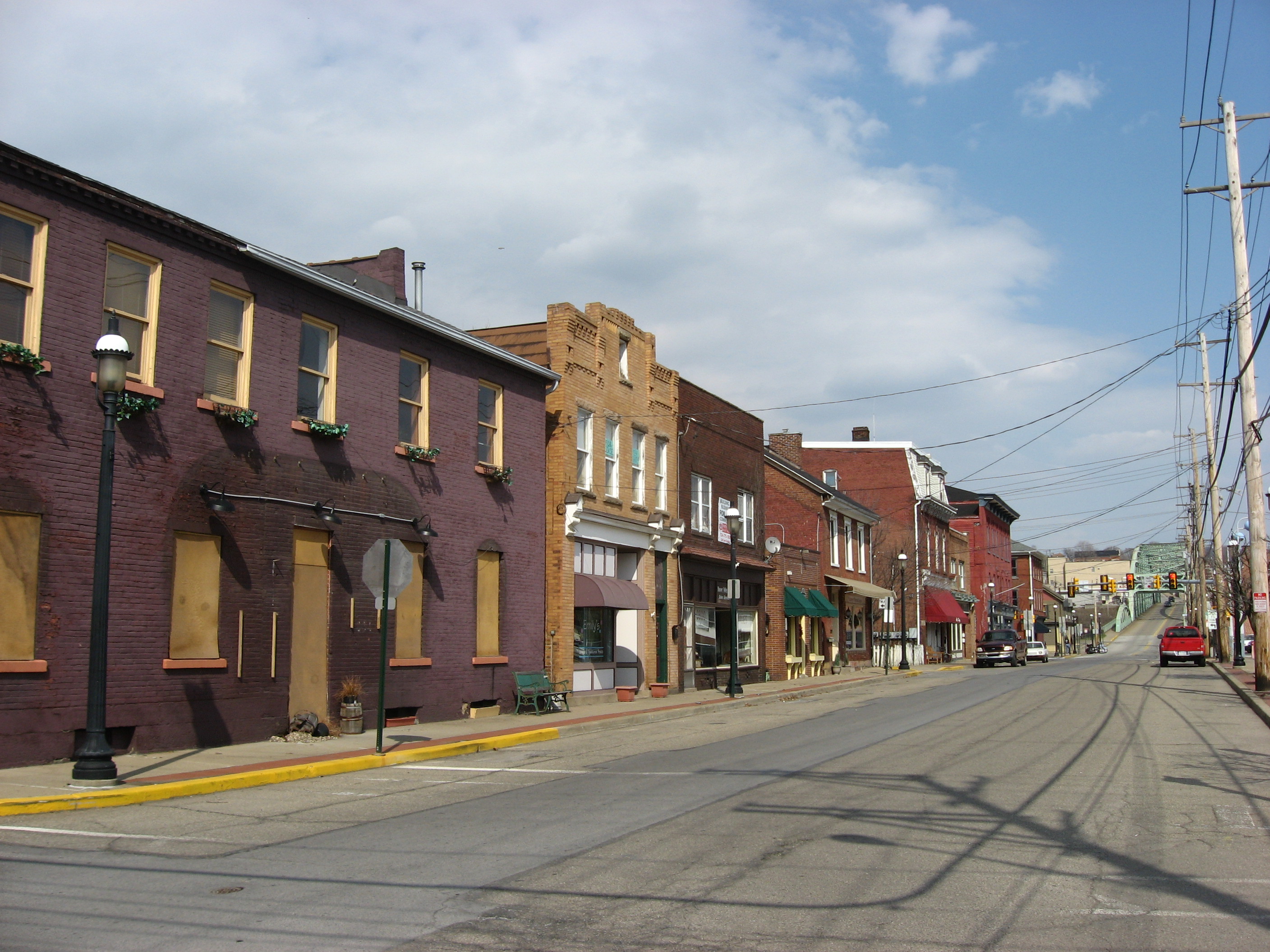
40°47′26″N 80°29′38″W / 40.790556°N 80.493889°WDarlington and South Beaver Townships Pratt pony truss bridge in rural northwestern Beaver County 4 Bridgewater Historic District 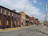
June 28, 1996 Roughly bounded by Bridge Street, Mulberry Street, Fulton Street, Cherry Alley, Elm Street, and the Beaver River
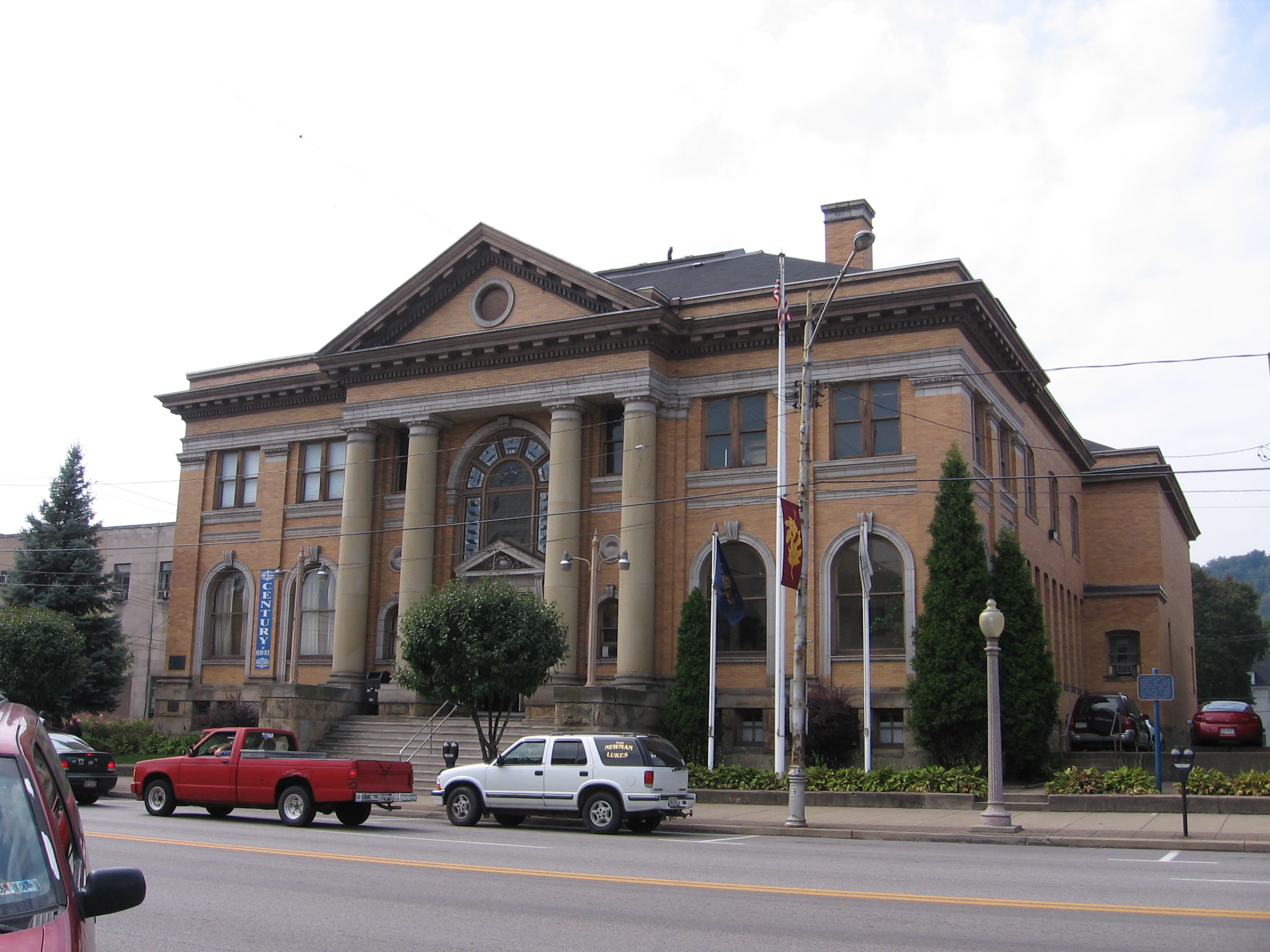
40°42′22″N 80°17′40″W / 40.706111°N 80.294444°WBridgewater and Rochester Historic residential and commercial areas of Bridgewater, plus a bridge from Bridgewater to Rochester 5 Carnegie Free Library, Beaver Falls 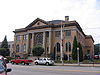
September 5, 1985 1301 7th Avenue
40°45′10″N 80°19′10″W / 40.752778°N 80.319444°WBeaver Falls Carnegie library and museum 6 James Beach Clow House 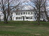
May 17, 1989 Chapel Drive at Ann Street
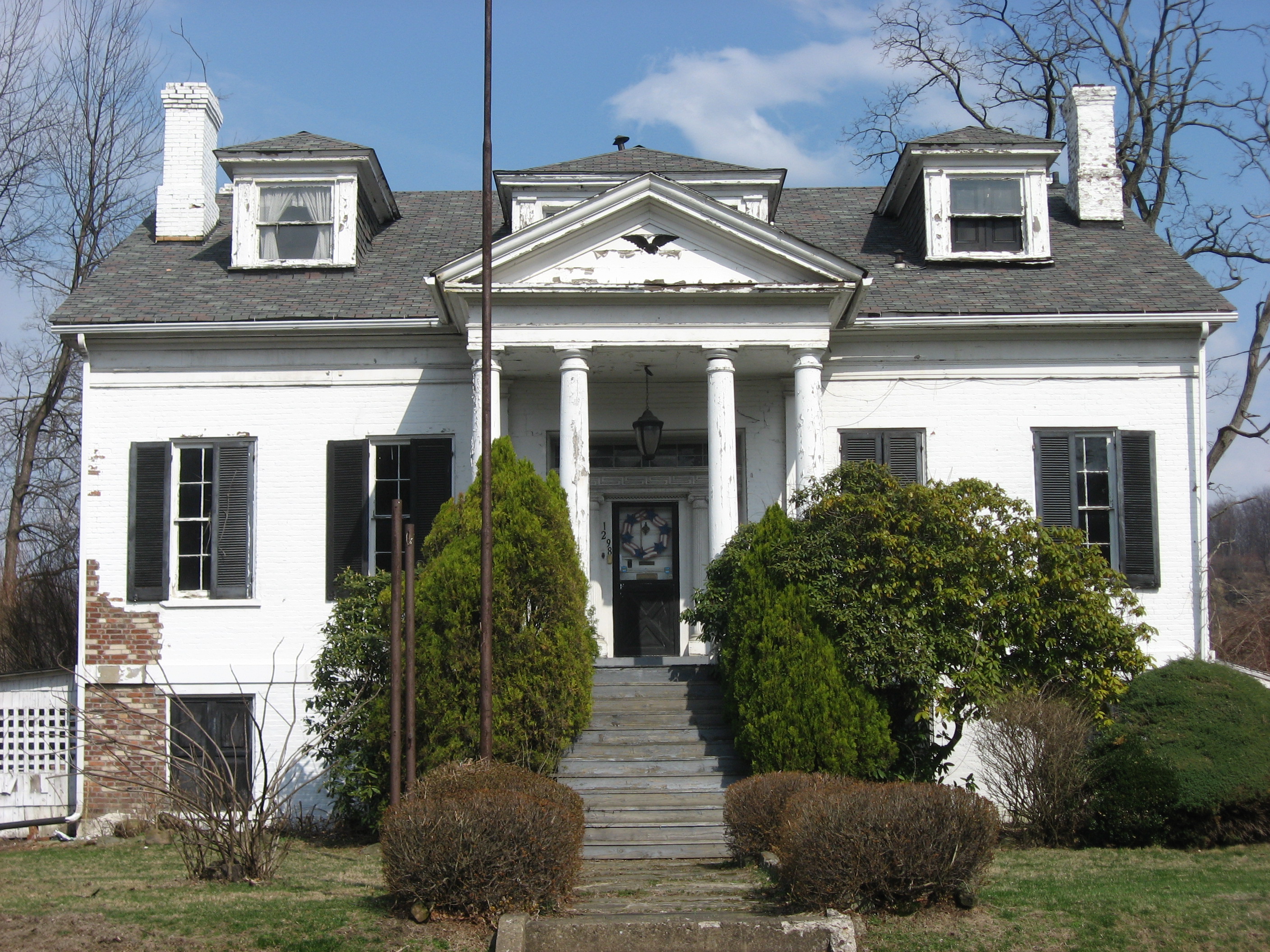
40°49′33″N 80°15′32″W / 40.825833°N 80.258889°WNorth Sewickley Township Well-preserved Greek Revival farmhouse 7 William B. Dunlap Mansion 
August 29, 1980 1298 Market Street
40°42′28″N 80°17′53″W / 40.707778°N 80.298056°WBridgewater Home of merchant and politician William B. Dunlap 8 Economy Historic District 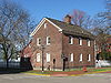
May 21, 1985 Old Economy Village roughly bounded by Pennsylvania Route 65 and 12th, Merchant, and 16th Streets
40°35′46″N 80°13′55″W / 40.596111°N 80.231944°WAmbridge Final home of the Harmony Society 9 Fort McIntosh Site 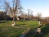
April 24, 1975 On a bluff overlooking the Ohio River, along River Road between College and Dravo Avenues
40°41′27.35″N 80°18′14.75″W / 40.6909306°N 80.3040972°W[4]Beaver Site of a 1780s frontier fort 10 Greersburg Academy 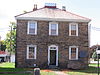
February 24, 1975 Junction of Third and Market Streets
40°48′36″N 80°25′25″W / 40.81°N 80.42361°W[5]Darlington Formerly a school and currently a museum 11 B.F. Jones Memorial Library 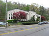
December 15, 1978 663 Franklin Avenue
40°36′47″N 80°15′05″W / 40.613056°N 80.251389°WAliquippa Built in honor of steel tycoon B.F. Jones 12 Legionville 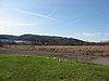
March 27, 1975 Between the Ohio River and Duss Avenue, north of its intersection with Legionville Road and south of its intersection with Anthony Wayne Drive
40°37′16″N 80°13′42″W / 40.62111°N 80.22833°W[6]Harmony Township First official U.S. Army training grounds 13 David Littell House 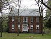
October 31, 1986 Pennsylvania Route 18
40°33′24″N 80°24′15″W / 40.556728°N 80.404119°WHanover Township Well-preserved 1850s brick farmhouse 14 Merrick Art Gallery 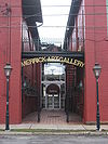
August 5, 1983 5th Avenue and 11th Street
40°43′59″N 80°18′39″W / 40.733056°N 80.310833°WNew Brighton 15 Merrill Lock No. 6 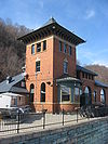
September 4, 1980 East of Midland on Pennsylvania Route 68
40°40′07″N 80°21′06″W / 40.668611°N 80.351667°WIndustry Buildings associated with a lock and dam complex on the Ohio River 16 Old Economy 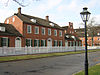
October 15, 1966 Northeast of Pittsburgh on Pennsylvania Route 65
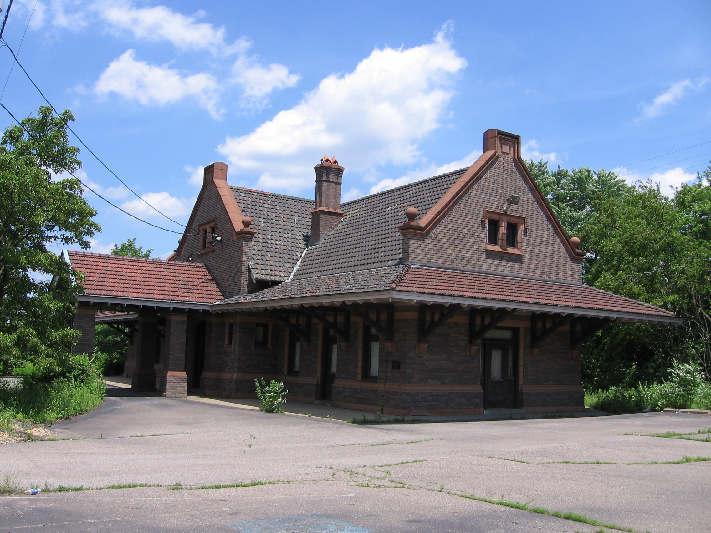
40°35′46″N 80°13′59″W / 40.596111°N 80.233056°WAmbridge Final home of the Harmony Society 17 Pittsburgh and Lake Erie Passenger Station, Aliquippa 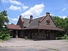
April 26, 1990 111 Station Street
40°37′10″N 80°14′35″W / 40.61935°N 80.24311°WAliquippa Former railroad station and office building 18 Matthew S. Quay House 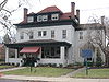
May 15, 1975 205 College Avenue
40°41′37″N 80°18′15″W / 40.693611°N 80.304167°WBeaver Home of Matthew S. Quay, a powerful U.S. senator 19 Raccoon Creek RDA 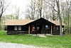
May 18, 1987 Along Pennsylvania Route 18 in Raccoon Creek State Park
40°30′42″N 80°26′34″W / 40.511667°N 80.442778°WHanover Township Recreational Demonstration Area constructed during the Great Depression[7] 20 Capt. William Vicary House 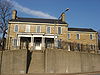
November 8, 1974 1235 3rd Ave.
40°40′55″N 80°15′0″W / 40.68194°N 80.25°W[8]Freedom Early nineteenth-century stone mansion See also
- List of National Historic Landmarks in Pennsylvania
- National Register of Historic Places listings in Pennsylvania
- List of Pennsylvania state historical markers in Beaver County
References
- ^ The latitude and longitude information provided in this table was derived originally from the National Register Information System, which has been found to be fairly accurate for about 99% of listings. For about 1% of NRIS original coordinates, experience has shown that one or both coordinates are typos or otherwise extremely far off; some corrections may have been made. A more subtle problem causes many locations to be off by up to 150 yards, depending on location in the country: most NRIS coordinates were derived from tracing out latitude and longitudes off of USGS topographical quadrant maps created under the North American Datum of 1927, which differs from the current, highly accurate WGS84 GPS system used by Google maps. Chicago is about right, but NRIS longitudes in Washington are higher by about 4.5 seconds, and are lower by about 2.0 seconds in Maine. Latitudes differ by about 1.0 second in Florida. Some locations in this table may have been corrected to current GPS standards.
- ^ "National Register of Historic Places: Weekly List Actions". National Park Service, United States Department of the Interior. Retrieved on November 10, 2011.
- ^ Numbers represent an ordering by significant words. Various colorings, defined here, differentiate National Historic Landmark sites and National Register of Historic Places Districts from other NRHP buildings, structures, sites or objects.
- ^ Location derived from Taylor, David S. National Register of Historic Places Inventory/Nomination: Beaver Historic District, National Park Service, 1996-07-06, page 4. The NRIS lists the site as "Address Restricted"
- ^ Greersburg Academy, Beaver County History Online, 1982. Accessed 2009-07-05.
- ^ Location derived from the area labeled "Legionville" on USGS topographical maps; the NRIS lists the site as "Address Restricted"
- ^ "The National Parks:Shaping the System:" (PDF). National Park Service. 2005. http://www.cr.nps.gov/history/online_books/shaping/part2.pdf. Retrieved 2007-03-14.
- ^ Location derived from this house owner's website; the NRIS lists it at the nonexistent 1251 4th St.
National Register of Historic Places in Beaver County, Pennsylvania National Historic Landmarks 
National Historic Landmark District Historic districts Beaver Historic District | Bridgewater Historic District | Economy Historic District | Raccoon Creek RDA
Other properties Bridge in South Beaver Township | Carnegie Free Library, Beaver Falls | James Beach Clow House | William B. Dunlap Mansion | Fort McIntosh Site | Greersburg Academy | B.F. Jones Memorial Library | Legionville | David Littell House | Merrick Art Gallery | Merrill Lock No. 6 | Pittsburgh and Lake Erie Passenger Station, Aliquippa | Capt. William Vicary House
See also: National Register of Historic Places listings in Beaver County, Pennsylvania and List of National Historic Landmarks in PennsylvaniaMunicipalities and communities of Beaver County, Pennsylvania Cities 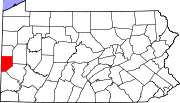
Boroughs Ambridge | Baden | Beaver | Big Beaver | Bridgewater | Conway | Darlington | East Rochester | Eastvale | Economy | Ellwood City‡ | Fallston | Frankfort Springs | Freedom | Georgetown | Glasgow | Homewood | Hookstown | Industry | Koppel | Midland | Monaca | New Brighton | New Galilee | Ohioville | Patterson Heights | Rochester | Shippingport | South Heights | West Mayfield
Townships Brighton | Center | Chippewa | Darlington | Daugherty | Franklin | Greene | Hanover | Harmony | Hopewell | Independence | Marion | New Sewickley | North Sewickley | Patterson | Potter | Pulaski | Raccoon | Rochester | South Beaver | Vanport | White
Unincorporated
communitiesByersdale | Cannelton | Fombell | Frisco | Gringo | Harshaville | Kobuta
Footnotes ‡This populated place also has portions in an adjacent county or counties
Categories:- National Register of Historic Places in Pennsylvania by county
- Beaver County, Pennsylvania
-


Wikimedia Foundation. 2010.