- National Register of Historic Places listings in Beaver County, Oklahoma
-
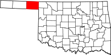 Location of Beaver County in Oklahoma
This is a list of the National Register of Historic Places listings in Beaver County, Oklahoma.
This is intended to be a complete list of the properties on the National Register of Historic Places in Beaver County, Oklahoma, United States. The locations of National Register properties for which the latitude and longitude coordinates are included below, may be seen in a Google map.[1]
There are 11 properties listed on the National Register in the county.
-
- This National Park Service list is complete through NPS recent listings posted November 10, 2011.[2]
Current listings
[3] Landmark name [4] Image Date listed Location City or town Summary 1 Beaver County Courthouse August 23, 1984 Off U.S. Route 270
36°48′57″N 100°31′16″W / 36.815833°N 100.521111°WBeaver 2 Floris Grain Elevator October 7, 1983 Off U.S. Route 64
36°52′13″N 100°42′28″W / 36.870278°N 100.707778°WFloris 3 Gate School September 10, 1999 Junction of 4th and Texas
36°51′18″N 100°03′23″W / 36.855°N 100.056389°WGate 4 Knowles Grain Elevator May 13, 1983 U.S. Route 64
36°52′28″N 100°11′30″W / 36.874444°N 100.191667°WKnowles 5 Lane Cabin June 5, 1974 Main St. and Ave. C
36°49′03″N 100°31′03″W / 36.8175°N 100.5175°WBeaver 6 Lonker Archeological Site November 27, 1978 Address Restricted Gate 7 Old Settler's Irrigation Ditch July 27, 1983 Intersects U.S. Route 283 north of Rosston
36°56′55″N 99°57′47″W / 36.948611°N 99.963056°WRosston 8 Presbyterian Church May 16, 1974 3rd St. and Ave. E
36°48′51″N 100°31′13″W / 36.814167°N 100.520278°WBeaver 9 Billy Rose Archeological Site September 1, 1978 Address Restricted Mocane 10 Sharps Creek Crossing Site April 4, 1975 Address Restricted Turpin 11 Turpin Grain Elevator May 13, 1983 Off U.S. Route 64
36°52′45″N 100°52′35″W / 36.879167°N 100.876389°WTurpin See also
- List of National Historic Landmarks in Oklahoma
- National Register of Historic Places listings in Oklahoma
References
- ^ The latitude and longitude information provided in this table was derived originally from the National Register Information System, which has been found to be fairly accurate for about 99% of listings. For about 1% of NRIS original coordinates, experience has shown that one or both coordinates are typos or otherwise extremely far off; some corrections may have been made. A more subtle problem causes many locations to be off by up to 150 yards, depending on location in the country: most NRIS coordinates were derived from tracing out latitude and longitudes off of USGS topographical quadrant maps created under the North American Datum of 1927, which differs from the current, highly accurate WGS84 GPS system used by Google maps. Chicago is about right, but NRIS longitudes in Washington are higher by about 4.5 seconds, and are lower by about 2.0 seconds in Maine. Latitudes differ by about 1.0 second in Florida. Some locations in this table may have been corrected to current GPS standards.
- ^ "National Register of Historic Places: Weekly List Actions". National Park Service, United States Department of the Interior. Retrieved on November 10, 2011.
- ^ Numbers represent an ordering by significant words. Various colorings, defined here, differentiate National Historic Landmark sites and National Register of Historic Places Districts from other NRHP buildings, structures, sites or objects.
- ^ "National Register Information System". National Register of Historic Places. National Park Service. . http://nrhp.focus.nps.gov/natreg/docs/All_Data.html.
U.S. National Register of Historic Places Topics Lists by states Alabama • Alaska • Arizona • Arkansas • California • Colorado • Connecticut • Delaware • Florida • Georgia • Hawaii • Idaho • Illinois • Indiana • Iowa • Kansas • Kentucky • Louisiana • Maine • Maryland • Massachusetts • Michigan • Minnesota • Mississippi • Missouri • Montana • Nebraska • Nevada • New Hampshire • New Jersey • New Mexico • New York • North Carolina • North Dakota • Ohio • Oklahoma • Oregon • Pennsylvania • Rhode Island • South Carolina • South Dakota • Tennessee • Texas • Utah • Vermont • Virginia • Washington • West Virginia • Wisconsin • WyomingLists by territories Lists by associated states Other National Register of Historic Places in Beaver County, Oklahoma Beaver Beaver County Courthouse · Lane Cabin · Presbyterian Church

Floris Floris Grain Elevator
Gate Gate School · Lonker Archaeological Site
Knowles Knowles Grain Elevator
Mocane Billy Rose Archaeological Site
Rosston Old Settler's Irrigation Ditch
Turpin Turpin Grain Elevator · Sharps Creek Crossing Archaeological Site
See also: National Register of Historic Places listings in Beaver County, Oklahoma and List of National Historic Landmarks in OklahomaCategories:- Beaver County, Oklahoma
- National Register of Historic Places in Oklahoma by county
- Buildings and structures in Beaver County, Oklahoma
-

Wikimedia Foundation. 2010.