- U.S. Route 283
Infobox U.S. Route
article_route=283
alternate_name=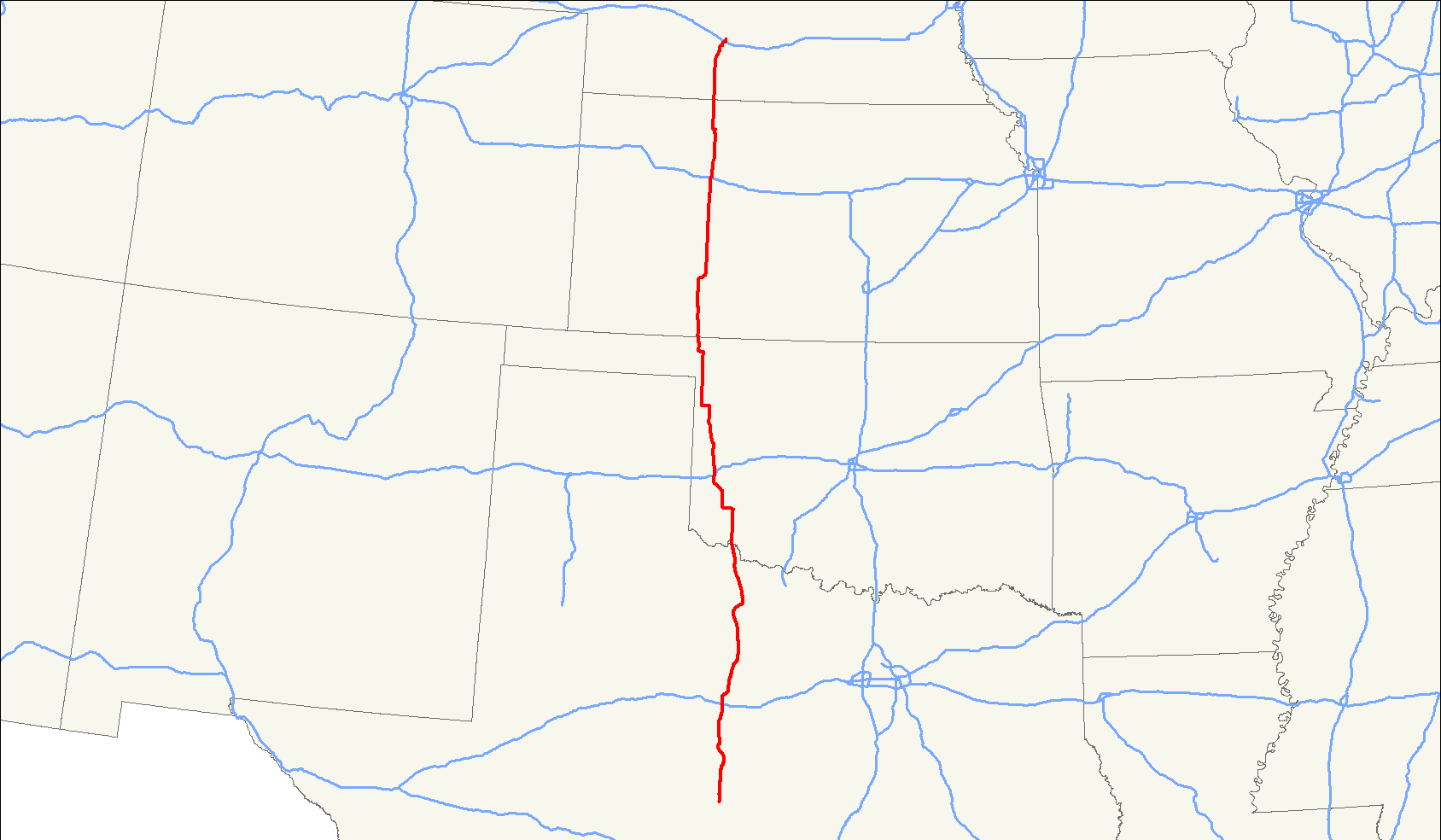
length_mi=730
length_round=
length_ref=cite web|last=Droz|first=Robert V|url=http://www.us-highways.com/usbt.htm|title=U.S. Highways: From US 1 to (US 830)|accessdate=2007-07-18]
yrcom=1931
direction_a=South
from=Jct|state=TX|US|87 nearBrady, TX
junction=Jct|state=TX|I|20 atBaird, TX
Jct|state=OK|I|40 atSayre, OK
Jct|state=KS|I|70 atWaKeeney, KS
Jct|state=NE|I|80 atLexington, NE
direction_b=North
to=Jct|state=NE|US|30 atLexington, NE
browse=
spur_of=83U.S. Route 283 is a spur of
U.S. Route 83 . It currently runs for 731 miles (1,175 km) fromBrady, Texas atU.S. Route 87 toLexington, Nebraska atU.S. Route 30 . It passes through the states ofTexas ,Oklahoma ,Kansas , andNebraska .Route description
Texas
Oklahoma
US-283 enters Oklahoma from Texas in rural Jackson County at a crossing of the
Red River . It runs concurrently with State Highway 5 for several miles past Elmer and continues north to Altus, the largest Oklahoma town on the route. At the intersection of U.S. Highway 62 in Altus, SH-5 splits off and 283 joins with State Highway 6 for the next 12 miles before it takes a western bend to the town of Mangum. The route continues northwesterly until it crosses I-40 at Sayre.Through northwestern Oklahoma, US-283 passes through very sparsely populated areas and is the main north-south traffic corridor. After passing through Cheyenne, 283 meanders through Black Kettle National Grassland then crosses the
Canadian River . It continues north to Arnett where it joins with State Highway 51 west for 7 miles then turns north again passing through Shattuck and Laverne following part of State Highway 15 along the way. North of Laverne, 283 turns west for 2 miles to visit the town of Rosston then turns north again to cross theCimarron River shortly before leaving the state for Kansas.Some points of interest along US-283 in Oklahoma include the Museum of the Western Prairie in Altus; the Old Greer County Museum in Mangum;
Black Kettle National Grassland and theWashita Battlefield National Historic Site near Cheyenne and the Shattuck Windmill Museum.Kansas
US-283 enters from Oklahoma south of Englewood in Clark County, and passes through largely unpopulated areas of the county until joining up for a brief concurrency with U.S. Route 160. Following the split, US-283 continues north through Minneola before making its way into Dodge City, the only town with a population of more than 3,300 the highway passes through in the Sunflower State.
At Dodge City, US-283 jogs east. It meets with U.S. Route 400, but the two highways do not stay joined for long; US-400 splits and heads southeast towards Greensburg, while US-283 continues eastbound past the
Dodge City Regional Airport . After passing the airport, the route then bends northeast before joining U.S. Route 50 and U.S. Route 56 for a brief stint.US-50 and US-56 peel east towards Kinsley, and US-283 resumes a due northerly course through open fields before reaching Jetmore, where K-156 crosses in an east-west direction. K-156 heads to Garden City westbound and Great Bend eastbound. The highway continues on another stretch through sparsely populated farmland before reaching Ness City and K-96, the first of two junctions in Ness County. The other junction in the county is at K-4 near Ransom.
The highway reaches Interstate 70 in WaKeeney, and makes a brief jog east through downtown WaKeeney before turning back to the north. US-283 between Ransom and I-70 was closed for much of 2006 as part of a major reconstruction program.
The highway continues north to Hill City, where it crosses U.S. Route 24. The route stays on course until it reaches southern Norton County, where it has a brief concurrency with K-9. At the split, K-9 continues west to Lenora, and US-283 resumes a straight northerly direction until the city of Norton, where after crossing U.S. Route 36, it reaches
Nebraska 11 miles later.With the exception of small sections in Dodge City, all portions of US-283 in Kansas are two-laned.
Nebraska
U.S. Highway 283 enters Nebraska south of Arapahoe. At Arapahoe, US 283 meets
U.S. Highway 6 andU.S. Highway 34 . It continues north through Elwood, then turns northeast. Near Lexington, US 283 crosses thePlatte River and intersectsInterstate 80 . It continues north into Lexington as a divided highway and ends at an intersection withU.S. Highway 30 .References
###@@@KEYEND@@@###
Wikimedia Foundation. 2010.