California State Route 283
- California State Route 283
Infobox road
state=CA
type=SR
route=283
section=583
maint=Caltrans
length_mi=0.36
length_ref= [ [http://www.dot.ca.gov/hq/structur/strmaint/brlog2.htm January 1, 2006 California Log of Bridges on State Highways] ]
length_round=2
established=1970 (from U.S. Route 101) [ [http://cahighways.org/281-288.html#283 California Highways: Unsigned State Route 283] ]
direction_a=South
terminus_a=jct|state=CA|US|101 near Scotia
direction_b=North
terminus_b=Rio Dell
previous_type=SR
previous_route=282
next_type=SR
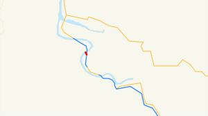
next_route=284State Route 283, also known as SR 283, is the shortest state highway in California, extending only 0.36 miles (0.58 km). Unsigned along its entire length, SR 283 runs from U.S. Route 101 south of Rio Dell to the north end of the Eel River Bridge in Rio Dell. The route was defined in 1970 as a transfer from a realigned Route 101.
State Route 283 largely serves as a trunk route into Rio Dell while relegating the maintenance of the Eel River Bridge to Caltrans. The bridge itself was built in 1941, when U.S. Route 101 ran through what was then known as Eagle Prairie. In 1977, the bridge was renamed the Albert Stanwood Murphy Memorial Bridge, in honor of the Pacific Lumber president who assisted the Save-the-Redwoods League. In 1990, the bridge was given a second name, the Eagle Prairie Bridge, in honor of the 50th anniversary of the bridge's construction and the 25th anniversary of Rio Dell's incorporation.
References
External links
* [http://www.dot.ca.gov/hq/roadinfo/sr283 Caltrans: Route 283 highway conditions]
* [http://www.cahighways.org/281-288.html#283 California Highways: Route 283]
* [http://www.geocities.com/bennyp81/ca283.html The Big Highways Page: California Route 283]
Wikimedia Foundation.
2010.
Look at other dictionaries:
California State Route 41 — CA 41 redirects here. For the congressional district, see California s 41st congressional district. State Route 41 … Wikipedia
California State Route 9 — Infobox road state=CA type=SR route=9 section=309 maint=Caltrans length mi=38.49 length ref= [http://www.dot.ca.gov/hq/structur/strmaint/brlog2.htm January 1, 2006 California Log of Bridges on State Highways] ] length round=2 established=1934… … Wikipedia
California State Route 16 — Infobox road state=CA type=SR route=16 section=316 maint=Caltrans length mi=111.17 length ref= [http://www.dot.ca.gov/hq/structur/strmaint/brlog2.htm July 2007 California Log of Bridges on State Highways] ] length round=2 length notes=(includes… … Wikipedia
California State Route 153 — Infobox road state=CA type=SR route=153 section=453 maint= length mi=0.550 length round=3 length ref= direction a=West terminus a=Marshall s Monument direction b=East terminus b=jct|state=CA|SR|49 at Coloma previous type=SR previous route=152… … Wikipedia
California State Route 282 — Infobox road state=CA type=SR route=282 section=582 maint=Caltrans length mi=0.6 length round=1 length ref= [ [http://www.dot.ca.gov/hq/structur/strmaint/brlog2.htm January 1, 2006 California Log of Bridges on State Highways] ] direction a=West… … Wikipedia
California State Route 284 — Infobox road state=CA type=SR route=284 section=584 maint=Caltrans length mi=8.302 length round=3 length ref= established= direction a=South terminus a=jct|state=CA|SR|70 at Chilcoot direction b=North terminus b=Frenchman Lake previous type=SR… … Wikipedia
California Freeway and Expressway System — The California Freeway and Expressway System is a system of existing or planned freeways and expressways in the U.S. state of California. It is defined by the Streets and Highways Code.List of roads in the system*State Route 1 (part) *State Route … Wikipedia
List of highways numbered 283 — The following highways are numbered 283: United States Interstate 283 U.S. Route 283 Alabama State Route 283 … Wikipedia
Liste der State-, U.S.- und Interstate-Highways in Kalifornien — Dies ist eine Aufstellung von State Highways in Kalifornien, USA nach Nummern. Inhaltsverzeichnis 1 State Routes 2 Interstates 2.1 Zubringer und Umgehungen 3 U.S. Highways … Deutsch Wikipedia
California's 4th congressional district — Infobox U.S. congressional district state = California district number = 4 representative = John Doolittle party = Republican english area = 16,453 metric area = 43,298 percent urban = 67.4 percent rural = 32.6 population = 639,088 population… … Wikipedia
