- Pennsylvania Route 222
-
PA Route 222

Route information Maintained by PennDOT Length: 4.49 mi[2] (7.23 km) Existed: 1991[1] – present Major junctions South end: 

 I-78 / US 222 / PA 309 in Dorneyville[3]
North end:  PA 145 in Allentown[3]
Location Counties: Lehigh Highway system Roads in Pennsylvania
Interstate • US • State • Legislative← US 222PA 223  →
→Pennsylvania Route 222 is a 4.49 mi (7.23 km)-long state highway contained entirely in Allentown, Lehigh County, Pennsylvania and its immediate suburbs mostly along Hamilton Boulevard. The route, in center city Allentown, is aligned along West Hamilton, West Linden, and West Walnut Streets. The route is referenced as SR 2006,[4] under the Local Referencing System.[5]
The southern terminus of the route is at Interstate 78 and Pennsylvania Route 309 in Dorneyville, where the right-of-way of PA 222 changes designation to U.S. Route 222. The northern terminus is Pennsylvania Route 145 in Allentown.
Contents
Route description
PA 222 begins at an interchange with the concurrency of Interstate 78 and Pennsylvania Route 309. The junction is the northern terminus of U.S. Route 222, the right-of-way of PA 222, designated southward towards Reading as Hamilton Boulevard. Route 222 is aligned south of Dorney Park & Wildwater Kingdom, a local amusement park.[6][7] Direct access to Dorney Park is limited to 222 southbound, as northbound traffic must make a left turn onto Lincoln Avenue to access the park.[8] Half-mile east of Dorney Park, 222 splits into two carriageways, with 222 north remaining on Hamilton Boulevard and 222 south following the newer Hamilton Boulevard Bypass to the north. A short distance to the east, the separated 222 intersects Cedar Crest Boulevard, a major north–south arterial in the Allentown metropolitan area.[9]
 PA 222 near Dorney Park & Wildwater Kingdom in South Whitehall Township
Northeast of Cedar Crest Boulevard, the two carriageways merge into a single Hamilton Boulevard in the shadow of Cedar Crest College. Roughly a half-mile from the merge, 222 becomes Hamilton Street at Ott Street and is designated along the southern edge of Cedar Creek Park, the host of the annual Mayfair Festival.[10][11] Route 222 continues east, intersecting 24th Street and 15th Street, among other roads, west of downtown Allentown.[12] In the downtown district, 222 splits once more at 12th Street, with 222 north turning right onto 12th before returning east on Walnut Street.[13] A half-mile east of 12th Street, 222 intersects the southbound-only 7th Street, carrying Pennsylvania Route 145 south, west of the terminus at the northbound-only 6th Street (PA 145 north).[14]
Southbound PA 222 begins where The Morning Call is situated, two blocks north of Walnut Street at the intersection of Linden Street and 6th Street.[15] Route 222 south is aligned on Linden to 12th Street, where 222 south joins 222 northbound at Hamilton Street one block to the south.[14] Hamilton Boulevard also is home to the global headquarters of Air Products & Chemicals.
History
 PA 3 (1924-1930)
From the establishment of Allentown in the 18th century to the modern age, Hamilton Street has been the main arterial of the municipality. Similar to many other Allentown-area streets at the time; Hamilton, Linden, and Walnut Streets were used for trolley car and horse transportation. Following a economic depression the city suffered in the late 19th century, it rebounded in the 20th century with the establishment of many shopping stores on Hamilton Street; the commercial center of the city, that hosted the annual Workhorse Parade, a popular attraction in the 1910s.[16]
When the Sproul Road Bill was signed on May 31, 1911,[17] the state began maintenance over state highways. One of those highways was Legislative Route 157, the modern Hamilton Boulevard section of PA 222, west of Allentown. Another state highway was Legislative Route 159, aligned east of Allentown to downtown Bethlehem along Hanover Avenue and Broad Street. No routes had a designation within the city of Allentown.[18][19]
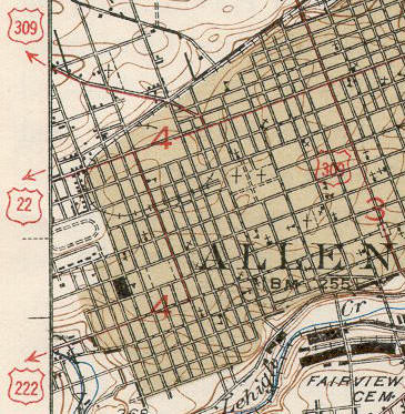
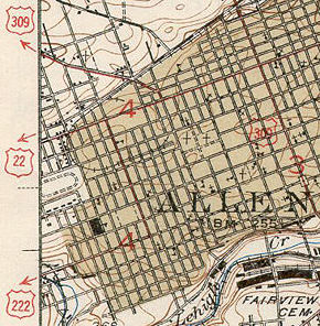 1939 USGS Allentown map. PA 222 was designated as US 222.
In 1916, the William Penn Highway was organized as an alternative to the Lincoln Highway. The roadway traversed downtown Allentown via Hamilton Street and Hamilton Boulevard. The Pennsylvania Department of Highways gave the road the Pennsylvania Route 3 numbering in 1924 and when the United States Highway System was formed, U.S. Route 22 became part of it.[20] The William Penn Highway served the nation's largest city; the road became problematic for motorists in Lebanon along the current U.S. Route 422; Reading via U.S. Routes 22 and 222; and Allentown on Hamilton Street (US 22).[21]
Pennsylvania Route 43 was aligned as a bypass, north of the Pennsylvania Dutch Country, between Allentown and Harrisburg.[22] On June 8, 1931, the American Association of State Highway Officials came to a resolution to the traffic problem, by replacing the PA 43 corridor with US 22 and the William Penn Highway name to match.[20][21] The state truncated PA 43 to Susquehanna Street from Allentown to Bethlehem.[23]
U.S. Route 222 replaced the former US 22 alignment from Reading to Allentown. Hamilton Street was numbered as US 222, west of downtown Allentown, where it turned north onto 15th Street. This portion of US 222 was seven-blocks long which ended at Tilghman Street (then US 22).[24] With the construction of the Lehigh Valley Thruway in the early 1950s and the relocation of US 22 to that route, US 222 was extended east along Tilghman Street to 7th Street, then north on 7th Street to the interchange with the new freeway.[25]
In the late 1950s, US 222 was realigned to a newly constructed bypass carrying U.S. Route 309 and PA Route 29, west of Allentown. From the south, US 222 left Hamilton Boulevard and turned north onto the freeway. US 222 terminated at an interchange with US 22, US 309, and PA 29 in South Whitehall Township.[26][27] The freeway, originally signed as US 309/PA 29/US 222, dropped the PA 29 designation in 1966; in 1968, US 309 was downgraded to PA 309 and US 222 was truncated to end at the current northern termini.[28][29][30] By the 1980s, Interstate 78 became part of the freeway that occupied PA 309.[31]
In 1984, the Pennsylvania Department of Transportation was planning to extend PA Route 145 and US 222. Traffic engineer Samuel D. Darrohh said that Allentown is one of few Pennsylvania cities without a traffic route going through it. After the plan was introduced, he said that motorists might be aided if US 222 is extended along Hamilton Boulevard to connect with the proposed PA 145 corridor.[32]
PennDOT originally planned the road as U.S. Route 222 but AASHTO denied the extension.[33] In 1991, it was commissioned as PA 222. PA 145 was extended south of the Lehigh Valley Thruway to the I-78/PA 309 overlap near Lanark.[1]
Major intersections
The entire route is in Lehigh County.
Location Mile[2] Destinations Notes South Whitehall Township 0.00 I-78 / PA 309
US 222 southExit 54 (I-78/PA 309). Northern terminus of US 222.
Former corridors of US 222, US 309, and PA 29.[34]1.14 Cedar Crest Boulevard (SR 1019)[3] Former corridor of PA 229.[23] Allentown 2.01 Ott Street Hamilton Boulevard and Hamilton Street transition. 2.31 24th Street (SR 2007)[3] 3.13 17th Street Access to Lehigh Valley Hospital; formerly PA 43[22] 3.36 15th Street Formerly part of US 222[23] 4.38 PA 145 south (7th Street)4.49 PA 145 north (6th Street)Allentown Symphony Hall. Headquarters of The Morning Call. 1.000 mi = 1.609 km; 1.000 km = 0.621 mi See also
References
- ^ a b "Routes 222, 145 Hookup Appoved PENNDOT Signs Along Hamilton Will Lead To 7th St. CROSSING". The Morning Call. 1991-07-10. http://pqasb.pqarchiver.com/mcall/access/91941121.html?dids=91941121:91941121&FMT=ABS&FMTS=ABS:FT&date=Jul+10%2C+1991&author=The+Morning+Call&pub=Morning+Call&edition=&startpage=B.05&desc=ROUTES+222%2C+145+HOOKUP+APPROVED+PENNDOT+SIGNS+ALONG+HAMILTON+WILL+LEAD+TO+7TH+ST.+CROSSING. Retrieved 2007-06-25.
- ^ a b DeLorme Street Atlas USA 2007. Toggle Measure Tool. Retrieved on June 24, 2007.
- ^ a b c d PennDOT. 2005 Lehigh County Traffic Map (Map). ftp://ftp.dot.state.pa.us/public/pdf/BPR_pdf_files/MAPS/Traffic/Traffic_Volume/2005/lehigh_2005_tv.pdf. Retrieved 2007-06-25.
- ^ DeLorme. Pennsylvania Atlas & Gazetteer (Map) (Detailed Topographic Maps ed.). p. 67, section D6.
- ^ "Location Referencing System (LRS) - Definitions, Uses & Testing (pp. 6-8)". PennDOT. ftp://ftp.dot.state.pa.us/public/Districts/District11/design/2006_SLD_Refresh/Lawrence_37/Lawrence_37.pdf. Retrieved 2007-07-11.
- ^ Rand McNally (2007). Motor Carriers' Road Atlas (Map) (Deluxe ed.). p. 88, section EC1.
- ^ Google, Inc. Google Maps – Exit 54 interchange of I-78 (PA 309) (Map). Cartography by Google, Inc. http://maps.google.com/maps?f=q&hl=en&geocode=&q=3500+Hamilton+Boulevard,+Allentown,+Pennsylvania&sll=37.0625,-95.677068&sspn=32.472848,58.271484&ie=UTF8&ll=40.574049,-75.535662&spn=0.007595,0.014226&z=16&om=1. Retrieved 2007-06-26.
- ^ Google, Inc. Google Maps – Route 222 south of Dorney Park (Map). Cartography by Google, Inc. http://maps.google.com/maps?f=q&hl=en&geocode=&q=3500+Hamilton+Boulevard,+Allentown,+Pennsylvania&sll=37.0625,-95.677068&sspn=32.472848,58.271484&ie=UTF8&ll=40.574049,-75.535662&spn=0.007595,0.014226&z=16&om=1. Retrieved 2007-06-26.
- ^ Google, Inc. Google Maps – Route 222 and Cedar Crest Blvd. (Map). Cartography by Google, Inc. http://maps.google.com/maps?f=q&hl=en&geocode=&q=3500+Hamilton+Boulevard,+Allentown,+Pennsylvania&sll=37.0625,-95.677068&sspn=32.472848,58.271484&ie=UTF8&ll=40.574049,-75.535662&spn=0.007595,0.014226&z=16&om=1. Retrieved 2007-06-26.
- ^ "About the Mayfair". Mayfair Festival. Archived from the original on 2007-10-10. http://web.archive.org/web/20071010124621/http://www.mayfairfestival.org/index.php?option=com_content&task=view&id=12&Itemid=26. Retrieved 2009-07-12.
- ^ "Mayfair Directions". Mayfair Festival. Archived from the original on 2007-10-10. http://web.archive.org/web/20071010124829/http://www.mayfairfestival.org/index.php?option=com_content&task=view&id=22&Itemid=37. Retrieved 2009-07-12.
- ^ Rand McNally (2007). Motor Carriers' Road Atlas (Map) (Deluxe ed.). p. 88, section EB2.
- ^ Google, Inc. Google Maps – 12th Street Area (Map). Cartography by Google, Inc. http://maps.google.com/maps?f=q&hl=en&geocode=&q=3500+Hamilton+Boulevard,+Allentown,+Pennsylvania&sll=37.0625,-95.677068&sspn=32.472848,58.271484&ie=UTF8&ll=40.574049,-75.535662&spn=0.007595,0.014226&z=16&om=1. Retrieved 2007-06-26.
- ^ a b Google, Inc. Google Maps – Downtown Allentown (Map). Cartography by Google, Inc. http://maps.google.com/maps?f=q&hl=en&geocode=&q=3500+Hamilton+Boulevard,+Allentown,+Pennsylvania&sll=37.0625,-95.677068&sspn=32.472848,58.271484&ie=UTF8&ll=40.574049,-75.535662&spn=0.007595,0.014226&z=16&om=1. Retrieved 2007-06-26.
- ^ Google Maps. Morning Call: 601 N. 6th Street, Allentown, PA (Map). http://maps.google.com/maps?f=q&hl=en&geocode=&q=%22The+Morning+Call,+Allentown,+Pennsylvania&sll=46.377254,-89.121094&sspn=28.273925,58.271484&ie=UTF8&ll=53.120405,-71.542969&spn=24.754767,58.447266&z=4&iwloc=A&om=1. Retrieved 2007-06-25.
- ^ Bartholomew, Ann E.; Carol M. Front (2002). Allentown. Arcadia Publishing. ISBN 0738509965.
- ^ "Department of Highways". Pennsylvania Historical and Museum Commission. http://www.phmc.state.pa.us/bah/DAM/rg/sd/r12sd.htm#constructionbureau. Retrieved 2007-06-25.
- ^ Pennsylvania Department of Highways. 1915 Lehigh County Map (Map). ftp://ftp.dot.state.pa.us/public/pdf/BPR_PDF_FILES/Maps/Type_10_GHS_Historical_Scans/Lehigh_1915.pdf. Retrieved 2007-06-25.
- ^ Pennsylvania Department of Highways. 1911 state Map, showing the early state highways (Map). ftp://ftp.dot.state.pa.us/public/pdf/BPR_pdf_files/Maps/Statewide/Historic_OTMs/1911.pdf. Retrieved 2007-06-25.
- ^ a b "William Penn Highway: US 22 in Pennsylvania". Federal Highway Administration. http://www.fhwa.dot.gov/infrastructure/us22.htm. Retrieved 2007-06-26.
- ^ a b Butko, Brian A.; Kevin Joseph Patrick (1999). Diners of Pennsylvania. Stackpole Books. ISBN 0811728781.
- ^ a b Pennsylvania Department of Highways. 1930 state map, front side (Map). ftp://ftp.dot.state.pa.us/public/pdf/BPR_pdf_files/Maps/Statewide/Historic_OTMs/1930fr.pdf. Retrieved 2007-06-26.
- ^ a b c Pennsylvania Department of Highways. 1941 Lehigh County Map (Map). ftp://ftp.dot.state.pa.us/public/pdf/BPR_PDF_FILES/Maps/Type_10_GHS_Historical_Scans/Lehigh_1941.pdf. Retrieved 2007-06-25.
- ^ Pennsylvania Department of Highways. 1940 state map, back side (Map). ftp://ftp.dot.state.pa.us/public/pdf/BPR_pdf_files/Maps/Statewide/Historic_OTMs/1940bk.pdf. Retrieved 2007-06-26.
- ^ "Pennsylvania Highways: US 222". Jeffrey J. Kitsko, pahighways.com. http://www.pahighways.com/us/US222.html. Retrieved 2011-01-07.
- ^ Pennsylvania Department of Highways. 1960 Lehigh County Map (Map). ftp://ftp.dot.state.pa.us/public/pdf/BPR_PDF_FILES/Maps/Type_10_GHS_Historical_Scans/Lehigh_1960.pdf. Retrieved 2007-06-26.
- ^ National Bridge Inventory, a database compiled by the United States Department of Transportation Federal Highway Administration, available at nationalbridges.com. Accessed 2007-06-26.
- ^ "End of US Highway 222". Dale Sanderson, USEnds.com. http://www.usends.com/20-29/222/222.html. Retrieved 2011-01-07.
- ^ "Pennsylvania Highways: US 309 (Decommissioned)". Jeffrey J. Kitsko, pahighways.com. http://www.pahighways.com/us/decommissioned/US309.html. Retrieved 2011-01-07.
- ^ Pennsylvania Department of Highways. 1970 state map, back side (Map). ftp://ftp.dot.state.pa.us/public/pdf/BPR_pdf_files/Maps/Statewide/Historic_OTMs/1970bk.pdf. Retrieved 2007-06-26.
- ^ PennDOT. 1980 state map, back side (Map). ftp://ftp.dot.state.pa.us/public/pdf/BPR_pdf_files/Maps/Statewide/Historic_OTMs/1980bk.pdf. Retrieved 2007-06-28.
- ^ Mellin, Ted (1984-07-31). "Route 145 Extension Through The City Receives Backing". The Morning Call. pp. B03. http://pqasb.pqarchiver.com/mcall/access/105495460.html?dids=105495460:105495460&FMT=ABS&FMTS=ABS:FT&date=Jul+31%2C+1984&author=TED+MELLIN%2C+The+Morning+Call&pub=Morning+Call&edition=&startpage=B.03&desc=R.145+EXTENSION+THROUGH+THE+CITY+RECEIVES+BACKING. Retrieved 2007-06-26.
- ^ "Route documents" (PDF). AASHTO. http://cms.transportation.org/sites/route/docs/1990-USRN_Cmte.pdf. Retrieved 2007-07-10.
- ^ Pennsylvania Department of Highways. 1960 Lehigh County Map (Map). ftp://ftp.dot.state.pa.us/public/pdf/BPR_PDF_FILES/Maps/Type_10_GHS_Historical_Scans/Lehigh_1960.pdf. Retrieved 2007-06-26.
External links
Transportation infrastructure of the Lehigh Valley Interstates U.S. Routes Pennsylvania Routes New Jersey Routes County Routes Named roads/streets Bridges Albertus L. Meyers Bridge · Hill to Hill Bridge · Philip J. Fahy Memorial Bridge · Minsi Trail Bridge · Easton–Phillipsburg Toll Bridge · Northampton Street Bridge · Interstate 78 Toll Bridge
Tunnels Public transportation Lehigh and Northampton Transportation Authority (Bethlehem Loop) · Trans-Bridge Lines · NJ Transit
Airports Waterways Rail Categories:- State highways in Pennsylvania
- Transportation in Lehigh County, Pennsylvania


Wikimedia Foundation. 2010.