- Delaware Route 41
-
Delaware Route 41
Lancaster Pike
Newport Gap PikeRoute information Maintained by DelDOT Length: 7.05 mi[1] (11.35 km) Major junctions South end:  DE 141 in Prices Corner
 DE 2 in Prices Corner
 DE 34 north of Prices Corner
 DE 48 in Hockessin
North end:  PA 41 near Hockessin
Highway system ←  US 40
US 40DE 42  →
→Delaware Route 41 (DE 41) is a highway in northwestern New Castle County. Its northern terminus is the Pennsylvania state line just north of Hockessin, and it continues on as Pennsylvania Route 41 to Gap. Its southern terminus is the on-ramp to Delaware Route 141 southbound. Just before its terminus, the highway is briefly concurrent with Delaware Route 2 in Prices Corner.
DE 41 was originally chartered as the Gap and Newport Turnpike in the 19th century. In the 1920s and 1930s, this road was upgraded into a state highway. DE 41 was designated by 1936 to run from US 40 (now DE 9/DE 273) in New Castle north to the Pennsylvania border in Hockessin. In the 1950s, the road from New Castle to north of Newport became concurrent with DE 141. DE 41 was removed from the DE 141 concurrency in the 1970s and was realigned to its current terminus in the 1980s, with a part of the old alignment becoming DE 62.
Contents
Route description
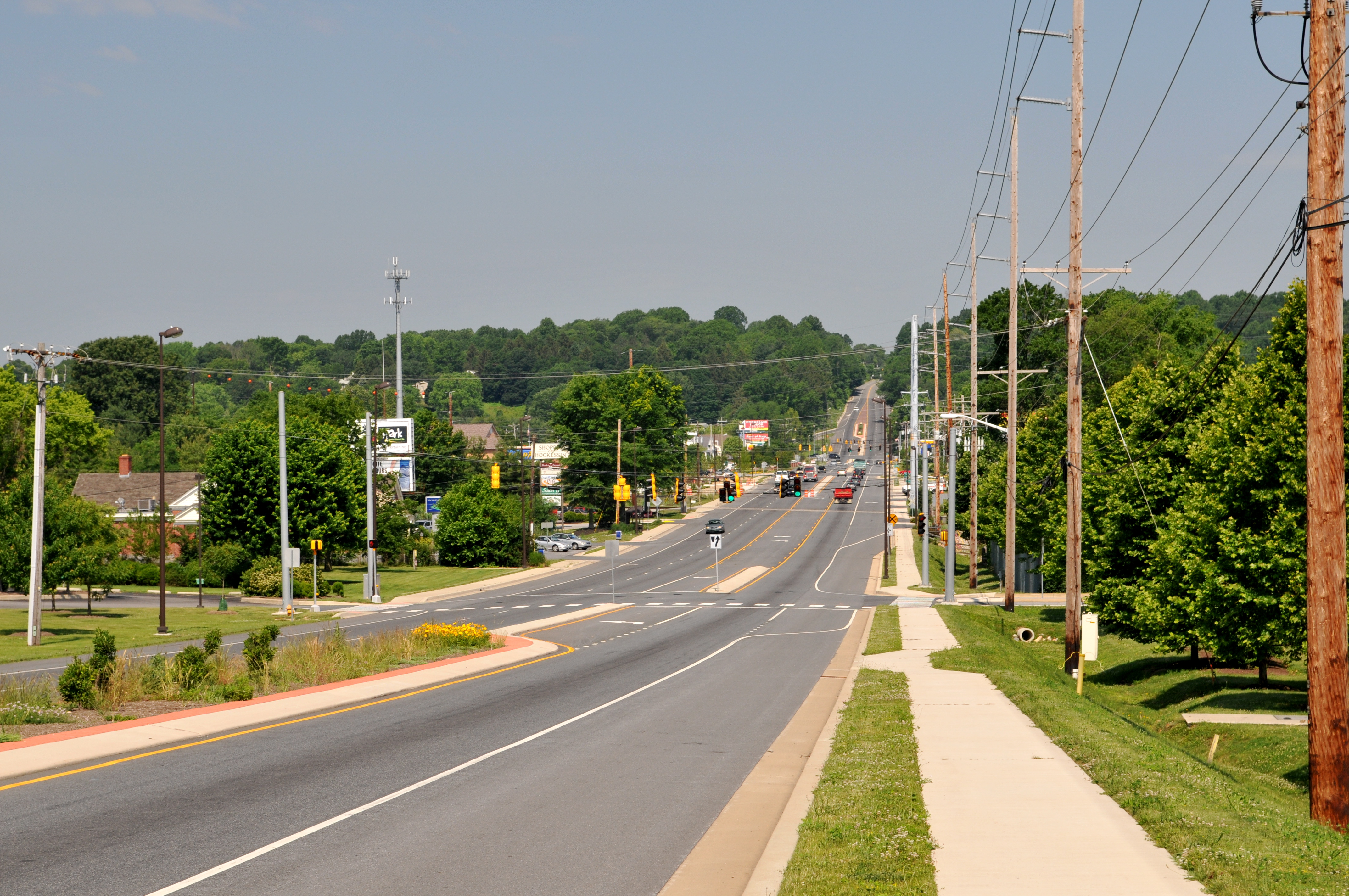
 Northbound DE 41 (Lancaster Pike) in Hockessin.
Delaware Route 41 begins at an interchange with DE 141 in Prices Corner, continuing west concurrent with DE 2 along the six-lane divided Kirkwood Highway. The route passes over Centerville Road before passing through commercial areas. DE 41 makes a turn northwest onto the Newport Gap Pike, which heads southeast from the Kirkwood Highway as DE 62. DE 41 is a two-lane divided highway before it crosses the Wilmington and Western Railroad and the Red Clay Creek in a wooded area. The route becomes an undivided road as it passes through residential neighborhoods with a few businesses. The road passes through woodland as it comes to an intersection with DE 34 (Faulkland Road). Past this junction, DE 41 passes through more suburban areas of homes, with stretches alternating between divided and undivided highway. It continues through developed areas and heads towards Hockessin. In Hockessin, DE 41 meets the western terminus of DE 48 (Lancaster Pike), and it merges onto the Lancaster Pike, which is briefly a divided highway before narrowing into an undivided road. The road continues to the northwest through more residential areas, again alternating between a divided and undivided road with two lanes. DE 41 turns more to the west-northwest as it enters business areas and becomes a three-lane divided highway with one northbound lane and two southbound lanes. The median turns into a center left-turn lane as the road passes more development, with the southbound direction narrowing to one lane at the Yorklyn Road intersection. The road briefly becomes a divided highway at the Valley Road junction. After leaving the center of Hockessin, the route becomes a three-lane undivided road, with two northbound lanes and one southbound lane. The road passes homes, eventually narrowing back to two lanes. DE 41 reaches the Pennsylvania border, where the route becomes PA 41, continuing northwest on Gap Newport Road.[1][2]
History
What is now DE 41 was originally chartered as the Gap and Newport Turnpike in 1808, an extension of the 1807-chartered turnpike in Pennsylvania that was to run from Gap, Pennsylvania southeast to Newport, Delaware.[3] By 1920, this road was maintained by the county.[4] By 1924, the road north of Lancaster Pike was proposed as a state highway.[5] A year later, what would become DE 41 between New Castle and Prices Corner was upgraded to a state highway.[6] By 1932, the portion of road between Brandywine Springs and Lancaster Pike became a state highway.[7] When Delaware assigned state route numbers by 1936, DE 41 was designated to run from US 40 (now DE 9/DE 273) in New Castle north to PA 41 at the Pennsylvania border in Hockessin, following Basin Road north to Newport, James Street through Newport, and the Newport Gap Pike north of there.[8] By 1952, DE 141 was designated to run concurrent with DE 41 from New Castle to north of Newport.[9] The southern terminus of DE 41 was truncated to DE 141 north of Newport by 1971, eliminating the concurrency with that route.[10] By 1981, DE 41 was realigned to follow DE 2 to end at an interchange with DE 141, with DE 62 being designated along the former DE 41 between DE 141 and DE 2.[11]
Junction list
The entire route is in New Castle County.
Location Mile[1] Intersections Notes Prices Corner 0.00 DE 141 (Basin Road)Interchange, southern terminus of DE 41 0.26 DE 2 east (Kirkwood Highway)South end of DE 2 concurrency 0.84  DE 2 west (Kirkwood Highway) / DE 62 east (Newport Gap Pike)
North end of DE 2 concurrency, Western terminus of DE 62 Brandywine Springs 1.85 DE 34 (Faulkland Road)Hockessin 4.28 DE 48 east (Lancaster Pike)Western terminus of DE 48 Pennsylvania state line 7.05 PA 41 (Gap Newport Pike)Northern terminus of DE 41, continues as PA 41 1.000 mi = 1.609 km; 1.000 km = 0.621 mi See also
 U.S. Roads portal
 Delaware portal
References
- ^ a b c http://www.deldot.gov/information/pubs_forms/manuals/traffic_counts/2006/pdf/rpt_pgs1_38_rev.pdf DelDOT 2006 Traffic Count and Mileage Report
- ^ Google, Inc. Google Maps – overview of Delaware Route 41 (Map). Cartography by Google, Inc. http://maps.google.com/maps?f=d&source=s_d&saddr=DE+2+and+north+woodward+avenue&daddr=DE+41+and+PA+41&geocode=FdBZXgIdDzB--yl7Ywvf_v3GiTGX_eUh9eQ7Wg%3BFQA3XwIdx7J8-ynN9A-Kff_GiTGWPpPfIu6FiQ&hl=en&mra=ls&sll=39.737678,-75.617652&sspn=0.003762,0.010568&ie=UTF8&t=h&z=13. Retrieved February 7, 2011.
- ^ Scharf, John Thomas. History of Delaware : 1609-1888, Volume 1. Philadelphia: L.J. Richards & Co.. p. 416. http://books.google.com/books?id=9wd5AAAAMAAJ&pg=PA416&dq=gap+and+newport+turnpike&hl=en&ei=1n5QTYHWO4XVgQeEnNTVDw&sa=X&oi=book_result&ct=result&resnum=1&ved=0CC0Q6AEwAA#v=onepage&q=gap%20and%20newport%20turnpike&f=false. Retrieved February 7, 2011.
- ^ Delaware Department of Transportation (PDF). Delaware Official Highway Map (Map) (1920 ed.). http://www.deldot.gov/archaeology/historic_pres/historic_highway_maps/pdf/cd_002.pdf. Retrieved April 15, 2010.
- ^ Delaware Department of Transportation (PDF). Delaware Official Highway Map (Map) (1924 ed.). http://www.deldot.gov/archaeology/historic_pres/historic_highway_maps/pdf/cd_003.pdf. Retrieved August 1, 2010.
- ^ Delaware Department of Transportation (PDF). Delaware Official Highway Map (Map) (1925 ed.). http://www.deldot.gov/archaeology/historic_pres/historic_highway_maps/pdf/cd_004.pdf. Retrieved August 19, 2010.
- ^ Delaware Department of Transportation (PDF). Delaware Official Highway Map (Map) (1932 ed.). http://www.deldot.gov/archaeology/historic_pres/historic_highway_maps/pdf/cd_006.pdf. Retrieved February 6, 2011.
- ^ Delaware Department of Transportation (PDF). Delaware Official Highway Map (Map) (1936/37 ed.). http://www.deldot.gov/archaeology/historic_pres/historic_highway_maps/pdf/cd_008.pdf. Retrieved April 15, 2010.
- ^ Delaware Department of Transportation (PDF). Delaware Official Highway Map (Map) (1952/53 ed.). http://www.deldot.gov/archaeology/historic_pres/historic_highway_maps/pdf/cd_026.pdf. Retrieved February 6, 2011.
- ^ Delaware Department of Transportation (PDF). Delaware Official Highway Map (Map) (1971 ed.). http://www.deldot.gov/archaeology/historic_pres/historic_highway_maps/pdf/cd_050.pdf. Retrieved April 15, 2010.
- ^ Delaware Department of Transportation (PDF). Delaware Official Highway Map (Map) (1981 ed.). http://www.deldot.gov/archaeology/historic_pres/historic_highway_maps/pdf/cd_058.pdf. Retrieved February 6, 2011.
Road transportation infrastructure of the metro Philadelphia area Interstates U.S. Routes Pennsylvania Routes New Jersey Routes Delaware Routes Named roads/streets Benjamin Franklin Parkway · Broad Street · City Avenue · Front Street · Girard Avenue · Market Street · Roosevelt Boulevard · South Street · Chestnut Street · Walnut Street
Pennsylvania Turnpike · New Jersey Turnpike · Delaware Turnpike · Atlantic City Expressway · Schuylkill Expressway · Delaware Expressway · Blue Route · Vine St Expressway · North South Freeway · Lancaster Avenue · Bethlehem Pike · Baltimore Pike · Black Horse PikeBridges Delaware Memorial Bridge · Commodore Barry Bridge · Walt Whitman Bridge · Ben Franklin Bridge · Betsy Ross Bridge · Tacony–Palmyra Bridge · Burlington–Bristol Bridge · Delaware River – Turnpike Toll BridgeCategories:- State highways in Delaware
- Transportation in New Castle County, Delaware

Wikimedia Foundation. 2010.