- Interstate 26
Infobox road
type=I
route=26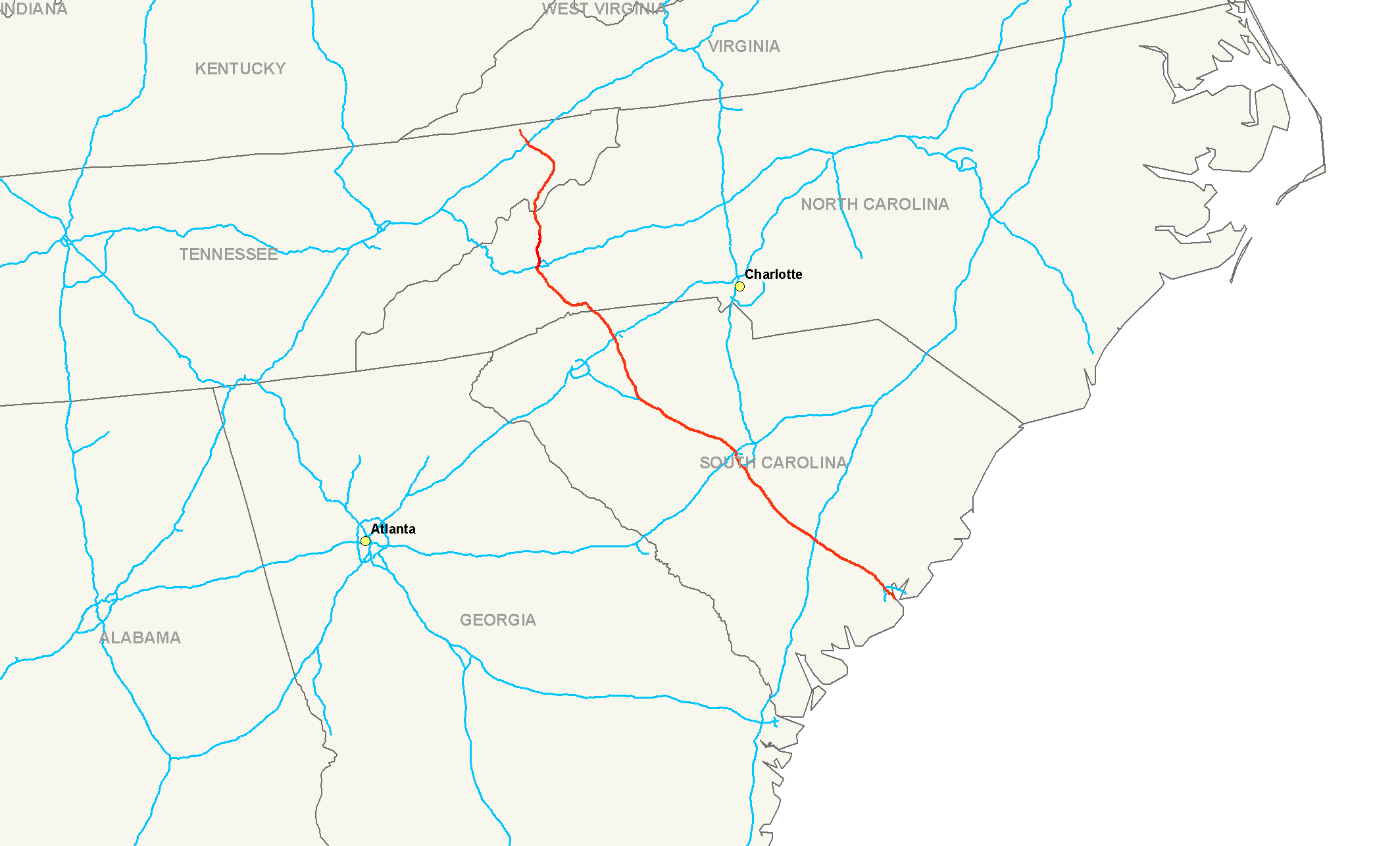
length_mi=349
length_round=2
length_ref=cite web|publisher=Interstate Guide|url=http://www.interstate-guide.com/i-026.html|title=Interstate 26 @ Interstate-Guide.com|accessdate=2008-02-15]
established=
direction_a=West
terminus_a=Jct|state=TN|US|11W|US|23|SR|1|SR|137 inKingsport, TN
junction=Jct|state=TN|I|81 inKingsport, TN
Jct|state=NC|I|40 inAsheville, NC
Jct|state=SC|I|85 nearSpartanburg, SC
Jct|state=SC|I|20 nearColumbia, SC
Jct|state=SC|I|77 in Cayce, SC
Jct|state=SC|I|95 near Rosinville SC
direction_b=East
terminus_b=Jct|state=SC|US|17 inCharleston, SC Interstate 26 (I-26) is a nominally east-west (but physically more north-south) main route of the
Interstate Highway System in theSoutheastern United States . I-26 runs from the junction ofU.S. Route 11W andU.S. Route 23 inKingsport, Tennessee , generally south and southeast toU.S. Route 17 inCharleston, South Carolina .cite web|publisher=Google Maps |url=http://maps.google.com/maps?f=d&hl=en&geocode=6310337734879748054,36.588650,-82.574130%3B14384335689451893313,32.799754,-79.945133&saddr=Exit+57+%4036.588650,+-82.574130&daddr=32.799721,-79.945064&mra=dme&mrcr=0&mrsp=1&sz=16&sll=32.799703,-79.942682&sspn=0.008153,0.014462&ie=UTF8&ll=34.759666,-80.057373&spn=4.079227,7.382813&z=7|title=Overview Map of I-26|accessdate=2008-02-15] The portion fromMars Hill, North Carolina , east (compass south) to Interstate 240 inAsheville, North Carolina , is signed as FUTURE I-26 because it does not yet meet allInterstate Highway standards . A short realignment as an improvement is also planned in Asheville.Prior to
August 5 ,2003 , the western terminus was atInterstate 40 on the southwest side of Asheville, where it continued on to make a clockwise loop around downtown asInterstate 240 . At that time, it was decided to extend the route northwest of Asheville intoTennessee . Thus the final section offreeway inNorth Carolina , from Mars Hill north to theTennessee state line, replaced the old two-lane U.S. Route 23. I-26 was extended into Tennessee on the US 23 freeway, taking over approximately one-half of the former "Interstate-181" fromU.S. Route 321 in Johnson City, to theInterstate 81 interchange southeast ofKingsport, Tennessee . TheAmerican Association of State Highway and Transportation Officials (AASHTO) denied an extension of I-26 (as a number) along the remainder of I-181 to Kingsport, since that would give a main route Interstate Highway (I-26) a stub end, not connecting to any other Interstate, an international border, or a seacoast. The numerical extension was finally achieved by the effect of the , signed into law onAugust 10 ,2005 . Thus the I-26 designation now extends to Kingsport, and it ends about two miles (three km) south of theVirginia state line, while thefreeway itself continues to the state line as US-23.Northwards from Kingsport, US-23 continues north to
Portsmouth, Ohio , as the Corridor B of theAppalachian Development Highway System , and beyond to Columbus, as the Corridor C. In conjunction with the Columbus-Toledo corridor formed byInterstate 75 , U.S. 23, and State Route 15, I-26 forms part of a mostly high-speed four-lane highway from theGreat Lakes to the Atlantic Coast inCharleston, South Carolina . There are no plans for further I-26 extensions intoVirginia ,Kentucky , beyond.Route description
-
TN
55
89
-
NC
71
114
-
SC
220.95
355.58
-
Total
347
558outh Carolina
Auxiliary routes
*
Interstate 126 is a spur intoColumbia, South Carolina from the northwest.
*Interstate 326 was a temporary unsigned designation for part of what is nowInterstate 77 south of Columbia.
*Interstate 526 is a partialbeltway of Charleston, South Carolina, running from U.S. Route 17 west of the city north to I-26 and back east and south to US 17 east of Charleston.External links
* [http://www.fhwa.dot.gov/reports/routefinder/ FHWA Route Log and Finder List]
* [http://www.mountainx.com/news/2003/0716tennessee.php Political History of I-26]
* [http://www.tricities.com/tristate/tri/news.apx.-content-articles-TRI-2007-03-02-0001.html News article listing new I-26 exit numbers published March 2, 2007]References
###@@@KEYEND@@@###
Wikimedia Foundation. 2010.