- Cumberland Gap Tunnel
-
Cumberland Gap Tunnel 
Carries 4 lanes of U.S. Route 25E Crosses Tennessee-Kentucky state line underneath Cumberland Gap Locale Cumberland Gap, Tennessee, Middlesboro, Kentucky Total length 4,600 ft (1,402.08 m) Vertical clearance 30 ft (9.14 m) Opened October 18, 1996 Toll none Coordinates 36°36′21″N 83°40′37″W / 36.60583°N 83.67694°W  Approach from Cumberland Gap, Tennessee
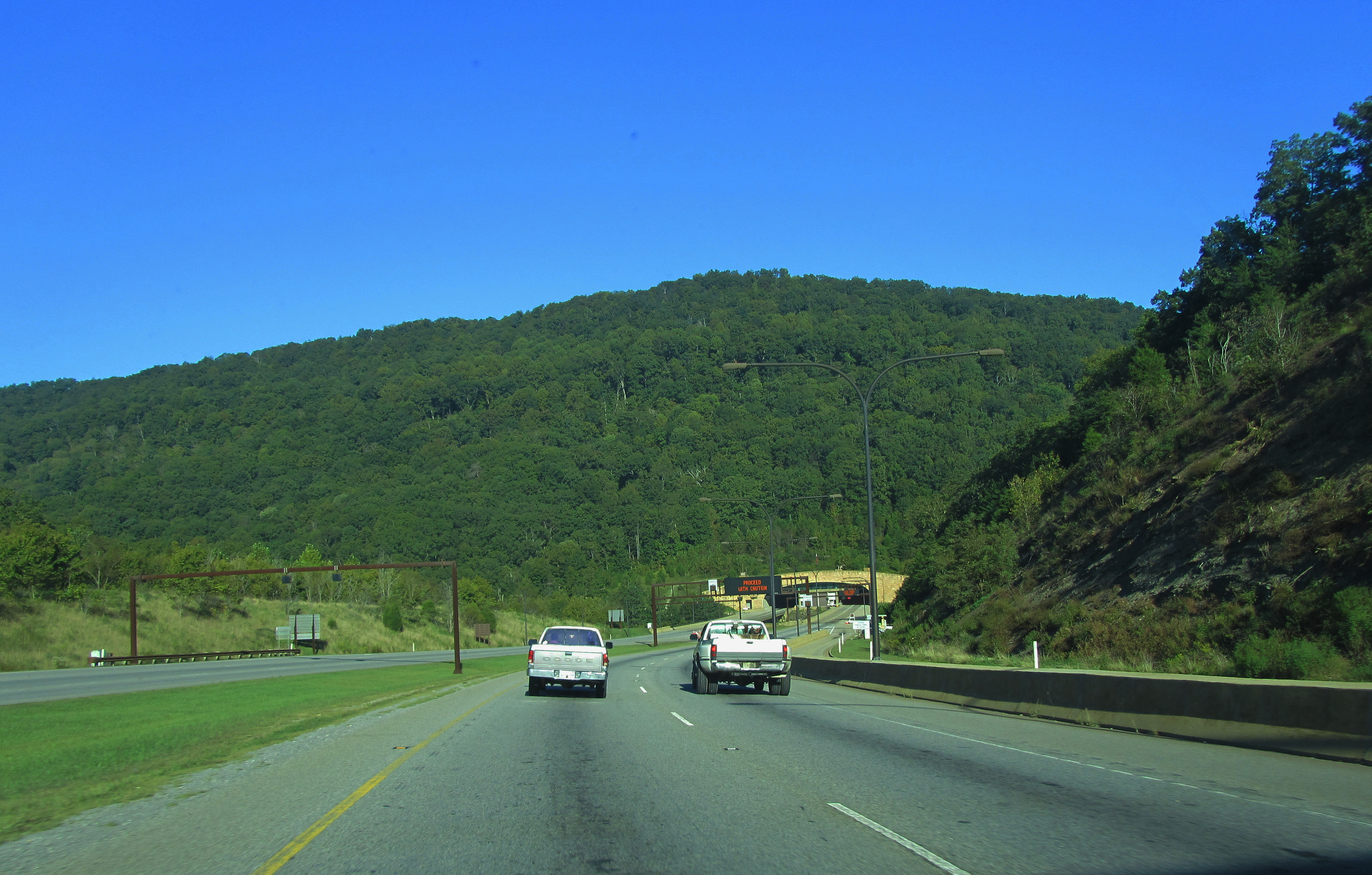
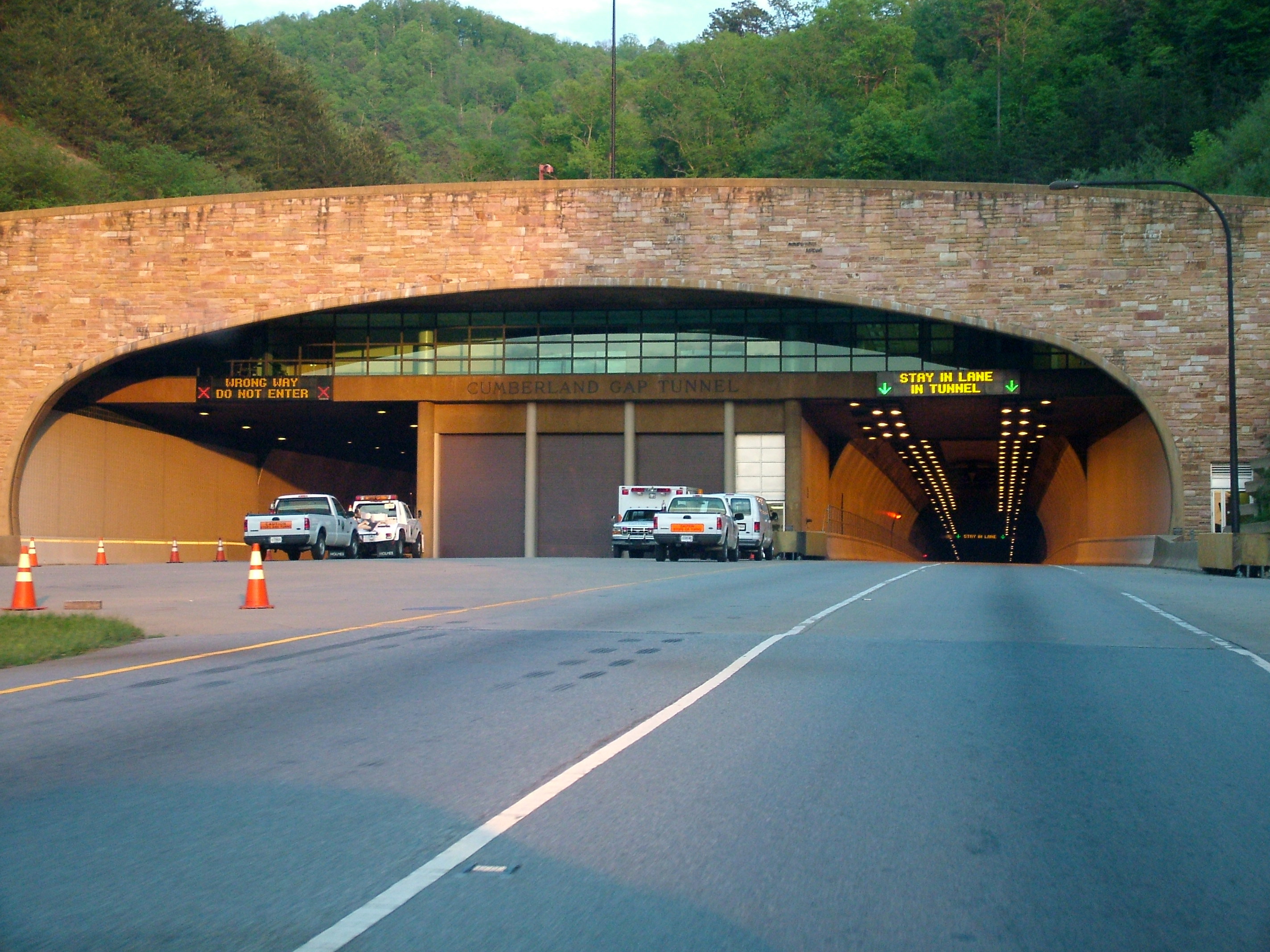
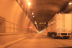 Tunnel interior
The Cumberland Gap Tunnel is a tunnel that carries U.S. Route 25E under Cumberland Gap National Historical Park near the intersection of Kentucky, Tennessee, and Virginia. The east portal of the tunnel is in Tennessee and the west portal is in Kentucky; according to United States Geological Survey maps of the area, the tunnel does not enter Virginia. It is one of only two mountain vehicular tunnels in the United States that cross a state line, the other being the East River Mountain Tunnel on Interstate 77 between Virginia and West Virginia.
Data
The tunnels consist of two tubes, each 4,600 feet (1,402 m) long. Each tube carries two lanes of traffic. An "illumination zone" is included at each portal to allow drivers' vision to adjust to the lower light level in the tunnel. The speed limit in the tunnel is 45 mph (70 km/h); lane changes are prohibited. Trucks carrying Class 1 hazardous cargo (i.e., explosives) are prohibited from using the tunnels, while other hazardous cargo and wide loads are directed to a pull-off area and sent through one at a time with an escort. The overall construction cost, including the four-lane approach roads at both portals, was $280 million.
The tunnel replaced a 2.3-mile (3.7 km) stretch of U.S. 25E between Middlesboro, Kentucky and Cumberland Gap, Tennessee that became known as "Massacre Mountain" due to the large number of travelers killed on the twisting mountain road over the Cumberland Gap pass.
Project history
Even in the late 1970s, road traffic through the park had increased to the point of being unmanageable, and the project to replace the surface road began in 1980. However, construction did not begin until 1991. Early on, it was decided that widening the existing surface road to four lanes would adversely affect the historically sensitive areas in the park, making a tunnel the only viable choice. As a part of the plan, the existing road through Cumberland Gap has been removed and restored as a wagon path similar to that used by early nineteenth century travelers.
Construction was administered by the Eastern Federal Lands Highway Division of the Federal Highway Administration for the National Park Service, with funding provided by both agencies as well as the states of Kentucky and Tennessee. While the project was in the planning phases, Kentucky and Tennessee both began widening their portions of U.S. 25E leading to Cumberland Gap to four lanes. Construction inspection, project management and engineering services were administered by Vaughn & Melton Consulting Engineers.
The first step in construction was the boring of a pilot tunnel underneath the mountain, which revealed some unexpected construction challenges. The boring revealed underground springs and streams that would result in leakage of 450 gallons (1,700 L) per minute of water into the tunnel, regardless of outside weather conditions. To eliminate leakage into the tunnel, the tubes were lined with a thick PVC layer.
Construction of the actual tubes began on June 21, 1991. Excavation continued simultaneously from both sides, and the tunnels were joined on July 9, 1992. The tunnels opened to traffic on October 18, 1996. The Tunnel that goes from Kentucky into Tennessee was briefly closed in 2006-2007 for construction.
External links
Visitor Attractions of the Eastern Mountain Coal Fields Parks StateBuckhorn Lake • Carr Creek • Carter Caves • Cumberland Falls • Dr. Thomas Walker • Fishtrap Lake • Grayson Lake • Greenbo Lake • Jenny Wiley • Kingdom Come • Levi Jackson Wilderness Road • Natural Bridge • Paintsville Lake • Pine Mountain • Pine Mountain Trail • Yatesville Lake
FederalInterstate


Museums Barthell Coal Mining Camp • Bell County Coal House & Museum • Bell County Historical Society Museum • Big Sandy Heritage Center • Blue Heron Coal Mining Camp • Bobby Davis Museum and Park • Breathitt County Museum • C.B. Caudill Store & History Center • Cloverfork Museum • Coal Miners' Museum • Cumberland Inn Museum • David A. Zegeer Coal-Railroad Museum • East Kentucky Science Center • Elkhorn City Railroad Museum • Harland Sanders Café & Museum • Highlands Museum and Discovery Center • Kentucky Coal Mining Museum • Kentucky Folk Art Center • Knox Historical Museum • Magoffin County Pioneer Village and Museum • Marie Stewart Museum & Craft Shop • McCreary County Museum • Morgan County History Museum • Mountain Homeplace • Mountain Life Museum • Northeastern Kentucky Museum • Swamp Valley Museum • U.S. 23 Country Music Highway Museum • Wolfe County History Museum
Forests Daniel Boone • Dewey Lake • Jefferson • Kentenia • Kentucky Ridge • Robinson • Tygarts
Reservoirs Buckhorn Lake • Carr Creek Lake • Cave Run Lake • Cranks Creek Lake • Lake Cumberland • Dewey Lake • Fishtrap Lake • Grayson Lake • Greenbo Lake • Laurel River Lake • Martins Fork Lake • Paintsville Lake • Yatesville Lake
Natural features Black Mountain • Cumberland Falls • Cumberland Gap • Eagle Falls • Middlesboro crater • Pine Mountain • Pound Gap • Raven Rock • Red River Gorge • Tri-State Peak • Yahoo Arch • Yahoo Falls
Miscellaneous Bad Branch Falls State Nature Preserve • Bat Cave and Cascade Caverns State Nature Preserves • Big South Fork Scenic Railway • Black Mountain Off-Road Adventure Area • Cumberland Gap Tunnel • Mayo Mansion • Middle Creek Battlefield • Pikeville Cut-Through • Samuel May House • Sheltowee Trace Trail
Coordinates: 36°36′21″N 83°40′37″W / 36.60583°N 83.67694°W
Categories:- Buildings and structures in Bell County, Kentucky
- Buildings and structures in Claiborne County, Tennessee
- Tunnels in Kentucky
- Tunnels in Tennessee
- U.S. Route 25
- 1996 establishments in the United States
- Tunnels completed in 1996


Wikimedia Foundation. 2010.