- Cumberland Gap
-
This article is about a mountain pass in the southern Appalachian Mountains of the United States. For other uses, see Cumberland Gap (disambiguation).Not to be confused with Cumberland Narrows, a water gap in the Appalachian Mountains near Cumberland, Maryland..
Cumberland Gap 
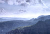
Cumberland Gap in winterElevation 1,600 ft (488 m) Traversed by U.S. Highway 25E Location Location Kentucky/Virginia/Tennessee,  United States
Range Cumberland Mountains Coordinates 36°36′14″N 83°40′27″W / 36.6038°N 83.6742°WCoordinates: 36°36′14″N 83°40′27″W / 36.6038°N 83.6742°W 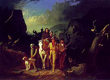 Daniel Boone Escorting Settlers through the Cumberland Gap (George Caleb Bingham, oil on canvas, 1851–52)
Cumberland Gap (el. 1,600 ft (490 m)) is a pass through the Cumberland Mountains region of the Appalachian Mountains, also known as the Cumberland Water Gap, at the juncture of the U.S. states of Tennessee, Kentucky, and Virginia. Famous in American history for its role as one key passageway through the lower central Appalachians, it was an important part of the Wilderness Road and is now part of the Cumberland Gap National Historical Park. The Cumberland Gap was discovered in 1750 by Dr. Thomas Walker, a Virginia physician and explorer. Long used by Native Americans, the path was widened by a team of loggers led by Daniel Boone, making it accessible to pioneers, who used it to journey into the western frontiers of Kentucky and Tennessee.
Contents
Location
Cumberland Gap is located just north of the spot where the current-day states of Kentucky, Tennessee and Virginia meet. The nearby town of Cumberland Gap, Tennessee takes its name from the pass.
History
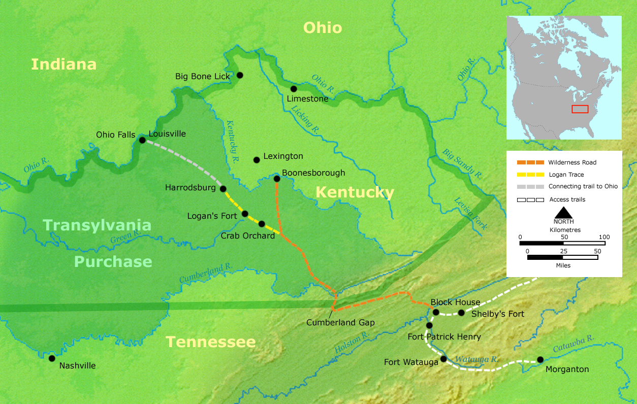
 Map showing Cumberland Gap in relation to the Wilderness Road route from Virginia to Kentucky
The gap was named for Prince William Augustus, Duke of Cumberland, who had many places named for him in the American colonies after the Battle of Culloden. The explorer Thomas Walker gave the name to the Cumberland River in 1750, and the name soon spread to many other features in the region, such as the Cumberland Gap. In 1769 Joseph Martin built a fort nearby at present-day Rose Hill, Virginia, on behalf of Dr. Walker's land claimants. But Martin and his men were chased out of the area by Native Americans, and Martin himself did not return until 1775.[1]
In 1775 Daniel Boone, hired by the Transylvania Company arrived in the region leading a company of men to widen the path through the gap to make settlement of Kentucky and Tennessee easier. On his arrival, Boone discovered that Martin had beaten him to Powell Valley, where Martin and his men were clearing land for their own settlement – the westernmost settlement in English colonial America at the time.[2] By the 1790s the trail that Boone and his men built was widened to accommodate wagon traffic.
Several American Civil War engagements were centered in and around the Cumberland Gap and are sometimes called Battle of the Cumberland Gap. In June 1862, Union Army General George W. Morgan captured the gap for the Union. In September of that year, Confederate States Army forces under Edmund Kirby Smith occupied the Gap during General Braxton Bragg's Kentucky Invasion. The following year, in a bloodless engagement in September 1863, Union Army troops under General Ambrose Burnside forced the surrender of 2,300 Confederates defending the gap, gaining Union control of the gap for the remainder of the war.
It is estimated that between 200,000 and 300,000 migrants passed through the gap on their way into Kentucky and the Ohio Valley before 1810. Today 18,000 cars pass beneath the site daily, and 1,200,000 people visit the park on the site annually.[3]
U.S. Route 25E passed overland through the gap before the completion of the Cumberland Gap Tunnel in 1996. The original trail was then restored.
Historic district
The gap and associated historic resources were listed on the National Register of Historic Places as a historic district on May 28, 1980.[4]
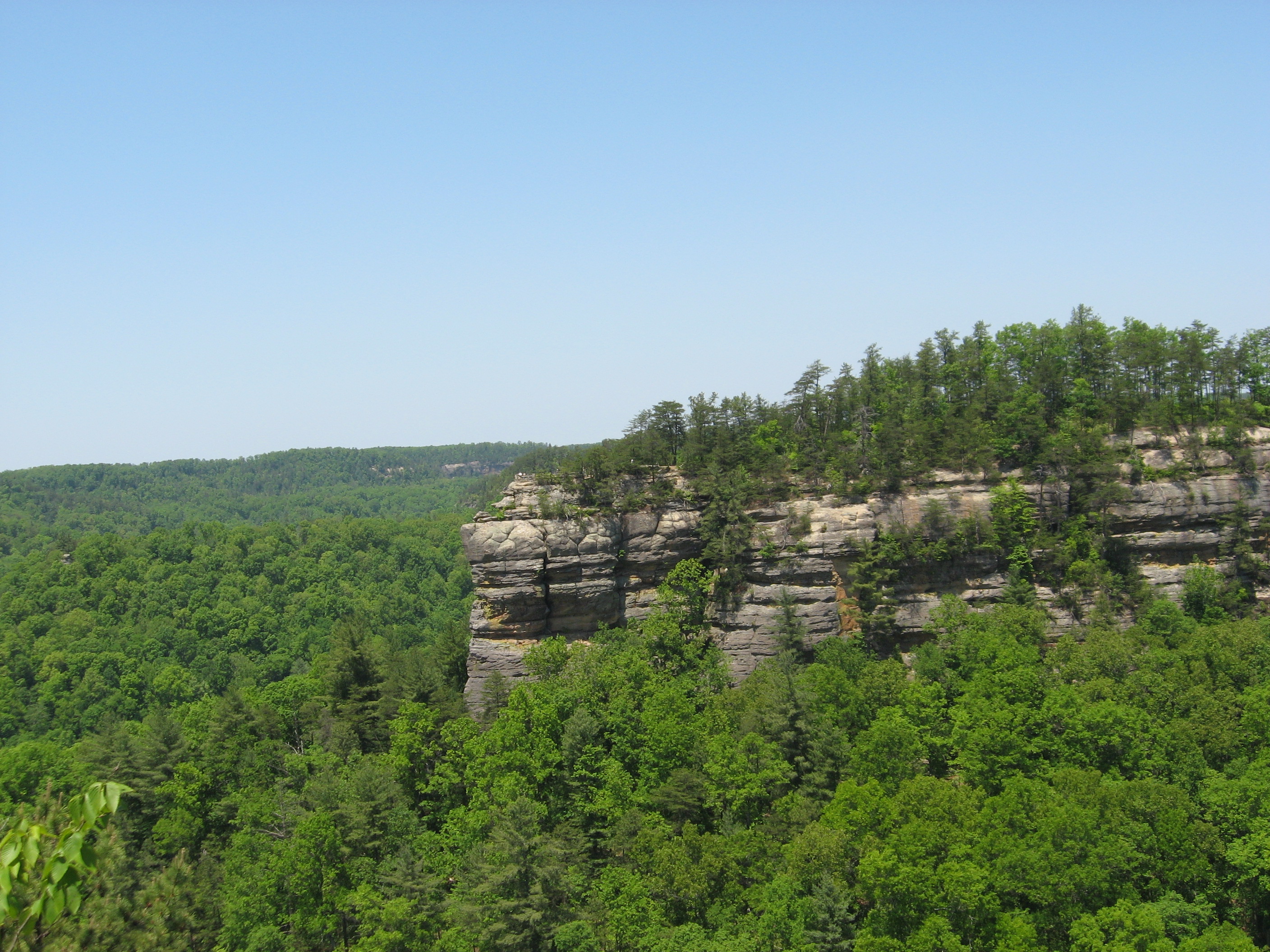
Geological features
The 12-mile (19 km) long Cumberland Gap consists of four geologic features: the Yellow Creek valley, the natural gap in the Cumberland Mountain ridge, the eroded gap in the Pine Mountain, and Middlesboro crater.
Middlesboro crater is a 3-mile (4.8 km) diameter meteorite impact crater in which Middlesboro, Kentucky, is located. The crater was identified in 1966 when Robert Dietz discovered shatter cones in sandstone, which led to the further identification of shocked quartz. Shatter cones, a rock shattering pattern naturally formed only during impact events, are found in abundance in the area. In September 2003 the site was designated a Distinguished Geologic Site by the Kentucky Society of Professional Geologists.[5]
Without Middlesboro crater, it would have been difficult for packhorses to navigate this gap and improbable that wagon roads would have been constructed at an early date. Middlesboro is the only place in the world where coal is mined inside an impact crater. Special mining techniques must be used in the complicated strata of this crater. (Milam & Kuehn, 36).
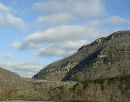
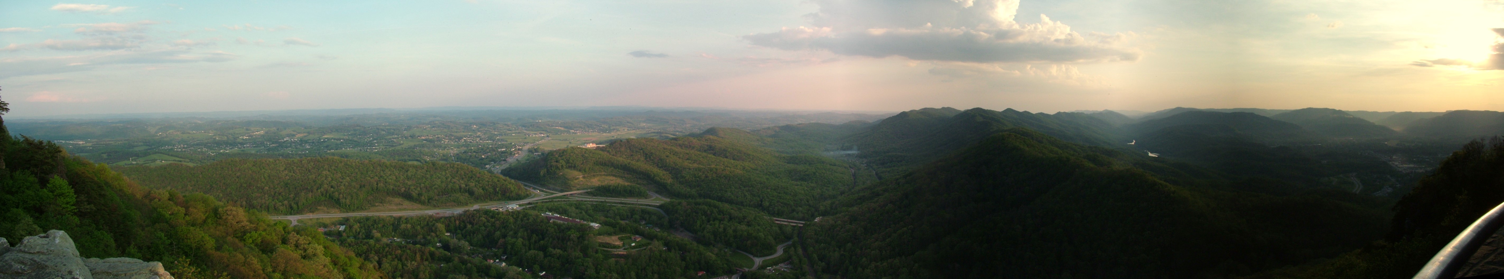
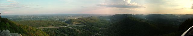 Panoramic view from Pinnacle Overlook at Cumberland Gap National Historic Park
The gap was formed by an ancient creek, flowing southward, which cut through the land being pushed up to form the mountains. As the land rose even more, the creek reversed direction flowing into the Cumberland River to the north.[citation needed]
References in popular culture
- Cumberland Gap has lent its name to a popular folk song recorded and performed by American folk and bluegrass musicians such as Woody Guthrie and Earl Scruggs and British skiffle artists such as Lonnie Donegan and the Vipers Skiffle Group.
- A style of beard with sideburns that has a "gap" cut through it about an inch wide right below each earlobe is colloquially known by some as a "Cumberland Gap".
- The gap has been mentioned in many songs, including the Old Crow Medicine Show song "Wagon Wheel" co-written by Bob Dylan and Ketch Secor, the song "The Ballad of Thunder Road", and the song "Mighty Joe Moon" by American band Grant Lee Buffalo.
- In 1889 a United States Senator voted against having a World's Fair, the fair Chicago's bid eventually won, "and out of sheer cussedness voted for Cumberland Gap" as the proposed site.[6]
See also
References
- ^ A Cumberland Gap Area Guidebook, Tom N. Shattuck, The Wilderness Road Company, 1999, ISBN 978-0-9677765-3-8
- ^ Boone: A Biography, Robert Morgan, Algonquin Books, Chapel Hill, ISBN 978-1-56512-455-4
- ^ "Cumberland Gap". http://www.roadstothefuture.com/Cumberland_Gap.html.
- ^ National Register of Historic Places Nomination Form: Cumberland Gap Historic District - Virginia/Kentucky/Tennessee, 1980
- ^ Kortenkamp, Steve (Summer 2004). "Impact at Cumberland Gap: Where Natural and National History Collide". PSI Newsletter 5 (2): 1–2. http://www.psi.edu/newsletter/summer04/Summer04.
- ^ Larson, Erik (2003), The Devil in the White City, Crown Publishers, p. 17, ISBN 0609608444
External links
- Rickie Longfellow, Back in Time: The Cumberland Gap, United States Department of Transportation, Federal Highway Administration
- Cumberland Gap National Historical Park at the U.S. National Park Service
Visitor Attractions of the Eastern Mountain Coal Fields Parks StateBuckhorn Lake • Carr Creek • Carter Caves • Cumberland Falls • Dr. Thomas Walker • Fishtrap Lake • Grayson Lake • Greenbo Lake • Jenny Wiley • Kingdom Come • Levi Jackson Wilderness Road • Natural Bridge • Paintsville Lake • Pine Mountain • Pine Mountain Trail • Yatesville Lake
FederalInterstate


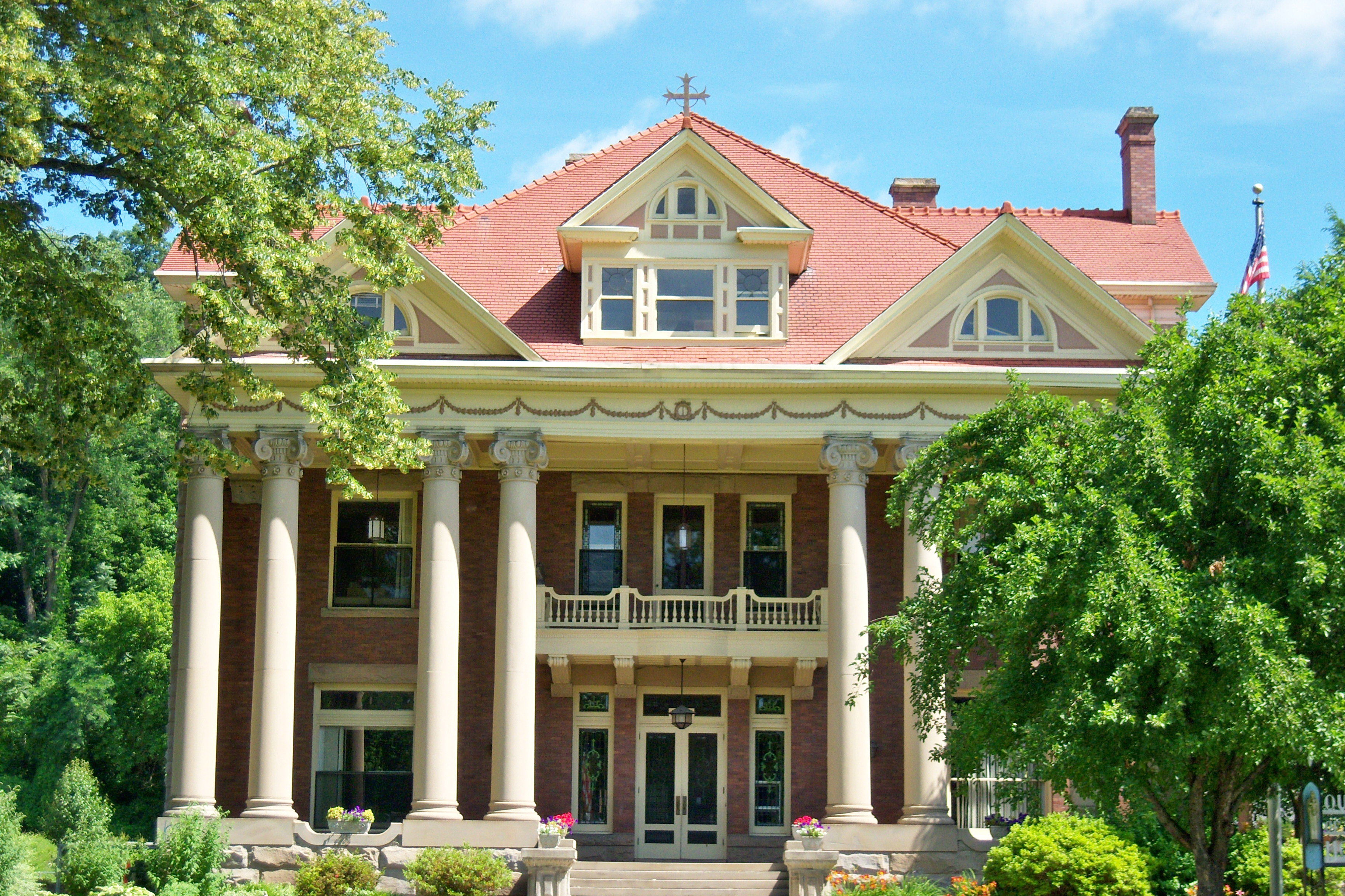
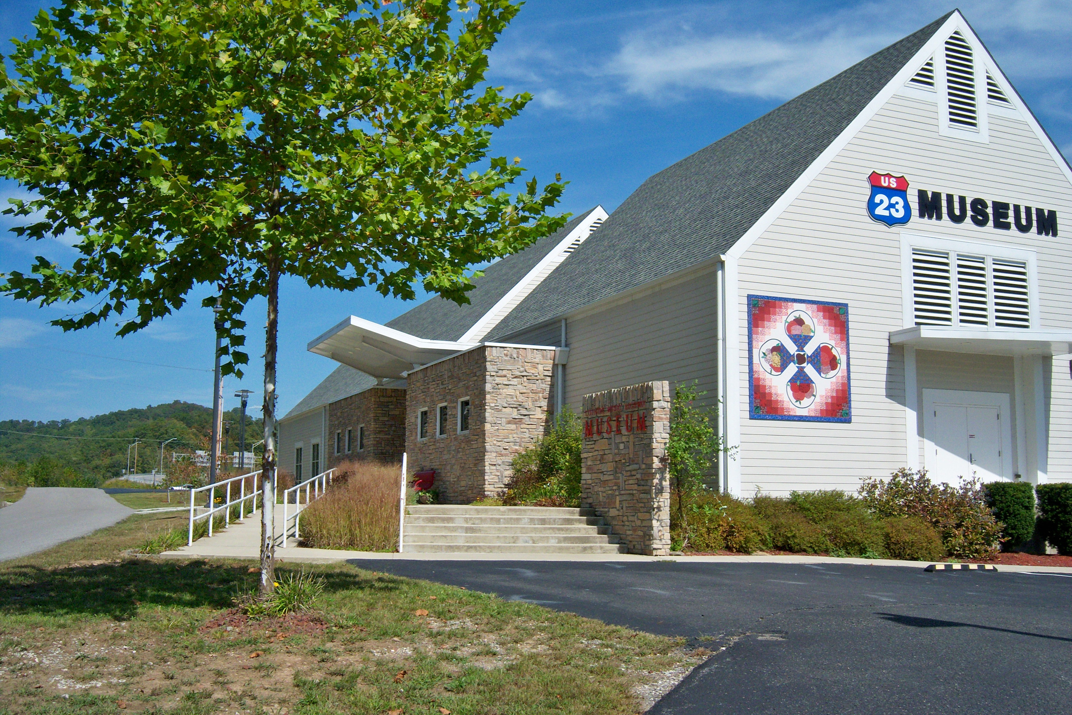
Museums Barthell Coal Mining Camp • Bell County Coal House & Museum • Bell County Historical Society Museum • Big Sandy Heritage Center • Blue Heron Coal Mining Camp • Bobby Davis Museum and Park • Breathitt County Museum • C.B. Caudill Store & History Center • Cloverfork Museum • Coal Miners' Museum • Cumberland Inn Museum • David A. Zegeer Coal-Railroad Museum • East Kentucky Science Center • Elkhorn City Railroad Museum • Harland Sanders Café & Museum • Highlands Museum and Discovery Center • Kentucky Coal Mining Museum • Kentucky Folk Art Center • Knox Historical Museum • Magoffin County Pioneer Village and Museum • Marie Stewart Museum & Craft Shop • McCreary County Museum • Morgan County History Museum • Mountain Homeplace • Mountain Life Museum • Northeastern Kentucky Museum • Swamp Valley Museum • U.S. 23 Country Music Highway Museum • Wolfe County History Museum
Forests Daniel Boone • Dewey Lake • Jefferson • Kentenia • Kentucky Ridge • Robinson • Tygarts
Reservoirs Buckhorn Lake • Carr Creek Lake • Cave Run Lake • Cranks Creek Lake • Lake Cumberland • Dewey Lake • Fishtrap Lake • Grayson Lake • Greenbo Lake • Laurel River Lake • Martins Fork Lake • Paintsville Lake • Yatesville Lake
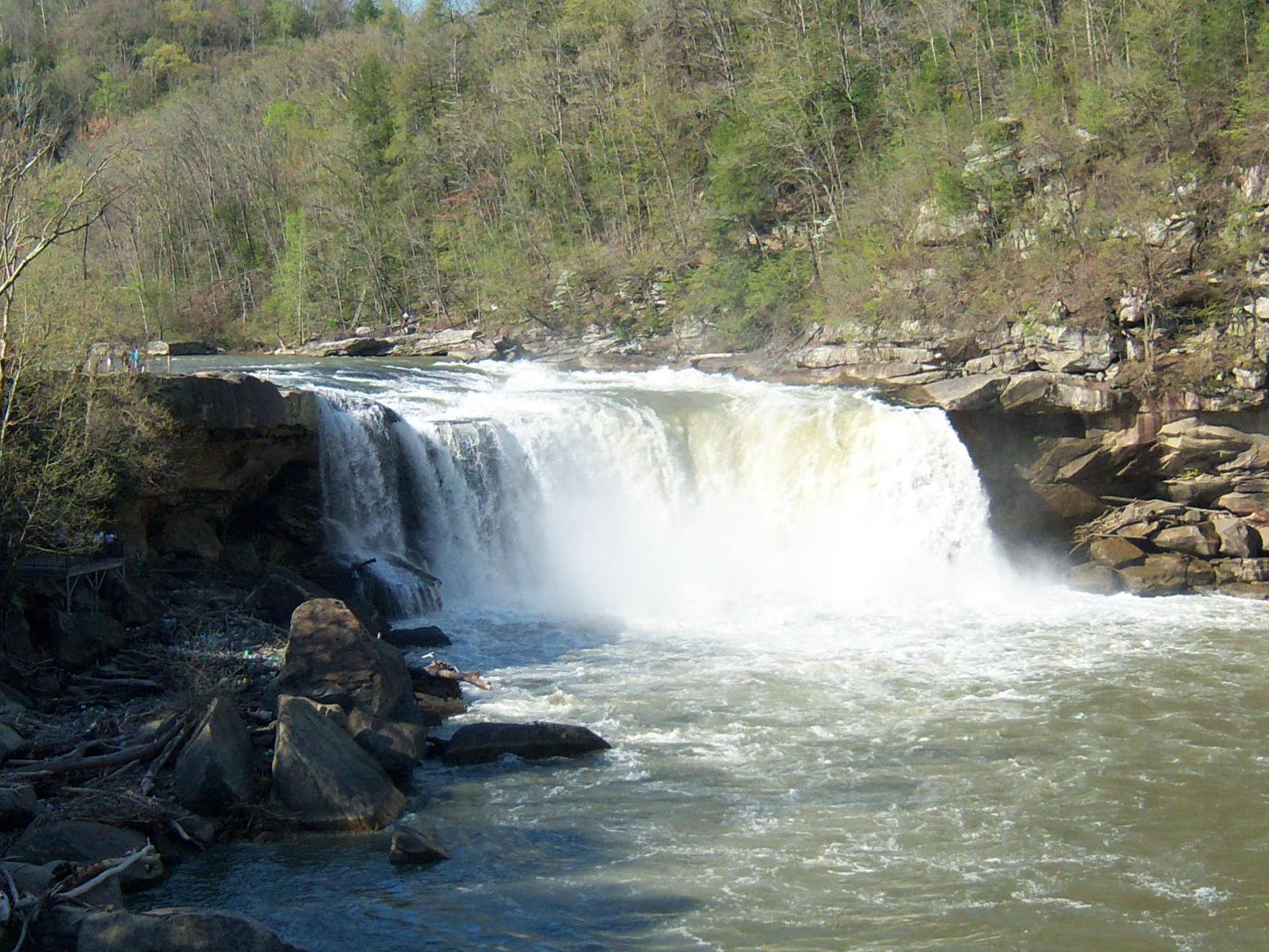
Natural features Black Mountain • Cumberland Falls • Cumberland Gap • Eagle Falls • Middlesboro crater • Pine Mountain • Pound Gap • Raven Rock • Red River Gorge • Tri-State Peak • Yahoo Arch • Yahoo Falls
Miscellaneous Bad Branch Falls State Nature Preserve • Bat Cave and Cascade Caverns State Nature Preserves • Big South Fork Scenic Railway • Black Mountain Off-Road Adventure Area • Cumberland Gap Tunnel • Mayo Mansion • Middle Creek Battlefield • Pikeville Cut-Through • Samuel May House • Sheltowee Trace Trail
Categories:- Geography of Bell County, Kentucky
- Geography of Claiborne County, Tennessee
- Geography of Lee County, Virginia
- Mountain passes of Kentucky
- Mountain passes of Tennessee
- Mountain passes of Virginia
- Rail mountain passes of the United States


Wikimedia Foundation. 2010.