- U.S. Route 25E
-
U.S. Route 25E
Route information Auxiliary route of US 25 Length: 114 mi[2] (183 km) Existed: 1926[1] – present Major junctions South end: 

 US-25 / US-25W / US-70 in Newport, TN US 25 / US 25W in North Corbin, KY
North end:  I-75 in North Corbin, KY
Highway system United States Numbered Highways
List • Bannered • Divided • ReplacedU.S. Route 25E is the eastern branch of U.S. Route 25 from Newport, Tennessee, where US 25 splits into US 25E and US 25W, to North Corbin, Kentucky, where the two highways rejoin. The road, however, continues as US 25E for roughly 2 miles (3.2 km) until it joins Interstate 75 in North Corbin.
All of US-25E in Tennessee is now the East Tennessee Crossings Byway, a National Scenic Byway.[3] A portion of US 25E in Tennessee is also designated as Appalachian Development Corridor S. The corridor follows US 25E between I-81 in White Pine and State Route 63 (Corridor F) in Harrogate.[4]
US 25E has been included in the U.S. Highway System since the system's inception in 1926.
Contents
Route description
Tennessee
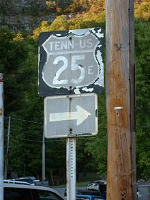
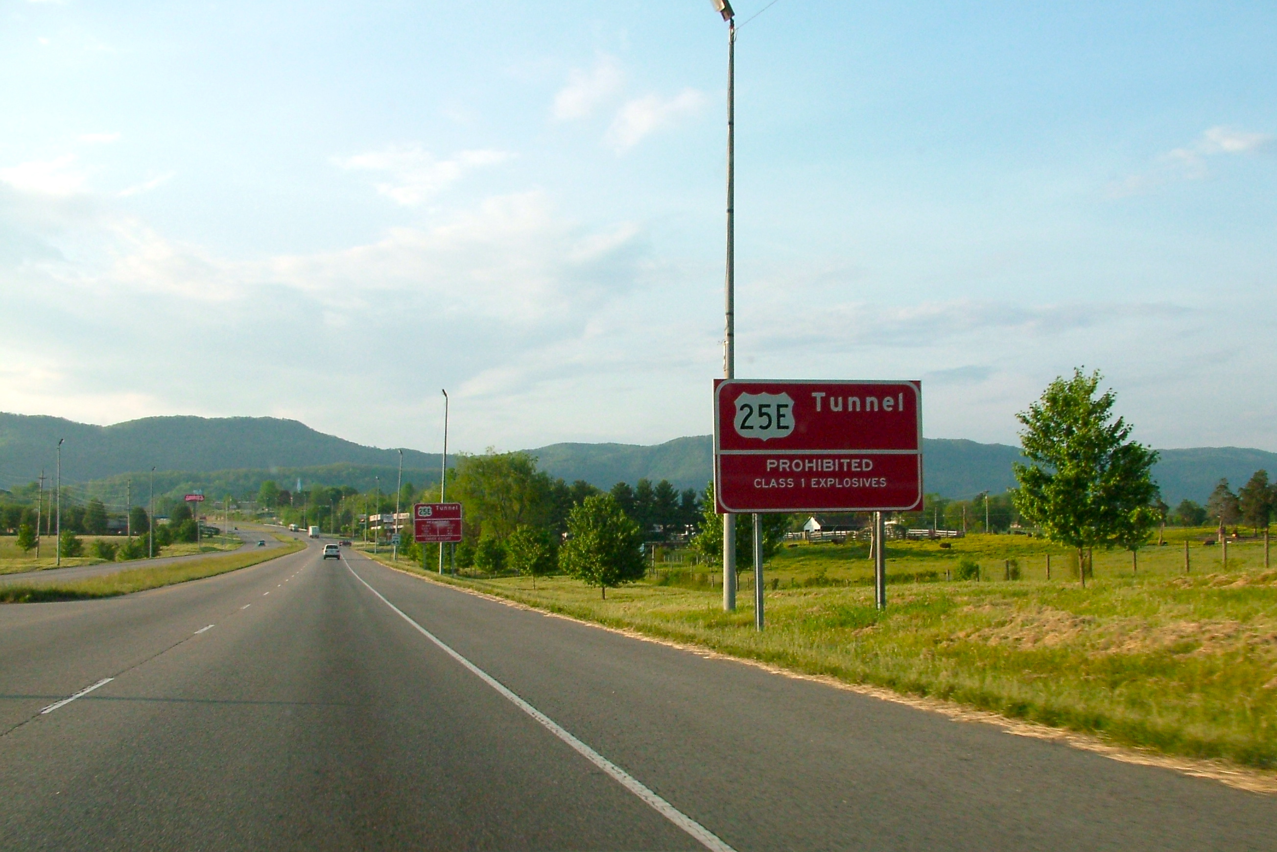
 Warning signs along U.S. 25E approaching Cumberland Gap Tunnel
Northbound US 25 and westbound US 70 leave Newport concurrent with one another. At an intersection west of town, US 25 splits into two highways: US 25E, which heads north from this point, and US 25W, which continues west along US 70.
US 25E crosses over Douglas Lake south of Baneberry. Between White Pine and Witt, the highway has an interchange with Interstate 81 (exit 8). North of the Interstate, the road widens out to four lanes, and receives the Appalachian Development designation "Corridor S". US 25E intersects US 11E east of Morristown. It then crosses Cherokee Reservoir.
Near Bean Station, US 25E joins US 11W. The two roads split 3 miles (4.8 km) west of Bean Station, and US 25E continues northwest to Tazewell.[5]
Northwest of Tazewell, the road bridges the Powell River, and then passes through Harrogate. In the town of Cumberland Gap, Tennessee, US 25E serves as the western terminus of US 58. US 25E used that highway en route to the Cumberland Gap prior to 1996, however, it now uses a new highway leading to the Cumberland Gap Tunnel, freeing up a portion of road that US 58 now uses. US 25E then passes through the tunnel, emerging on the other side in Kentucky.
Kentucky
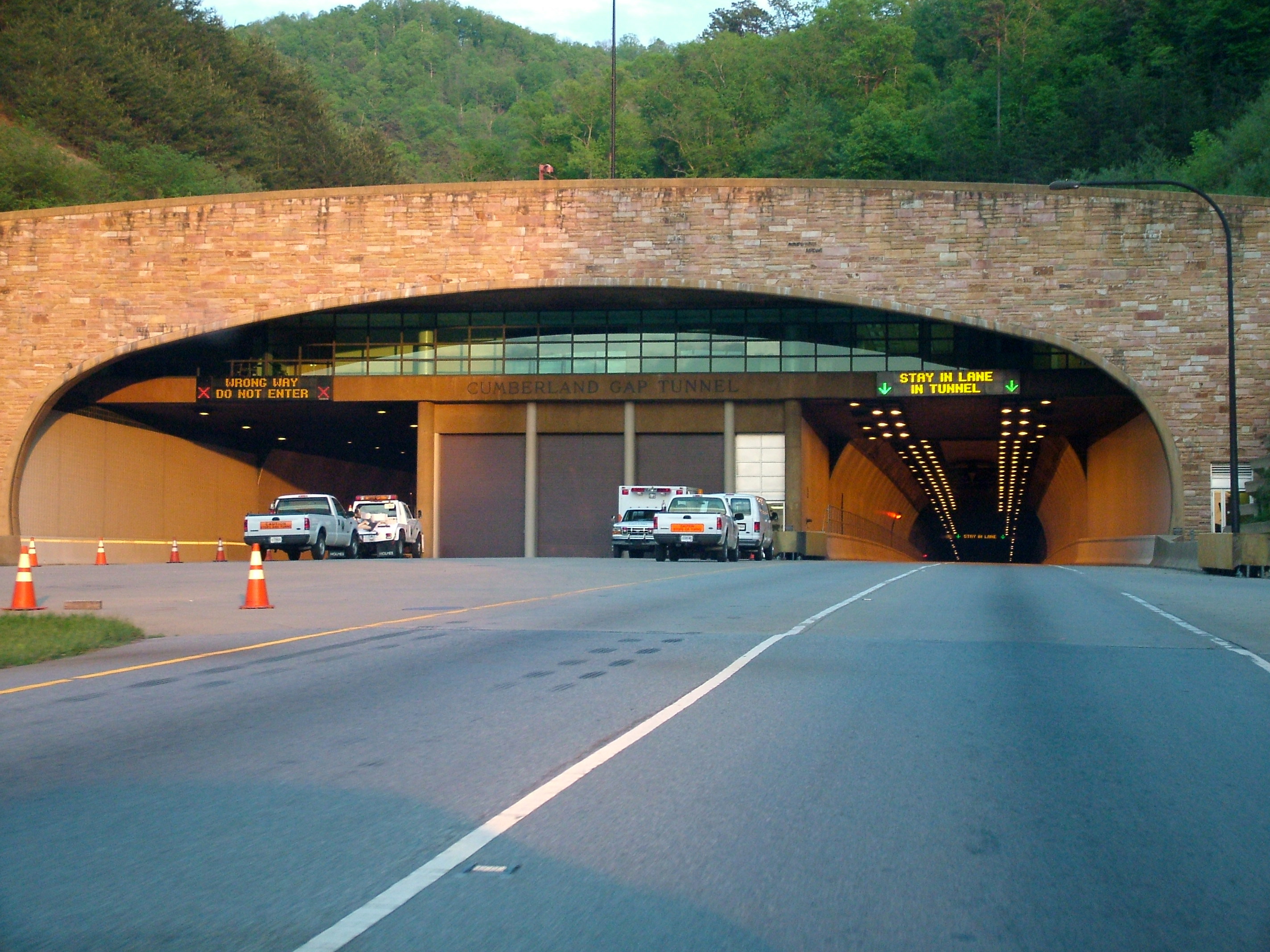
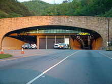 The Kentucky side of the Cumberland Gap Tunnel.
US-25E remains a multilane divided highway for its entire extent in Kentucky.[6] Upon departing the tunnel, the road heads west to the town of Middlesboro, Kentucky, where it intersects Route 74. US-25E turns north at Middlesboro toward Pineville, the county seat of Bell County. In Pineville, the route is the western terminus of US-119.
US-25E departs Pineville and heads northwest, indirectly serving Tinsley via KY 92, crossing into Knox County, and bypassing Flat Lick to the west. The route makes an S-shaped curve, dipping south then turning back northwest as it approaches Barbourville. After serving the east side of Barbourville, the highway passes near Heidrick and runs through Baileys Switch.
Between Baileys Switch and Gray, US-25E gradually turns more east–west. After running through Gray, the route serves as the northern terminus of KY 3041. The road then reunites with US-25W north of Corbin, and the unsuffixed US-25 continues to points north. However, the US-25E designation continues west to Interstate 75, where it ends at Exit 29.[7]
History
 Old US 25E sign in Cumberland Gap, Tennessee directing traffic to the former route over Cumberland Gap.
Before the Cumberland Gap Tunnel was opened in 1996, US 25E passed through the Cumberland Gap in Virginia. Prior to the U.S. highway system's arrival, Virginia's State Highway 10 began at the Cumberland Gap and proceeded to Bristol.[8] A short spur south to Tennessee was soon added,[citation needed] becoming State Route 107 in the 1923 renumbering and State Route 100 in the 1928 renumbering.[9]
Early U.S. Highway planning assigned the number U.S. Route 411 to SR 10 through Cumberland Gap to Kentucky, and no number to SR 107.[10] By the final 1926 plan, US 411 was truncated to Cumberland Gap, and US 25E ran from Tennessee to Kentucky along SR 10 and SR 107.[11] The State Route numbers were dropped in the 1933 renumbering.
The Cumberland Gap Tunnel opened in 1996, completely bypassing Cumberland Gap and Virginia. U.S. Route 58 was moved to a new alignment, meeting US 25E in Tennessee, and US 25E was decommissioned through Virginia. As it lay within the boundaries of the Cumberland Gap National Historical Park, the National Park Service now controls the former road, and decided to return it to its pre-pavement state. The pavement was torn up, and old US 25E is now a dirt path.[12]
Junction list
Tennessee
County Location Mile[13] Destinations Notes Cocke 0.0 US-25 / US-25W / US-70US-25 splits into US 25E and US-25W Jefferson White Pine 9.5  SR-341
Eastern terminus of TN 341 11.1  SR-113
SR-113 joins northbound and splits southbound Hamblen 13.0  I-81
I-81Interchange, I-81 exit 8 14.8  SR-343
Southern terminus of SR-343 15.5 SR-113SR-113 splits northbound and joins southbound Morristown 17.1  SR-160
Parclo interchange 19.5  US-11E south
Interchange 19.8 US-11E northInterchange 22.3 SR-343Northern terminus of SR-343 Grainger 26.2  SR-375
Northern terminus of SR-375 Bean Station 29.3  US-11W
US 11W joins northbound and splits southbound 31.2 US-11WUS 11W joins southbound and splits northbound Thorn Hill 38.6  SR-131
Claiborne 45.5  SR-33
SR-33SR-33 joins northbound and splits southbound Tazewell 50.8 SR-33SR-33 splits southbound and splits northbound 51.3  SR-345
Western terminus of SR-345 Patterson Crossroads 60.2  SR-63
SR-63SR-63 joins northbound and splits southbound 60.4  SR-63
SR-63SR-63 joins southbound and splits northbound Harrogate 61.2  US-58
US-58Western terminus of US 58 Cumberland Gap Tunnel
US-25E leaves Tennessee1.000 mi = 1.609 km; 1.000 km = 0.621 mi Kentucky
County Location Mile[7][14][15] Destinations Notes Cumberland Gap Tunnel
US-25E enters KentuckyBell Middlesboro 1.719  KY 74
KY 74Eastern terminus of KY 74 2.781  KY 441
Eastern terminus of KY 441 6.322  KY 3486
Northern terminus of KY 3486 6.402  KY 188
Western terminus of KY 188 Ferndale 8.313  KY 1534
Southern terminus of KY 1534 8.900  KY 3151
Eastern terminus of KY 3151 11.604  KY 190
Eastern terminus of KY 190 Pineville 12.355  US 119
Southern terminus of US 119 13.460  KY 66
KY 66Southern terminus of KY 66 14.200  KY 2015
Eastern terminus of KY 2015 17.360  KY 2014
Southern terminus of KY 2014 17.576  KY 92
KY 92Northern terminus of KY 92 Knox 19.075  KY 3085
21.543  KY 930
Eastern terminus of KY 930 21.709 KY 3085Northern terminus of KY 3085 22.471  KY 223
Western terminus of KY 223 24.081  KY 3439
25.581  KY 1304
Southern terminus of KY 1304 26.684  KY 3153
27.418  KY 2415
Barbourville 28.470  KY 225 / KY 3439
Northern terminus of KY 225; western terminus of KY 3439 29.439  KY 11
KY 11KY 11 joins northbound and splits southbound 29.596  KY 2420
Heidrick 30.205 KY 1130.811  KY 1487
31.206  KY 2418
Northern terminus of KY 2418 32.610  KY 3438
33.124  KY 229
Southern terminus of KY 229 34.437  KY 1527
Southern terminus of KY 1527 40.366  KY 233
42.227  KY 830
42.872 
 KY 2417 / KY 3041
Northern terminus of KY 3041 Corbin 44.301  KY 312
44.593  KY 1629
Eastern terminus of KY 1629 Laurel North Corbin 15.192 US 25 / US 25WUS-25W becomes US-25 45.703  KY 3431
46.805 I-7546.872  KY 770
Western terminus of US-25E 1.000 mi = 1.609 km; 1.000 km = 0.621 mi See also
References
- ^ United States Department of Agriculture. United States System of Highways [map]. (1926-11-11)
- ^ US Highways: Divided (Split) Routes Robert V. Droz
- ^ Duay O'Neil, Hwy 25 East is Now a National Scenic Byway, The Newport Plain Talk, October 20, 2009
- ^ ADHS Approved Corridors and Termini
- ^ Rand McNally. The Road Atlas (Map) (2008 Large Scale ed.). p. 193, Eastern Tennessee inset.
- ^ Kentucky Transportation Cabinet. Official Highway Map (Map) (2008 ed.).
- ^ a b "HIS Official Milepoint Route Log Report (Laurel County)". Kentucky Transportation Cabinet. http://transportation.ky.gov/dmireports/Official_MP_RL_Report.aspx?param=LAUREL. Retrieved 2010-01-19.
- ^ Staff (PDF). Minutes of the First Meeting of the State Highway Commission Created Under the Acts of 1922, Held July 5th, 1922, Richmond, Va. (Report). Commonwealth of Virginia. http://www.virginiadot.org/meetings/minutes_pdf/CTB-07-1922-01.pdf. , Proposed "State Highway System" for Virginia, as Recommended by the State Roads Committee, January, 1918
- ^ Virginia Highways Project: VA 100
- ^ Report of Joint Board on Interstate Highways, October 30, 1925
- ^ United States System of Highways, November 11, 1926
- ^ Cumberland Gap National Historical Park MapPDF (1.21 MiB)
- ^ Google, Inc. Google Maps – U.S. Route 25E (Map). Cartography by Google, Inc. http://maps.google.com/maps?f=d&source=s_d&saddr=TN-32+N%2FUS-25E+N&daddr=TN-32+N%2FUS-25E+N+to:State+St+to:S+Davy+Crockett+Pkwy%2FTN-113+N%2FTN-32+N%2FUS-25E+N%2FUS-25E+Scenic+N+to:S+Davy+Crockett+Pkwy%2FTN-113+N%2FTN-32+N%2FUS-25E+N%2FUS-25E+Scenic+N+to:S+Davy+Crockett+Pkwy%2FTN-113+N%2FTN-32+N%2FTN-32+Bypass+N%2FUS-25E+N%2FUS-25E+Scenic+N+to:S+Davy+Crockett+Pkwy+to:N+Davy+Crockett+Pkwy+to:N+Davy+Crockett+Pkwy+to:N+Davy+Crockett+Pkwy+to:Dixie+Hwy%2FTN-32+N%2FUS-25E+N+to:US-25E+N+to:Old+Lee+Hwy%2FTN-1+W%2FTN-32+N%2FUS-25E+N+to:36.354744,-83.434811+to:Dixie+Hwy%2FTN-32+N%2FUS-25E+N%2FUS-25E+Scenic+N+to:TN-32+N%2FTN-33+S%2FUS-25E+N%2FUS-25E+Scenic+N+to:TN-32+N%2FUS-25E+N%2FUS-25E+Scenic+N+to:TN-32+N%2FUS-25E+N%2FUS-25E+Scenic+N+to:Cumberland+Gap+Pkwy+to:TN-32+N%2FUS-25E+N+to:TN-32+N%2FUS-25E+N&hl=en&geocode=FaDiJAIdq0wK-w%3BFYqsJgId3lQJ-w%3BFQgBJwIdbi4J-w%3BFcVnJwIdQz8J-w%3BFVPIJwIdNlwJ-w%3BFfTtJwIdw1kJ-w%3BFcJAKAIdSnUJ-w%3BFTm6KAIdp5cJ-w%3BFUPJKAId05IJ-w%3BFfU-KQIdGDYJ-w%3BFe4IKgIdsg0J-w%3BFXqVKgIdvvcI-w%3BFX2SKgId93gI-w%3B%3BFQKeKwId9tYF-w%3BFeg1LAIdV9UE-w%3BFSJQLAIdgNoE-w%3BFTTsLQIdHJUD-w%3BFc73LQIdko0D-w%3BFVRcLgIdE2cD-w%3BFUFxLgId4DQD-w&mra=mi&mrcr=12,13&mrsp=13&sz=14&sll=36.348246,-83.419447&sspn=0.046456,0.090895&ie=UTF8&ll=36.589551,-83.65591&spn=0.046036,0.090895&z=14. Retrieved 2010-01-19.
- ^ "HIS Official Milepoint Route Log Report (Bell County)". Kentucky Transportation Cabinet. http://transportation.ky.gov/dmireports/Official_MP_RL_Report.aspx?param=BELL. Retrieved 2010-01-19.
- ^ "HIS Official Milepoint Route Log Report (Knox County)". Kentucky Transportation Cabinet. http://transportation.ky.gov/dmireports/Official_MP_RL_Report.aspx?param=KNOX. Retrieved 2010-01-19.
Categories:- U.S. Highways in Tennessee
- U.S. Highways in Kentucky
- Divided U.S. Highways
- National Scenic Byways


Wikimedia Foundation. 2010.