- Levi Jackson Wilderness Road State Park
-
Levi Jackson Wilderness Road State Park Kentucky State Park 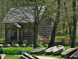 McHargue’s Mill
named for: Levi Jackson and the Wilderness Road Country United States State Kentucky County Laurel County Location [1] - coordinates 37°04′59″N 84°02′30″W / 37.08306°N 84.04167°WCoordinates: 37°04′59″N 84°02′30″W / 37.08306°N 84.04167°W - elevation 1,152 ft (351 m) [1] Area 896 acres (363 ha) Founded 1931 Managed by Kentucky State Parks 
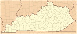 Location of Levi Jackson Wilderness Road State Park in Kentucky
Website : Levi Jackson Wilderness Road State Park Levi Jackson Wilderness Road State Park is a park located just south of London, Kentucky in Laurel County. The park encompasses 896 acres (3.63 km2), and includes a section of the Wilderness Road that early settlers used to reach Kentucky. The park is named for Levi Jackson, an early Kentucky pioneer.[2] It is open for year-round recreation including picnicking, camping, hiking and bird-watching.[3]
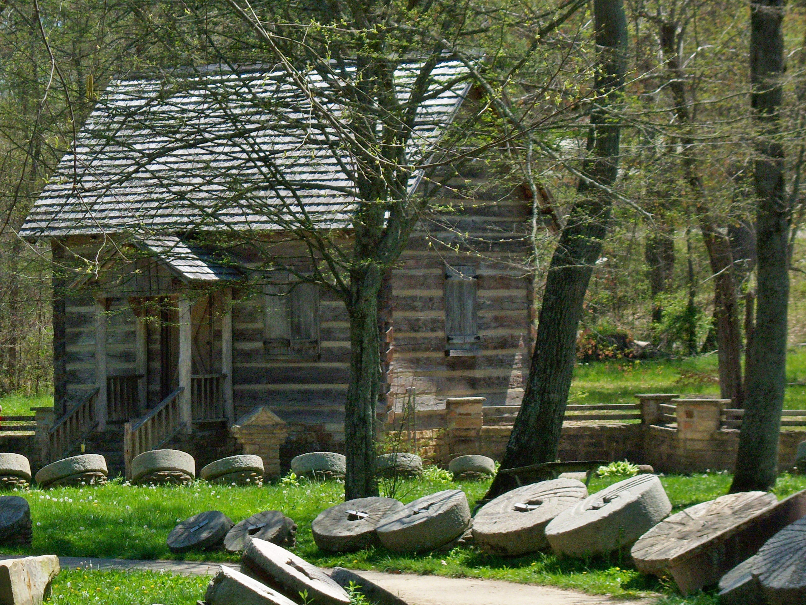
Levi Jackson Wilderness Road State Park features two historic recreations of pioneer life. The Mountain Life Museum is a restored pioneer village that includes seven buildings with tools and household items. The museum is open seasonally.[4] McHargue’s Mill is a reproduction working watermill with authentic interior works, built on the banks of the Little Laurel River. Outside the mill is a large display of millstones. The mill is open seasonally and admission is free.[4]
History
Levi Jackson Wilderness Road State Park is on the historic Wilderness Road. The road was the main route used by settlers fifty-plus years to reach Kentucky from Virginia.[5] In 1775, Daniel Boone blazed a trail for the Transylvania Company from Fort Chiswell in Virginia through the Cumberland Gap into Kentucky. It was later lengthened, following Native American trails, to the Falls of the Ohio at Louisville.[5] The Wilderness Road was rough and steep. In the early days of the trail, it could only be traveled on foot or horseback. As more travelers passed the road improved and horse-drawn wagons were able to follow the trail.[6] In spite of the conditions, thousands of people used it.[5] Many of their descendants still live in Kentucky.[6] Including the members of the McNitt Company a group of pioneers who were attacked by Native Americans on October 3, 1786.[7][8] The park is also at the intersection of Boone's Trace and the Wilderness Road. Boone's Trace was also blazed by Daniel Boone. It is still open today to hiking and the Wilderness Road has since been paved as part of Kentucky Route 229.[6]
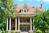
Levi Jackson was one of the first settlers in Laurel County. He arrived in 1802 with his partner, John Freeman, who claimed a large tract of land along the Wilderness Road as payment for Freeman's services in the American Revolutionary War.[7] Jackson built a large two-story house which he licensed as a tavern in 1803. He and John Freeman ran the Wilderness Road Tavern and Laurel River Post Office.[7] The surrounding area became known as "Jackson's Farm" and remained in the Jackson family until 1931 when the land was donated to the state to honor the pioneers of Kentucky.[7]
The McNitt Company was one of may large groups of early settlers to use the Wilderness Road as the moved across the Appalachian Mountains and into the Ohio Valley. The group of fourteen families came under attack on the evening of October 3, 1786.[8] On this night they failed to post a guard against attacks by Native Americans on whose land the settlers were encroaching.[7][8] The settlers "danced and drank until late the evening."[7] They were attacked after they had fallen asleep. Twenty-four known victims died that night with just three survivors. The dead were buried near the site of the massacre at what is known as the Defeated Camp Burial Ground, within the boundaries of Levi Jackson Wilderness Road State Park.[8]
The land on which Levi Jackson Wilderness Road State Park sits was donated to the state by his descendants in 1931. The park facilities were constructed during the Great Depression in 1935. The National Park Service spent $55,000, building cabins, foot-bridges, parking areas, an auditorium, and observation tower.[7] Additionally the Civilian Conservation Corps restored an old log cabin and built McHargue's Mill in 1939.[7][9] Park improvements have continued to the present day and Levi Jackson Wilderness Road State Park serves as both a recreational and historic park.[7]
Recreation
Levi Jackson Wilderness Road State Park is open for year-round recreation.[4] It has a wooded campground with 146 sites. Campers have access to utility hook-ups and a grocery store. There are three central services buildings featuring laundry and shower facilities as well as modern latrines. There is a miniature golf course near the campground entrance.[4] There is a large group camping area. The large group area includes an "activity center." There are 8.5 miles (13.7 km) of hiking trails in the park. The trails follow the Wilderness Road and Boone's Trace.[3][4] A community pool is located within the park, as are basketball courts, horseshoes pits and volleyball facilities.[4] Picnic tables are scattered throughout the park and there are four picnic shetlers available for large groups.[4]
McHargue's Mill, rebuilt by the Civilian Conservation Corps in 1939, is a working grist mill.[9] The largest collection of millstones is on the grounds of the mill.[6] The working stones in the mill were brought over the Wilderness Road in 1805. Fresh ground corn meal can be purchased by visitors. The corn meal sells in one pound bags at $2.50 a pound.[9]
The Mountain Home Museum consists of several cabins and other pioneer era structures. Some of the cabins are arranged to demonstrate what a pioneer settlement looked like during the Wilderness Road era.[6] Relics of the early settlers and displace Native Americans are also on display in the museum. Other buildings on the grounds are, a barn, stable, loom house, church and blacksmith shop.[6] The blacksmith has barred windows and was used as a jail in location filming of "The Kentuckian" a 1955 movie starring Burt Lancaster.[6]
References
- ^ a b "Levi Jackson Wilderness Road State Park". Geographic Names Information System. United States Geological Survey. September 20, 1979. http://geonames.usgs.gov/pls/gnispublic/f?p=gnispq:3:::NO::P3_FID:513350. Retrieved 2010-06-03.
- ^ Kleber, John E., ed (1992). "Parks, State". The Kentucky Encyclopedia. Associate editors: Thomas D. Clark, Lowell H. Harrison, and James C. Klotter. Lexington, Kentucky: The University Press of Kentucky. ISBN 0-8131-1772-0.
- ^ a b "Levi Jackson Wilderness Road State Park". L. L. Bean. http://www.llbean.com/parksearch/parks/html?568lls.html. Retrieved 2010-06-03.
- ^ a b c d e f g "Levi Jackson Wilderness Road State Park". Kentucky State Parks. http://parks.ky.gov/findparks/recparks/lj/. Retrieved 2010-06-03.
- ^ a b c Kincaid, Robert (1992). The Wilderness Road. Kingsport, Tennessee: Arcata Graphics. pp. 100–103. ASIN B0006BNK0U.
- ^ a b c d e f g Reigler, Susan (2008-06-06). "Kentucky: Pioneer Adventure at Levi Jackson Park". Louisville Courier-Journal. http://www.courier-journal/fdcp/?1275582657112. Retrieved 2010-06-04.
- ^ a b c d e f g h i "History of Levi Jackson Wilderness Road State Park". Kentucky State Parks. http://parks.ky.gov/findparks/recparks/lj/history. Retrieved 2010-06-03.
- ^ a b c d "Defeated Camp Burial Ground". Signs of History. http://www.signsofhistory.com/kentucky/Laurel/102.htm. Retrieved 2010-06-03.
- ^ a b c "McHargue's Mill". Virtual Tourist. http://www.virtualtourist.com/travel/North_America/United_States_of_America/Kentucky/Off_the_Beaten_Path-Kentucky-R-2.html. Retrieved 2010-06-03.
Visitor Attractions of the Eastern Mountain Coal Fields Parks StateBuckhorn Lake • Carr Creek • Carter Caves • Cumberland Falls • Dr. Thomas Walker • Fishtrap Lake • Grayson Lake • Greenbo Lake • Jenny Wiley • Kingdom Come • Levi Jackson Wilderness Road • Natural Bridge • Paintsville Lake • Pine Mountain • Pine Mountain Trail • Yatesville Lake
FederalInterstate

Museums Barthell Coal Mining Camp • Bell County Coal House & Museum • Bell County Historical Society Museum • Big Sandy Heritage Center • Blue Heron Coal Mining Camp • Bobby Davis Museum and Park • Breathitt County Museum • C.B. Caudill Store & History Center • Cloverfork Museum • Coal Miners' Museum • Cumberland Inn Museum • David A. Zegeer Coal-Railroad Museum • East Kentucky Science Center • Elkhorn City Railroad Museum • Harland Sanders Café & Museum • Highlands Museum and Discovery Center • Kentucky Coal Mining Museum • Kentucky Folk Art Center • Knox Historical Museum • Magoffin County Pioneer Village and Museum • Marie Stewart Museum & Craft Shop • McCreary County Museum • Morgan County History Museum • Mountain Homeplace • Mountain Life Museum • Northeastern Kentucky Museum • Swamp Valley Museum • U.S. 23 Country Music Highway Museum • Wolfe County History Museum
Forests Daniel Boone • Dewey Lake • Jefferson • Kentenia • Kentucky Ridge • Robinson • Tygarts
Reservoirs Buckhorn Lake • Carr Creek Lake • Cave Run Lake • Cranks Creek Lake • Lake Cumberland • Dewey Lake • Fishtrap Lake • Grayson Lake • Greenbo Lake • Laurel River Lake • Martins Fork Lake • Paintsville Lake • Yatesville Lake
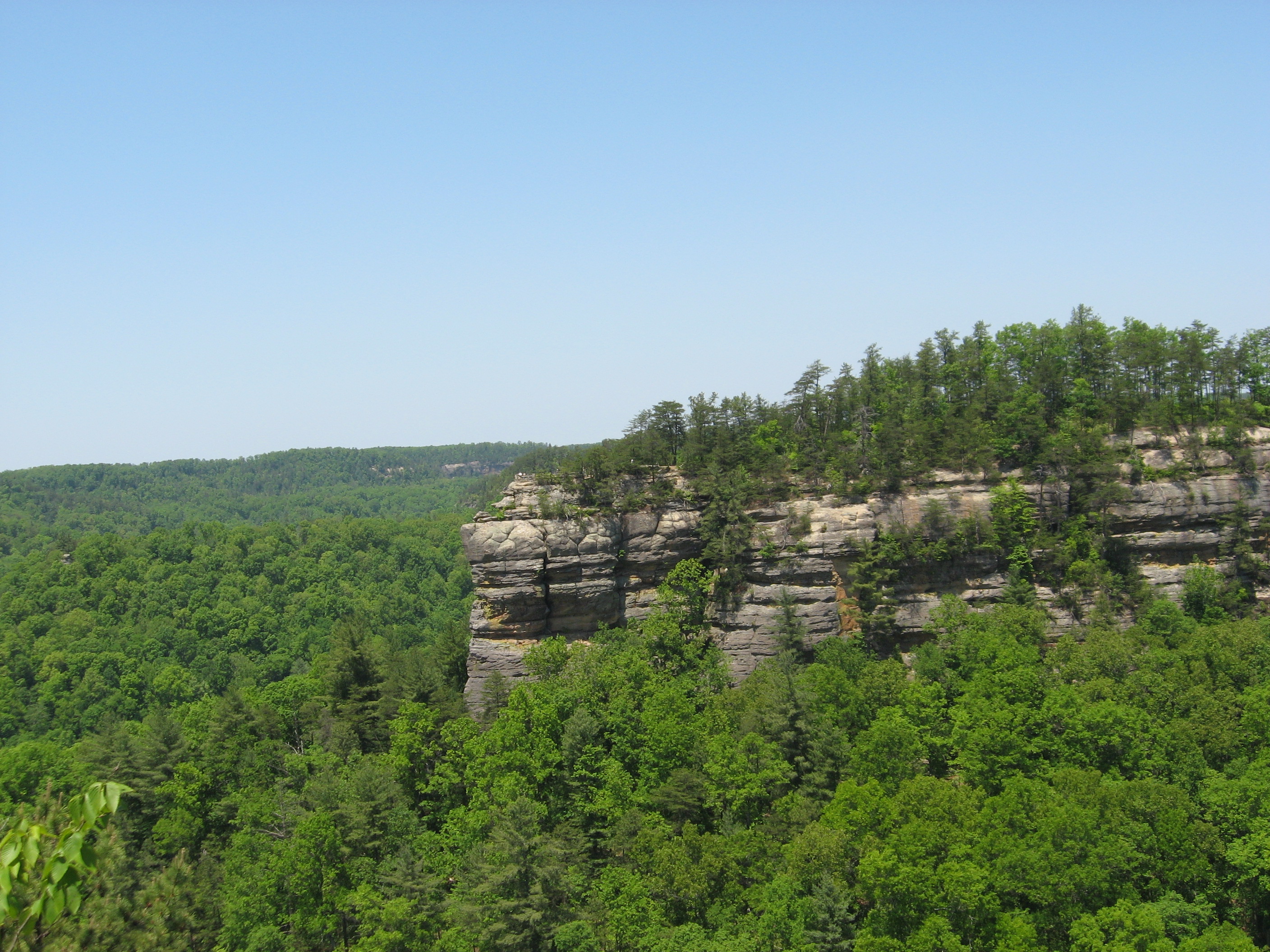
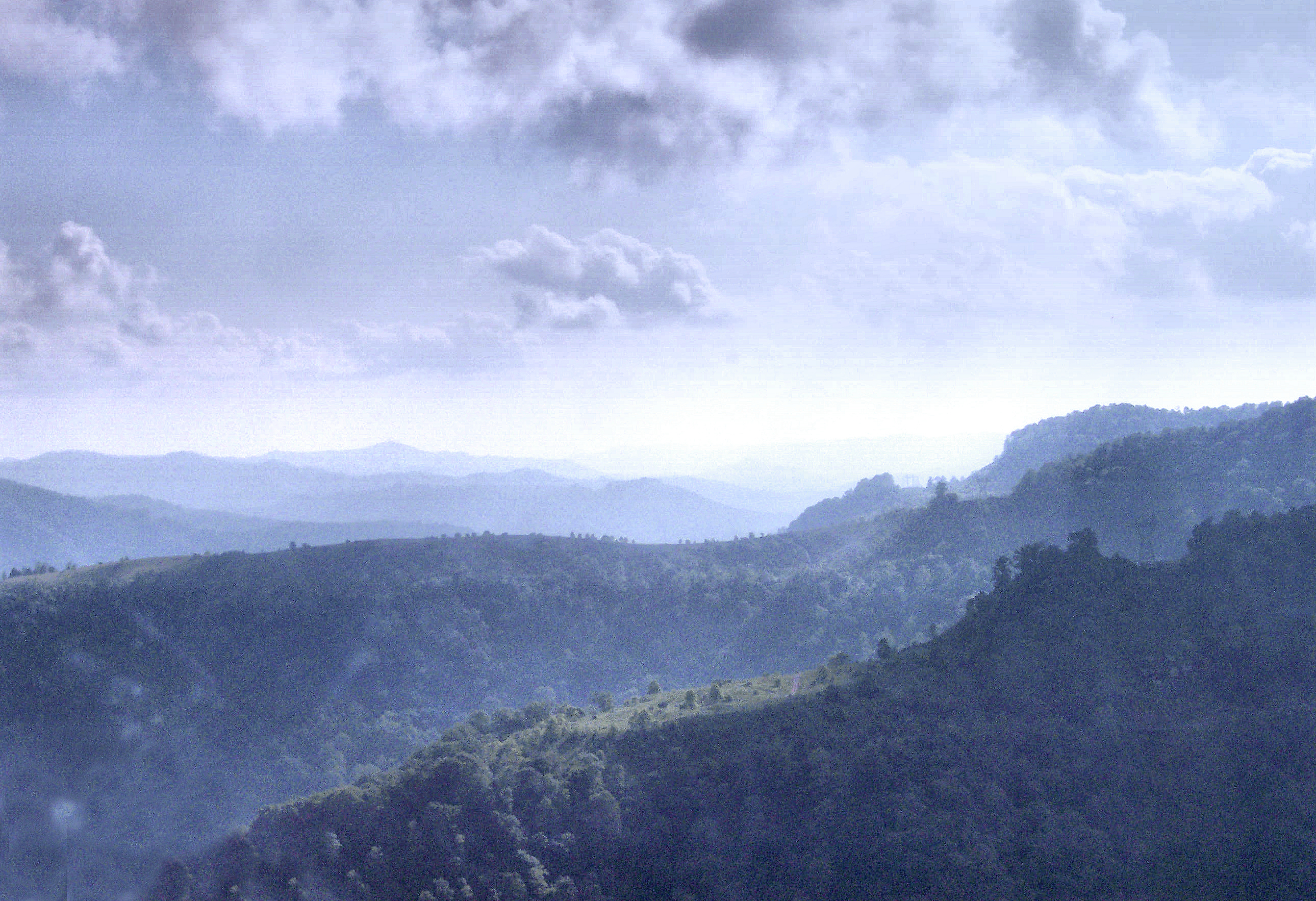
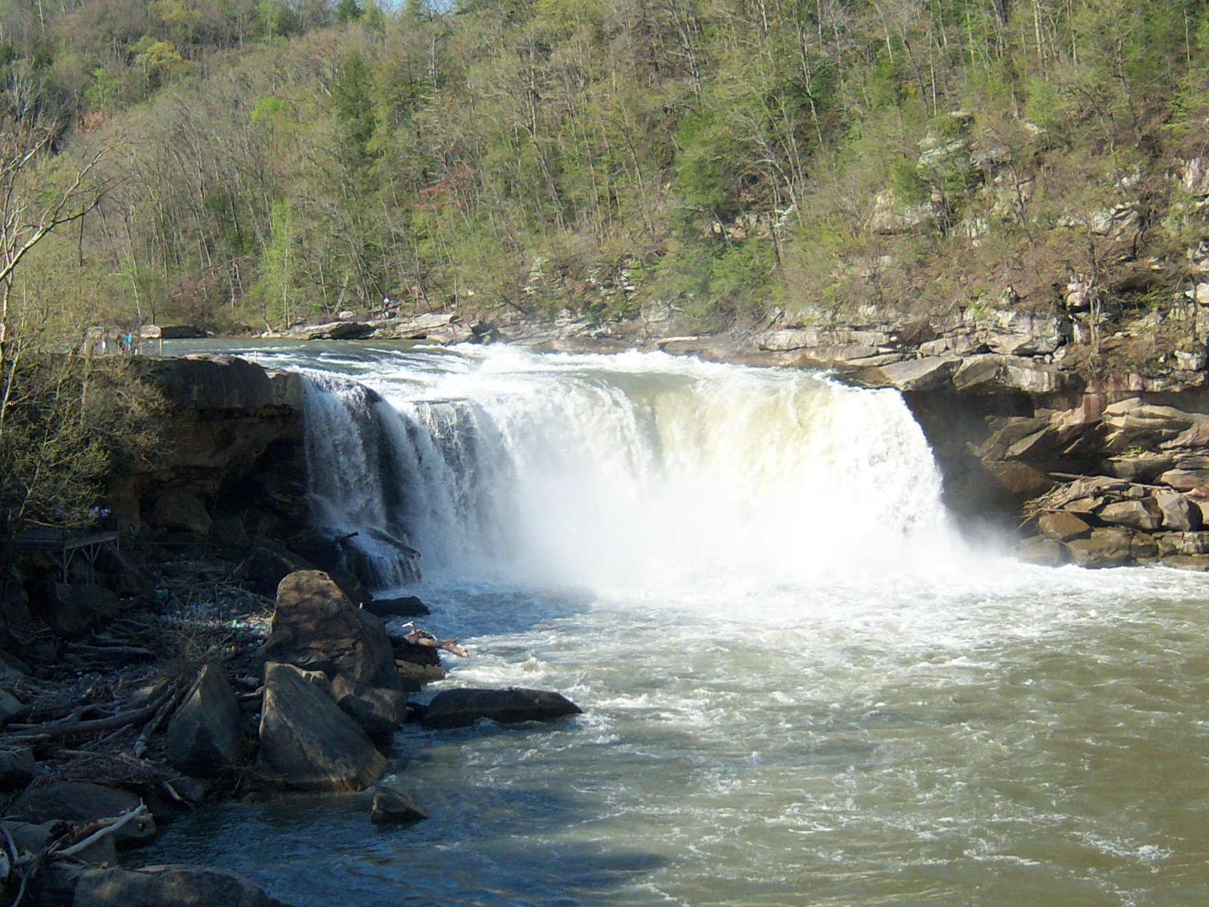
Natural features Black Mountain • Cumberland Falls • Cumberland Gap • Eagle Falls • Middlesboro crater • Pine Mountain • Pound Gap • Raven Rock • Red River Gorge • Tri-State Peak • Yahoo Arch • Yahoo Falls
Miscellaneous Bad Branch Falls State Nature Preserve • Bat Cave and Cascade Caverns State Nature Preserves • Big South Fork Scenic Railway • Black Mountain Off-Road Adventure Area • Cumberland Gap Tunnel • Mayo Mansion • Middle Creek Battlefield • Pikeville Cut-Through • Samuel May House • Sheltowee Trace Trail
Categories:- Protected areas established in 1931
- Kentucky state parks
- Protected areas of Laurel County, Kentucky


Wikimedia Foundation. 2010.